
Weird & wonderful · Yorkshire & the Humber
The Forbidden Corner
In or near Aysgarth.
A four-acre folly garden of mazes, tunnels and surreal sculptures in the Yorkshire Dales.

Roger Templeman — CC BY-SA 2.0 via Wikimedia Commons licence

Plan your visit
- Typical visit
- 1 h–2 h
- Nearest railway station
- Redmire · 3.8 km
Getting there & planning your visit
The Forbidden Corner is located in North Yorkshire, with the postcode DL8 4NA. The nearest railway station is Redmire, which is 3.8 km away. Entry details are not specified, so please check in advance, and accessibility information is not provided.
About
The Forbidden Corner is the four-acre eccentric folly garden at Tupgill Park near Leyburn in the Yorkshire Dales, originally built by Colin Armstrong as a private folly in 1989 and opened to the public after popular demand. A puzzle-and-mystery walkthrough where every corner hides a tunnel, a talking statue, a chamber with mirrors, a giant grotesque face that swallows children and the Temple of the Underworld. Pre-booked timed tickets; the most-recommended hidden attraction in the Dales.
Photo gallery
Protected designations
- Site of Special Scientific Interest: River Ure Grasslands SSSI
Designations sourced from Natural England open data under OGL v3.
Place summary
The Forbidden Corner is a modern quirky attraction located in West Witton, Yorkshire. It features a labyrinth of tunnels, follies, and hidden surprises designed to intrigue visitors. The site is notable for its unusual and playful approach to garden design.
AI-generated from the structured facts on this page (operator, designation, listing, era). Not a substitute for visiting.
- Coordinates
- 54.2854, -1.9170
- District
- North Yorkshire
- Parish
- West Witton
- Postcode
- DL8 4NA
- Parliamentary constituency
- Richmond and Northallerton
- Nearest railway station
- Redmire — 3.8 km
Sources
- manual: the-forbidden-corner (manual)
- wikipedia: The Forbidden Corner (CC BY-SA 4.0)
Featured in this guide
Other places nearby

He brak' his knee
Public art & sculpture · 0.8 km

The Wensleydale Heifer
Hotels · 0.8 km

Fox And Hounds Inn
Historic pubs · 0.9 km
West Witton
Villages · 0.9 km

The Old Vicarage
B&Bs · 1.0 km

Penhill
Mountains & hills · 1.6 km

Swinithwaite Hall
Historic houses · 1.8 km
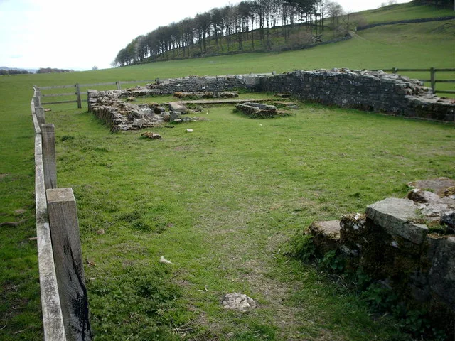
Penhill Preceptory
Hill forts · 2.2 km

Templars Chapel
Historic houses · 2.2 km

Penhill Beacon
Mountains & hills · 2.3 km

Height of Hazely
Mountains & hills · 2.5 km
Height of Hazely
Mountains & hills · 2.5 km
Nearby
📷 3Public art & sculpture · Yorkshire & the Humber
He brak' his knee
He brak' his knee — a public art in england-yorkshire, United Kingdom.
📷 7Hotels · Yorkshire & the Humber
The Wensleydale Heifer
The Wensleydale Heifer — a hotel in england yorkshire.
📷 7Historic pubs · Yorkshire & the Humber
Fox And Hounds Inn
Fox And Hounds Inn in England Yorkshire, United Kingdom.
📷 5📷 7B&Bs · Yorkshire & the Humber
The Old Vicarage
The Old Vicarage — a bed-and-breakfast in england yorkshire.
📷 4Mountains & hills · Yorkshire & the Humber
Penhill
Penhill — a mountain in england-yorkshire, United Kingdom, 546 m.
Where to eat & stay near The Forbidden Corner
Places to stay
📷 7Hotels · Yorkshire & the Humber
The Wensleydale Heifer
The Wensleydale Heifer — a hotel in england yorkshire.
📷 7B&Bs · Yorkshire & the Humber
The Old Vicarage
The Old Vicarage — a bed-and-breakfast in england yorkshire.
 📷 5
📷 5Campsites · Yorkshire & the Humber
Swan Farm Camp Site
Swan Farm Camp Site — a campsite in england yorkshire.
 📷 5
📷 5Caravan parks · Yorkshire & the Humber
Aysgarth Lodge Holidays
Aysgarth Lodge Holidays — a caravan park in england yorkshire.
 📷 5
📷 5Campsites · Yorkshire & the Humber
Streethead Caravan Park
Streethead Caravan Park — a campsite in england north west.
📷 7B&Bs · Yorkshire & the Humber
The Street Head Inn
The Street Head Inn — a bed-and-breakfast in england north west.
Places to eat & drink
📷 7Historic pubs · Yorkshire & the Humber
Fox And Hounds Inn
Fox And Hounds Inn in England Yorkshire, United Kingdom.
 📷 5
📷 5Historic pubs · Yorkshire & the Humber
Foresters Arms Inn
Foresters Arms Inn in England Yorkshire, United Kingdom.
 📷 7
📷 7Cafés · Yorkshire & the Humber
Kim's Cafe & Bistro
Kim's Cafe & Bistro — a café in england yorkshire.
 📷 5
📷 5Restaurants · Yorkshire & the Humber
The Sandpiper Inn
The Sandpiper Inn — a restaurant in england yorkshire.
 📷 7
📷 7Cafés · Yorkshire & the Humber
The Castle Keep Tea Room
The Castle Keep Tea Room — a café in england yorkshire.
 📷 6
📷 6Historic pubs · Yorkshire & the Humber
The Blue Lion
The Blue Lion in England Yorkshire, United Kingdom.
Other places from this era
 Flagship📷 10
Weird & wonderful · London
Hamleys
The world's oldest toy shop, seven floors of Regent Street since 1760.
 ★ Iconic📷 10
Weird & wonderful · South East England
Bekonscot Model Village & Railway
The world's oldest model village — a frozen 1930s England in miniature.
 ★ Iconic📷 10
Weird & wonderful · South East England
Long Man of Wilmington
72-metre chalk hill figure on the South Downs, largest in Western Europe.
 ★ Iconic📷 10
Weird & wonderful · South East England
Shell Grotto
A 4.6-million-shell underground passage of unknown origin, discovered in 1835.
Frequently asked questions
- Where is The Forbidden Corner?
- The Forbidden Corner is in Yorkshire, United Kingdom (postcode DL8 4NA), in the parish of West Witton.
- What is The Forbidden Corner?
- A four-acre folly garden of mazes, tunnels and surreal sculptures in the Yorkshire Dales.
- How do I get to The Forbidden Corner?
- The nearest railway station is Redmire, about 3.8 km away. Drivers can use postcode DL8 4NA.
- When was The Forbidden Corner built?
- Dates from the modern period.
- Is The Forbidden Corner a protected site?
- Yes — The Forbidden Corner is part of the River Ure Grasslands SSSI Site of Special Scientific Interest.
- How do I get to The Forbidden Corner?
- The nearest railway station is Redmire, about 3.8 km away. Drivers can navigate to postcode DL8 4NA.