
Weird & wonderful · South East England
Shell Grotto
In or near Westwood.
A 4.6-million-shell underground passage of unknown origin, discovered in 1835.

John Baker — CC BY-SA 2.0 via Wikimedia Commons licence

Plan your visit
- Typical visit
- 1 h–2 h
- Nearest railway station
- Margate · 1.0 km
Getting there & planning your visit
To visit the Shell Grotto, the nearest railway station is Margate, located 1 km away. The postcode for your sat-nav is CT9 4DE. Entry details are not provided, so please check in advance for any fees or accessibility options.
About
The Shell Grotto at Margate is an underground passage and chamber whose walls are entirely covered with 4.6 million seashells arranged in mosaics — discovered by accident in 1835 by a workman digging in a field, with no record of who built it or when. Theories range from a Phoenician temple to a Regency folly, but no carbon dating has ever been done because every shell is fixed in mortar. The grotto runs as a small private attraction; the entire 21-metre passage and rotunda dome are still open to visitors.
Photo gallery
Protected designations
- Site of Special Scientific Interest: Thanet Coast SSSI
- Area of Outstanding Natural Beauty: Kent Downs
- Ramsar wetland: Thanet Coast & Sandwich Bay
Designations sourced from Natural England open data under OGL v3.
From the Wikipedia article
The Shell Grotto, sometimes called the Shell Temple, is an ornate underground shell grotto in the seaside town of Margate, Kent, England. The grotto, which has a passageway and main room, was dug out from chalk, a soft limestone common in the region. Almost all the surface area of the walls and roof is covered in mosaics created entirely of seashells, totalling about 2,000 square feet (190 m2) of mosaic, with approximately 4.6 million shells. Its age, creators, and purpose are unknown, which has inspired a wide range of speculation, although several other shell grottos in England were made in the 18th century. This grotto was rediscovered in about 1835 and first opened to the public as a privately-owned tourist attraction in 1837. The grotto is a Grade I-listed building and remains open to the public. Attached to the grotto is a modern museum room, cafe, and gift shop.
Excerpt from Wikipedia under CC BY-SA 4.0. See the source article linked in Sources below.
Background
History
The origin and purpose of the structure are unknown. A member of the Kent Archaeological Society analyzed the grotto and concluded in 2006 that it was likely a mediaeval denehole, a small chalk mine, reworked and decorated in the 17th or 18th century. The decoration may have been created or added to in the early 19th century. People have come up with a variety of speculations and hypotheses for the age and purpose of the grotto, such as: it was an 18th or 19th-century rich man's folly; In the late 1940s, a writer, who was also interested in the Baconian theory of Shakespeare authorship, published a book about his theory of Phoenician origins for the shell grotto. In 1952, a member of the…
Architecture
The Shell Grotto consists of a winding subterranean passageway, about 8 ft high and 70 ft in length, terminating in a rectangular room, referred to as the "altar chamber" and measuring approximately 15 by. The grotto is entirely underground. Steps at the upper end lead into a passage about 3 ft wide, roughly hewn out of the chalk, which winds down in serpentine fashion until it reaches an arch, the walls and roof of which here onward are covered in with shell mosaic. The arch leads to what is known as the "rotunda", a central circular column, meeting at the farther side at the domea shaft rising to the surface, capped to allow some daylight into the structure. The sub-base of the dome is…
Sourced from Wikipedia under CC BY-SA 4.0.
- Coordinates
- 51.3779, 1.3815
- County
- Kent
- District
- Thanet
- Parish
- Thanet, unparished area
- Postcode
- CT9 4DE
- Parliamentary constituency
- East Thanet
- Nearest railway station
- Margate — 1 km
Sources
- manual: shell-grotto-margate (manual)
- wikipedia: Shell Grotto, Margate (CC BY-SA 4.0)
Featured in these 2 guides
Other places nearby

Salmestone Grange
Manor houses · 0.2 km

P.C. Jon Odell
Memorials & monuments · 0.5 km

Spread Eagle Public House
Historic pubs · 0.8 km

Margate
Beaches · 0.8 km

Drapers Windmill
Windmills · 0.9 km

The Scenic Railway
Natural landmarks · 0.9 km
Scenic Railway (Dreamland Margate)
Theme parks · 0.9 km
Hawley Projects
Galleries · 0.9 km
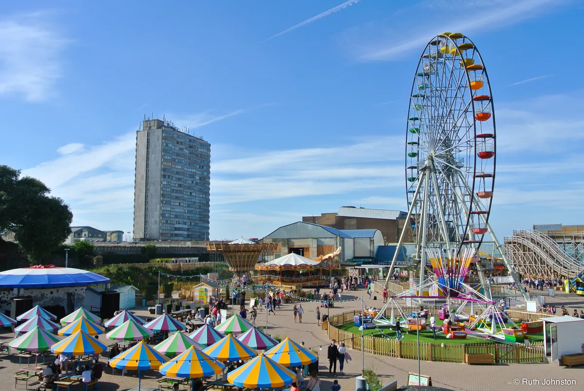
Dreamland Margate
Theme parks · 1.0 km

Dreamland Cinema, Margate
Theatres · 1.0 km

Former Methodist Chapel
Chapels · 1.0 km

Cinque Ports Public House
Historic pubs · 1.0 km
Nearby
📷 5Manor houses · South East England
Salmestone Grange
Salmestone Grange — a manor in england-south-east, United Kingdom.
📷 5Memorials & monuments · South East England
P.C. Jon Odell
P.C. Jon Odell — a memorial in england-south-east, United Kingdom.
📷 5Historic pubs · South East England
Spread Eagle Public House
Spread Eagle Public House in England South East, United Kingdom.
📷 5Beaches · South East England
Margate
Margate — a beach in england-south-east, United Kingdom.
📷 5Windmills · South East England
Drapers Windmill
Drapers Windmill is a windmill in the United Kingdom.
📷 5Natural landmarks · South East England
The Scenic Railway
The Scenic Railway — a other in england-south-east, United Kingdom.
Where to eat & stay near Shell Grotto
Places to stay
 📷 5
📷 5Hotels · South East England
Nayland Rock Hotel
Nayland Rock Hotel — a hotel in england south east.
 📷 5
📷 5Caravan parks · South East England
Manston Caravan & Camping Park
Manston Caravan & Camping Park — a caravan park in england south east.
 📷 5
📷 5B&Bs · South East England
Copperfields Vegetarian Guest House
Copperfields Vegetarian Guest House — a bed-and-breakfast in england south east.
 📷 5
📷 5Hotels · South East England
The Yarrow Hotel
The Yarrow Hotel — a hotel in england south east.
 📷 5
📷 5 📷 5
📷 5Places to eat & drink
📷 5Historic pubs · South East England
Spread Eagle Public House
Spread Eagle Public House in England South East, United Kingdom.
📷 5Historic pubs · South East England
Cinque Ports Public House
Cinque Ports Public House in England South East, United Kingdom.
 📷 5
📷 5 📷 7
📷 7Restaurants · South East England
Masala Gate
Masala Gate — a restaurant in england south east.
 📷 5
📷 5Restaurants · South East England
Hantverk & Found
Hantverk & Found — a restaurant in england south east.
 📷 5
📷 5Restaurants · South East England
Osteria Posillipo Pizzeria
Osteria Posillipo Pizzeria — a restaurant in england south east. Cuisine: italian.
Other places from this era
 Flagship📷 10
Weird & wonderful · London
Hamleys
The world's oldest toy shop, seven floors of Regent Street since 1760.
 ★ Iconic📷 10
Weird & wonderful · South East England
Bekonscot Model Village & Railway
The world's oldest model village — a frozen 1930s England in miniature.
 ★ Iconic📷 10
Weird & wonderful · South East England
Long Man of Wilmington
72-metre chalk hill figure on the South Downs, largest in Western Europe.
 ★ Iconic📷 3
Weird & wonderful · Yorkshire & the Humber
The Forbidden Corner
A four-acre folly garden of mazes, tunnels and surreal sculptures in the Yorkshire Dales.
Frequently asked questions
- Where is Shell Grotto?
- Shell Grotto is in Kent, South-East England, United Kingdom (postcode CT9 4DE), in the parish of Thanet, unparished area.
- What is Shell Grotto?
- A 4.6-million-shell underground passage of unknown origin, discovered in 1835.
- How do I get to Shell Grotto?
- The nearest railway station is Margate, about 1.0 km away. Drivers can use postcode CT9 4DE.
- When was Shell Grotto built?
- Dates from the modern period.
- Is Shell Grotto a protected site?
- Yes — Shell Grotto is part of the Thanet Coast SSSI Site of Special Scientific Interest and the Kent Downs National Landscape (AONB).
- How do I get to Shell Grotto?
- The nearest railway station is Margate, about 1.0 km away. Drivers can navigate to postcode CT9 4DE.