
Mountains & hills · Yorkshire & the Humber
Penhill
In or near Aysgarth.
Penhill — a mountain in england-yorkshire, United Kingdom, 546 m.

David Robinson — CC BY-SA 2.0 via Wikimedia Commons licence

Plan your visit
- Typical visit
- 3 h–8 h
- Best time of year
- Late spring – early autumn (May–Oct)
- Nearest railway station
- Redmire · 4.9 km
- Free entry
- Dog-friendly
Getting there & planning your visit
To visit Penhill in North Yorkshire, the nearest railway station is Redmire, located 4.9 km away. Entry to the site is free.
About
Penhill is a named summit in england-yorkshire, United Kingdom, with an elevation of approximately 546 metres. Listed in the Wikidata register of UK peaks; see the Wikipedia article for further details on the mountain's location, geology and walking routes.
Photo gallery
Protected designations
- Site of Special Scientific Interest: River Ure Grasslands SSSI
Designations sourced from Natural England open data under OGL v3.
From the Wikipedia article
Penhill (526 metres (1,726 ft) high at the trig point, 553 metres (1,814 ft) at Height of Hazely) is a prominent hill, 5.5 miles (9 km) south west of Leyburn, in the Pennines, North Yorkshire, England. It forms a ridge that commands the southern side of Wensleydale and the northern side of Coverdale. Its concave shape was formed during the last ice age, when glaciers carved Wensleydale into a U-shape. The summit plateau has a trig point, small tarns on the peat moor, and, visible from the valley floor, a beacon at its eastern end, part of the large network built to warn of a Spanish invasion. Penhill is accessed by public footpaths from the village of West Witton, by a bridleway from a minor road between West Witton and Melmerby, or over open access land from the south. Although Penhill is not a very high hill, its position near the mouth of Wensleydale makes it visible from a considerable distance – from the North York Moors across the Vale of York, as well as from many points in the dale. Like Pendle Hill, Penhill is a pleonastic name consisting of Brittonic (penn) and Old English (hyll) words for 'hill'. One local legend is that the hill was the home of the Penhill Giant, who would steal sheep from the local flocks.
Excerpt from Wikipedia under CC BY-SA 4.0. See the source article linked in Sources below.
- Coordinates
- 54.2752, -1.9353
- District
- North Yorkshire
- Parish
- West Witton
- Postcode
- DL8 4NA
- Parliamentary constituency
- Richmond and Northallerton
- Nearest railway station
- Redmire — 4.9 km
Sources
Other places nearby

Height of Hazely
Mountains & hills · 0.8 km
Height of Hazely
Mountains & hills · 0.9 km

Penhill Beacon
Mountains & hills · 1.0 km

The Forbidden Corner
Weird & wonderful · 1.6 km

foundations
Archaeological sites · 1.7 km

West Burton
Villages · 2.2 km
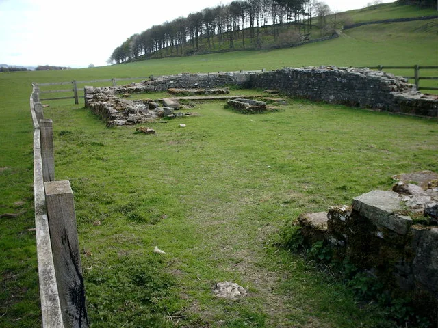
Penhill Preceptory
Hill forts · 2.3 km

Templars Chapel
Historic houses · 2.3 km

He brak' his knee
Public art & sculpture · 2.3 km

Cauldron Falls
Waterfalls · 2.3 km

Aysgarth Folly
Memorials & monuments · 2.4 km

The Wensleydale Heifer
Hotels · 2.4 km
Nearby
📷 5Mountains & hills · Yorkshire & the Humber
Height of Hazely
Height of Hazely — mountain in england yorkshire. Elevation: 550 m.
📷 5Mountains & hills · Yorkshire & the Humber
Height of Hazely
Height of Hazely — a hill or mountain in england yorkshire.
📷 3Mountains & hills · Yorkshire & the Humber
Penhill Beacon
Penhill Beacon — a mountain in england-yorkshire, United Kingdom.
★ Iconic📷 3Weird & wonderful · Yorkshire & the Humber
The Forbidden Corner
A four-acre folly garden of mazes, tunnels and surreal sculptures in the Yorkshire Dales.
📷 3Archaeological sites · Yorkshire & the Humber
foundations
foundations — a archaeological in england-yorkshire, United Kingdom.
📷 5Where to eat & stay near Penhill
Places to stay
📷 7Hotels · Yorkshire & the Humber
The Wensleydale Heifer
The Wensleydale Heifer — a hotel in england yorkshire.
 📷 7
📷 7B&Bs · Yorkshire & the Humber
The Old Vicarage
The Old Vicarage — a bed-and-breakfast in england yorkshire.
 📷 5
📷 5Caravan parks · Yorkshire & the Humber
Aysgarth Lodge Holidays
Aysgarth Lodge Holidays — a caravan park in england yorkshire.
 📷 5
📷 5Campsites · Yorkshire & the Humber
Streethead Caravan Park
Streethead Caravan Park — a campsite in england north west.
 📷 5
📷 5Campsites · Yorkshire & the Humber
Swan Farm Camp Site
Swan Farm Camp Site — a campsite in england yorkshire.
📷 7B&Bs · Yorkshire & the Humber
The Street Head Inn
The Street Head Inn — a bed-and-breakfast in england north west.
Places to eat & drink
 📷 7
📷 7Historic pubs · Yorkshire & the Humber
Fox And Hounds Inn
Fox And Hounds Inn in England Yorkshire, United Kingdom.
 📷 5
📷 5Historic pubs · Yorkshire & the Humber
Foresters Arms Inn
Foresters Arms Inn in England Yorkshire, United Kingdom.
 📷 7
📷 7Cafés · Yorkshire & the Humber
Kim's Cafe & Bistro
Kim's Cafe & Bistro — a café in england yorkshire.
 📷 5
📷 5Restaurants · Yorkshire & the Humber
The Sandpiper Inn
The Sandpiper Inn — a restaurant in england yorkshire.
 📷 7
📷 7Cafés · Yorkshire & the Humber
The Castle Keep Tea Room
The Castle Keep Tea Room — a café in england yorkshire.
 📷 6
📷 6Historic pubs · Yorkshire & the Humber
The Blue Lion
The Blue Lion in England Yorkshire, United Kingdom.
More mountains in this region
 📷 3
📷 3 📷 5
📷 5Mountains & hills · Yorkshire & the Humber
Whaley Moor
Whaley Moor — a hill or mountain in england west midlands.
 📷 5
📷 5Mountains & hills · Yorkshire & the Humber
Idle Hill
Idle Hill — a hill or mountain in england west midlands.
 📷 5
📷 5Mountains & hills · Yorkshire & the Humber
Hollingworthhall Moor
Hollingworthhall Moor — a hill or mountain in england west midlands.
Frequently asked questions
- Where is Penhill?
- Penhill is in Yorkshire, United Kingdom (postcode DL8 4NA), in the parish of West Witton.
- What is Penhill?
- Penhill — a mountain in england-yorkshire, United Kingdom, 546 m.
- How do I get to Penhill?
- The nearest railway station is Redmire, about 4.9 km away. Drivers can use postcode DL8 4NA.
- Is Penhill a protected site?
- Yes — Penhill is part of the River Ure Grasslands SSSI Site of Special Scientific Interest.
- Is Penhill free to visit?
- Yes, Penhill is free to enter.
- How do I get to Penhill?
- The nearest railway station is Redmire, about 4.9 km away. Drivers can navigate to postcode DL8 4NA.