
National parks · Yorkshire & the Humber
Yorkshire Dales
In or near Cubeck.
Yorkshire Dales is a Upland area of the Pennines in Northern England.

Photo by Jez Smith from Whitefield, Bury, Gtr. Manchester, United Kingdom (Wikimedia Commons, CC BY 2.0) licence
Plan your visit
- Typical visit
- 4 h–8 h
- Best time of year
- Spring – autumn (Apr–Oct)
- Free entry
- Family-friendly
- Dog-friendly
Getting there & planning your visit
To visit the Yorkshire Dales, you can use the postcode DL8 3DN for sat-nav coordinates. Entry to the park is free. Accessibility details are not provided.
About
Yorkshire Dales is a national park in the United Kingdom. It covers approximately 2179 km². Designated in 1954. According to Wikipedia: "The Yorkshire Dales are a series of valleys, or dales, in the Pennines, an upland range in England.". It is one of fifteen designated national parks across England, Scotland, and Wales, protected for its landscape and recreation value.
Photo gallery
From the Wikipedia article
The Yorkshire Dales are a series of valleys, or dales, in the Pennines, an upland range in England. They are mostly located in the ceremonial county of North Yorkshire, but extend into Cumbria and Lancashire; they are entirely within the historic boundaries of Yorkshire. The majority of the dales are within the Yorkshire Dales National Park, created in 1954. The exception is the area around Nidderdale, which forms the separate Nidderdale National Landscape. The landscape of the Yorkshire Dales consists of sheltered glacial valleys separated by exposed moorland. The predominant rock is Carboniferous Limestone, which is particularly visible in the south-west in features such as Malham Cove. It is overlain in many areas by the Yoredale Series of alternating weak shales and hard limestones and sandstones, which give the dales their characteristic 'stepped' appearance. Most of the dales contain rivers, and the area contains seven primary catchments: the Swale, Ure, Wharfe, Aire, Nidd, Ribble, and Lune. There are several notable cave systems in the area, including part of the longest system in the United Kingdom, the Three Counties. Agriculture and other land management has significantly affected the appearance of the Dales, through the creation of pastures and meadows for livestock grazing and moorland for red grouse shooting. Dry stone walls and field barns are characteristic of the valley floors, particularly Wensleydale and Swaledale in the north. Wensleydale cheese is a particularly famous product from the region. The dales are popular for hiking, and are crossed by the Dales Way, Pennine Way, and Coast to Coast long-distance footpaths. The Yorkshire Three Peaks is a walking trail entirely within the area which takes in three of its mountains: Ingleborough (723 m (2,372 ft)), Whernside (736 m (2,415 ft)), and Pen-y-ghent (694 m (2,277 ft)). The extensive cave systems are a major centre for caving in the UK.
Excerpt from Wikipedia under CC BY-SA 4.0. See the source article linked in Sources below.
Background
Visiting
In this primarily agricultural area, tourism has become an important contributor to the economy. In 2016, there were 3.8 million visits to the Yorkshire Dales National Park including 0.48 million who stayed at least one night. The park authority estimates that this contributed £252 million to the economy and provided 3,583 full-time equivalent jobs. The wider Yorkshire Dales area received 9.7 million visitors who contributed £644 million to the economy. Visitors are often attracted by the hiking trails, including some that lead to waterfalls and picturesque villages and small towns. These include Kirkby Lonsdale (just outside the area), Hawes, Appletreewick, Masham, Clapham, Long Preston…
Sourced from Wikipedia under CC BY-SA 4.0.
- Coordinates
- 54.2667, -2.0833
- District
- North Yorkshire
- Parish
- Bainbridge
- Postcode
- DL8 3DN
- Parliamentary constituency
- Richmond and Northallerton
- Established
- 1954
Sources
- wikidata: Q977613 (CC0)
- wikipedia: Yorkshire Dales (CC BY-SA 4.0)
- commons: The Western Edge of the Yorkshire Dales.jpg (CC BY 2.0)

Featured in these 3 guides
Itinerary
All fifteen UK national parks, ranked
From the wild Cairngorms to the Norfolk Broads — every UK national park, opinionated.
Itinerary
The Yorkshire Three Peaks circuit
Pen-y-ghent, Whernside and Ingleborough in twelve hours of walking.
Itinerary
Top 10 UK national parks ranked
All 15 UK national parks, ranked by what to expect.
Other places nearby

Water Ling Force
Waterfalls · 1.0 km

Stake Fell
Mountains & hills · 1.2 km

Burnet Force
Waterfalls · 1.7 km

enclosures
Archaeological sites · 1.8 km

Semer Water
Lakes · 2.2 km

Addlebrough
Mountains & hills · 2.2 km

Addlebrough
Mountains & hills · 2.4 km

Little Ings Bridge
Historic bridges · 2.9 km
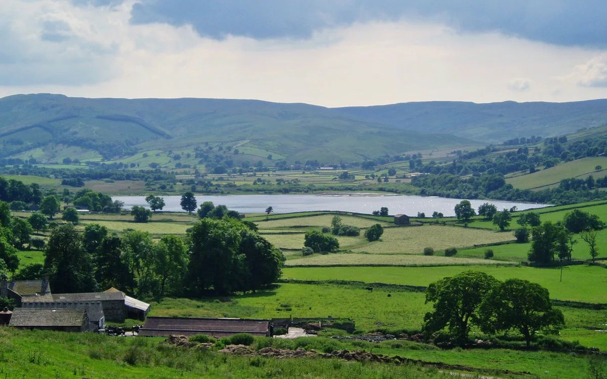
Semerwater
Natural landmarks · 3.1 km

Semer Water Bridge
Historic bridges · 3.3 km

High Park Scar
Waterfalls · 3.4 km
Park Scar
Waterfalls · 3.5 km
Nearby
📷 5Waterfalls · Yorkshire & the Humber
Water Ling Force
Water Ling Force — waterfall in england north west.
📷 5Mountains & hills · Yorkshire & the Humber
Stake Fell
Stake Fell — mountain in england north west. Elevation: 495.0 m.
📷 5📷 3Archaeological sites · Yorkshire & the Humber
enclosures
enclosures — a archaeological in england-north-west, United Kingdom.
📷 5📷 5Mountains & hills · Yorkshire & the Humber
Addlebrough
Addlebrough — a hill or mountain in england north west.
Where to eat & stay near Yorkshire Dales
Places to stay
 📷 5
📷 5Campsites · Yorkshire & the Humber
Stablefell Camping
Stablefell Camping — a campsite in england north west.
 📷 7
📷 7B&Bs · Yorkshire & the Humber
The Street Head Inn
The Street Head Inn — a bed-and-breakfast in england north west.
 📷 5
📷 5Campsites · Yorkshire & the Humber
Askrigg Camping
Askrigg Camping — a campsite in england north west.
📷 5Campsites · Yorkshire & the Humber
Streethead Caravan Park
Streethead Caravan Park — a campsite in england north west.
 📷 5
📷 5Caravan parks · Yorkshire & the Humber
Aysgarth Lodge Holidays
Aysgarth Lodge Holidays — a caravan park in england yorkshire.
 📷 7
📷 7B&Bs · Yorkshire & the Humber
The George Inn
The George Inn — a bed-and-breakfast in england north west.
Places to eat & drink
 📷 7
📷 7Historic pubs · Yorkshire & the Humber
Fox And Hounds Inn
Fox And Hounds Inn in England Yorkshire, United Kingdom.
 📷 5
📷 5Historic pubs · Yorkshire & the Humber
Foresters Arms Inn
Foresters Arms Inn in England Yorkshire, United Kingdom.
 📷 5
📷 5Historic pubs · Yorkshire & the Humber
Kings Head Inn
Kings Head Inn in England North West, United Kingdom.
 📷 7
📷 7Cafés · Yorkshire & the Humber
Kim's Cafe & Bistro
Kim's Cafe & Bistro — a café in england yorkshire.
 📷 5
📷 5Restaurants · Yorkshire & the Humber
The Sandpiper Inn
The Sandpiper Inn — a restaurant in england yorkshire.
 📷 7
📷 7Cafés · Yorkshire & the Humber
The Castle Keep Tea Room
The Castle Keep Tea Room — a café in england yorkshire.
More national parks in this region
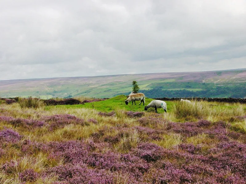 Flagship📷 5
National parks · Yorkshire & the Humber
North York Moors
North York Moors is a Upland area in North Yorkshire, England.
 📷 3
📷 3National parks · Yorkshire & the Humber
Danby Lodge National Park Centre
Danby Lodge National Park Centre — a other in england-yorkshire, United Kingdom.
 📷 5
📷 5National parks · Yorkshire & the Humber
Forbidden Corner
The Forbidden Corner is a folly garden located in the Tupgill Park Estate, at Coverham in Coverdale, in the Yorkshire Dales National Park, England. It is open to the public. The folly garden is design
 📷 5
📷 5National parks · Yorkshire & the Humber
Malham Cove
Malham Cove is a large curved limestone formation 0.6 miles (1 km) north of the village of Malham, North Yorkshire, England. It was formed by a waterfall carrying meltwater from glaciers at the end of
Frequently asked questions
- Where is Yorkshire Dales?
- Yorkshire Dales is in North-West England, United Kingdom (postcode DL8 3DN), in the parish of Bainbridge.
- What is Yorkshire Dales?
- Yorkshire Dales is a Upland area of the Pennines in Northern England.
- How do I get to Yorkshire Dales?
- Drivers can use postcode DL8 3DN.
- When was Yorkshire Dales built?
- Built or established in 1954.
- Is Yorkshire Dales free to visit?
- Yes, Yorkshire Dales is free to enter.
- How do I get to Yorkshire Dales?
- Drivers can navigate to postcode DL8 3DN. It sits within the Richmond and Northallerton parliamentary constituency.