
National parks · North West England
Macclesfield Forest
In or near Rainow.
Macclesfield Forest is an area of woodland, predominantly conifer plantation, around 3 miles (5 km) south east of Macclesfield in the civil parish of Macclesfield Forest and Wildboarclough, in Cheshir

Alan Murray-Rust — CC BY-SA 2.0 via Wikimedia Commons licence
_-_geograph.org.uk_-_1943564.jpg)
Plan your visit
- Typical visit
- 4 h–8 h
- Best time of year
- Spring – autumn (Apr–Oct)
- Nearest railway station
- Macclesfield · 5.1 km
- Free entry
- Family-friendly
- Dog-friendly
Getting there & planning your visit
To visit Macclesfield Forest, the nearest railway station is Macclesfield, located 5.1 km away. The postcode for navigation is SK11 0NS, and entry to the forest is free.
About
Macclesfield Forest is an area of woodland, predominantly conifer plantation, around 3 miles (5 km) south east of Macclesfield in the civil parish of Macclesfield Forest and Wildboarclough, in Cheshire, England. The existing woodland is the last substantial remnant of the Royal Forest of Macclesfield, a once-extensive ancient hunting reserve. The area also includes two reservoirs, Trentabank and Ridgegate. Macclesfield Forest lies on the western edge of the Peak District, within the South West Peak, and is partly inside the boundary of the National Park. The hills of Tegg's Nose and Shutlingsloe stand to the north west and south east, respectively; the moorland of High Moor lies to the south and the Goyt Valley lies to the west. Nearby villages include Langley and Wildboarclough. Macclesfield Forest is owned by United Utilities. Most of the woodland is designated a Site of Biological Importance, while part of the area including Trentabank Reservoir is a nature reserve managed by the Cheshire Wildlife Trust; the reserve contains a large heronry. Other wildlife includes a small herd of red deer. Recreational uses of the area include walking, orienteering, horse riding, cycling, mountain biking, fishing and birdwatching.
Photo gallery
From the Wikipedia article
Macclesfield Forest is an area of woodland, predominantly conifer plantation, around 3 miles (5 km) south east of Macclesfield in the civil parish of Macclesfield Forest and Wildboarclough, in Cheshire, England. The existing woodland is the last substantial remnant of the Royal Forest of Macclesfield, a once-extensive ancient hunting reserve. The area also includes two reservoirs, Trentabank and Ridgegate. Macclesfield Forest lies on the western edge of the Peak District, within the South West Peak, and is partly inside the boundary of the National Park. The hills of Tegg's Nose and Shutlingsloe stand to the north west and south east, respectively; the moorland of High Moor lies to the south and the Goyt Valley lies to the west. Nearby villages include Langley and Wildboarclough. Macclesfield Forest is owned by United Utilities. Most of the woodland is designated a Site of Biological Importance, while part of the area including Trentabank Reservoir is a nature reserve managed by the Cheshire Wildlife Trust; the reserve contains a large heronry. Other wildlife includes a small herd of red deer. Recreational uses of the area include walking, orienteering, horse riding, cycling, mountain biking, fishing and birdwatching.
Excerpt from Wikipedia under CC BY-SA 4.0. See the source article linked in Sources below.
Background
History
The area is believed to have been occupied during the Bronze Age; there is a Bronze Age barrow near High Low Farm west of Macclesfield Forest and another (a scheduled monument) east of the forest near Toot Hill. After the Norman Conquest, the modern area known as Macclesfield Forest formed part of the much larger region of the Royal forest of Macclesfield, a hunting reserve owned by the Earls of Chester, which formerly stretched from the foothills of the Pennines east into the High Peak near Whaley Bridge and south to Staffordshire Moorlands. Remains of a medieval deerpound survive on Toot Hill. South of the forest stands the Greenway Cross (), a standing stone carved on each side with a…
Sourced from Wikipedia under CC BY-SA 4.0.
- Coordinates
- 53.2380, -2.0540
- District
- Cheshire East
- Parish
- Sutton
- Postcode
- SK11 0NS
- Parliamentary constituency
- Macclesfield
- Nearest railway station
- Macclesfield — 5.1 km
Sources
- wikipedia: Macclesfield Forest (CC BY-SA 4.0)
Other places nearby
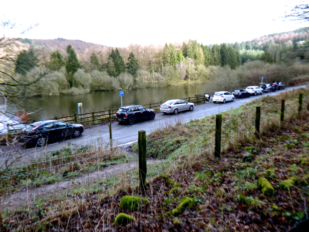
Trentabank Reservoir Nature Reserve
Wildlife reserves · 0.2 km

Trentabank Reservoir
Reservoirs & lochs · 0.3 km

Forest Bridleway
Mountain bike trails · 0.5 km

Grit and Gears II
Mountain bike trails · 0.7 km

Ridgegate Reservoir
Reservoirs & lochs · 1.0 km

Forest Chapel
Historic churches · 1.3 km

Walter Whiston Bullock
Memorials & monuments · 1.4 km

Whitehills
Mountains & hills · 1.5 km

Macclesfield Forest and Wildboarclough
Parks · 1.5 km

Forest Distillery
Distilleries · 1.7 km
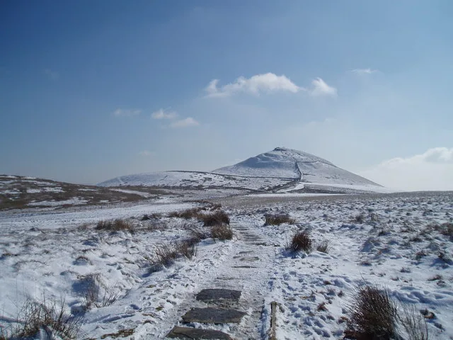
Shutlingsloe
Mountains & hills · 2.0 km
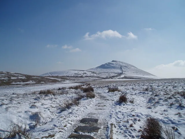
Shutlingsloe
Natural landmarks · 2.0 km
Nearby
📷 3Wildlife reserves · West Midlands
Trentabank Reservoir Nature Reserve
Trentabank Reservoir Nature Reserve — nature reserve in Macclesfield Forest, Cheshire.
📷 3Reservoirs & lochs · West Midlands
Trentabank Reservoir
Trentabank Reservoir — reservoir in Cheshire East, Cheshire, England, UK.
📷 5Mountain bike trails · West Midlands
Forest Bridleway
Forest Bridleway — a mtb trail in england west midlands.
📷 5Mountain bike trails · West Midlands
Grit and Gears II
Grit and Gears II — a mtb trail in england west midlands.
📷 3Reservoirs & lochs · West Midlands
Ridgegate Reservoir
Ridgegate Reservoir — reservoir in Cheshire, England, UK.
📷 4Historic churches · West Midlands
Forest Chapel
Forest Chapel — grade II listed church in the parish of Macclesfield Forest and Wildboarclough, Cheshire East, Cheshire, England, UK.
Where to eat & stay near Macclesfield Forest
Places to stay
 📷 5
📷 5Campsites · West Midlands
Gradbach Scout Camp
Gradbach Scout Camp — a campsite in england west midlands.
📷 5📷 5 📷 5
📷 5Caravan parks · West Midlands
Stoneyfold Caravan Park
Stoneyfold Caravan Park — a caravan park in england west midlands.
 📷 5
📷 5Hotels · West Midlands
Hollin House Hotel
Hollin House Hotel — a hotel in england west midlands.
 📷 5
📷 5Caravan parks · East Midlands
Buxton Caravan and Motorhome Club
Buxton Caravan and Motorhome Club — a caravan park in england east midlands.
Places to eat & drink
 📷 5
📷 5Historic pubs · East Midlands
Cat and Fiddle Inn
Cat and Fiddle Inn in England South East, United Kingdom.
 📷 5
📷 5Restaurants · West Midlands
Sutton Hall
Sutton Hall — a restaurant in england west midlands.
 📷 5
📷 5Historic pubs · North West England
Lord Byron Public House
Lord Byron Public House in England North West, United Kingdom.
 📷 5
📷 5Historic pubs · North West England
The Castle, Macclesfield
The Castle, Macclesfield in England North West, United Kingdom.
 📷 5
📷 5Historic pubs · North West England
2 and 4, Market Place
2 and 4, Market Place in England North West, United Kingdom.
 📷 5
📷 5Historic pubs · North West England
Bate Hall Public House
Bate Hall Public House in England North West, United Kingdom.
More national parks in this region
 📷 5
📷 5National parks · North West England
Lyme Park
Lyme Park is a large estate south of Disley, Cheshire, England. It is managed by the National Trust and consists of a mansion house surrounded by formal gardens and a deer park in the Peak District Na
 📷 4
📷 4National parks · North West England
Windgather Rocks
The Windgather Rocks (416 metres/1,365 ft a.s.l.) is a gritstone crag on the Derbyshire–Cheshire border in England. It is in the Peak District National Park and is a popular site for learning the rudi
 ★ Iconic📷 5
National parks · North West England
Lake District National Park
England's largest national park — mountains, lakes, Wordsworth country, UNESCO.
 Flagship📷 5
National parks · North West England
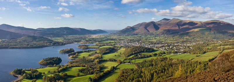
Lake District
Lake District is a Mountainous region and national park in North West England.
Frequently asked questions
- Where is Macclesfield Forest?
- Macclesfield Forest is in North-West England, United Kingdom (postcode SK11 0NS), in the parish of Sutton.
- What is Macclesfield Forest?
- Macclesfield Forest is an area of woodland, predominantly conifer plantation, around 3 miles (5 km) south east of Macclesfield in the civil parish of Macclesfield Forest and Wildboarclough, in Cheshir
- How do I get to Macclesfield Forest?
- The nearest railway station is Macclesfield, about 5.1 km away. Drivers can use postcode SK11 0NS.
- Who owns Macclesfield Forest?
- Macclesfield Forest is owned by | website =.
- Is Macclesfield Forest free to visit?
- Yes, Macclesfield Forest is free to enter.
- How do I get to Macclesfield Forest?
- The nearest railway station is Macclesfield, about 5.1 km away. Drivers can navigate to postcode SK11 0NS.