
Natural landmarks · West Midlands
Shutlingsloe
In or near Quarnford.
Shutlingsloe — mountain in United Kingdom.

Wikimedia Commons contributors — see linked file page for photographer and licence licence

Plan your visit
- Typical visit
- 1 h–2 h
- Nearest railway station
- Macclesfield · 7.0 km
- Free entry
- Dog-friendly
Getting there & planning your visit
To visit Shutlingsloe, the nearest railway station is Macclesfield, located 7 km away. The postcode for your sat-nav is SK11 0BD. Entry to the landmark is free.
About
Shutlingsloe is a named natural landmark in the United Kingdom. Wikidata describes it as: "mountain in United Kingdom". Coordinates: 53.2232°, -2.0367°.
Photo gallery
Protected designations
- Site of Special Scientific Interest: Leek Moors SSSI
Designations sourced from Natural England open data under OGL v3.
From the Wikipedia article
Shutlingsloe is a hill near the village of Wildboarclough, in the east of the county of Cheshire. It stands to the south of Macclesfield Forest, on the edge of the Peak District and within the Peak District National Park. It is a steep-sided hill with a distinctive profile and commands excellent views over Cheshire . Sometimes described as the 'Matterhorn of Cheshire' it is the third highest peak in the historic county, Shining Tor being the highest at 559 m (1,660 ft). The Peak District Boundary Walk crosses the summit, which is the highest point on the footpath's 200-mile long route. The name derives from old English 'Scyttel's hlaw' meaning 'Scyttel's (personal name) hill' and is one of several 'low' names in the Peak District, from the same Old English root that gives rise to the name "Law" for many hills in southern Scotland.
Excerpt from Wikipedia under CC BY-SA 4.0. See the source article linked in Sources below.
- Coordinates
- 53.2232, -2.0367
- District
- Cheshire East
- Parish
- Macclesfield Forest and Wildboarclough
- Postcode
- SK11 0BD
- Parliamentary constituency
- Macclesfield
- Nearest railway station
- Macclesfield — 7 km
Sources
- wikidata: Q7505630 (CC0)
- wikipedia: Shutlingsloe (CC BY-SA 4.0)
- commons: Shutlingsloe.jpg (CC BY-SA 4.0)
Other places nearby
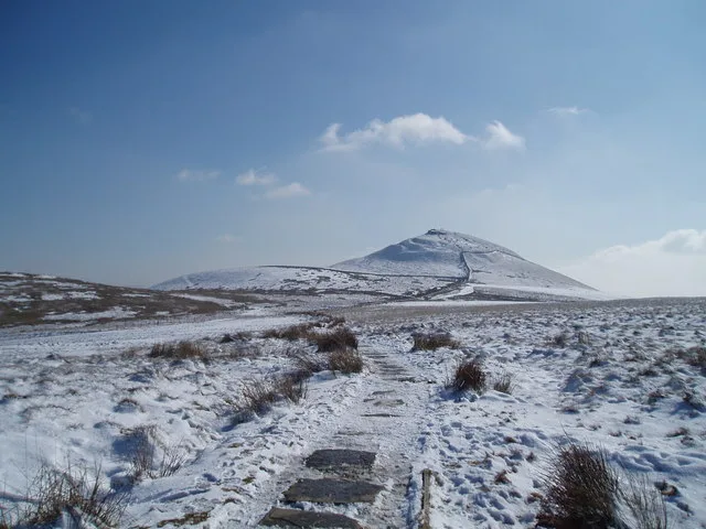
Shutlingsloe
Mountains & hills · 0.0 km

Macclesfield Forest and Wildboarclough
Parks · 1.1 km
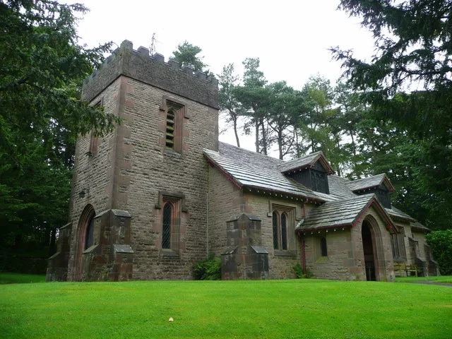
St Saviour's Church, Wildboarclough
Historic churches · 1.1 km

Macclesfield Forest
National parks · 2.0 km
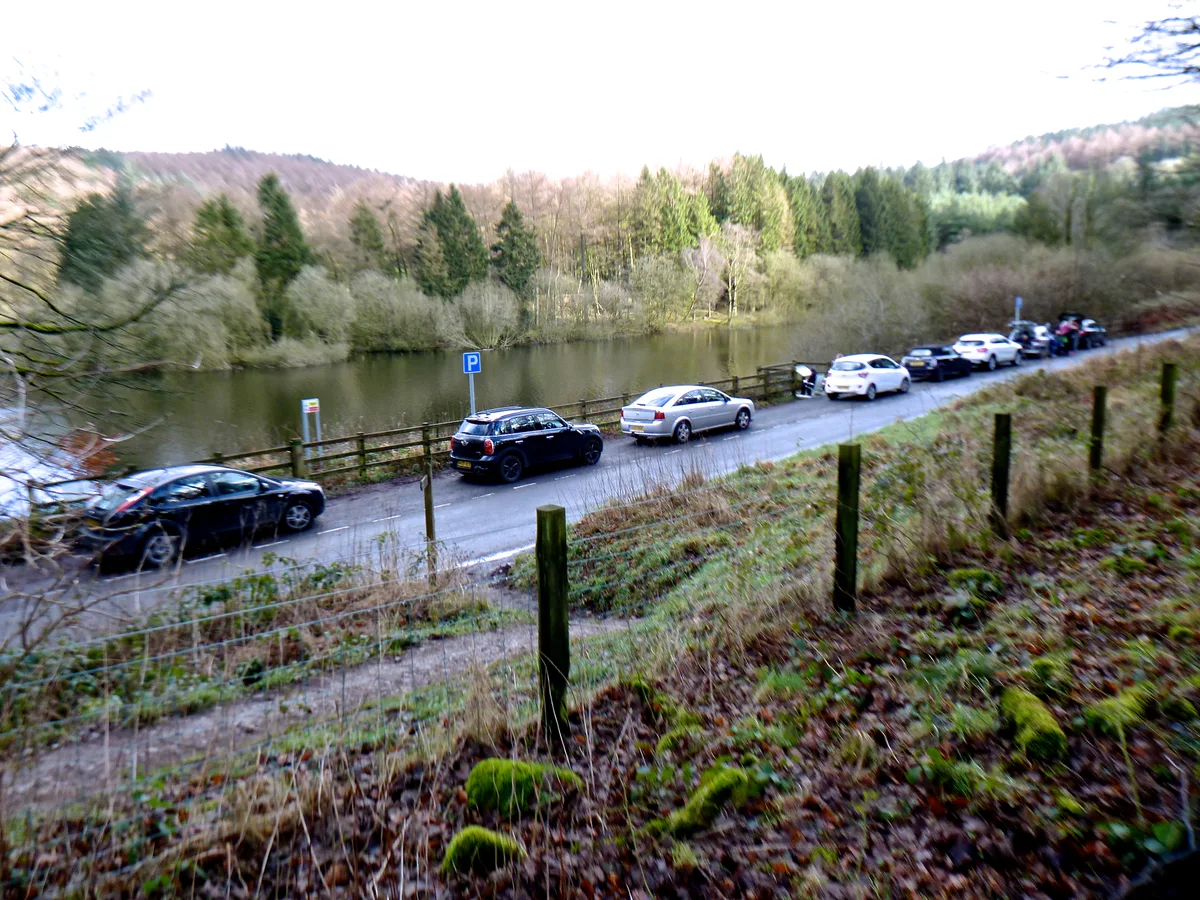
Trentabank Reservoir Nature Reserve
Wildlife reserves · 2.2 km

Trentabank Reservoir
Reservoirs & lochs · 2.2 km

Roy - a Faithful Friend
Memorials & monuments · 2.3 km

Birchenough Hill
Mountains & hills · 2.4 km
Birchenough Hill
Mountains & hills · 2.4 km

Forest Bridleway
Mountain bike trails · 2.4 km

Allgreave Bridge
Historic bridges · 2.5 km

Forest Distillery
Distilleries · 2.6 km
Nearby
📷 3📷 5Parks · West Midlands
Macclesfield Forest and Wildboarclough
Macclesfield Forest and Wildboarclough is a civil parish in the unitary authority of Cheshire East and the ceremonial county of Cheshire, England. It lies on the western fringe of the Peak District
📷 3Historic churches · West Midlands
St Saviour's Church, Wildboarclough
St Saviour's Church, Wildboarclough — grade II listed church in Wildboarclough, Cheshire East, England, UK.
📷 4National parks · North West England
Macclesfield Forest
Macclesfield Forest is an area of woodland, predominantly conifer plantation, around 3 miles (5 km) south east of Macclesfield in the civil parish of Macclesfield Forest and Wildboarclough, in Cheshir
📷 3Wildlife reserves · West Midlands
Trentabank Reservoir Nature Reserve
Trentabank Reservoir Nature Reserve — nature reserve in Macclesfield Forest, Cheshire.
📷 3Reservoirs & lochs · West Midlands
Trentabank Reservoir
Trentabank Reservoir — reservoir in Cheshire East, Cheshire, England, UK.
Where to eat & stay near Shutlingsloe
Places to stay
 📷 5
📷 5Campsites · West Midlands
Gradbach Scout Camp
Gradbach Scout Camp — a campsite in england west midlands.
📷 5📷 5 📷 5
📷 5Caravan parks · West Midlands
Stoneyfold Caravan Park
Stoneyfold Caravan Park — a caravan park in england west midlands.
 📷 5
📷 5Caravan parks · East Midlands
Buxton Caravan and Motorhome Club
Buxton Caravan and Motorhome Club — a caravan park in england east midlands.
 📷 5
📷 5Campsites · East Midlands
Cold Springs Farm Campsite
Cold Springs Farm Campsite — a campsite in england east midlands.
Places to eat & drink
 📷 5
📷 5Historic pubs · East Midlands
Cat and Fiddle Inn
Cat and Fiddle Inn in England South East, United Kingdom.
 📷 5
📷 5Restaurants · West Midlands
Sutton Hall
Sutton Hall — a restaurant in england west midlands.
 📷 5
📷 5Historic pubs · North West England
Lord Byron Public House
Lord Byron Public House in England North West, United Kingdom.
 📷 5
📷 5Historic pubs · North West England
The Castle, Macclesfield
The Castle, Macclesfield in England North West, United Kingdom.
 📷 5
📷 5Historic pubs · North West England
2 and 4, Market Place
2 and 4, Market Place in England North West, United Kingdom.
 📷 5
📷 5Historic pubs · North West England
Bate Hall Public House
Bate Hall Public House in England North West, United Kingdom.
More natural landmarks in this region
 📷 5
📷 5Natural landmarks · West Midlands
Abbots Bromley School
Abbots Bromley School — a school heritage in england-east-midlands, United Kingdom.
 📷 5
📷 5Natural landmarks · West Midlands
Fair Oak Academy
Fair Oak Academy — a school heritage in england-east-midlands, United Kingdom.
 📷 5
📷 5Natural landmarks · West Midlands
The Hart School
The Hart School — a school heritage in england-east-midlands, United Kingdom.
 📷 3
📷 3Natural landmarks · West Midlands
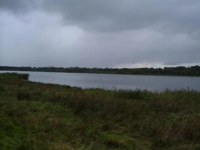
Aqualate Mere
Aqualate Mere is a natural landmark in the United Kingdom.
Frequently asked questions
- Where is Shutlingsloe?
- Shutlingsloe is in the West Midlands, United Kingdom (postcode SK11 0BD), in the parish of Macclesfield Forest and Wildboarclough.
- What is Shutlingsloe?
- Shutlingsloe — mountain in United Kingdom.
- How do I get to Shutlingsloe?
- The nearest railway station is Macclesfield, about 7.0 km away. The nearest town is Quarnford. Drivers can use postcode SK11 0BD.
- Is Shutlingsloe a protected site?
- Yes — Shutlingsloe is part of the Leek Moors SSSI Site of Special Scientific Interest.
- Is Shutlingsloe free to visit?
- Yes, Shutlingsloe is free to enter.
- How do I get to Shutlingsloe?
- The nearest railway station is Macclesfield, about 7.0 km away. Drivers can navigate to postcode SK11 0BD.