
National parks · North West England
Lyme Park
In or near Disley.
Lyme Park is a large estate south of Disley, Cheshire, England. It is managed by the National Trust and consists of a mansion house surrounded by formal gardens and a deer park in the Peak District Na

Eirian Evans — CC BY-SA 2.0 via Wikimedia Commons licence

Plan your visit
- Typical visit
- 4 h–8 h
- Best time of year
- Spring – autumn (Apr–Oct)
- Nearest railway station
- Disley · 2.4 km
- Free entry
- Family-friendly
- Dog-friendly
Getting there & planning your visit
To visit Lyme Park, the nearest railway station is Disley, located 2.4 km away. Entry to the park is free, and it is accessible for visitors. The postcode for sat-nav is SK12 2NX.
About
Lyme Park is a large estate south of Disley, Cheshire, England. It is managed by the National Trust and consists of a mansion house surrounded by formal gardens and a deer park in the Peak District National Park. The house is the largest in Cheshire and is recorded in the National Heritage List for England as a designated Grade I listed building. The estate was granted to Sir Thomas d'Anyers in 1346 and passed to the Leghs of Lyme by marriage in 1388. It remained in the possession of the Legh family until 1946, when it was given to the National Trust. The house dates from the latter part of the 16th century. Modifications were made to it in the 1720s by Giacomo Leoni, who retained some of the Elizabethan features and added others, particularly the courtyard and the south range. It is difficult to classify Leoni's work at Lyme, as it contains elements of both Palladian and Baroque styles. Further modifications were made by Lewis Wyatt in the 19th century, especially to the interior. Formal gardens were created and developed in the late 19th and early 20th centuries. The house, gardens and park have been used as locations for filming and they are open to the public. The Lyme Caxton Missal, an early printed book by William Caxton, is on display in the Library.
Photo gallery
Official information
Lyme Park is a historic park and garden located in the Peak District, known for its medieval deer park and landscaped gardens. Visitors can explore the grounds, which feature a grand country house, formal gardens, and various historical structures, including The Cage and Paddock Belvedere.
From the Wikipedia article
Lyme Park is a large estate south of Disley, Cheshire, England. It is managed by the National Trust and consists of a mansion house surrounded by formal gardens and a deer park in the Peak District National Park. The house is the largest in Cheshire and is recorded in the National Heritage List for England as a designated Grade I listed building. The estate was granted to Sir Thomas d'Anyers in 1346 and passed to the Leghs of Lyme by marriage in 1388. It remained in the possession of the Legh family until 1946, when it was given to the National Trust. The house dates from the latter part of the 16th century. Modifications were made to it in the 1720s by Giacomo Leoni, who retained some of the Elizabethan features and added others, particularly the courtyard and the south range. It is difficult to classify Leoni's work at Lyme, as it contains elements of both Palladian and Baroque styles. Further modifications were made by Lewis Wyatt in the 19th century, especially to the interior. Formal gardens were created and developed in the late 19th and early 20th centuries. The house, gardens and park have been used as locations for filming and they are open to the public. The Lyme Caxton Missal, an early printed book by William Caxton, is on display in the Library.
Excerpt from Wikipedia under CC BY-SA 4.0. See the source article linked in Sources below.
Background
History
The land now occupied by Lyme Park was granted to Piers Legh and his wife Margaret d'Anyers, with letters patent dated 4 January 1398, by Richard II, son of Edward, the Black Prince. Margaret d'Anyers' father, Sir Thomas d'Anyers, had taken part in retrieving the standard of the Black Prince at the Battle of Crécy in 1346 and was rewarded with annuity of 40 marks a year by the Black Prince, drawn on his Cheshire estate, and which could be exchanged for land of that value belonging to the Black Prince. Sir Thomas died in 1354 and the annuity passed to his daughter Margaret, who married the first Piers Legh (Piers Legh I) in 1388. Richard II favoured Piers and granted his family a coat of…
Architecture
The most obvious structure in the park, other than the house, is a tower called the Cage which stands on a hill to the east of the approach road to the house (). It was originally a hunting lodge and was later used as a park-keeper's cottage and as a lock-up for prisoners. The first structure on the site was built about 1580; this was taken down and rebuilt in 1737, possibly to a design by Leoni for Peter Legh X. The tower is built in buff sandstone rubble with ashlar sandstone dressings. It is square in plan, in three storeys, with attached small square towers surmounted by cupolas at the corners. The Cage is a Grade II* listed building. Also in the park is the Paddock Cottage which was…
Sourced from Wikipedia under CC BY-SA 4.0.
- Coordinates
- 53.3381, -2.0548
- District
- Cheshire East
- Parish
- Kettleshulme and Lyme Handley
- Postcode
- SK12 2NX
- Parliamentary constituency
- Macclesfield
- Nearest railway station
- Disley — 2.4 km
- Official site
- historicengland.org.uk
Sources
- wikipedia: Lyme Park (CC BY-SA 4.0)
Featured in this guide
Other places nearby

Hamper's Bridge
Historic bridges · 0.3 km

The Knott
Mountains & hills · 0.7 km

Paddock Cottage
Natural landmarks · 1.1 km

Higher Moor
Mountains & hills · 1.2 km

The Bowstones
Memorials & monuments · 1.4 km

Bridge Number 17 over canal, north of Mitchelfold
Historic bridges · 2.0 km

Elm Beds Caravan Park
Caravan parks · 2.0 km

Canal Bridge Number 14 - carries track to Red Legg Farm
Historic bridges · 2.2 km

Mine Shafts in Poynton and Surrounding Area
Public art & sculpture · 2.2 km

Disley
Towns & cities · 2.2 km

Tower In Garden Of Woodbank House
Memorials & monuments · 2.3 km

Bridge over Bollinhurst Brook 30 metres north of Brookside Farmhouse
Historic bridges · 2.3 km
Nearby
📷 3Historic bridges · Yorkshire & the Humber
Hamper's Bridge
Hamper's Bridge — Grade II listed building-listed bridge in england-west-midlands, United Kingdom.
📷 5Mountains & hills · Yorkshire & the Humber
The Knott
The Knott — mountain in england west midlands. Elevation: 250 m.
📷 3Natural landmarks · Yorkshire & the Humber
Paddock Cottage
Paddock Cottage — a other in england-west-midlands, United Kingdom.
📷 5Mountains & hills · Yorkshire & the Humber
Higher Moor
Higher Moor — mountain in england west midlands. Elevation: 402 m.
📷 3Memorials & monuments · Yorkshire & the Humber
The Bowstones
The Bowstones — a memorial in england-west-midlands, United Kingdom.
📷 3Historic bridges · Yorkshire & the Humber
Bridge Number 17 over canal, north of Mitchelfold
Bridge Number 17 over canal, north of Mitchelfold — Grade II listed building-listed bridge in england-west-midlands, United Kingdom.
Where to eat & stay near Lyme Park
Places to stay
📷 5Caravan parks · Yorkshire & the Humber
Elm Beds Caravan Park
Elm Beds Caravan Park — a caravan park in england west midlands.
 📷 5
📷 5Caravan parks · Yorkshire & the Humber
Eastwood End Holiday Park
Eastwood End Holiday Park — a caravan park in england west midlands.
 📷 5
📷 5Caravan parks · East Midlands
Ringstones Caravan Park
Ringstones Caravan Park — a caravan park in england east midlands.
 📷 5
📷 5Caravan parks · Yorkshire & the Humber
Shaw Farm - Static Caravans
Shaw Farm - Static Caravans — a caravan park in england west midlands.
 📷 5
📷 5Campsites · Yorkshire & the Humber
Linnet Clough Scout Camp
Linnet Clough Scout Camp — a campsite in england west midlands.
 📷 5
📷 5Hotels · West Midlands
Hollin House Hotel
Hollin House Hotel — a hotel in england west midlands.
Places to eat & drink
 📷 5
📷 5Historic pubs · North West England
Disley Friends Meeting House
Disley Friends Meeting House in England North West, United Kingdom.
 📷 4
📷 4Historic pubs · Yorkshire & the Humber
Rams Head Hotel
Rams Head Hotel — Historic pub — listed building or notable heritage status.
 📷 5
📷 5Historic pubs · East Midlands
The Hare And Hounds Hotel
The Hare And Hounds Hotel in England Yorkshire, United Kingdom.
 📷 7
📷 7Restaurants · Yorkshire & the Humber
Maple Tree
Maple Tree — a restaurant in england west midlands.
 📷 5
📷 5 📷 7
📷 7Historic pubs · North West England
George Hotel Public House
George Hotel Public House in England North West, United Kingdom.
More national parks in this region
 📷 4
📷 4National parks · North West England
Windgather Rocks
The Windgather Rocks (416 metres/1,365 ft a.s.l.) is a gritstone crag on the Derbyshire–Cheshire border in England. It is in the Peak District National Park and is a popular site for learning the rudi
 ★ Iconic📷 5
National parks · North West England
Lake District National Park
England's largest national park — mountains, lakes, Wordsworth country, UNESCO.
 📷 4
📷 4National parks · North West England
Macclesfield Forest
Macclesfield Forest is an area of woodland, predominantly conifer plantation, around 3 miles (5 km) south east of Macclesfield in the civil parish of Macclesfield Forest and Wildboarclough, in Cheshir
 Flagship📷 5
National parks · North West England
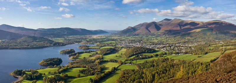
Lake District
Lake District is a Mountainous region and national park in North West England.
Frequently asked questions
- Where is Lyme Park?
- Lyme Park is in North-West England, United Kingdom (postcode SK12 2NX), in the parish of Kettleshulme and Lyme Handley.
- What is Lyme Park?
- Lyme Park is a large estate south of Disley, Cheshire, England. It is managed by the National Trust and consists of a mansion house surrounded by formal gardens and a deer park in the Peak District Na
- How do I get to Lyme Park?
- The nearest railway station is Disley, about 2.4 km away. Drivers can use postcode SK12 2NX.
- Is Lyme Park free to visit?
- Yes, Lyme Park is free to enter.
- How do I get to Lyme Park?
- The nearest railway station is Disley, about 2.4 km away. Drivers can navigate to postcode SK12 2NX.