
National parks · East Midlands
Peak District
In or near Edale.
Peak District is a Upland area in England.

Photo by Evilbish (Wikimedia Commons, CC BY 3.0) licence
Plan your visit
- Typical visit
- 4 h–8 h
- Best time of year
- Spring – autumn (Apr–Oct)
- Nearest railway station
- Edale · 4.4 km
- Free entry
- Family-friendly
- Dog-friendly
Getting there & planning your visit
To visit the Peak District, the nearest railway station is Edale, which is 4.4 km away. Entry to the park is free.
About
Peak District is a national park in the United Kingdom. It covers approximately 1444 km². According to Wikipedia: "The Peak District is an upland area in central-northern England, at the southern end of the Pennines.". It is one of fifteen designated national parks across England, Scotland, and Wales, protected for its landscape and recreation value.
Photo gallery
Summary from the official site
The Peak District is a national park known for its stunning landscapes, diverse wildlife, and outdoor activities. Visitors can enjoy guided walks, bike hire, and various accessible routes, making it a great destination for nature enthusiasts and families alike.
Read more on the official property page.
Protected designations
- Site of Special Scientific Interest: Dark Peak SSSI
- National Nature Reserve: KINDER SCOUT
Designations sourced from Natural England open data under OGL v3.
From the Wikipedia article
The Peak District is an upland area in central-northern England, at the southern end of the Pennines. Mostly in Derbyshire, it extends into Cheshire, Greater Manchester, Staffordshire, West Yorkshire and South Yorkshire. It is subdivided into the Dark Peak, moorland dominated by gritstone, and the White Peak, a limestone area with valleys and gorges. The Dark Peak forms an arc on the north, east and west of the district, and the White Peak covers central and southern areas. The highest point is Kinder Scout (2,087 ft (636 m)). Most of the area is within the Peak District National Park, a protected landscape designated in 1951. A 2021 report states that "the Park's own population numbers around 40,000 and supports an estimated 18,000 jobs, predominantly through farming, manufacturing and, inevitably, tourism". The area has been inhabited since the Mesolithic era; it was largely used for agricultural purposes until mining arose in the Middle Ages. During the Industrial Revolution, several cotton mills were constructed in the area's valleys by Richard Arkwright. As mining declined, quarrying grew. Tourism came with the railways, spurred by the landscape, spa towns and Castleton's show caves.
Excerpt from Wikipedia under CC BY-SA 4.0. See the source article linked in Sources below.
Background
History
valley from Mam Tor]] The Peak has been inhabited from the earliest periods of human activity, as shown by finds of Mesolithic flint artefacts and palaeo-environmental evidence from caves in Dovedale and elsewhere. Signs of Neolithic activity include monumental earthworks or barrows such as the one at Margery Hill. The Bronze Age saw the area well populated and farmed. Evidence remains in henges such as Arbor Low near Youlgreave and the Nine Ladies stone circle at Stanton Moor. In the same period and into the Iron Age, hill forts such as Mam Tor's were created. The Romans drew on the area's rich mineral veins, exporting lead from the Buxton area along well-used routes. Buxton was a Roman…
Visiting
De Mirabilibus Pecci or The Seven Wonders of the Peak by Thomas Hobbes was an early touring description published in 1636. Much scorn was poured on the seven wonders by visitors, including Daniel Defoe, who called the moors by Chatsworth "a waste and houling wilderness" and scorned particularly Peak Cavern near Castleton, known as the "Devil's Arse". Visitor numbers did not rise until the Victorian era, when railways provided access and cultural appreciation of the Picturesque and Romantic developed. John Mawe's Mineralogy of Derbyshire (1802) and William Adam's Gem of the Peak (1843) raised interest in the area's unique geology. A tradition of public access and outdoor recreation grew up…
Sourced from Wikipedia under CC BY-SA 4.0.
- Coordinates
- 53.3847, -1.8739
- Address
- Cheshire, Derbyshire, Greater Manchester, South Yorkshire, Staffordshire, West Yorkshire
- Nearest railway station
- Edale — 4.4 km
- Official site
- www.peakdistrict.gov.uk
Sources
- wikidata: Q1330811 (CC0)
- wikipedia: Peak District (CC BY-SA 4.0)
- commons: Mam Tor.jpg (CC BY 3.0)

Featured in these 2 guides
Other places nearby
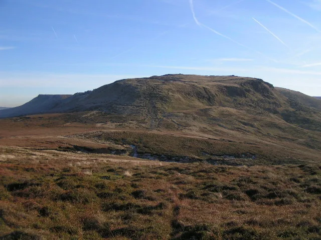
Kinder Scout
Mountains & hills · 0.0 km

Kinder Low
Mountains & hills · 0.8 km

Crowden Head
Mountains & hills · 1.2 km

Kinder Downfall
Waterfalls · 1.4 km

Swine's Back
Mountains & hills · 1.4 km

Kinder Low Bowl Barrow
Burial mounds & barrows · 1.5 km

Kinder Low Bowl Barrow
Archaeological sites · 1.5 km

Mermaid's pool
Wild swimming spots · 1.5 km

Edale Cross
Memorials & monuments · 1.6 km

Kinderlow Cavern
Caves · 1.9 km

The Edge
Mountains & hills · 2.0 km
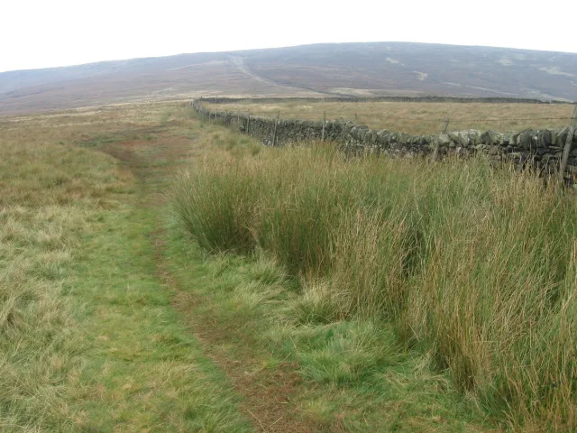
Brown Knoll
Mountains & hills · 2.4 km
Nearby
📷 5Mountains & hills · East Midlands
Kinder Scout
Kinder Scout — Named summit at 636 m.
📷 5Mountains & hills · East Midlands
Kinder Low
Kinder Low — mountain in england east midlands. Elevation: 633 m.
📷 5Mountains & hills · East Midlands
Crowden Head
Crowden Head — mountain in england east midlands. Elevation: 632 m.
📷 5📷 5Mountains & hills · East Midlands
Swine's Back
Swine's Back — mountain in england east midlands. Elevation: 596 m.
📷 3Burial mounds & barrows · East Midlands
Kinder Low Bowl Barrow
Kinder Low Bowl Barrow — a burial mound in england-east-midlands, United Kingdom.
Where to eat & stay near Peak District
Places to stay
 📷 5
📷 5Campsites · East Midlands
Upper Booth Farm Campsite
Upper Booth Farm Campsite — a campsite in england east midlands.
 📷 5
📷 5Campsites · East Midlands
Whitmore Lea Campsite
Whitmore Lea Campsite — a campsite in england east midlands.
 📷 5
📷 5Hostels · East Midlands
Dalehead Bunkhouse & Information Barn
Dalehead Bunkhouse & Information Barn — a hostel in england east midlands.
 📷 5
📷 5Campsites · East Midlands
Whitmore Lea Campsite
Whitmore Lea Campsite — a campsite in england east midlands.
 📷 5
📷 5Campsites · East Midlands
Hayfield Campsite
Hayfield Campsite — a campsite in england east midlands.
 📷 5
📷 5Campsites · East Midlands
chapel view campsite
chapel view campsite — a campsite in england east midlands.
Places to eat & drink
 📷 5
📷 5Historic pubs · East Midlands
The Old Nags Head
The Old Nags Head in England Yorkshire, United Kingdom.
 📷 5
📷 5 📷 5
📷 5Historic pubs · East Midlands
The Hare And Hounds Hotel
The Hare And Hounds Hotel in England Yorkshire, United Kingdom.
 📷 5
📷 5Historic pubs · East Midlands
The Crown Inn, Glossop
The Crown Inn, Glossop in England Yorkshire, United Kingdom.
 📷 5
📷 5Historic pubs · East Midlands
Former Dollars Public House
Former Dollars Public House in England Yorkshire, United Kingdom.
 📷 5
📷 5Historic pubs · East Midlands
Norfolk Arms Public House
Norfolk Arms Public House in England Yorkshire, United Kingdom.
More national parks in this region
 📷 4
📷 4National parks · East Midlands
Longshaw Estate
The Longshaw Estate is an area of moorland, woodland and farmland within the Peak District National Park in Derbyshire, England. The name of Longshaw is thought to have derived from the long wood in P
Frequently asked questions
- Where is Peak District?
- Peak District is in the East Midlands, United Kingdom.
- What is Peak District?
- Peak District is a Upland area in England.
- How do I get to Peak District?
- The nearest railway station is Edale, about 4.4 km away. Its coordinates are 53.3847°, -1.8739°.
- Is Peak District a protected site?
- Yes — Peak District is part of the Dark Peak SSSI Site of Special Scientific Interest and the KINDER SCOUT National Nature Reserve.
- Is Peak District free to visit?
- Yes, Peak District is free to enter.
- How do I get to Peak District?
- The nearest railway station is Edale, about 4.4 km away.