
National parks · North West England
Lake District National Park
Also known as: Ardal y Llynnoedd, Lloegr, Lake District, Pow an Lynnyn
In or near Grasmere.
England's largest national park — mountains, lakes, Wordsworth country, UNESCO.

Michael Graham — CC BY-SA 2.0 via Wikimedia Commons licence

Plan your visit
- Typical visit
- 4 h–8 h
- Best time of year
- Spring – autumn (Apr–Oct)
- Free entry
- Family-friendly
- Dog-friendly
Getting there & planning your visit
The Lake District National Park is located in North West England, with the postcode LA22 9JX. Entry to the park is free. For accessibility, please note that specific details are not provided.
About
The Lake District National Park covers 2,362 sq km of the historic county of Cumberland and Westmorland — England's largest national park and a UNESCO World Heritage Site (2017). It contains every English peak above 900 m (Scafell Pike at 978 m is the highest in England), 16 named lakes (Windermere, Ullswater, Coniston Water, Derwentwater the most visited), 26 of England's 30 highest hills, and the inspirations of Wordsworth, Coleridge, Ruskin, Beatrix Potter and Arthur Ransome. Around 19 million people visit each year, making it the most-visited national park in the UK.
Photo gallery
Protected designations
- Site of Special Scientific Interest: Langdale Pikes SSSI
Designations sourced from Natural England open data under OGL v3.
From the Wikipedia article
The Lake District, also known as the Lakes or Lakeland, is a mountainous region and national park in Cumbria, North West England. It is famous for its landscape, including its lakes, coast, and mountains, and for its literary associations with Beatrix Potter, John Ruskin, Arthur Ransome, and the Lake Poets. The Lakeland fells, or mountains, include England's highest: Scafell Pike (978 m; 3,209 ft), Helvellyn (950 m; 3,120 ft) and Skiddaw (931 m; 3,054 ft). The region also contains sixteen major lakes. They include Windermere, which with a length of 11 miles (18 km) and an area of 5.69 square miles (14.73 km2) is the longest and largest lake in England, and Wast Water, which at 79 metres (259 ft) is the deepest lake in England. The Lake District National Park was established in 1951, and covers an area of 2,362 km2 (912 square miles), the bulk of the region. It was designated a UNESCO World Heritage Site in 2017.
Excerpt from Wikipedia under CC BY-SA 4.0. See the source article linked in Sources below.
Background
History
Early visitors to the Lake District, who travelled for the education and pleasure of the journey, include Celia Fiennes, who in 1698 undertook a journey the length of England, including riding through Kendal and over Kirkstone Pass into Patterdale. Her experiences and impressions were published in her book Great Journey to Newcastle and Cornwall: <blockquote>As I walked down at this place I was walled on both sides by those inaccessible high rocky barren hills which hang over one's head in some places and appear very terrible; and from them springs many little currents of water from the sides and clefts which trickle down to some lower part where it runs swiftly over the stones and shelves…
Sourced from Wikipedia under CC BY-SA 4.0.
- Coordinates
- 54.4609, -3.0886
- District
- Westmorland and Furness
- Parish
- Lakes
- Postcode
- LA22 9JX
- Parliamentary constituency
- Westmorland and Lonsdale
- Established
- 1951
Sources
- manual: lake-district-national-park (manual)
- wikipedia: Lake District (CC BY-SA 4.0)
Featured in these 2 guides
Other places nearby

Blea Rigg (high point)
Mountains & hills · 0.5 km

Tarn Crag
Mountains & hills · 0.6 km
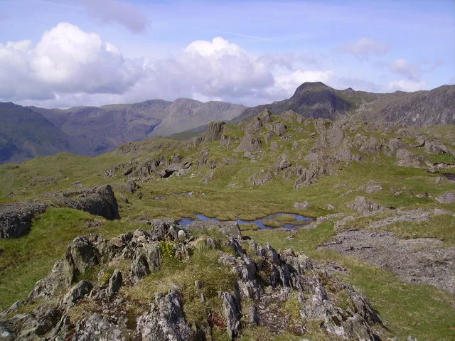
Blea Rigg (Wainwright)
Mountains & hills · 0.6 km
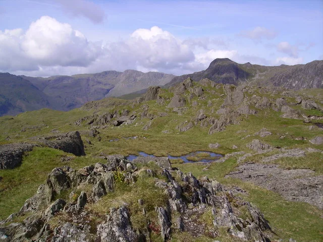
Blea Rigg
Natural landmarks · 0.7 km

Belles Knott
Mountains & hills · 0.8 km
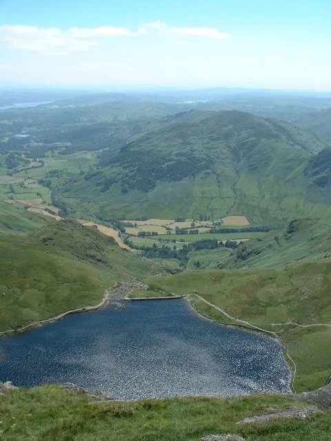
Stickle Tarn
Natural landmarks · 0.9 km
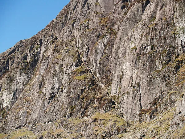
Pavey Ark
Natural landmarks · 1.0 km
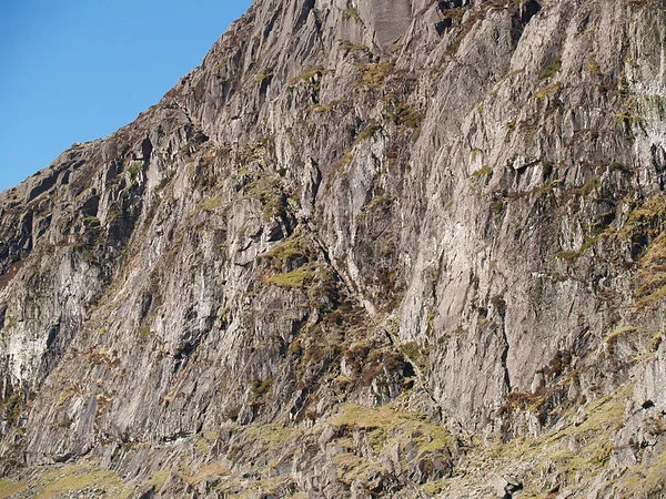
Pavey Ark
Mountains & hills · 1.1 km

Greenhowe Caravan Park
Caravan parks · 1.2 km

Dungeon Ghyll Waterfall
Waterfalls · 1.3 km

Stone Age Quarry
Archaeological sites · 1.3 km

Dungeon Ghyll Force
Waterfalls · 1.4 km
Nearby
📷 5Mountains & hills · North West England
Blea Rigg (high point)
Blea Rigg (high point) — mountain in england north west. Elevation: 545.1 m.
📷 5Mountains & hills · North West England
Tarn Crag
Tarn Crag — mountain in england north west. Elevation: 505.7 m.
📷 5Mountains & hills · North West England
Blea Rigg (Wainwright)
Blea Rigg (Wainwright) — Named summit at 541.5 m.
📷 5📷 5Mountains & hills · North West England
Belles Knott
Belles Knott — mountain in england north west. Elevation: 490.7 m.
Flagship📷 3Natural landmarks · North West England
Stickle Tarn
Stickle Tarn — lake near Harrison Stickle, Langdale, Cumbria, United Kingdom.
Where to eat & stay near Lake District National Park
Places to stay
📷 5Caravan parks · North West England
Greenhowe Caravan Park
Greenhowe Caravan Park — a caravan park in england north west.
 📷 5
📷 5Campsites · North West England
Great Langdale Campsite
Great Langdale Campsite — a campsite in england north west.
 📷 5
📷 5Campsites · North West England
Baysbrown Farm
Baysbrown Farm — a campsite in england north west.
 📷 5
📷 5Hostels · North West England
Thorney How
Thorney How — a hostel in england north west.
 📷 5
📷 5 📷 7
📷 7Hotels · North West England
Dale Lodge Hotel
Dale Lodge Hotel — a hotel in england north west.
Places to eat & drink
 📷 7
📷 7Historic pubs · North West England
The Travellers Rest
The Travellers Rest in England North West, United Kingdom.
 📷 5
📷 5Historic pubs · North West England
Golden Rule Hotel
Golden Rule Hotel in England North West, United Kingdom.
 📷 7
📷 7Cafés · North West England
Grange Bridge Cottage
Grange Bridge Cottage — a café in england north east.
 📷 5
📷 5Restaurants · North West England
Holbeck Ghyll Restaurant
Holbeck Ghyll Restaurant — a restaurant in england north west.
 📷 4
📷 4Restaurants · North West England
Holbeck Ghyll
Holbeck Ghyll is a restaurant located in Windermere, Cumbria, England. "The late 19th century building was once Lord Lonsdale's hunting lodge and only became a hotel in the 1970s. It won a Michelin st
📷 5Historic pubs · North West England
Holbeck Ghyll
Holbeck Ghyll in England North West, United Kingdom.
Other national parks from this era
 ★ Iconic📷 5
National parks · North Wales
Snowdonia National Park
Wales' largest national park — Snowdon, slate heritage, Welsh-language heartland.
More national parks in this region
 📷 5
📷 5National parks · North West England
Lyme Park
Lyme Park is a large estate south of Disley, Cheshire, England. It is managed by the National Trust and consists of a mansion house surrounded by formal gardens and a deer park in the Peak District Na
 📷 4
📷 4National parks · North West England
Windgather Rocks
The Windgather Rocks (416 metres/1,365 ft a.s.l.) is a gritstone crag on the Derbyshire–Cheshire border in England. It is in the Peak District National Park and is a popular site for learning the rudi
 📷 4
📷 4National parks · North West England
Macclesfield Forest
Macclesfield Forest is an area of woodland, predominantly conifer plantation, around 3 miles (5 km) south east of Macclesfield in the civil parish of Macclesfield Forest and Wildboarclough, in Cheshir
 Flagship📷 5
National parks · North West England
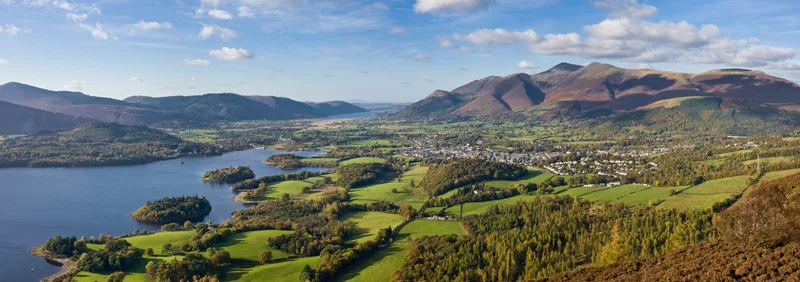
Lake District
Lake District is a Mountainous region and national park in North West England.
Frequently asked questions
- Where is Lake District National Park?
- Lake District National Park is in North-West England, United Kingdom (postcode LA22 9JX), in the parish of Lakes.
- What is Lake District National Park?
- England's largest national park — mountains, lakes, Wordsworth country, UNESCO.
- How do I get to Lake District National Park?
- Drivers can use postcode LA22 9JX.
- When was Lake District National Park built?
- Built or established in 1951.
- Is Lake District National Park a protected site?
- Yes — Lake District National Park is part of the Langdale Pikes SSSI Site of Special Scientific Interest.
- Is Lake District National Park free to visit?
- Yes, Lake District National Park is free to enter.
- How do I get to Lake District National Park?
- Drivers can navigate to postcode LA22 9JX. It sits within the Westmorland and Lonsdale parliamentary constituency.