
Archaeological sites · North West England
Hardknott Roman Fort
Also known as: Dúnfort Rómhánach Hardknott
In or near Boot.
Hardknott Roman Fort is an archeological site, the remains of the Roman fort Mediobogdum, located on the western side of the challenging Hardknott Pass in the English Lake District. The fort was built

Rob Farrow — CC BY-SA 2.0 via Wikimedia Commons licence

Plan your visit
- Typical visit
- 45 min–1.5 h
- Nearest railway station
- Dalegarth · 4.6 km
- Free entry
- Dog-friendly
Getting there & planning your visit
To visit Hardknott Roman Fort, the nearest railway station is Dalegarth, located 4.6 km away. Entry to the fort is free. The site is accessible, but please consider the distance from the station when planning your visit.
About
Hardknott Roman Fort is an archeological site, the remains of the Roman fort Mediobogdum, located on the western side of the challenging Hardknott Pass in the English Lake District. The fort was built between 120 and 138 on a rocky spur, and was initially garrisoned by a detachment of the Cohors IV Delmatarum from the Dalmatian coast (in modern Croatia). It was abandoned around a decade later, then reoccupied circa 200 and remained in use for much of the next two centuries. The fort is on land owned by the National Trust, part of the Trust's Wasdale, Eskdale and Duddon property, and is maintained by English Heritage. It is in the civil parish of Eskdale, the unitary authority area of Cumberland, and the ceremonial county of Cumbria.
Photo gallery
Official information
Hardknott Roman Fort is a historical site established during the 2nd century under Emperor Hadrian. Visitors can explore well-preserved remains, including the headquarters building, commandant's house, and bath house, as well as the site of the parade ground and the ancient road it guarded.
From the Wikipedia article
Hardknott Roman Fort is an archeological site, the remains of the Roman fort Mediobogdum, located on the western side of the challenging Hardknott Pass in the English Lake District. The fort was built between 120 and 138 on a rocky spur, and was initially garrisoned by a detachment of the Cohors IV Delmatarum from the Dalmatian coast (in modern Croatia). It was abandoned around a decade later, then reoccupied circa 200 and remained in use for much of the next two centuries. The fort is on land owned by the National Trust, part of the Trust's Wasdale, Eskdale and Duddon property, and is maintained by English Heritage. It is in the civil parish of Eskdale, the unitary authority area of Cumberland, and the ceremonial county of Cumbria.
Excerpt from Wikipedia under CC BY-SA 4.0. See the source article linked in Sources below.
Background
History
Built between about 120 and 138, the fort was abandoned during the Antonine advance into Scotland during the mid-2nd century. The fort was reoccupied around 200 and continued in use until the last years of the 4th century. During this time, an extensive vicus developed outside the fort. The initial Roman garrison here was a detachment of 500 infantry of the Cohors IV Delmatarum from the Dalmatian coast. Leather objects from Roman occupation have been found at the site. A 1965 excavation found a piece of leather near the granary, thought to be part of soldier's jerkin. Another excavation in 1968 by Dorothy Charlesworth and J. H. Thornton uncovered more leather, including several shoes.
Architecture
The fort is square with rounded corners, 114 metres long externally, or 105 metres internally, the rampart wall being about 1.7 metres thick with ditches adding to the total width of the rampart. The low walls of the fort were "restored" some years ago, a slate course showing the height of the walls before their rebuilding. The outer wall has four gates, at the centre of each side, and lookout towers at each corner. Within the walls are the remaining outlines of several buildings: two side-by-side granaries, the garrison headquarters building and garrison commander's villa, or Praetorium. In addition to these stone buildings, long-lost timber structures would have housed barracks for the…
Sourced from Wikipedia under CC BY-SA 4.0.
- Coordinates
- 54.4028, -3.2053
- Address
- Cumbria, England
- Nearest railway station
- Dalegarth — 4.6 km
- Opening
- Open any reasonable time during daylight hours
- Official site
- www.english-heritage.org.uk
Sources
- wikipedia: Hardknott Roman Fort (CC BY-SA 4.0)
Other places nearby

Hardknott Roman Fort
Archaeological sites · 0.0 km

Border End
Mountains & hills · 1.0 km

Eskdale Needle
Natural landmarks · 1.3 km

Eskdale Needle
Mountains & hills · 1.3 km

Goat Crag
Mountains & hills · 1.5 km

Wha House Bridge
Historic bridges · 1.6 km
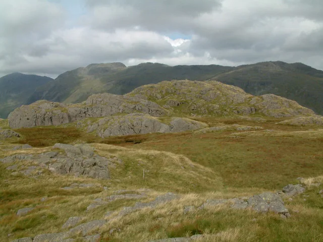
Hard Knott
Mountains & hills · 1.6 km
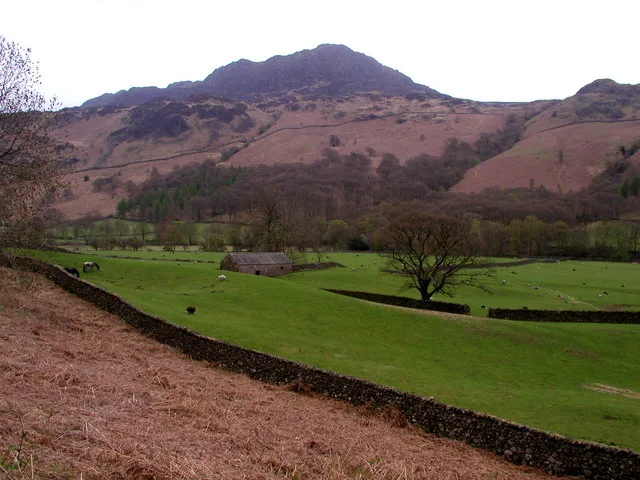
Harter Fell
Natural landmarks · 1.6 km

Harter Fell (Eskdale)
Mountains & hills · 1.8 km
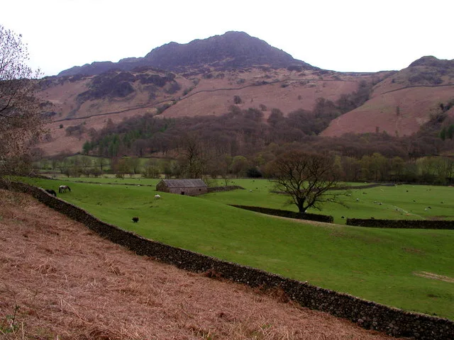
Harter Fell
Mountains & hills · 1.8 km

Yew Bank
Mountains & hills · 2.1 km

Hardknot Pass Viewpoint
Viewpoints · 2.1 km
Nearby
📷 5Archaeological sites · North West England
Hardknott Roman Fort
Hardknott Roman Fort — archaeological in england north west. Operated by English Heritage.
📷 5Mountains & hills · North West England
Border End
Border End — mountain in england north west. Elevation: 522 m.
📷 3Natural landmarks · North West England
Eskdale Needle
Eskdale Needle — a other in england-north-west, United Kingdom.
📷 5Mountains & hills · North West England
Eskdale Needle
Eskdale Needle — mountain in england north west. Elevation: 468 m.
📷 5Mountains & hills · North West England
Goat Crag
Goat Crag — mountain in england north west. Elevation: 312 m.
📷 3Historic bridges · North West England
Wha House Bridge
Wha House Bridge is a historic bridge in the United Kingdom.
Where to eat & stay near Hardknott Roman Fort
Places to stay
 📷 5
📷 5Hostels · North West England
YHA Eskdale
YHA Eskdale — a hostel in england north west.
 📷 5
📷 5Campsites · North West England
Eskdale Campsite
Eskdale Campsite — a campsite in england north west.
 📷 5
📷 5Campsites · North West England
Turner Hall Farm Campsite
Turner Hall Farm Campsite — a campsite in england north west.
 📷 5
📷 5Campsites · North West England
Fisherground Campsite
Fisherground Campsite — a campsite in england north west.
 📷 5
📷 5Campsites · North West England
Wasdale Campsite
Wasdale Campsite — a campsite in england north west.
 📷 5
📷 5Hostels · North West England
YHA Coppermines
YHA Coppermines — a hostel in england north west.
Places to eat & drink
 📷 7
📷 7Historic pubs · North West England
Church House Public House
Church House Public House in England North West, United Kingdom.
 📷 5
📷 5Restaurants · North West England
The Terrace Coffee House and Restaurant
The Terrace Coffee House and Restaurant — a restaurant in england north west. Cuisine: sandwich;lunch.
 📷 5
📷 5Historic pubs · North West England
Blacksmiths Arms
Blacksmiths Arms in England North West, United Kingdom.
 📷 5
📷 5Historic pubs · North West England
Sun Cottage Sun Inn Public House
Sun Cottage Sun Inn Public House in England North West, United Kingdom.
 📷 7
📷 7Historic pubs · North West England
The Travellers Rest
The Travellers Rest in England North West, United Kingdom.
 📷 5
📷 5Historic pubs · North West England
Golden Rule Hotel
Golden Rule Hotel in England North West, United Kingdom.
More archaeological sites in this region
 📷 3
📷 3Archaeological sites · North West England
Early medieval sculptural fragments in St Mary's churchyard
Early medieval sculptural fragments in St Mary's churchyard — archaeological site in Sandbach, Cheshire East, England, UK.
 📷 3
📷 3Archaeological sites · North West England
Gaddum's Wood
Gaddum's Wood is a archaeological site in the United Kingdom.
 📷 3
📷 3Archaeological sites · North West England
Marton moated monastic grange, three fishponds, connecting channels and base of stone cross
Marton moated monastic grange, three fishponds, connecting channels and base of stone cross — archaeological site in Whitegate and Marton, Cheshire West and Chester, England, UK.
 📷 3
📷 3Archaeological sites · North West England
St Oswalds Well
St Oswalds Well — a archaeological in england-west-midlands, United Kingdom.
Frequently asked questions
- Where is Hardknott Roman Fort?
- Hardknott Roman Fort is in North-West England, United Kingdom.
- What is Hardknott Roman Fort?
- Hardknott Roman Fort is an archeological site, the remains of the Roman fort Mediobogdum, located on the western side of the challenging Hardknott Pass in the English Lake District. The fort was built
- How do I get to Hardknott Roman Fort?
- The nearest railway station is Dalegarth, about 4.6 km away. Its coordinates are 54.4028°, -3.2053°.
- Is Hardknott Roman Fort free to visit?
- Yes, Hardknott Roman Fort is free to enter.
- How do I get to Hardknott Roman Fort?
- The nearest railway station is Dalegarth, about 4.6 km away.