
Campsites · North West England
Turner Hall Farm Campsite
In or near Seathwaite.
Turner Hall Farm Campsite — a campsite in england north west.

Ian Greig — CC BY-SA 2.0 via Wikimedia Commons licence

Plan your visit
- Typical visit
- 1 h–2 h
- Nearest railway station
- Dalegarth · 7.4 km
About
Turner Hall Farm Campsite is a campsite located in england north west. Phone: +44 1229 716420. Address: Seathwaite, LA20 6EE.
Photo gallery
Place summary
Turner Hall Farm Campsite is located in North-West England, postcode LA20. This campsite offers a natural setting for outdoor enthusiasts, providing basic facilities for camping. Visitors can expect a tranquil environment, ideal for relaxation and exploration of the surrounding countryside.
AI-generated from the structured facts on this page (operator, designation, listing, era). Not a substitute for visiting.
- Coordinates
- 54.3560, -3.1821
- District
- Westmorland and Furness
- Parish
- Dunnerdale-with-Seathwaite
- Postcode
- LA20 6EE
- Parliamentary constituency
- Barrow and Furness
- Phone
- +44 1229 716420
- Nearest railway station
- Dalegarth — 7.4 km
Sources
- osm: w346071414 (ODbL)
Other places nearby

Holy Trinity Church, Seathwaite
Historic churches · 0.4 km

Seathwaite
Towns & cities · 0.4 km

Seathwaite Bridge
Historic bridges · 0.6 km

Pen
Mountains & hills · 0.6 km

Wallowbarrow Crag
Mountains & hills · 1.2 km

Green Pikes
Mountains & hills · 1.2 km

High Tongue
Mountains & hills · 1.4 km

Pikes
Mountains & hills · 1.6 km
Pikes
Mountains & hills · 1.6 km

White Pike
Mountains & hills · 1.8 km
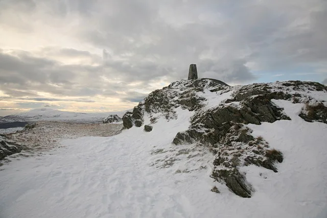
Caw
Mountains & hills · 1.8 km

White Maiden
Mountains & hills · 2.2 km
Nearby
📷 3Historic churches · North West England
Holy Trinity Church, Seathwaite
Holy Trinity Church, Seathwaite — a Grade II-listed church in england-north-west, United Kingdom.
📷 5Towns & cities · North West England
Seathwaite
Seathwaite — village in South Lakeland, Cumbria, United Kingdom.
📷 3Historic bridges · North West England
Seathwaite Bridge
Seathwaite Bridge — Grade II listed building-listed bridge in england-north-west, United Kingdom.
📷 5📷 5Mountains & hills · North West England
Wallowbarrow Crag
Wallowbarrow Crag — mountain in england north west. Elevation: 292 m.
📷 5Mountains & hills · North West England
Green Pikes
Green Pikes — mountain in england north west. Elevation: 420 m.
Where to eat & stay near Turner Hall Farm Campsite
Places to stay
 📷 7
B&Bs · North West England
The Church House Inn
The Church House Inn — a bed-and-breakfast in england north west.
 📷 5
Caravan parks · North West England
Shepherd's View Caravan Site
Shepherd's View Caravan Site — a caravan park in england north west.
 📷 5
Hostels · North West England
YHA Coppermines
YHA Coppermines — a hostel in england north west.
 📷 5
Hostels · North West England
YHA Eskdale
YHA Eskdale — a hostel in england north west.
 📷 5
Hostels · North West England
Yorkshire Mountaineering Club Hut
Yorkshire Mountaineering Club Hut — a hostel in england north west.
 📷 5
Caravan parks · North West England
Coniston Park Coppice Caravan Club Site
Coniston Park Coppice Caravan Club Site — a caravan park in england north west.
Places to eat & drink
 📷 7
Historic pubs · North West England
Church House Public House
Church House Public House in England North West, United Kingdom.
 📷 5
Historic pubs · North West England
Blacksmiths Arms
Blacksmiths Arms in England North West, United Kingdom.
 📷 5
Restaurants · North West England
The Terrace Coffee House and Restaurant
The Terrace Coffee House and Restaurant — a restaurant in england north west. Cuisine: sandwich;lunch.
 📷 5
Historic pubs · North West England
Sun Cottage Sun Inn Public House
Sun Cottage Sun Inn Public House in England North West, United Kingdom.
 📷 7
Cafés · North West England
Joey's Cafe
Joey's Cafe — a café in england north west.
 📷 7
Historic pubs · North West England
The Travellers Rest
The Travellers Rest in England North West, United Kingdom.
More places in this region
 📷 5
Campsites · North West England
5th Urmston (Aquilifer) Scout Camp Site
5th Urmston (Aquilifer) Scout Camp Site — a campsite in england west midlands.
 📷 5
Campsites · North West England
Tatton Park Scout Campsite
Tatton Park Scout Campsite — a campsite in england west midlands.
 📷 5
Campsites · North West England
Holly Bank Caravan Park
Holly Bank Caravan Park — a campsite in england west midlands.
 📷 5
Campsites · North West England
Into the Wild Bushcraft
Into the Wild Bushcraft — a campsite in england west midlands.
Frequently asked questions
- Where is Turner Hall Farm Campsite?
- Turner Hall Farm Campsite is in North-West England, United Kingdom (postcode LA20 6EE), in the parish of Dunnerdale-with-Seathwaite.
- What is Turner Hall Farm Campsite?
- Turner Hall Farm Campsite — a campsite in england north west.
- How do I get to Turner Hall Farm Campsite?
- The nearest railway station is Dalegarth, about 7.4 km away. The nearest town is Seathwaite. Drivers can use postcode LA20 6EE.
- How do I get to Turner Hall Farm Campsite?
- The nearest railway station is Dalegarth, about 7.4 km away. Drivers can navigate to postcode LA20 6EE.