
Towns & cities · North West England
Shap
Shap — village in Cumbria, United Kingdom.

Wikimedia Commons contributors — see linked file page for photographer and licence licence

Plan your visit
- Typical visit
- 3 h–6 h
- Free entry
- Family-friendly
- Dog-friendly
About
Shap is a town, city, village or settlement in the United Kingdom. Recent population estimates put it at around 1,218 people. Address: CA10. Wikidata describes it as: "village in Cumbria, United Kingdom". Coordinates: 54.5290°, -2.6760°.
Photo gallery
See it from the streetimagery from 2020
Imagery © Mapillary contributors, CC BY-SA 4.0
Protected designations
- Site of Special Scientific Interest: River Eden and Tributaries SSSI
- Area of Outstanding Natural Beauty: North Pennines
Designations sourced from Natural England open data under OGL v3.
From the Wikipedia article
Shap is a village and civil parish located among fells and isolated dales in Westmorland and Furness, Cumbria, England. The village is in the historic county of Westmorland. The parish had a population of 1,221 in 2001, increasing slightly to 1,264 at the 2011 Census.
Excerpt from Wikipedia under CC BY-SA 4.0. See the source article linked in Sources below.
Background
History
Although Shap is a small village in terms of population, it is legally a market town with a charter dating from the 17th century. The parish was administered between 1905 and 1935 by an urban district council. At one time, the granite works situated a mile outside the village was a separate community, with its own Co-op store. Shap polished pink granite can be found in many buildings in the UK, including outside St Paul's Cathedral in London.
Description
Shap Summit is located on the motorway at and the railway at . Before the M6 opened, Shap Fell used to be notorious for the difficult and dangerous stretch of A6 for drivers, and it includes a well-known section of the West Coast Main Line. It has a 1:75 gradient for trains heading north, and in the days of steam locomotives banking engines from Tebay were often used to assist trains. It has been popular with railway photographers and there have been many pictures published taken in the area, most notably at Scout Green which lies on the southern approach to the hill. Shap Fell is known for Shap granite, a pink rock rich in orthoclase, quartz and biotite; Shap Pink Quarry takes its name…
Visiting
The library which, in 2014, was in the process of being relinquished from local council control and being adopted by the community as part of a budget cutting measure. As of 2025, it is operated as "Shap Library Link" by the local council. On 3 November 2025, a Glasgow to London Avanti West Coast train with 86 passengers and five crew derailed near the village due to a landslide. There were four minor injuries.
Sourced from Wikipedia under CC BY-SA 4.0.
- Coordinates
- 54.5290, -2.6760
- District
- Westmorland and Furness
- Parish
- Shap
- Postcode
- CA10
- Parliamentary constituency
- Westmorland and Lonsdale
- Population
- 1,218
Sources
- wikidata: Q1023939 (CC0)
- wikipedia: Shap (CC BY-SA 4.0)
- commons: Shap - Market Cross.jpg (CC BY-SA 4.0)
Featured in this guide
Other places nearby

The Exhibit ‘A’ Gallery
Galleries · 0.1 km

Shap War Memorial
Memorials & monuments · 0.3 km

New Ing Lodge Camping
Campsites · 0.5 km
New Ing Lodge
Hostels · 0.5 km

Shap railway station
Heritage railway stations · 0.8 km

Hill of Skulls
Archaeological sites · 0.8 km

Skellaw Hill
Mountains & hills · 0.9 km

Keld Chapel
Chapels · 1.1 km

Keld
Abbeys & priories · 1.2 km
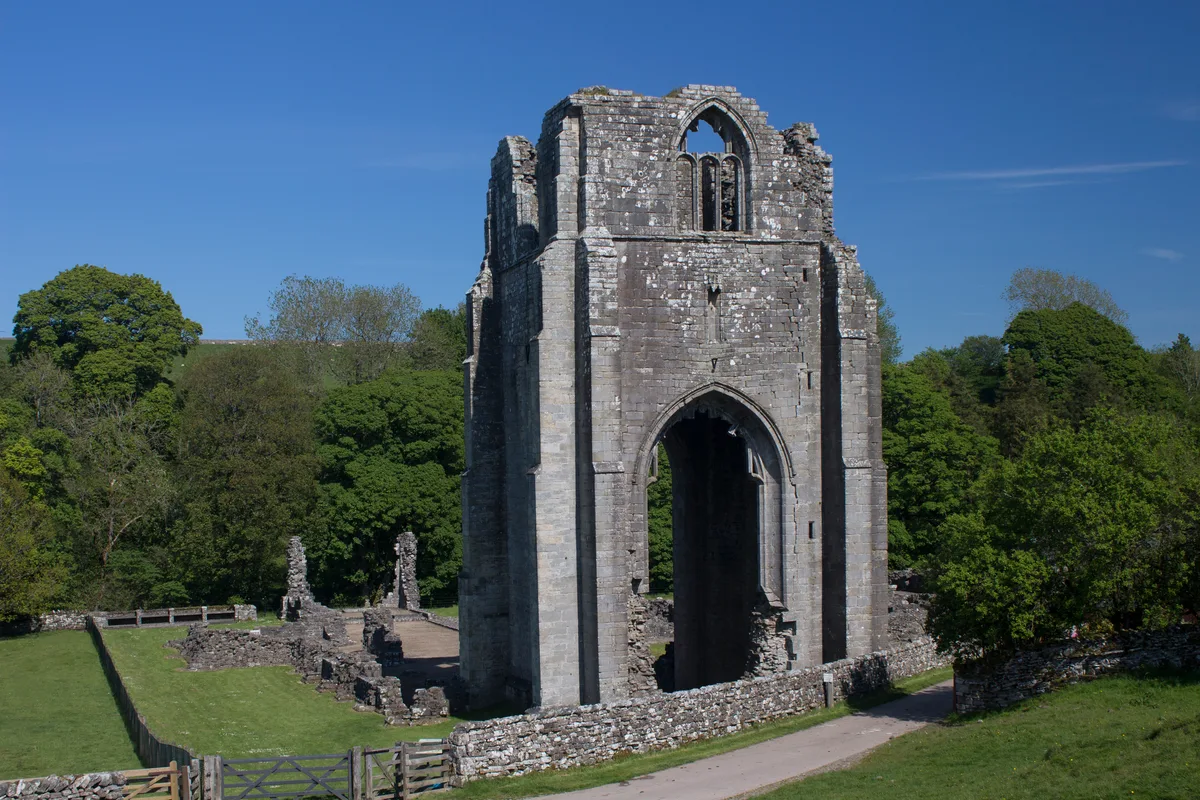
Shap Abbey
Abbeys & priories · 1.5 km

Shap Abbey
Cathedrals · 1.5 km

Lingly Hill
Mountains & hills · 1.7 km
Shap is a village located in North East England with a population of 1,218. Our guide lists N attractions within reach.
At a glance
- Population
- 1,218
- Constituency
- Westmorland and Lonsdale
Things to see in Shap
43 attractions within 12 km — showing the 24 most editorially-significant. Full guide: things to do in Shap →
 📷 4
📷 4Historic bridges · North West England
Packhorse Bridge
Packhorse Bridge is a historic bridge in the United Kingdom.
 📷 3
📷 3Reservoirs & lochs · North West England
Wet Sleddale Reservoir
Wet Sleddale Reservoir — reservoir in the United Kingdom.
 📷 5
📷 5Mountains & hills · North West England
Shap Summit
Shap Summit — a hill or mountain in england north west.
 📷 5
📷 5Mountains & hills · North West England
Long Fell
Long Fell — a hill or mountain in england north west.
 📷 5
📷 5Mountains & hills · North West England
Wasdale Pike
Wasdale Pike — mountain in england north west. Elevation: 565 m.
 📷 5
📷 5Mountains & hills · North West England
Little Saddle Crag
Little Saddle Crag — mountain in england north west. Elevation: 579.4 m.
 📷 5
📷 5Mountains & hills · North West England
Hallmoss Hill
Hallmoss Hill — mountain in england north west. Elevation: 476 m.
 📷 5
📷 5Mountains & hills · North West England
White Crag
White Crag — mountain in england north west. Elevation: 426 m.
 📷 5
📷 5Mountains & hills · North West England
Sleddale Pike
Sleddale Pike — mountain in england north west. Elevation: 500 m.
📷 5Mountains & hills · North West England
Great Saddle Crag
Great Saddle Crag — mountain in england north west. Elevation: 560 m.
📷 3📷 4Abbeys & priories · North West England
Shap Abbey
Shap Abbey — abbey in the Eden District of Cumbria, England, UK.
 📷 3
📷 3Hill forts · North West England
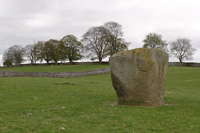
Shap Stone Avenue
Shap Stone Avenue — Neolithic stone complex in Cumbria, England.
Flagship📷 4Cathedrals · North West England
Shap Abbey
Shap Abbey is a cathedral in the United Kingdom.
 📷 4
📷 4Natural landmarks · North West England
River Lowther
River Lowther in England North East, United Kingdom.
📷 4 📷 4
📷 4Reservoirs & lochs · North West England
Wet Sleddale Horseshoe
Wet Sleddale Horseshoe in England North East, United Kingdom.
📷 3National parks · North West England
Wet Sleddale Meadows
Wet Sleddale Meadows in England North East, United Kingdom.
 📷 5
📷 5 📷 5📷 3
Heritage railway stations · North West England
Shap railway station
Shap railway station in England North East, United Kingdom.
 📷 5
📷 5Mountains & hills · North West England
Shap Summit
Shap Summit in England North East, United Kingdom.
 📷 3
📷 3Stone circles · North West England
Oddendale Stone Circles
Oddendale Stone Circles — a stone circle in england-north-east, United Kingdom.
 📷 3
📷 3Archaeological sites · North West England
Iron Hill North Circle
Iron Hill North Circle — a archaeological in england-north-east, United Kingdom.
Nearby
📷 3Galleries · North West England
The Exhibit ‘A’ Gallery
The Exhibit ‘A’ Gallery — a gallery in england-north-east, United Kingdom.
📷 3Memorials & monuments · North West England
Shap War Memorial
Shap War Memorial — Grade II listed building-listed memorial in england-north-east, United Kingdom.
📷 5Campsites · North West England
New Ing Lodge Camping
New Ing Lodge Camping — a campsite in england north east.
📷 5📷 3Heritage railway stations · North West England
Shap railway station
Shap railway station in England North East, United Kingdom.
📷 3Archaeological sites · North West England
Hill of Skulls
Hill of Skulls — a archaeological in england-north-east, United Kingdom.
Where to eat & stay near Shap
Places to stay
📷 5Campsites · North West England
New Ing Lodge Camping
New Ing Lodge Camping — a campsite in england north east.
📷 5 📷 5
📷 5 📷 5
📷 5Caravan parks · North East England
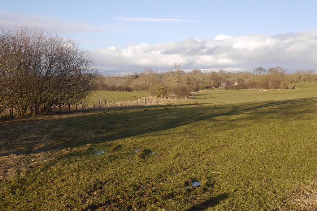
Midtown Farm Camping & Caravan Site
Midtown Farm Camping & Caravan Site — a caravan park in england north east.
 📷 5
📷 5Caravan parks · North West England
Newby End Farm Caravan Site
Newby End Farm Caravan Site — a caravan park in england north east.
 📷 5
📷 5Caravan parks · North West England
Oaklands Country Park
Oaklands Country Park — a caravan park in england north east.
Places to eat & drink
 📷 5
📷 5Historic pubs · North East England
1, Scattergate
1, Scattergate in England North East, United Kingdom.
 📷 5
📷 5Historic pubs · North West England
Horse And Farrier Inn And Stables
Horse And Farrier Inn And Stables in Scotland Lowlands, United Kingdom.
 📷 7
📷 7Historic pubs · North West England
Two Lions public house and integral stables
Two Lions public house and integral stables in Scotland Lowlands, United Kingdom.
 📷 6
📷 6Historic pubs · North West England
Gloucester Arms
Gloucester Arms in Scotland Lowlands, United Kingdom.
 📷 7
📷 7Cafés · North West England
Narrowbar Cafe
Narrowbar Cafe — a café in scotland lowlands.
 📷 3
📷 3More towns in this region
 Flagship📷 3
Towns & cities · North West England
Manchester
Manchester — city in Greater Manchester, England.
 📷 3
📷 3Towns & cities · North West England
Alderley Edge
Alderley Edge — village and civil parish in Cheshire East, UK.
_-_geograph.org.uk_-_60497.jpg?width=1200) 📷 5
📷 5Towns & cities · North West England
Appleton Thorn
Appleton Thorn — village in Warrington, Cheshire, UK.
 📷 5
📷 5Towns & cities · North West England
Aston juxta Mondrum
Aston juxta Mondrum — village and civil parish in Cheshire East, England, UK.
Frequently asked questions
- Where is Shap?
- Shap is in North-East England, United Kingdom (postcode CA10), in the parish of Shap.
- What is Shap?
- Shap — village in Cumbria, United Kingdom.
- How do I get to Shap?
- Drivers can use postcode CA10.
- Is Shap a protected site?
- Yes — Shap is part of the River Eden and Tributaries SSSI Site of Special Scientific Interest and the North Pennines National Landscape (AONB).
- Is Shap free to visit?
- Yes, Shap is free to enter.
- How do I get to Shap?
- Drivers can navigate to postcode CA10. It sits within the Westmorland and Lonsdale parliamentary constituency.