
Natural landmarks · North West England
River Lowther
In or near Shap.
River Lowther in England North East, United Kingdom.

Tim Leete — CC BY-SA 2.0 via Wikimedia Commons licence

Plan your visit
- Typical visit
- 1 h–2 h
- Dog-friendly
About
River Lowther is a place of interest in England North East, United Kingdom — drawn from open-data sources for visitor reference. See the linked Wikipedia article for the full description.
Photo gallery
See it from the streetimagery from 2022
Imagery © Mapillary contributors, CC BY-SA 4.0
Protected designations
- Site of Special Scientific Interest: River Eden and Tributaries SSSI
- Area of Outstanding Natural Beauty: North Pennines
Designations sourced from Natural England open data under OGL v3.
From the Wikipedia article
The River Lowther is a small river which flows through limestone rock in Cumbria, England. It is a tributary of the River Eamont which in turn is a tributary of the River Eden which flows into the Solway Firth near Carlisle. The Lowther begins with the confluence of the Keld Gill and the Keld Dub near the village of Keld. It flows north-west until it passes between Bampton and Bampton Grange, before turning north until it flows into the River Eamont close to Penrith. It is the main spawning area for Eden spring salmon, but is primarily a trout fishery. The river is held back by the Wet Sleddale dam, and so flows at a fairly consistent level (between 0.33 m and 1.8 m for 90% of monitoring time), with the highest level ever recorded at the River Lowther (2.93 m) occurring at Eamont Bridge, Beehive, on Sunday 6 December 2015. Its name is recorded about 1175 as Lauder. It may come from Brittonic lǭwadr, "a washing or bathing place", which would give it the same etymology as Lauder, Scotland. Alternatively, it may come from Old Norse lauðr + á, meaning "foamy river".
Excerpt from Wikipedia under CC BY-SA 4.0. See the source article linked in Sources below.
- Coordinates
- 54.4978, -2.6922
- District
- Westmorland and Furness
- Parish
- Shap Rural
- Postcode
- CA10 3NE
- Parliamentary constituency
- Westmorland and Lonsdale
Sources
- wikidata: Q1872647 (CC0)
- wikipedia: River Lowther (CC BY-SA 4.0)
Other places nearby

Wet Sleddale Reservoir
Reservoirs & lochs · 0.3 km
Wet Sleddale Meadows
National parks · 0.4 km

Wet Sleddale Horseshoe
Reservoirs & lochs · 0.4 km

Slate Hill
Mountains & hills · 0.9 km

Packhorse Bridge
Historic bridges · 1.4 km

White Crag
Mountains & hills · 1.4 km

Nuttall Sidings
Public art & sculpture · 1.4 km

Lingly Hill
Mountains & hills · 2.0 km

Hallmoss Hill
Mountains & hills · 2.0 km

Bleak Hill
Mountains & hills · 2.1 km

Great Ladstones
Mountains & hills · 2.2 km
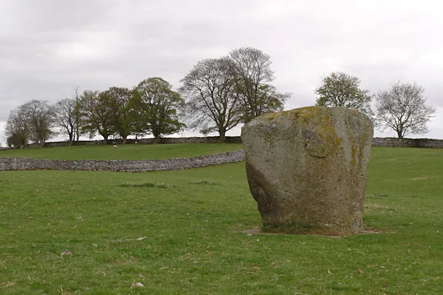
Shap Stone Avenue
Hill forts · 2.3 km
Nearby
📷 3Reservoirs & lochs · North West England
Wet Sleddale Reservoir
Wet Sleddale Reservoir — reservoir in the United Kingdom.
📷 3National parks · North West England
Wet Sleddale Meadows
Wet Sleddale Meadows in England North East, United Kingdom.
📷 4Reservoirs & lochs · North West England
Wet Sleddale Horseshoe
Wet Sleddale Horseshoe in England North East, United Kingdom.
📷 5Mountains & hills · North West England
Slate Hill
Slate Hill — mountain in england north east. Elevation: 292 m.
📷 4Historic bridges · North West England
Packhorse Bridge
Packhorse Bridge is a historic bridge in the United Kingdom.
📷 5Mountains & hills · North West England
White Crag
White Crag — mountain in england north west. Elevation: 426 m.
Where to eat & stay near River Lowther
Places to stay
 📷 5📷 5
Campsites · North West England
New Ing Lodge Camping
New Ing Lodge Camping — a campsite in england north east.
 📷 5
📷 5 📷 5
📷 5Caravan parks · North East England
Midtown Farm Camping & Caravan Site
Midtown Farm Camping & Caravan Site — a caravan park in england north east.
 📷 5
📷 5Caravan parks · North West England
Tebay Caravan Park
Tebay Caravan Park — a caravan park in england north west.
 📷 5
📷 5Caravan parks · North West England
Newby End Farm Caravan Site
Newby End Farm Caravan Site — a caravan park in england north east.
Places to eat & drink
 📷 5
📷 5Historic pubs · North East England
1, Scattergate
1, Scattergate in England North East, United Kingdom.
 📷 5
📷 5Historic pubs · North West England
Horse And Farrier Inn And Stables
Horse And Farrier Inn And Stables in Scotland Lowlands, United Kingdom.
 📷 4
📷 4Restaurants · North West England
Holbeck Ghyll
Holbeck Ghyll is a restaurant located in Windermere, Cumbria, England. "The late 19th century building was once Lord Lonsdale's hunting lodge and only became a hotel in the 1970s. It won a Michelin st
 📷 5
📷 5Restaurants · North West England
Holbeck Ghyll Restaurant
Holbeck Ghyll Restaurant — a restaurant in england north west.
 📷 7
📷 7Historic pubs · North West England
Two Lions public house and integral stables
Two Lions public house and integral stables in Scotland Lowlands, United Kingdom.
📷 5Historic pubs · North West England
Holbeck Ghyll
Holbeck Ghyll in England North West, United Kingdom.
More natural landmarks in this region
 📷 3
📷 3Natural landmarks · North West England
Statue of Oliver Cromwell
Statue of Oliver Cromwell — Public artwork (statue).
 📷 3
📷 3Natural landmarks · North West England
Dagfields Craft Centre
Dagfields Craft Centre — a other in england-west-midlands, United Kingdom.
 📷 3
📷 3Natural landmarks · North West England
Weaver Valley Cruises
Weaver Valley Cruises — a other in england-west-midlands, United Kingdom.
 📷 3
📷 3Natural landmarks · North West England
Golden Gates
Golden Gates — a other in england-west-midlands, United Kingdom.
Frequently asked questions
- Where is River Lowther?
- River Lowther is in North-East England, United Kingdom (postcode CA10 3NE), in the parish of Shap Rural.
- What is River Lowther?
- River Lowther in England North East, United Kingdom.
- How do I get to River Lowther?
- Drivers can use postcode CA10 3NE.
- Is River Lowther a protected site?
- Yes — River Lowther is part of the River Eden and Tributaries SSSI Site of Special Scientific Interest and the North Pennines National Landscape (AONB).
- How do I get to River Lowther?
- Drivers can navigate to postcode CA10 3NE. It sits within the Westmorland and Lonsdale parliamentary constituency.