
Hill forts · South East England
Richborough Roman Fort
In or near Ware.
Richborough Roman Fort — Roman fort at Richborough, Ash, United Kingdom.

Wikimedia Commons contributors — see linked file page for photographer and licence licence

Plan your visit
- Typical visit
- 1 h–2 h
- Nearest railway station
- Sandwich · 2.8 km
- Free entry
- Family-friendly
- Dog-friendly
- Wheelchair accessible
Getting there & planning your visit
Richborough Roman Fort is located in Dover, Kent, with the postcode CT13 9JW. The nearest railway station is Sandwich, which is 2.8 km away. Entry is free, and the site is wheelchair accessible.
About
Richborough Roman Fort is a hill fort in the United Kingdom. It covers approximately 3 km². Heritage designation: Grade I listed building. Owned by English Heritage. Managed by English Heritage. Part of Saxon Shore. Wikidata describes it as: "Roman fort at Richborough, Ash, United Kingdom". Coordinates: 51.2940°, 1.3320°.
Photo gallery
Summary from the official site
Richborough Roman Fort is a historical site that marks the arrival of the Roman army in Britain in AD 43. Visitors can explore a reconstructed timber gateway, a revamped museum showcasing archaeological finds, and the remains of the fort and amphitheatre, along with guided audio tours and family trails.
Read more on the official property page.
Protected designations
- Site of Special Scientific Interest: Sandwich Bay to Hacklinge Marshes SSSI
- Area of Outstanding Natural Beauty: Kent Downs
- Ramsar wetland: Thanet Coast & Sandwich Bay
Designations sourced from Natural England open data under OGL v3.
From the Wikipedia article
Richborough Castle is a Roman Saxon Shore fort better known as Richborough Roman Fort. It is situated in Richborough near Sandwich, Kent. Substantial remains of the massive fort walls still stand to a height of several metres. It is part of a larger Roman town called Rutupiae or Portus Ritupis that developed around the fort and the associated port. The settlement was founded after the Roman conquest of Britain in AD 43. Because of its position near to a large natural harbour in the Wantsum Channel and to the mouth of the Stour, Rutupiae served as a main gateway to Roman Britain and the starting point for the road now known as Watling Street. The site is now 2+1⁄2 miles inland from the current coastline. Earth fortifications were first dug on the site in the 1st century, probably for a storage depot and bridgehead for the Roman army. The site expanded into a major civilian and commercial town, and the stone Saxon Shore fort was added around the year 277. The later fort is believed to have been constructed by the rebel Carausius. The site is now under the care of English Heritage.
Excerpt from Wikipedia under CC BY-SA 4.0. See the source article linked in Sources below.
Background
Visiting
The American Russell Hoban repurposed Richborough Castle as "Roaming Rune" (alluding to its Roman origins) in his 1980, post-apocalyptic novel Riddley Walker.
Sourced from Wikipedia under CC BY-SA 4.0.
- Coordinates
- 51.2940, 1.3320
- County
- Kent
- District
- Dover
- Parish
- Ash
- Postcode
- CT13 9JW
- Parliamentary constituency
- Herne Bay and Sandwich
- Phone
- 01304 612013
- Nearest railway station
- Sandwich — 2.8 km
- Opening
- Daily 10am–5pm; last entry at 4.30pm
- Official site
- www.english-heritage.org.uk
Sources
- wikidata: Q1309736 (CC0)
- wikipedia: Richborough Castle (CC BY-SA 4.0)
- commons: Richborough Roman Fort.JPG (CC BY-SA 4.0)
Featured in this guide
Other places nearby

Roman temple at Richborough fort
Follies · 0.1 km

Richborough Fort
Forts · 0.1 km

Richborough Castle Museum
Museums · 0.2 km

Rutupiae amphitheatre
Open-air theatres · 0.6 km

Richborough Roman Amphitheatre
Archaeological sites · 0.6 km

Monk's Wall nature reserve
Wildlife reserves · 1.2 km

Watermills Wake and Aqua Park
Watermills · 1.6 km
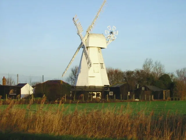
White Mill
Museums · 1.6 km

Invicta House Ye Olde King's Arms
Historic pubs · 1.9 km
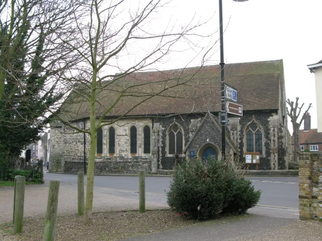
St Mary's Church, Sandwich
Historic churches · 1.9 km

Giles Quay
Marinas · 1.9 km

Boundary Walling To West Side Of No 59
Holy wells · 1.9 km
Nearby
📷 5Follies · South East England
Roman temple at Richborough fort
Roman temple at Richborough fort — a temple folly in england-south-east, United Kingdom.
📷 5Forts · South East England
Richborough Fort
Richborough Fort — a other in england-south-east, United Kingdom.
📷 5Museums · South East England
Richborough Castle Museum
Richborough Castle Museum — a museum in england-south-east, United Kingdom.
📷 5Open-air theatres · South East England
Rutupiae amphitheatre
Rutupiae amphitheatre — a open-air theatre in england south east.
📷 5Archaeological sites · South East England
Richborough Roman Amphitheatre
Richborough Roman Amphitheatre — a archaeological in england-south-east, United Kingdom.
📷 5Wildlife reserves · South East England
Monk's Wall nature reserve
Monk's Wall nature reserve is a wildlife reserve in the United Kingdom.
Where to eat & stay near Richborough Roman Fort
Places to stay
 📷 5
📷 5Caravan parks · South East England
Sandwich Leisure Park
Sandwich Leisure Park — a caravan park in england south east.
 📷 5
📷 5Campsites · South East England
Goldstone Camping
Goldstone Camping — a campsite in england south east.
 📷 7
📷 7B&Bs · South East England
Durlock Lodge B&B
Durlock Lodge B&B — a bed-and-breakfast in england south east.
 📷 5
📷 5Campsites · South East England
Marshside Scout Camp
Marshside Scout Camp — a campsite in england south east.
 📷 5
📷 5Caravan parks · South East England
Pegwell Bay Caravan Park
Pegwell Bay Caravan Park — a caravan park in england south east.
 📷 5
📷 5Caravan parks · South East England
Nethercourt Touring Park
Nethercourt Touring Park — a caravan park in england south east.
Places to eat & drink
📷 5Historic pubs · South East England
Invicta House Ye Olde King's Arms
Invicta House Ye Olde King's Arms in England South East, United Kingdom.
 📷 6
📷 6Historic pubs · South East England
The Admiral Owen Public House
The Admiral Owen Public House in England South East, United Kingdom.
 📷 7
📷 7Historic pubs · South East England
The Chequer Inn
The Chequer Inn in England South East, United Kingdom.
 📷 5
📷 5Historic pubs · South East England
The Black Pig Inn
The Black Pig Inn in England South East, United Kingdom.
 📷 5
📷 5Historic pubs · South East England
Queen Charlotte Public House
Queen Charlotte Public House in England South East, United Kingdom.
 📷 6
📷 6Restaurants · South East England
The Empire Room
The Empire Room — a restaurant in england south east.
More places run by English Heritage
 Flagship📷 10
Museums · London
Kenwood House
Kenwood House — art museum and historic house in Hampstead, London.
 📷 5
📷 5Galleries · London
Apsley House
Apsley House — London townhouse of the Dukes of Wellington.
 📷 5
📷 5Castles · London
Eynsford Castle
Eynsford Castle — castle, now ruinous, in Eynsford, Kent, England, UK.
 📷 5
📷 5Museums · London
Jewel Tower
Jewel Tower — medieval tower in Westminster, London, England, UK.
More places in this region
 📷 5
📷 5Hill forts · South East England
Ankerwycke Priory
Ankerwycke Priory — Benedictine nunnery with associated moat and fishponds.
 📷 5
📷 5Hill forts · South East England
Shornemead Fort
Shornemead Fort — fort in Shorne, Kent, England, UK.
 📷 5
📷 5Hill forts · South East England
Smythe's Megalith
Smythe's Megalith — neolithic monument in Kent, England.
 📷 5
📷 5Hill forts · South East England
White Horse Stone
White Horse Stone — Two megaliths near Aylesford, Kent, England.
Frequently asked questions
- Where is Richborough Roman Fort?
- Richborough Roman Fort is in Kent, South-East England, United Kingdom (postcode CT13 9JW), in the parish of Ash.
- What is Richborough Roman Fort?
- Richborough Roman Fort — Roman fort at Richborough, Ash, United Kingdom.
- How do I get to Richborough Roman Fort?
- The nearest railway station is Sandwich, about 2.8 km away. Drivers can use postcode CT13 9JW.
- Who runs Richborough Roman Fort?
- Richborough Roman Fort is operated by English Heritage.
- Is Richborough Roman Fort a listed building?
- Richborough Roman Fort is officially recognised as Grade I listed building listed.
- Is Richborough Roman Fort a protected site?
- Yes — Richborough Roman Fort is part of the Sandwich Bay to Hacklinge Marshes SSSI Site of Special Scientific Interest and the Kent Downs National Landscape (AONB).
- Is Richborough Roman Fort free to visit?
- Yes, Richborough Roman Fort is free to enter.
- How do I get to Richborough Roman Fort?
- The nearest railway station is Sandwich, about 2.8 km away. Drivers can navigate to postcode CT13 9JW.