
Follies · South East England
Roman temple at Richborough fort
In or near Ware.
Roman temple at Richborough fort — a temple folly in england-south-east, United Kingdom.

Elliott Simpson — CC BY-SA 2.0 via Wikimedia Commons licence

Plan your visit
- Typical visit
- 20 min–45 min
- Nearest railway station
- Sandwich · 2.7 km
- Free entry
- Family-friendly
- Dog-friendly
- Wheelchair accessible
About
Roman temple at Richborough fort is a temple folly located in england-south-east, United Kingdom. Catalogued from Wikidata's UK heritage register; see the Wikipedia article for further historical and visitor details.
Photo gallery
Official information
Richborough Roman Fort is a historical site where the Roman army first landed in Britain in AD 43. Visitors can explore the reconstructed timber gateway, a revamped museum with artifacts from excavations, and the remains of the fort and amphitheatre. The site offers audio tours and family trails to enhance the experience.
Protected designations
- Site of Special Scientific Interest: Sandwich Bay to Hacklinge Marshes SSSI
- Area of Outstanding Natural Beauty: Kent Downs
- Ramsar wetland: Thanet Coast & Sandwich Bay
Designations sourced from Natural England open data under OGL v3.
Place summary
The Roman temple at Richborough Fort is a folly located in South-East England. This structure is notable for its historical significance as part of a larger Roman military fortification.
AI-generated from the structured facts on this page (operator, designation, listing, era). Not a substitute for visiting.
- Coordinates
- 51.2933, 1.3324
- County
- Kent
- District
- Dover
- Parish
- Ash
- Postcode
- CT13 9JW
- Parliamentary constituency
- Herne Bay and Sandwich
- Established
- 275
- Nearest railway station
- Sandwich — 2.7 km
- Opening
- Daily 10am–5pm; last entry at 4.30pm
- Official site
- www.english-heritage.org.uk
Sources
- wikidata: Q139593893 (CC0)
Other places nearby

Richborough Fort
Forts · 0.0 km
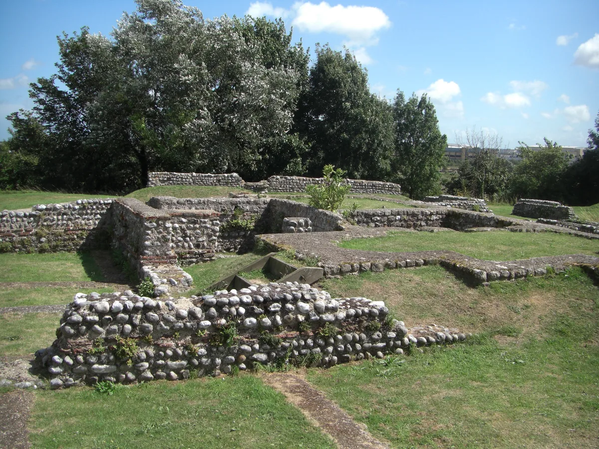
Richborough Roman Fort
Hill forts · 0.1 km

Richborough Castle Museum
Museums · 0.1 km

Rutupiae amphitheatre
Open-air theatres · 0.5 km

Richborough Roman Amphitheatre
Archaeological sites · 0.5 km

Monk's Wall nature reserve
Wildlife reserves · 1.1 km

Watermills Wake and Aqua Park
Watermills · 1.5 km
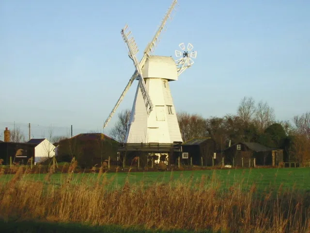
White Mill
Museums · 1.6 km

Invicta House Ye Olde King's Arms
Historic pubs · 1.8 km
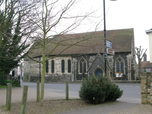
St Mary's Church, Sandwich
Historic churches · 1.8 km

Giles Quay
Marinas · 1.8 km

Boundary Walling To West Side Of No 59
Holy wells · 1.9 km
Nearby
📷 5Forts · South East England
Richborough Fort
Richborough Fort — a other in england-south-east, United Kingdom.
Flagship📷 10Hill forts · South East England
Richborough Roman Fort
Richborough Roman Fort — Roman fort at Richborough, Ash, United Kingdom.
📷 5Museums · South East England
Richborough Castle Museum
Richborough Castle Museum — a museum in england-south-east, United Kingdom.
📷 5Open-air theatres · South East England
Rutupiae amphitheatre
Rutupiae amphitheatre — a open-air theatre in england south east.
📷 5Archaeological sites · South East England
Richborough Roman Amphitheatre
Richborough Roman Amphitheatre — a archaeological in england-south-east, United Kingdom.
📷 5Wildlife reserves · South East England
Monk's Wall nature reserve
Monk's Wall nature reserve is a wildlife reserve in the United Kingdom.
Where to eat & stay near Roman temple at Richborough fort
Places to stay
 📷 5
📷 5Caravan parks · South East England
Sandwich Leisure Park
Sandwich Leisure Park — a caravan park in england south east.
 📷 5
📷 5Campsites · South East England
Goldstone Camping
Goldstone Camping — a campsite in england south east.
 📷 7
📷 7B&Bs · South East England
Durlock Lodge B&B
Durlock Lodge B&B — a bed-and-breakfast in england south east.
 📷 5
📷 5Campsites · South East England
Marshside Scout Camp
Marshside Scout Camp — a campsite in england south east.
 📷 5
📷 5Caravan parks · South East England
Pegwell Bay Caravan Park
Pegwell Bay Caravan Park — a caravan park in england south east.
 📷 5
📷 5Caravan parks · South East England
Nethercourt Touring Park
Nethercourt Touring Park — a caravan park in england south east.
Places to eat & drink
📷 5Historic pubs · South East England
Invicta House Ye Olde King's Arms
Invicta House Ye Olde King's Arms in England South East, United Kingdom.
 📷 6
📷 6Historic pubs · South East England
The Admiral Owen Public House
The Admiral Owen Public House in England South East, United Kingdom.
 📷 7
📷 7Historic pubs · South East England
The Chequer Inn
The Chequer Inn in England South East, United Kingdom.
 📷 5
📷 5Historic pubs · South East England
The Black Pig Inn
The Black Pig Inn in England South East, United Kingdom.
 📷 5
📷 5Historic pubs · South East England
Queen Charlotte Public House
Queen Charlotte Public House in England South East, United Kingdom.
 📷 6
📷 6Restaurants · South East England
The Empire Room
The Empire Room — a restaurant in england south east.
More follies in this region
 📷 5
📷 5 📷 5
📷 5 📷 5
📷 5Follies · South East England
Clandon Park Grotto
Clandon Park Grotto — Folly or eyecatcher.
 📷 5
📷 5Follies · South East England
Clandon Park Temple
Clandon Park Temple — Folly or eyecatcher.
Frequently asked questions
- Where is Roman temple at Richborough fort?
- Roman temple at Richborough fort is in Kent, South-East England, United Kingdom (postcode CT13 9JW), in the parish of Ash.
- What is Roman temple at Richborough fort?
- Roman temple at Richborough fort — a temple folly in england-south-east, United Kingdom.
- How do I get to Roman temple at Richborough fort?
- The nearest railway station is Sandwich, about 2.7 km away. The nearest town is Ware. Drivers can use postcode CT13 9JW.
- When was Roman temple at Richborough fort built?
- Built or established in 275.
- Is Roman temple at Richborough fort a protected site?
- Yes — Roman temple at Richborough fort is part of the Sandwich Bay to Hacklinge Marshes SSSI Site of Special Scientific Interest and the Kent Downs National Landscape (AONB).
- Is Roman temple at Richborough fort free to visit?
- Yes, Roman temple at Richborough fort is free to enter.
- How do I get to Roman temple at Richborough fort?
- The nearest railway station is Sandwich, about 2.7 km away. Drivers can navigate to postcode CT13 9JW.