
Hill forts · South East England
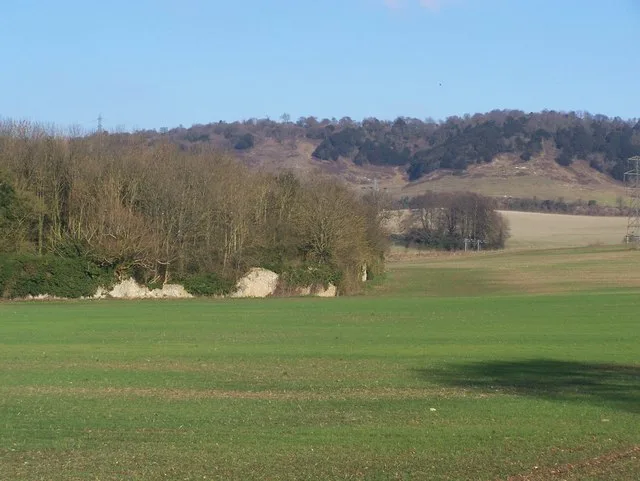
Smythe's Megalith
In or near Boxley.
Smythe's Megalith — neolithic monument in Kent, England.

Wikimedia Commons contributors — see linked file page for photographer and licence licence

Plan your visit
- Typical visit
- 1 h–2 h
- Nearest railway station
- Aylesford · 3.9 km
- Free entry
- Dog-friendly
Getting there & planning your visit
To visit Smythe's Megalith, the nearest railway station is Aylesford, located 3.9 km away. The postcode for navigation is ME20 7EH, and entry is free.
About
Smythe's Megalith is a hill fort in the United Kingdom. Wikidata describes it as: "neolithic monument in Kent, England". Coordinates: 51.3167°, 0.5167°.
Photo gallery
Protected designations
- Site of Special Scientific Interest: Wouldham to Detling Escarpment SSSI
- Area of Outstanding Natural Beauty: Kent Downs
Designations sourced from Natural England open data under OGL v3.
From the Wikipedia article
Smythe's Megalith, also known as the Warren Farm Chamber, was a chambered long barrow near the village of Aylesford in the south-eastern English county of Kent. Probably constructed in the 4th millennium BCE, during Britain's Early Neolithic period, it was discovered in 1822, at which point it was dismantled. Built out of earth and at least five local sarsen megaliths, the long barrow consisted of a roughly rectangular earthen tumulus with a stone chamber in its eastern end. Human remains were deposited into this chamber. Archaeologists have established that the monument was built by pastoralist communities shortly after the introduction of agriculture to Britain from continental Europe. Although representing part of an architectural tradition of long barrow building widespread across Neolithic Europe, Smythe's Megalith belonged to a localised regional variant produced in the vicinity of the River Medway, now known as the Medway Megaliths. Several of these still survive: Coldrum Long Barrow, Addington Long Barrow, and Chestnuts Long Barrow are on the river's western side, while Kit's Coty House, the Little Kit's Coty House, and the Coffin Stone are on the eastern side nearer to Smythe's Megalith. Close to the site of the lost monument is the White Horse Stone, a standing stone that may have once been part of another chambered long barrow. The site may have been ransacked during the Middle Ages, as other Medway Megaliths were. By the early 19th century it was buried beneath soil, largely due to millennia of hillwash coming down from the adjacent Blue Bell Hill. In 1822, it was discovered by farm labourers ploughing the land; the local antiquarians Clement Smythe and Thomas Charles were called in to examine it. Shortly after, the labourers pulled away the stones and dispersed most of the human remains, destroying the monument. Smythe and Charles produced, but did not publish, reports on their findings, and these have been discussed by archaeologists since the…
Excerpt from Wikipedia under CC BY-SA 4.0. See the source article linked in Sources below.
Background
Architecture
The part of the chambered long barrow that was discovered was a stone chamber composed of four large stones. The stones used were sarsens. The northern stone measured 7 ft by 4 ft by 1 ft. The southern stone measured 7 ft by 5 ft by 2 ft. The third stone, on the western side, measured 3 ft by 4 ft by 1 ft. A fourth, smaller stone, measuring 3 ft by 2 ft by 1 ft, was placed to prevent the north stone falling onto its southern counterpart. This may have once been used to divide the chamber in two. Given the recorded dimensions of the stones, Ashbee suggested that the chamber may have once measured 20 ft in length and could have included as many as ten sarsen stones in its original…
Sourced from Wikipedia under CC BY-SA 4.0.
- Coordinates
- 51.3167, 0.5167
- County
- Kent
- District
- Tonbridge and Malling
- Parish
- Aylesford
- Postcode
- ME20 7EH
- Parliamentary constituency
- Chatham and Aylesford
- Nearest railway station
- Aylesford — 3.9 km
Sources
- wikidata: Q7546772 (CC0)
- wikipedia: Smythe's Megalith (CC BY-SA 4.0)
- commons: Smythe's Megalith field.jpg (CC BY-SA 4.0)
Other places nearby

White Horse Stone
Hill forts · 0.2 km

Westfield Wood
Parks · 0.5 km

Kit's Coty House
Archaeological sites · 1.0 km

Kit's Coty House
Memorials & monuments · 1.0 km

Little Kit's Coty House
Historic houses · 1.1 km

Little Kit's Coty House
Archaeological sites · 1.1 km

Medway megaliths
Museums · 1.2 km

Tottington Stone
Archaeological sites · 1.3 km

Kits Coty Glamping
Campsites · 1.4 km

Coffin Stone
Natural landmarks · 1.5 km

Coffin Stone
Archaeological sites · 1.5 km
Boxley Abbey
Abbeys & priories · 1.9 km
Nearby
📷 5Hill forts · South East England
White Horse Stone
White Horse Stone — Two megaliths near Aylesford, Kent, England.
📷 5📷 5Archaeological sites · South East England
Kit's Coty House
Kit's Coty House — archaeological in england london.
📷 5Memorials & monuments · South East England
Kit's Coty House
Kit's Coty House or Kit's Coty is a chambered long barrow near the village of Aylesford in the southeastern English county of Kent. Constructed circa 4000 BCE, during the Early Neolithic period of Bri
📷 5Historic houses · South East England
Little Kit's Coty House
Little Kit's Coty House — a other in england-london, United Kingdom.
📷 5Archaeological sites · South East England
Little Kit's Coty House
Little Kit's Coty House — archaeological in england london.
Where to eat & stay near Smythe's Megalith
Places to stay
📷 5Campsites · South East England
Kits Coty Glamping
Kits Coty Glamping — a campsite in england london.
 📷 5
📷 5 📷 5
📷 5Campsites · South East England
Lower Grange Farm Scout Activity Centre
Lower Grange Farm Scout Activity Centre — a campsite in england london.
 📷 5
📷 5Campsites · South East England
Buckmore Park Scout Campsite
Buckmore Park Scout Campsite — a campsite in england london. Brand: The Scout Association.
 📷 5
📷 5Caravan parks · South East England
Oak View Caravan Park
Oak View Caravan Park — a caravan park in england london.
 📷 5
📷 5Places to eat & drink
 📷 6
📷 6Historic pubs · South East England
The King's Arms
The King's Arms in England South East, United Kingdom.
 📷 7
📷 7Cafés · South East England
The Little Old Toll House
The Little Old Toll House — a café in england london.
 📷 5
📷 5 📷 5
📷 5Historic pubs · South East England
Robin Hood Public House
Robin Hood Public House in England South East, United Kingdom.
 📷 7
📷 7Historic pubs · South East England
The Hollybush Public House
The Hollybush Public House in England South East, United Kingdom.
 📷 5
📷 5Historic pubs · South East England
The Cock Horse
The Cock Horse in England South East, United Kingdom.
More places in this region
 📷 5
📷 5Hill forts · South East England
Ankerwycke Priory
Ankerwycke Priory — Benedictine nunnery with associated moat and fishponds.
 📷 5
📷 5Hill forts · South East England
Shornemead Fort
Shornemead Fort — fort in Shorne, Kent, England, UK.
📷 5Hill forts · South East England
White Horse Stone
White Horse Stone — Two megaliths near Aylesford, Kent, England.
 Flagship📷 10
Hill forts · South East England
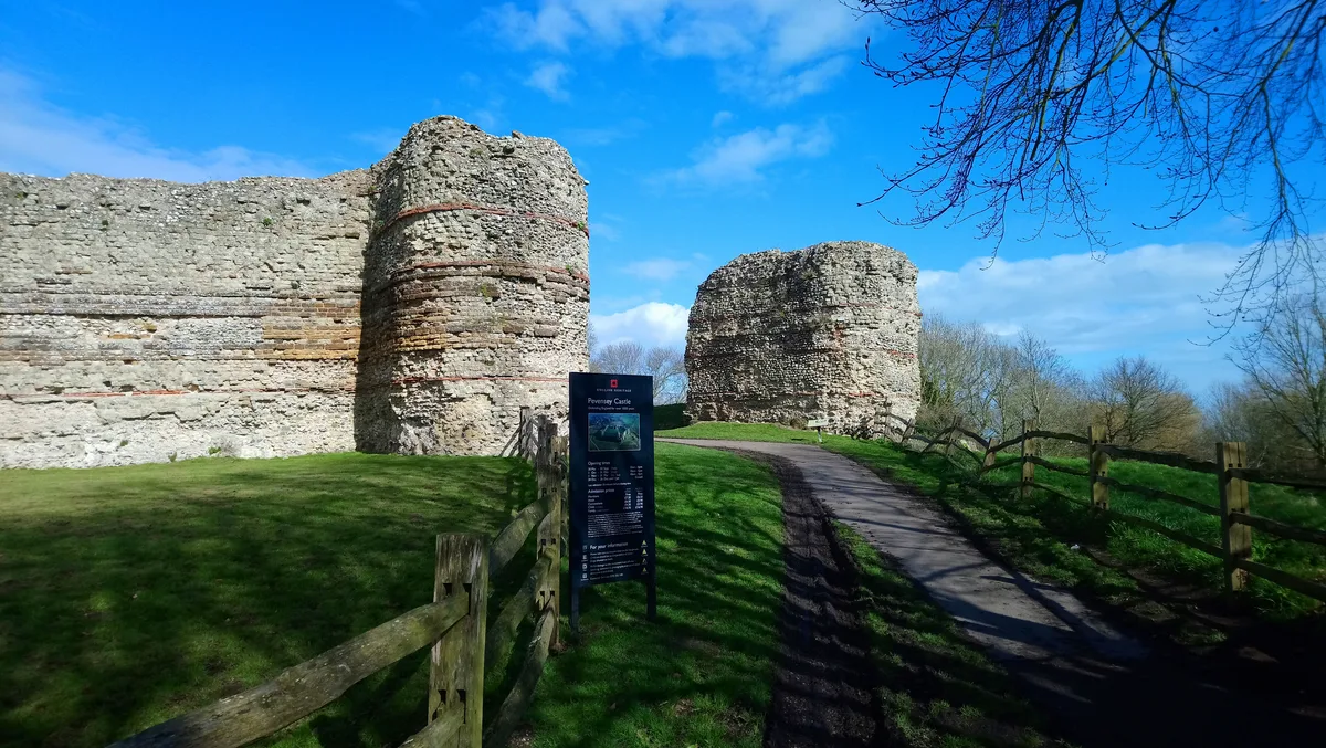
Castrum Anderitum
Castrum Anderitum — 3rd century Roman fort in the province of Britannia.
Frequently asked questions
- Where is Smythe's Megalith?
- Smythe's Megalith is in Kent, London, United Kingdom (postcode ME20 7EH), in the parish of Aylesford.
- What is Smythe's Megalith?
- Smythe's Megalith — neolithic monument in Kent, England.
- How do I get to Smythe's Megalith?
- The nearest railway station is Aylesford, about 3.9 km away. Drivers can use postcode ME20 7EH.
- Is Smythe's Megalith a protected site?
- Yes — Smythe's Megalith is part of the Wouldham to Detling Escarpment SSSI Site of Special Scientific Interest and the Kent Downs National Landscape (AONB).
- Is Smythe's Megalith free to visit?
- Yes, Smythe's Megalith is free to enter.
- How do I get to Smythe's Megalith?
- The nearest railway station is Aylesford, about 3.9 km away. Drivers can navigate to postcode ME20 7EH.