Holy wells · South East England
Boundary Walling To West Side Of No 59
Boundary Walling To West Side Of No 59 — wall in Sandwich, Dover, Kent, England, UK.

Wikimedia Commons contributors — see linked file page for photographer and licence licence
Plan your visit
- Typical visit
- 15 min–30 min
- Nearest railway station
- Sandwich · 0.8 km
- Free entry
- Dog-friendly
About
Boundary Walling To West Side Of No 59 is a place of interest in Kent, South-East England. Officially recognised as Grade II listed building. The site is within the Kent Downs National Landscape (AONB), and is a designated Site of Special Scientific Interest. It sits within the Herne Bay and Sandwich parliamentary constituency. The nearest railway station is Sandwich, about 0.8 km away. Postcode area CT13.
Photo gallery
Protected designations
- Site of Special Scientific Interest: Sandwich Bay to Hacklinge Marshes SSSI
- Area of Outstanding Natural Beauty: Kent Downs
- Ramsar wetland: Thanet Coast & Sandwich Bay
Designations sourced from Natural England open data under OGL v3.
Place summary
Boundary Walling to West Side of No 59 is a Grade II listed building located in Sandwich, Kent, in South-East England. It is situated within the Sandwich Bay to Hacklinge Marshes SSSI and the Kent Downs AONB, contributing to the area's significant natural designations, including the Ramsar site of Thanet Coast & Sandwich Bay.
AI-generated from the structured facts on this page (operator, designation, listing, era). Not a substitute for visiting.
- Coordinates
- 51.2771, 1.3391
- County
- Kent
- District
- Dover
- Parish
- Sandwich
- Postcode
- CT13 9EX
- Parliamentary constituency
- Herne Bay and Sandwich
- Nearest railway station
- Sandwich — 0.8 km
Sources
- wikidata: Q26322622 (CC0)
- commons: 1069540 II BOUNDARY WALLING TO WEST SIDE OF NO 59 STRAND STREET Sandwich 20250910 0001.jpg (CC BY-SA 4.0)
Other places nearby
Loading nearby places…
Nearby
 📷 5
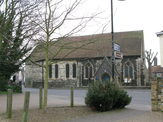
📷 5Historic churches · South East England
St Mary's Church, Sandwich
St Mary's Church, Sandwich — church in the town of Sandwich, Kent, England, UK.
 📷 5
📷 5Historic houses · South East England
Richborough House
Richborough House — house in Sandwich, Dover, England, UK.
 📷 5
📷 5Galleries · South East England
The Hunt Gallery
The Hunt Gallery — a gallery in england-south-east, United Kingdom.
 📷 5
📷 5Historic houses · South East England
Delf House
Delf House — house in Sandwich, Dover, England, UK.
Cinemas · South East England
The Empire Cinema
The Empire Cinema — a cinema in england south east.
 📷 5
📷 5Memorials & monuments · South East England
Sandwich War Memorial
Sandwich War Memorial — Grade II listed building-listed memorial in england-south-east, United Kingdom.
More places in this region
 📷 5
📷 5Holy wells · South East England
Boundary wall extending south from The Old Farmhouse
Boundary wall extending south from The Old Farmhouse — Grade II listed wall in Monxton, Test Valley, Hampshire, England, UK.
 📷 5
📷 5Holy wells · South East England
Forecourt Walls, Gate Piers, and Gates of Nos 39 to 46
Forecourt Walls, Gate Piers, and Gates of Nos 39 to 46 — Grade I listed wall in Salisbury, Wiltshire, England, UK.
 📷 5
📷 5Holy wells · South East England
Garden wall of Fullerton Grange
Garden wall of Fullerton Grange — Grade II listed wall in Fullerton, Test Valley, Hampshire, England, UK.
 📷 5
📷 5Holy wells · South East England
Garden Wall To Fordwich House
Garden Wall To Fordwich House — wall in Fordwich, Canterbury, Kent, England, UK.
Frequently asked questions
- Where is Boundary Walling To West Side Of No 59?
- Boundary Walling To West Side Of No 59 is in Kent, South-East England, United Kingdom (postcode CT13 9EX), in the parish of Sandwich.
- Is Boundary Walling To West Side Of No 59 a listed building?
- Boundary Walling To West Side Of No 59 is officially recognised as Grade II listed building listed.
- Is Boundary Walling To West Side Of No 59 a protected site?
- Yes — Boundary Walling To West Side Of No 59 is part of the Sandwich Bay to Hacklinge Marshes SSSI Site of Special Scientific Interest and the Kent Downs National Landscape (AONB).
- Is Boundary Walling To West Side Of No 59 free to visit?
- Yes, Boundary Walling To West Side Of No 59 is free to enter.
- How do I get to Boundary Walling To West Side Of No 59?
- The nearest railway station is Sandwich, about 0.8 km away. Drivers can navigate to postcode CT13 9EX.