
Wildlife reserves · South East England
Monk's Wall nature reserve
In or near Ware.
Monk's Wall nature reserve is a wildlife reserve in the United Kingdom.

Nick Smith — CC BY-SA 2.0 via Wikimedia Commons licence

Plan your visit
- Typical visit
- 2 h–4 h
- Best time of year
- Autumn & winter (migration & wildfowl)
- Nearest railway station
- Sandwich · 1.6 km
- Free entry
- Dog-friendly
Getting there & planning your visit
To visit Monk's Wall nature reserve, the nearest railway station is Sandwich, located 1.6 km away. The postcode for the reserve is CT13 9JG, and entry is free.
About
Monk's Wall nature reserve is a wildlife reserve in the United Kingdom. Coordinates: 51.2833°, 1.3333°. This entry is part of The Great Britain Guide, a free, ad-free, open-data tourist directory.
Photo gallery
Protected designations
- Site of Special Scientific Interest: Sandwich Bay to Hacklinge Marshes SSSI
- Area of Outstanding Natural Beauty: Kent Downs
- Ramsar wetland: Thanet Coast & Sandwich Bay
Designations sourced from Natural England open data under OGL v3.
From the Wikipedia article
The Monk's Wall nature reserve is located a short distance from the quay in Sandwich, Kent and is ideal for seeing wild duck and other wildlife in a wetland habitat. The reserve was opened by celebrity bird-watcher Bill Oddie in May 2000. Sandwich Bay Bird Observatory Trust proposed the design and a management plan which included modifications to ditches and control of water levels to create ecological conditions that attract wetland species of plants, animals and birds. Historically the land was reclaimed from the river and sea by the monks of Sandwich and the northern boundary is still the old Monks' wall of the 13th century. In the 1953 floods the sea covered the whole area around Sandwich and after these fields were drained a new river bank was created and the land ploughed for arable farming with heavy use of fertiliser. The site covers 69 acres (28 ha) and attracts many rare and migratory birds such as long-billed waders and the red-rumped swallow. The nature reserve recreates wet grazing meadows which were common before land was drained for agriculture. Returning the site to its natural state has also allowed the establishment of many other indigenous plants and animals. The current warden is Ken Chapman. The local community benefits from the programme as a footpath around the reserve allows easy access for walkers and bird watchers.
Excerpt from Wikipedia under CC BY-SA 4.0. See the source article linked in Sources below.
- Coordinates
- 51.2833, 1.3333
- County
- Kent
- District
- Dover
- Parish
- Ash
- Postcode
- CT13 9JG
- Parliamentary constituency
- Herne Bay and Sandwich
- Nearest railway station
- Sandwich — 1.6 km
Sources
- wikidata: Q6900582 (CC0)
- wikipedia: Monk's Wall nature reserve (CC BY-SA 4.0)
Other places nearby
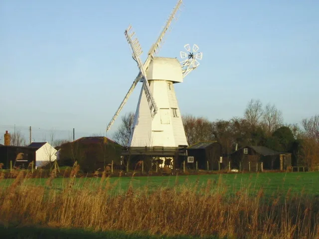
White Mill
Museums · 0.6 km

Watermills Wake and Aqua Park
Watermills · 0.7 km

Invicta House Ye Olde King's Arms
Historic pubs · 0.7 km
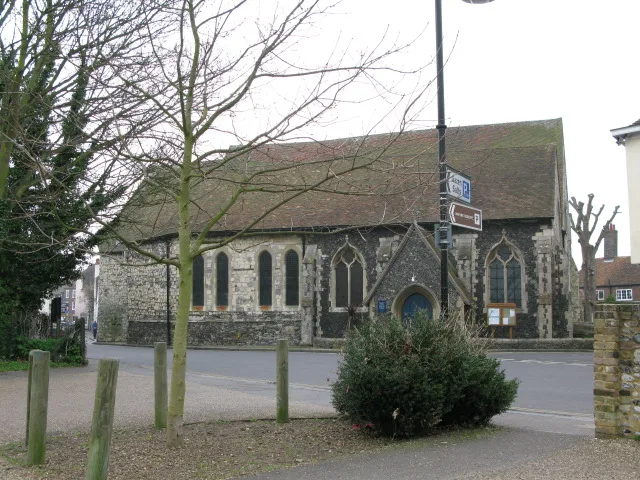
St Mary's Church, Sandwich
Historic churches · 0.8 km

Giles Quay
Marinas · 0.8 km

Boundary Walling To West Side Of No 59
Holy wells · 0.8 km

Richborough House
Historic houses · 0.9 km

Richborough Roman Amphitheatre
Archaeological sites · 0.9 km

Rutupiae amphitheatre
Open-air theatres · 0.9 km

Sandwich Leisure Park
Caravan parks · 0.9 km

Delf House
Historic houses · 0.9 km

The Empire Cinema
Cinemas · 0.9 km
Nearby
📷 5Museums · South East England
White Mill
White Mill — windmill, now heritage centre, in Sandwich, Kent, England, UK.
📷 5Watermills · South East England
Watermills Wake and Aqua Park
Watermills Wake and Aqua Park — a watermill in South East England, United Kingdom.
📷 5Historic pubs · South East England
Invicta House Ye Olde King's Arms
Invicta House Ye Olde King's Arms in England South East, United Kingdom.
📷 5Historic churches · South East England
St Mary's Church, Sandwich
St Mary's Church, Sandwich — church in the town of Sandwich, Kent, England, UK.
📷 5📷 5Holy wells · South East England
Boundary Walling To West Side Of No 59
Boundary Walling To West Side Of No 59 — wall in Sandwich, Dover, Kent, England, UK.
Where to eat & stay near Monk's Wall nature reserve
Places to stay
📷 5Caravan parks · South East England
Sandwich Leisure Park
Sandwich Leisure Park — a caravan park in england south east.
 📷 5
📷 5Campsites · South East England
Goldstone Camping
Goldstone Camping — a campsite in england south east.
 📷 7
📷 7B&Bs · South East England
Durlock Lodge B&B
Durlock Lodge B&B — a bed-and-breakfast in england south east.
 📷 5
📷 5 📷 5
📷 5Campsites · South East England
Marshside Scout Camp
Marshside Scout Camp — a campsite in england south east.
 📷 5
📷 5Caravan parks · South East England
Pegwell Bay Caravan Park
Pegwell Bay Caravan Park — a caravan park in england south east.
Places to eat & drink
📷 5Historic pubs · South East England
Invicta House Ye Olde King's Arms
Invicta House Ye Olde King's Arms in England South East, United Kingdom.
 📷 6
📷 6Historic pubs · South East England
The Admiral Owen Public House
The Admiral Owen Public House in England South East, United Kingdom.
 📷 7
📷 7Historic pubs · South East England
The Chequer Inn
The Chequer Inn in England South East, United Kingdom.
 📷 5
📷 5Historic pubs · South East England
The Black Pig Inn
The Black Pig Inn in England South East, United Kingdom.
 📷 5
📷 5Historic pubs · South East England
Queen Charlotte Public House
Queen Charlotte Public House in England South East, United Kingdom.
 📷 6
📷 6Restaurants · South East England
The Empire Room
The Empire Room — a restaurant in england south east.
More places in this region
 📷 5
📷 5 📷 5
📷 5Wildlife reserves · South East England
Burham Down
Burham Down — nature reserve in Kent, England, UK.
 📷 5
📷 5Wildlife reserves · South East England
Combe Bottom
Combe Bottom — nature reserve in Surrey, England.
 📷 5
📷 5Wildlife reserves · South East England
Dryhill Nature Reserve
Dryhill Nature Reserve is a wildlife reserve in the United Kingdom.
Frequently asked questions
- Where is Monk's Wall nature reserve?
- Monk's Wall nature reserve is in Kent, South-East England, United Kingdom (postcode CT13 9JG), in the parish of Ash.
- What is Monk's Wall nature reserve?
- Monk's Wall nature reserve is a wildlife reserve in the United Kingdom.
- How do I get to Monk's Wall nature reserve?
- The nearest railway station is Sandwich, about 1.6 km away. The nearest town is Ware. Drivers can use postcode CT13 9JG.
- Is Monk's Wall nature reserve a protected site?
- Yes — Monk's Wall nature reserve is part of the Sandwich Bay to Hacklinge Marshes SSSI Site of Special Scientific Interest and the Kent Downs National Landscape (AONB).
- Is Monk's Wall nature reserve free to visit?
- Yes, Monk's Wall nature reserve is free to enter.
- How do I get to Monk's Wall nature reserve?
- The nearest railway station is Sandwich, about 1.6 km away. Drivers can navigate to postcode CT13 9JG.
- Are dogs allowed at Monk's Wall nature reserve?
- Most wildlife reserves allow dogs on lead only, with restrictions during ground-nesting bird season (March-July). Check signage at the reserve.