
Archaeological sites · North West England
Long Meg and Her Daughters
Also known as: Long Meg
In or near Great Salkeld.
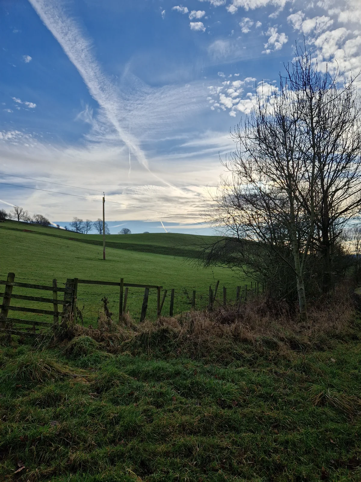
Long Meg and Her Daughters in England North East, United Kingdom.

James T M Towill — CC BY-SA 2.0 via Wikimedia Commons licence

Plan your visit
- Typical visit
- 45 min–1.5 h
- Nearest railway station
- Lazonby and Kirkoswald · 3.3 km
- Free entry
- Dog-friendly
Getting there & planning your visit
To visit Long Meg and Her Daughters, the nearest railway station is Lazonby and Kirkoswald, located 3.3 km away. Entry to the site is free, and it is accessible to visitors. The postcode for sat-nav is CA10 1NW.
About
Long Meg and Her Daughters is a place of interest in England North East, United Kingdom — drawn from open-data sources for visitor reference. See the linked Wikipedia article for the full description.
Photo gallery
Official information
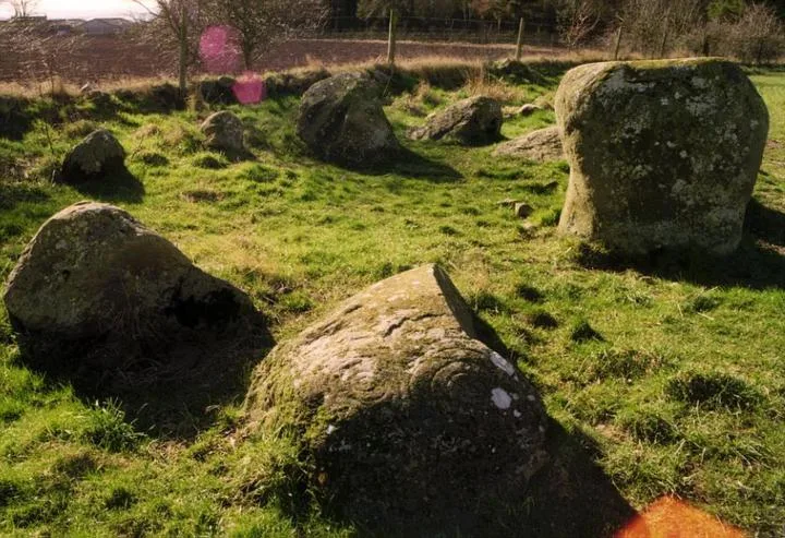
Long Meg and her Daughters is a significant Neolithic and Bronze Age stone circle located in Cumbria, England. The site features a large sandstone pillar known as Long Meg and a circle of granite stones, with various rock carvings present on the stones, indicating its historical and archaeological importance.
Protected designations
- Site of Special Scientific Interest: River Eden and Tributaries SSSI
- Area of Outstanding Natural Beauty: North Pennines
Designations sourced from Natural England open data under OGL v3.
From the Wikipedia article
Long Meg and Her Daughters is a Neolithic stone circle situated north-east of Penrith near Little Salkeld in Cumbria, North West England. One of around 1,300 stone circles in the British Isles and Brittany, it was constructed as a part of a megalithic tradition that emerged during Neolithic, and continued into the Early Bronze Age (c. 3200 - 2500 BC). The stone circle is the third widest in England, behind Avebury in Wiltshire and Stanton Drew in Somerset. It consists of 66 stones (of which 27 remain upright) set in an east / west oval configuration measuring 380 ft (120 m) on its long axis. There may originally have been as many as 77 stones, as this was mentioned by William Camden in the 16th century. Long Meg herself is a 12 ft (3.7 m) high monolith of red sandstone 80 ft (24 m), standing to the southwest of the circle. The stone is marked with examples of megalithic art including a cup and ring mark, a spiral, and rings of concentric circles. This art mirrors examples from Neolithic Ireland, including the contemporary Newgrange. The composition and position of the stone is similar to that of the Altar Stone, at Stonehenge, and may be part of a similar tradition of using red sandstone to mark the solstice. Infra-red aerial photography has identified several Early Neolithic enclosures. These include a so-called 'super henge', a possible cursus monument, and a henge similar to examples found near Millom to the far west of Cumbria. These appear to pre-date the stone circle, and its northern edge dips to avoid the lost ditch. There is also the smaller kerbed burial mound of Little Meg to the north.
Excerpt from Wikipedia under CC BY-SA 4.0. See the source article linked in Sources below.
Background
Architecture
The monument is 120 m × 100 m in diameter. Long Meg herself stands 80 ft outside the circle, 20 ft above the farthest stone in the circle, "and is the tallest of the 69 stones at 12 ft high and weighing c. 9 tons (tonnes)." The Long Meg monolith is of local red sandstone, probably from the River Eden or the nearby Lazonby hills, whereas the circle stones are of rhyolite and are glacial erratics. Two large blocks are placed to the east and west and there are two extra 'portal' stones placed to the south-west. The placement of Long Meg is in the alignment between the centre of the circle and the point of the midwinter sunset. The south-west face of Long Meg has crystals in it, whereas the…
Sourced from Wikipedia under CC BY-SA 4.0.
- Coordinates
- 54.7284, -2.6694
- District
- Westmorland and Furness
- Parish
- Hunsonby
- Postcode
- CA10 1NW
- Parliamentary constituency
- Penrith and Solway
- Nearest railway station
- Lazonby and Kirkoswald — 3.3 km
- Official site
- www.stone-circles.org.uk
Sources
- wikidata: Q1869414 (CC0)
- wikipedia: Long Meg and Her Daughters (CC BY-SA 4.0)
Featured in these 4 guides
Itinerary
Neolithic Britain's stone circles
Stonehenge gets the headlines. Avebury, Callanish and Castlerigg deserve them.
Itinerary
Neolithic Britain: stones, circles and burial mounds
Stonehenge, Avebury, Skara Brae and the henges of Orkney — 5,000 years of monument.
Itinerary
Hadrian's Wall in 4 days
From Bowness-on-Solway to Wallsend with the best forts in between.
Itinerary
Hadrian's Wall weekend
The forts of the central sector: Housesteads, Vindolanda, Birdoswald.
Other places nearby

Long Meg
Archaeological sites · 0.1 km
Throstle Brow prehistoric enclosure
Archaeological sites · 0.4 km
Little Meg
Hill forts · 0.8 km

Little Salkeld rail accident
Heritage railway stations · 0.8 km

Long Meg Mine
Viewpoints · 0.8 km

Eden Lacy Viaduct
Historic bridges · 1.0 km

Lacy's Caves
Caves · 1.2 km

Salkeld Hall
Historic houses · 1.2 km

Little Salkeld Flour Mill
Watermills · 1.3 km
The Watermill, Attached House, Barn And Stables
Watermills · 1.3 km

Bank House Farm
Campsites · 1.3 km

Glassonby
Historic houses · 1.3 km
Nearby
📷 3Archaeological sites · North West England
Long Meg
Long Meg — a archaeological in scotland-lowlands, United Kingdom.
📷 3Archaeological sites · North West England
Throstle Brow prehistoric enclosure
Throstle Brow prehistoric enclosure — archaeological site in Hunsonby, Eden, England, UK.
📷 5Hill forts · North West England
Little Meg
Little Meg — archaeological site in Little Salkeld, Hunsonby, England, UK.
📷 3Heritage railway stations · North West England
Little Salkeld rail accident
Little Salkeld rail accident in England North East, United Kingdom.
📷 3Viewpoints · North West England
Long Meg Mine
Long Meg Mine is a viewpoint in the United Kingdom.
📷 3Historic bridges · North West England
Eden Lacy Viaduct
Eden Lacy Viaduct is a historic bridge in the United Kingdom.
Where to eat & stay near Long Meg and Her Daughters
Places to stay
📷 5 📷 5
📷 5Campsites · North West England
Mains Farm
Mains Farm — a campsite in scotland lowlands.
 📷 5
📷 5Campsites · North West England
Lazonby Pool Campsite
Lazonby Pool Campsite — a campsite in scotland lowlands.
 📷 5
📷 5Caravan parks · North West England
Melmerby Mill Holiday Caravan Park
Melmerby Mill Holiday Caravan Park — a caravan park in scotland lowlands.
 📷 5
📷 5Caravan parks · North East England
Melmerby Holiday Park
Melmerby Holiday Park — a caravan park in scotland lowlands.
 📷 5
📷 5Caravan parks · North East England
Crossfell Caravan Park
Crossfell Caravan Park — a caravan park in scotland lowlands.
Places to eat & drink
 📷 3
📷 3 📷 7
📷 7Cafés · North West England
Narrowbar Cafe
Narrowbar Cafe — a café in scotland lowlands.
 📷 6
📷 6Historic pubs · North West England
Gloucester Arms
Gloucester Arms in Scotland Lowlands, United Kingdom.
 📷 7
📷 7Historic pubs · North West England
Two Lions public house and integral stables
Two Lions public house and integral stables in Scotland Lowlands, United Kingdom.
 📷 5
📷 5Historic pubs · North West England
Horse And Farrier Inn And Stables
Horse And Farrier Inn And Stables in Scotland Lowlands, United Kingdom.
 📷 5
📷 5Historic pubs · North West England
Graham Arms (West Of Gelt Bridge)
Graham Arms (West Of Gelt Bridge) in Scotland Lowlands, United Kingdom.
More archaeological sites in this region
 📷 3
📷 3Archaeological sites · North West England
Early medieval sculptural fragments in St Mary's churchyard
Early medieval sculptural fragments in St Mary's churchyard — archaeological site in Sandbach, Cheshire East, England, UK.
 📷 3
📷 3Archaeological sites · North West England
Gaddum's Wood
Gaddum's Wood is a archaeological site in the United Kingdom.
 📷 3
📷 3Archaeological sites · North West England
Marton moated monastic grange, three fishponds, connecting channels and base of stone cross
Marton moated monastic grange, three fishponds, connecting channels and base of stone cross — archaeological site in Whitegate and Marton, Cheshire West and Chester, England, UK.
 📷 3
📷 3Archaeological sites · North West England
St Oswalds Well
St Oswalds Well — a archaeological in england-west-midlands, United Kingdom.
Frequently asked questions
- Where is Long Meg and Her Daughters?
- Long Meg and Her Daughters is in North-East England, United Kingdom (postcode CA10 1NW), in the parish of Hunsonby.
- What is Long Meg and Her Daughters?
- Long Meg and Her Daughters in England North East, United Kingdom.
- How do I get to Long Meg and Her Daughters?
- The nearest railway station is Lazonby and Kirkoswald, about 3.3 km away. Drivers can use postcode CA10 1NW.
- Is Long Meg and Her Daughters a protected site?
- Yes — Long Meg and Her Daughters is part of the River Eden and Tributaries SSSI Site of Special Scientific Interest and the North Pennines National Landscape (AONB).
- Is Long Meg and Her Daughters free to visit?
- Yes, Long Meg and Her Daughters is free to enter.
- How do I get to Long Meg and Her Daughters?
- The nearest railway station is Lazonby and Kirkoswald, about 3.3 km away. Drivers can navigate to postcode CA10 1NW.