Natural landmarks · North West England
Stickle Tarn
In or near Elterwater.
Stickle Tarn — lake near Harrison Stickle, Langdale, Cumbria, United Kingdom.

Wikimedia Commons contributors — see linked file page for photographer and licence licence
Plan your visit
- Typical visit
- 1 h–2 h
- Free entry
- Dog-friendly
Getting there & planning your visit
Stickle Tarn is located in Westmorland and Furness, with the postcode LA22 9JX. Admission is free, and the site is accessible for visitors.
About
Stickle Tarn is a named natural landmark in the United Kingdom. Wikidata describes it as: "lake near Harrison Stickle, Langdale, Cumbria, United Kingdom". Coordinates: 54.4586°, -3.1025°.
Photo gallery
Protected designations
- Site of Special Scientific Interest: Langdale Pikes SSSI
Designations sourced from Natural England open data under OGL v3.
From the Wikipedia article
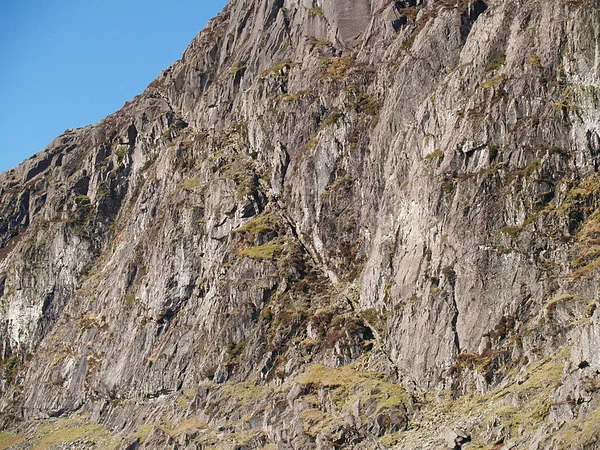
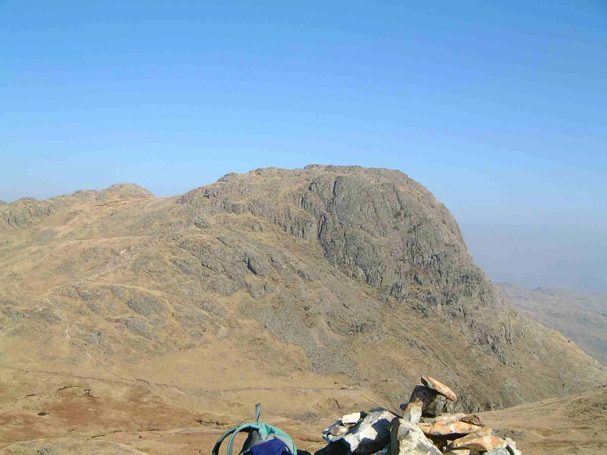
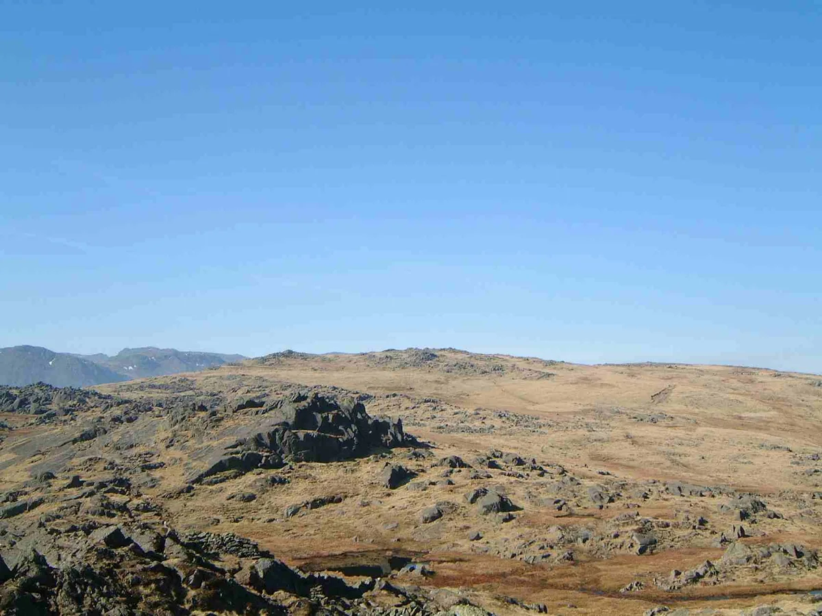
Stickle Tarn is a small tarn near Harrison Stickle in Lake District, England. The tarn was enlarged by the building of a stone dam in 1838 and is used to supply water for the inhabitants of Langdale. The tarn is situated in a corrie, flanked on the west side by Harrison Stickle, and on the north by the massive imposing bulk of Pavey Ark's south face. The tarn is frequently visited by fellwalkers ascending to Pavey Ark's summit, or en route to High Raise from Great Langdale. In February 2015 it was put up for sale by the Lake District National Park Authority, which was seeking to reduce its landholdings in the national park. The walk from Langdale to Stickle Tarn is one of the most popular in the Lake District, and short enough to be a relatively easy outing for families.
Excerpt from Wikipedia under CC BY-SA 4.0. See the source article linked in Sources below.
- Coordinates
- 54.4586, -3.1025
- District
- Westmorland and Furness
- Parish
- Lakes
- Postcode
- LA22 9JX
- Parliamentary constituency
- Westmorland and Lonsdale
Sources
- wikidata: Q7363091 (CC0)
- wikipedia: Stickle Tarn, Langdale (CC BY-SA 4.0)
- commons: Stickle Tarn - geograph.org.uk - 241395.jpg (CC BY-SA 4.0)
Other places nearby

Pavey Ark
Natural landmarks · 0.3 km

Tarn Crag
Mountains & hills · 0.4 km
Pavey Ark
Mountains & hills · 0.4 km

Axe Workings
Archaeological sites · 0.5 km
Harrison Stickle
Mountains & hills · 0.5 km

Harrison Stickle
Natural landmarks · 0.6 km

Thunacar Knott (summit)
Mountains & hills · 0.8 km

Dungeon Ghyll Waterfall
Waterfalls · 0.8 km
Thunacar Knott
Natural landmarks · 0.8 km

Thorn Crag
Mountains & hills · 0.8 km

Thunacar Knott
Mountains & hills · 0.9 km

Lake District National Park
National parks · 0.9 km
Nearby
📷 3📷 5Mountains & hills · North West England
Tarn Crag
Tarn Crag — mountain in england north west. Elevation: 505.7 m.
📷 3📷 3Archaeological sites · North West England
Axe Workings
Axe Workings — a archaeological in england-north-west, United Kingdom.
📷 3Mountains & hills · North West England
Harrison Stickle
Harrison Stickle — Named summit at 735.3 m.
📷 3Natural landmarks · North West England
Harrison Stickle
Harrison Stickle — mountain in United Kingdom.
Where to eat & stay near Stickle Tarn
Places to stay
 📷 5
📷 5Caravan parks · North West England
Greenhowe Caravan Park
Greenhowe Caravan Park — a caravan park in england north west.
 📷 5
📷 5Campsites · North West England
Great Langdale Campsite
Great Langdale Campsite — a campsite in england north west.
 📷 5
📷 5Campsites · North West England
Baysbrown Farm
Baysbrown Farm — a campsite in england north west.
 📷 5
📷 5 📷 5
📷 5Hostels · North West England
Thorney How
Thorney How — a hostel in england north west.
 📷 5
📷 5Places to eat & drink
 📷 7
📷 7Historic pubs · North West England
The Travellers Rest
The Travellers Rest in England North West, United Kingdom.
 📷 5
📷 5Historic pubs · North West England
Golden Rule Hotel
Golden Rule Hotel in England North West, United Kingdom.
 📷 7
📷 7Cafés · North West England
Grange Bridge Cottage
Grange Bridge Cottage — a café in england north east.
 📷 5
📷 5Historic pubs · North West England
Sun Cottage Sun Inn Public House
Sun Cottage Sun Inn Public House in England North West, United Kingdom.
 📷 5
📷 5Restaurants · North West England
Holbeck Ghyll Restaurant
Holbeck Ghyll Restaurant — a restaurant in england north west.
 📷 4
📷 4Restaurants · North West England
Holbeck Ghyll
Holbeck Ghyll is a restaurant located in Windermere, Cumbria, England. "The late 19th century building was once Lord Lonsdale's hunting lodge and only became a hotel in the 1970s. It won a Michelin st
More natural landmarks in this region
 📷 3
📷 3Natural landmarks · North West England
Statue of Oliver Cromwell
Statue of Oliver Cromwell — Public artwork (statue).
 📷 3
📷 3Natural landmarks · North West England
Dagfields Craft Centre
Dagfields Craft Centre — a other in england-west-midlands, United Kingdom.
 📷 3
📷 3Natural landmarks · North West England
Weaver Valley Cruises
Weaver Valley Cruises — a other in england-west-midlands, United Kingdom.
 📷 3
📷 3Natural landmarks · North West England
Golden Gates
Golden Gates — a other in england-west-midlands, United Kingdom.
Frequently asked questions
- Where is Stickle Tarn?
- Stickle Tarn is in North-West England, United Kingdom (postcode LA22 9JX), in the parish of Lakes.
- What is Stickle Tarn?
- Stickle Tarn — lake near Harrison Stickle, Langdale, Cumbria, United Kingdom.
- How do I get to Stickle Tarn?
- Drivers can use postcode LA22 9JX.
- Is Stickle Tarn a protected site?
- Yes — Stickle Tarn is part of the Langdale Pikes SSSI Site of Special Scientific Interest.
- Is Stickle Tarn free to visit?
- Yes, Stickle Tarn is free to enter.
- How do I get to Stickle Tarn?
- Drivers can navigate to postcode LA22 9JX. It sits within the Westmorland and Lonsdale parliamentary constituency.