National parks · North Wales
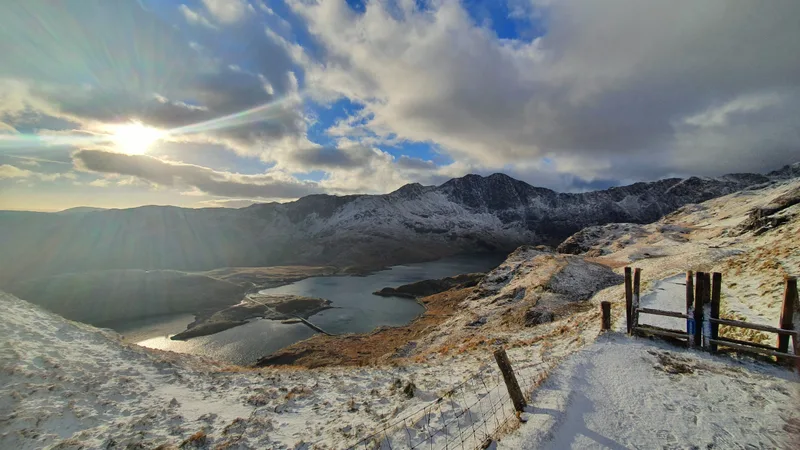
Snowdonia National Park
Also known as: Eryri, Parc Cenedlaethol Eryri, Park Kenedhlek Eryri
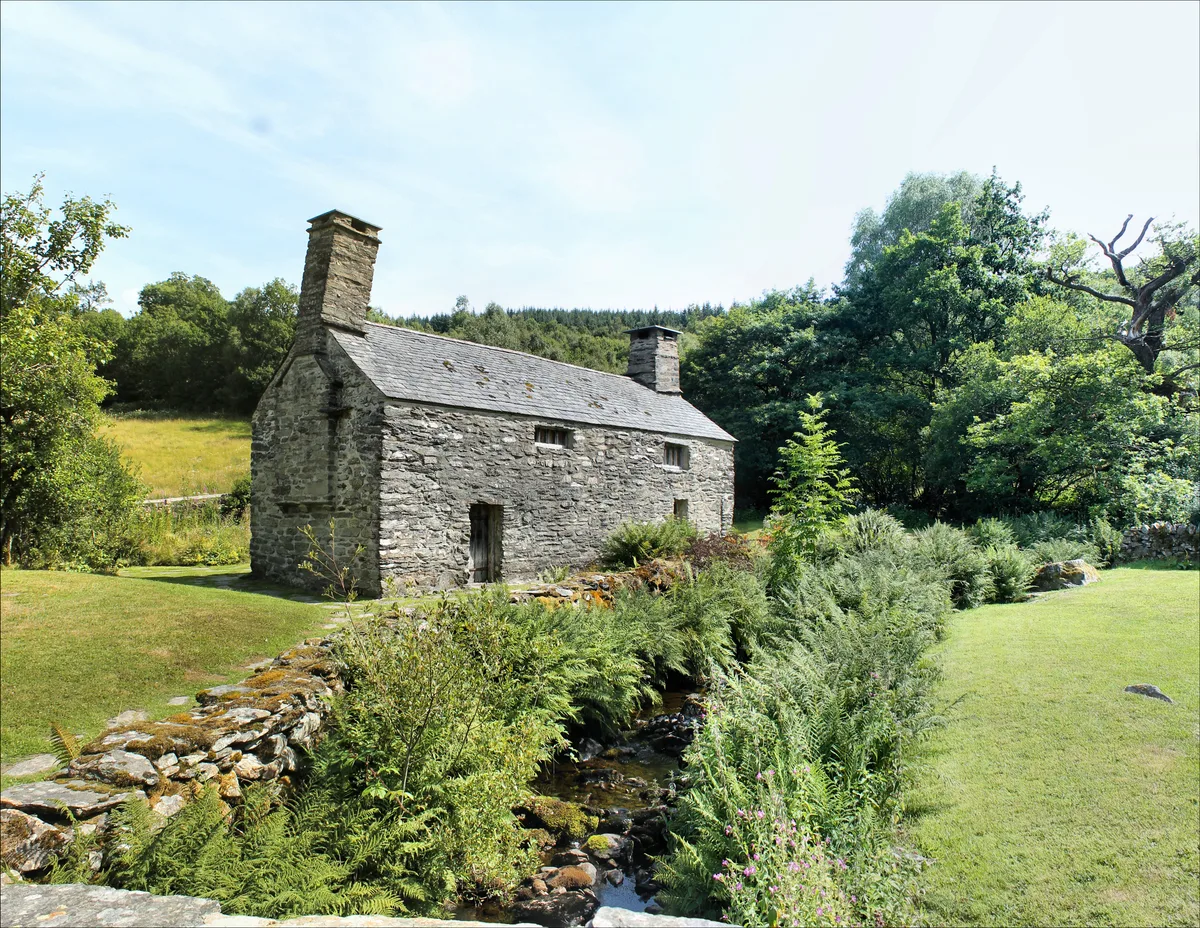
In or near Capel Garmon.
Wales' largest national park — Snowdon, slate heritage, Welsh-language heartland.

Jonathan Wilkins — CC BY-SA 2.0 via Wikimedia Commons licence
Plan your visit
- Typical visit
- 4 h–8 h
- Best time of year
- Spring – autumn (Apr–Oct)
- Nearest railway station
- Pont-y-Pant · 1.9 km
- Free entry
- Family-friendly
- Dog-friendly
Getting there & planning your visit
To visit Snowdonia National Park, the nearest railway station is Pont-y-Pant, located 1.9 km away. Entry to the park is free, and it is accessible to visitors. The postcode for navigation is LL25 0HJ.
About
Snowdonia National Park (Welsh: Parc Cenedlaethol Eryri) covers 2,130 sq km of north-west Wales — Wales' largest national park and home to Snowdon (Yr Wyddfa, 1,085 m), the highest peak in Wales and England. The park contains nine mountain ranges, more than 200 lakes, the Welsh-language heartland (Welsh is the everyday tongue for half its residents), and over 1,500 km of public footpaths. Slate-quarrying heritage at Penrhyn, Llanberis and Blaenau Ffestiniog is now a UNESCO World Heritage Site (2021). The park was the first designated in Wales (1951).
Photo gallery
Summary from the official site
Snowdonia National Park, covering 823 square miles, is the largest national park in Wales, known for its stunning landscapes, rich culture, and heritage. It attracts nearly 4 million visitors annually who come to explore its mountain ranges, valleys, and extensive recreational opportunities.
Read more on the official property page.
From the Wikipedia article
Snowdonia, or Eryri (Welsh: [ɛrəˈri] ), is a mountainous region and national park in North Wales. It contains all 15 mountains in Wales over 3000 feet high, including the country's highest, Snowdon (Yr Wyddfa), which is 1,085 metres (3,560 ft) tall. These peaks are all part of the Snowdon, Glyderau, and Carneddau ranges in the north of the region. The lower Moelwynion and Moel Hebog ranges lie immediately to the south. The national park has an area of 823 square miles (2,130 km2) (the fourth-largest in the UK), and covers most of central and southern Gwynedd and the western part of Conwy County Borough. This is much larger than the area traditionally considered Snowdonia (Eryri), and in addition to the five ranges above includes the Rhinogydd, Cadair Idris, and Aran ranges and the Dyfi Hills. It also includes most of the coast between Porthmadog and Aberdyfi. The park was the first of the three national parks of Wales to be designated, in October 1951, and the third in the UK after the Peak District and Lake District, which were established in April and May 1951 respectively. The park received 3.89 million visitors in 2015.
Excerpt from Wikipedia under CC BY-SA 4.0. See the source article linked in Sources below.
Background
History
The earliest evidence for human occupation of the area dates from around 4000–3000 BC with extensive traces of prehistoric field systems evident in the landscape. Within these are traces of irregular enclosures and hut circles. There are burial chambers of Neolithic and Bronze Age such as Bryn Cader Faner and Iron Age hillforts such as Bryn y Castell near Ffestiniog. The region was finally conquered by the Romans by AD 77–78. Remains of Roman marching camps and practice camps are evident. There was a Roman fort and amphitheatre at Tomen y Mur. Roads are known to have connected with (Caernarfon) and (Chester) and include the northern reaches of Sarn Helen. There are numerous memorial stones…
Visiting
Research indicates that there were 3.67 million visitors to Snowdonia National Park in 2013, with approximately 9.74 million tourist days spent in the park during that year. Total tourist expenditure was £433.6 million in 2013.
Sourced from Wikipedia under CC BY-SA 4.0.
- Coordinates
- 53.0500, -3.8500
- District
- Conwy
- Parish
- Dolwyddelan
- Postcode
- LL25 0HJ
- Parliamentary constituency
- Bangor Aberconwy
- Established
- 1951
- Nearest railway station
- Pont-y-Pant — 1.9 km
- Official site
- eryri.gov.wales
Sources
- manual: snowdonia-national-park (manual)
- wikipedia: Snowdonia (CC BY-SA 4.0)
Featured in these 3 guides
Itinerary
Dark sky Britain: where to see the stars
Designated Dark Sky Reserves and Discovery Sites for stargazing without light pollution.
Itinerary
Top 10 UK national parks ranked
All 15 UK national parks, ranked by what to expect.
Itinerary
Snowdonia in 3 days
Snowdon, Cadair Idris and Welsh slate heritage.
Other places nearby

Drosgol
Mountains & hills · 0.5 km
Tŷ Mawr Wybrnant
Historic houses · 1.0 km

Tŷ Mawr Wybrnant Museum
Museums · 1.0 km

Ro-Lwyd
Mountains & hills · 1.3 km

Hanner a hanner
Mountain bike trails · 1.3 km

Igam Ogam
Mountain bike trails · 1.7 km
Igam Ogam
Mountain bike trails · 1.7 km
Igam Ogam
Mountain bike trails · 1.7 km
Penmachno Trail
Mountain bike trails · 1.8 km
Igam Ogam
Mountain bike trails · 1.8 km

Ty'n-y-Bryn quarry
Quarries · 1.8 km

Ffastis Tri
Mountain bike trails · 1.9 km
Nearby
📷 5📷 3Historic houses · North Wales
Tŷ Mawr Wybrnant
Tŷ Mawr Wybrnant — house in Bro Machno, Conwy County Borough, Wales.
📷 3Museums · North Wales
Tŷ Mawr Wybrnant Museum
Tŷ Mawr Wybrnant Museum — a museum in wales-north, United Kingdom.
📷 5📷 4📷 5Where to eat & stay near Snowdonia National Park
Places to stay
 📷 5
📷 5Hostels · North Wales
Lledr Hall Outdoor Education Centre
Lledr Hall Outdoor Education Centre — a hostel in wales north.
 📷 5
📷 5 📷 5
📷 5Campsites · North Wales
Tan-aeldroch - Camp Snowdonia
Tan-aeldroch - Camp Snowdonia — a campsite in wales north.
 📷 7
📷 7 📷 5📷 5
Places to eat & drink
 📷 5
📷 5 📷 7
📷 7Restaurants · North Wales
Tafarn Tryfan
Tafarn Tryfan — a restaurant in wales north.
Other national parks from this era
 ★ Iconic📷 5
National parks · North West England
Lake District National Park
England's largest national park — mountains, lakes, Wordsworth country, UNESCO.
More national parks in this region
 Flagship📷 5
National parks · North Wales
Eryri (Snowdonia)
Eryri (Snowdonia) is a Mountainous region and national park in North Wales.
 📷 4
📷 4National parks · North Wales
Llandudno Cable Car
The Llandudno Cable Car is an attraction in the seaside resort of Llandudno in Conwy County Borough, Wales. The cable car runs along the Great Orme spanning a distance of one mile forty feet (1.622 km
Frequently asked questions
- Where is Snowdonia National Park?
- Snowdonia National Park is in North Wales, United Kingdom (postcode LL25 0HJ), in the parish of Dolwyddelan.
- What is Snowdonia National Park?
- Wales' largest national park — Snowdon, slate heritage, Welsh-language heartland.
- How do I get to Snowdonia National Park?
- The nearest railway station is Pont-y-Pant, about 1.9 km away. Drivers can use postcode LL25 0HJ.
- When was Snowdonia National Park built?
- Built or established in 1951.
- Is Snowdonia National Park free to visit?
- Yes, Snowdonia National Park is free to enter.
- How do I get to Snowdonia National Park?
- The nearest railway station is Pont-y-Pant, about 1.9 km away. Drivers can navigate to postcode LL25 0HJ.