Natural landmarks · North West England
Hadrian's Wall Path
In or near Greenhead.
84-mile National Trail along the UNESCO Roman frontier — 7-day walk across Northumberland.

Russel Wills — CC BY-SA 2.0 via Wikimedia Commons licence
Plan your visit
- Typical visit
- 1 h–2 h
- Nearest railway station
- Haltwhistle · 9.2 km
- Free entry
- Dog-friendly
- Wheelchair accessible
Getting there & planning your visit
To visit Hadrian's Wall Path, the nearest railway station is Haltwhistle, located 9.2 km away. The postcode for navigation is CA8 7DD, and entry to the site is free.
About
Hadrian's Wall Path is the 84-mile National Trail running along Hadrian's Wall from Bowness-on-Solway in Cumbria to Wallsend on the Tyne — opened 2003, traversing the UNESCO World Heritage Site Roman frontier with its surviving milecastles, forts (Vindolanda, Housesteads, Birdoswald) and views over the Northumberland fells. 7-day end-to-end walk.
Photo gallery
Summary from the official site
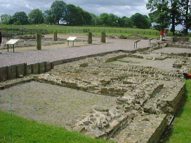
Birdoswald Roman Fort is a historical site along Hadrian's Wall where visitors can learn about the Roman history of the area. The fort features interactive displays and the longest visible stretch of Hadrian's Wall, along with activities for families such as model building and puzzle hunts.
Read more on the official property page.
Protected designations
- Site of Special Scientific Interest: River Eden and Tributaries SSSI
Designations sourced from Natural England open data under OGL v3.
From the Wikipedia article
Hadrian's Wall Path is a long-distance footpath in the north of England, which became the 15th National Trail in 2003. It runs for 84 miles (135 km), from Wallsend on the east coast of England to Bowness-on-Solway on the west coast. For most of its length it is close to the remains of Hadrian's Wall, the defensive wall built by the Romans on the northern border of their empire. This is now recognised as part of the "Frontiers of the Roman Empire" World Heritage Site.
Excerpt from Wikipedia under CC BY-SA 4.0. See the source article linked in Sources below.
Background
Visiting
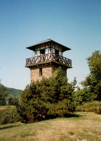
Both Newcastle and Carlisle are on the UK national railway network. The start of the walk at Wallsend can be easily reached by taking a local train from Newcastle to Wallsend Metro Station, which is the only station in the world with bilingual notices in English and Latin. From the station walk in the opposite direction to the shops along Station Road towards the tall observation tower of Segedunum Roman Fort and Museum. The Tyne Valley railway line runs between Newcastle and Carlisle, with stops at Wylam, Prudhoe, Corbridge, Hexham, Haydon Bridge, Bardon Mill, Haltwhistle, Brampton (1 mile from the town of Brampton) and Wetheral. For most of its length, the line is not within easy walking…
Sourced from Wikipedia under CC BY-SA 4.0.
- Coordinates
- 54.9908, -2.6011
- District
- Cumberland
- Parish
- Waterhead
- Postcode
- CA8 7DD
- Parliamentary constituency
- Carlisle
- Phone
- 0370 333 1181
- Nearest railway station
- Haltwhistle — 9.2 km
- Opening
- Daily 10am–5pm; last entry at 4.30pm
- Official site
- www.english-heritage.org.uk
Sources
- manual: hadrians-wall-path (manual)
- wikipedia: Hadrian's Wall Path (CC BY-SA 4.0)
Featured in this guide
Other places nearby

Birdoswald Roman Fort and Study Centre
Museums · 0.1 km

Birdoswald Roman Fort
Forts · 0.2 km
Banna
Hill forts · 0.2 km

Birdoswald
Archaeological sites · 0.2 km
borders of the Roman Empire
UNESCO World Heritage · 0.2 km

Roman Altar
Archaeological sites · 0.2 km

Birdoswald Roman fort and the section of Hadrian's Wall and vallum between the River Irthing and the field boundaries east of milecastle 50
Archaeological sites · 0.4 km

Milecastle
Historic houses · 0.4 km
Milecastle 49
Roman villas · 0.4 km

Waterhead
Archaeological sites · 0.4 km
Turret 49B
Archaeological sites · 0.5 km

Slack House Organic Farm
Historic houses · 0.7 km
Nearby
📷 3Museums · North West England
Birdoswald Roman Fort and Study Centre
Birdoswald Roman Fort and Study Centre — a museum in scotland-lowlands, United Kingdom.
📷 5Forts · North West England
Birdoswald Roman Fort
Birdoswald Roman Fort is a fort in the United Kingdom.
📷 5Hill forts · North West England
Banna
Banna — Roman fort in Cumbria, England.
📷 4Archaeological sites · North West England
Birdoswald
Birdoswald in England North East, United Kingdom.
Flagship📷 3UNESCO World Heritage · North West England
borders of the Roman Empire
borders of the Roman Empire — world heritage site (limes in Germany and UK).
📷 3Archaeological sites · North East England
Roman Altar
Roman Altar — a archaeological in scotland-lowlands, United Kingdom.
Where to eat & stay near Hadrian's Wall Path
Places to stay
 📷 5
📷 5Campsites · North East England
Chapel house farm walkers campsite
Chapel house farm walkers campsite — a campsite in scotland lowlands.
 📷 5
📷 5Hostels · North East England
Greenhead Hostel
Greenhead Hostel — a hostel in scotland lowlands.
 📷 5
📷 5Campsites · North West England
Camping at Banks
Camping at Banks — a campsite in scotland lowlands.
 📷 5
📷 5Caravan parks · North West England
Cleugh Head Caravan Club
Cleugh Head Caravan Club — a caravan park in scotland lowlands.
 📷 5
📷 5Caravan parks · North East England
Blenkinsopp Castle Home Park
Blenkinsopp Castle Home Park — a caravan park in scotland lowlands.
 📷 5
📷 5Places to eat & drink
 📷 4
📷 4 📷 4
📷 4Historic pubs · North West England
Hallbankgate
Hallbankgate in England North East, United Kingdom.
 📷 5
📷 5Historic pubs · North West England
Graham Arms (West Of Gelt Bridge)
Graham Arms (West Of Gelt Bridge) in Scotland Lowlands, United Kingdom.
 📷 5
📷 5 📷 7
📷 7Historic pubs · North East England
Anchor Hotel
Anchor Hotel in Scotland Lowlands, United Kingdom.
 📷 5
📷 5Historic pubs · North West England
St Nicholas Arms Public House
St Nicholas Arms Public House in Scotland Lowlands, United Kingdom.
Other natural landmarks from this era
_(cropped).JPG?width=1200) 📷 5
📷 5Natural landmarks · London
George Stuart White
George Stuart White — Public artwork (statue).
 📷 5
📷 5 📷 5
📷 5Natural landmarks · London
John Keats
John Keats — Public artwork (statue) by Stuart Williamson.
 📷 5
📷 5More natural landmarks in this region
 📷 3
📷 3Natural landmarks · North West England
Statue of Oliver Cromwell
Statue of Oliver Cromwell — Public artwork (statue).
 📷 3
📷 3Natural landmarks · North West England
Dagfields Craft Centre
Dagfields Craft Centre — a other in england-west-midlands, United Kingdom.
 📷 3
📷 3Natural landmarks · North West England
Weaver Valley Cruises
Weaver Valley Cruises — a other in england-west-midlands, United Kingdom.
 📷 3
📷 3Natural landmarks · North West England
Golden Gates
Golden Gates — a other in england-west-midlands, United Kingdom.
Frequently asked questions
- Where is Hadrian's Wall Path?
- Hadrian's Wall Path is in North-East England, United Kingdom (postcode CA8 7DD), in the parish of Waterhead.
- What is Hadrian's Wall Path?
- 84-mile National Trail along the UNESCO Roman frontier — 7-day walk across Northumberland.
- How do I get to Hadrian's Wall Path?
- The nearest railway station is Haltwhistle, about 9.2 km away. Drivers can use postcode CA8 7DD.
- When was Hadrian's Wall Path built?
- Dates from the modern period.
- Is Hadrian's Wall Path a protected site?
- Yes — Hadrian's Wall Path is part of the River Eden and Tributaries SSSI Site of Special Scientific Interest.
- Is Hadrian's Wall Path free to visit?
- Yes, Hadrian's Wall Path is free to enter.
- How do I get to Hadrian's Wall Path?
- Drivers can navigate to postcode CA8 7DD. It sits within the Carlisle parliamentary constituency.