Towns & cities · North East England
Greenhead
Also known as: Greenhead, Northumberland
Greenhead — village in Northumberland, England, United Kingdom.

Wikimedia Commons contributors — see linked file page for photographer and licence licence
Plan your visit
- Typical visit
- 3 h–6 h
- Nearest railway station
- Haltwhistle · 4.2 km
- Free entry
- Family-friendly
- Dog-friendly
Getting there & planning your visit
To visit Greenhead, the nearest railway station is Haltwhistle, located 4.2 km away. Entry to the area is free. The postcode for your sat-nav is CA8 7HF.
About
Greenhead is a town, city, village or settlement in the United Kingdom. Recent population estimates put it at around 343 people. Wikidata describes it as: "village in Northumberland, England, United Kingdom". Coordinates: 54.9830°, -2.5230°.
Photo gallery
Protected designations
- Site of Special Scientific Interest: River Eden and Tributaries SSSI
Designations sourced from Natural England open data under OGL v3.
From the Wikipedia article
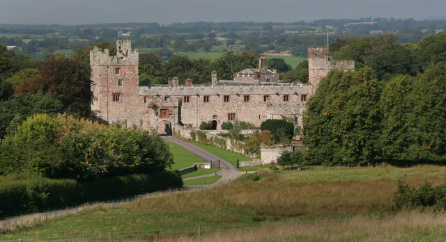
Greenhead is a village and civil parish in Northumberland, England. The village is on the Military Road (B6318), about 17 miles (27 km) from Chollerford, 3 miles (5 km) from Haltwhistle and 9 miles (14 km) from Brampton, Cumbria along the A69 road. The A69 bypasses the village, but until the 1980s all vehicular traffic passed through it. The village lies just outside the Northumberland National Park, close to Hadrian's Wall. Just to the north of the village is the 12th-century Thirlwall Castle, recently restored and opened to the public. Nearby villages include Upper Denton and Haltwhistle. A former Methodist chapel in the village is now a youth hostel. The Pennine Way, the UK's first National Trail, passes through Greenhead.
Excerpt from Wikipedia under CC BY-SA 4.0. See the source article linked in Sources below.
- Coordinates
- 54.9830, -2.5230
- District
- Northumberland
- Parish
- Greenhead
- Postcode
- CA8 7HF
- Parliamentary constituency
- Hexham
- Population
- 343
- Nearest railway station
- Haltwhistle — 4.2 km
- Official site
- www.neighbourhood.statistics.gov.uk
Sources
- wikidata: Q680824 (CC0)
- wikipedia: Greenhead, Northumberland (CC BY-SA 4.0)
- commons: Greenhead Hotel.jpg (CC BY-SA 4.0)
Other places nearby

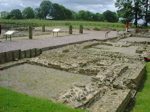
Magnis Roman fort
Archaeological sites · 0.2 km
Magna Roman Fort
Museums · 0.2 km

Roman Army Museum
Museums · 0.3 km

Walltown Quarry
Natural landmarks · 0.5 km

Milecastle 46
Archaeological sites · 0.5 km
Milecastle 36 (Carvoran)
Archaeological sites · 0.5 km

The section of Stanegate Roman road from Fell End Roman temporary camp to the track to Old Shield, and the Roman cemetery adjacent to Carvoran Roman fort
Archaeological sites · 0.6 km

Greenhead Hostel
Hostels · 0.6 km

Greenhead railway station
Heritage railway stations · 0.7 km
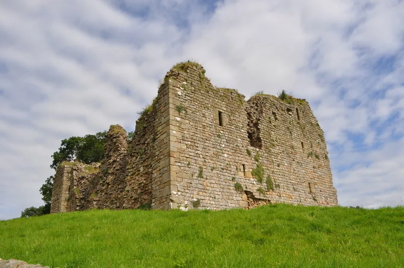
Thirlwall Castle
Castles · 0.9 km

Blenkinsopp Castle (uninhabited parts)
Literary houses · 1.0 km
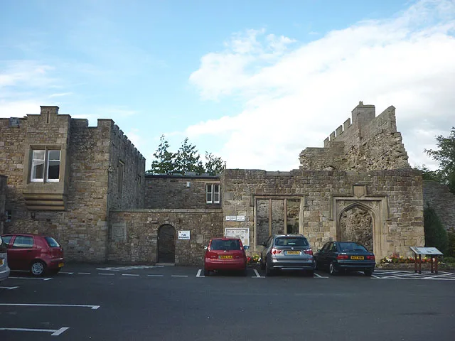
Blenkinsopp Castle
Castles · 1.0 km
Greenhead is a small village located in the Scottish Lowlands with a population of 343. Our guide lists nearby attractions within reach.
At a glance
- Population
- 343
- Constituency
- Hexham
Things to see in Greenhead
139 attractions within 12 km — showing the 24 most editorially-significant. Full guide: things to do in Greenhead →
 ★ Iconic📷 5
Natural landmarks · North West England
Hadrian's Wall Path
84-mile National Trail along the UNESCO Roman frontier — 7-day walk across Northumberland.
 📷 4
📷 4Archaeological sites · North West England
Waterhead
Waterhead in England North East, United Kingdom.
 📷 4
📷 4Archaeological sites · North West England
Birdoswald
Birdoswald in England North East, United Kingdom.
 📷 4
📷 4Heritage railway stations · North West England
Low Row railway station
Low Row railway station in England North East, United Kingdom.
 📷 4
📷 4Heritage railway stations · North West England
Naworth railway station
Naworth railway station in England North East, United Kingdom.
 📷 5
📷 5 📷 4
📷 4Archaeological sites · North West England
Nether Denton
Nether Denton in England North East, United Kingdom.
 📷 4
📷 4Abbeys & priories · North West England
Banks
Banks in England North East, United Kingdom.
 📷 4
📷 4Castles · North West England
Leahill Turret
Leahill Turret in England North East, United Kingdom.
 📷 3
📷 3Historic houses · North West England
Milecastle 50
Milecastle 50 in England North East, United Kingdom.
 📷 4
📷 4Archaeological sites · North West England
Milecastle 51
Milecastle 51 in England North East, United Kingdom.
 📷 5
📷 5Archaeological sites · North West England
Milecastle 52
Milecastle 52 in England North East, United Kingdom.
 📷 4
📷 4Archaeological sites · North West England
Milecastle 50TW
Milecastle 50TW in England North East, United Kingdom.
 📷 4
📷 4Castles · North West England
Triermain Castle
Triermain Castle in England North East, United Kingdom.
 Flagship📷 3
UNESCO World Heritage · North West England
borders of the Roman Empire
borders of the Roman Empire — world heritage site (limes in Germany and UK).
 📷 5
📷 5Hill forts · North West England
Banna
Banna — Roman fort in Cumbria, England.
 📷 5
📷 5Forts · North West England
Birdoswald Roman Fort
Birdoswald Roman Fort is a fort in the United Kingdom.
 📷 3
📷 3Archaeological sites · North West England
Birdoswald Roman fort and the section of Hadrian's Wall and vallum between the River Irthing and the field boundaries east of milecastle 50
Birdoswald Roman fort and the section of Hadrian's Wall and vallum between the River Irthing and the field boundaries east of milecastle 50 — archaeological site in Waterhead, Carlisle, England, UK.
 📷 3
📷 3Archaeological sites · North West England
Hadrian's Wall and vallum between the field boundaries east of milecastle 50 and the boundary west of Coombe Crag in wall miles 50 and 51
Hadrian's Wall and vallum between the field boundaries east of milecastle 50 and the boundary west of Coombe Crag in wall miles 50 and 51 — archaeological site in Waterhead, Cumbria, England, UK.
 📷 3
📷 3Archaeological sites · North West England
Hadrian's Wall and vallum between the field boundary west of Coombe Crag and Banks Green Cottage and the road to Lanercost at Banks in wall miles 51 and 52
Hadrian's Wall and vallum between the field boundary west of Coombe Crag and Banks Green Cottage and the road to Lanercost at Banks in wall miles 51 and 52 — archaeological site in Burtholme, Cumberland, Cumbria , England, UK.
 📷 5
📷 5Castles · North West England
Naworth Castle
Naworth Castle — Grade I listed castle in Cumbria, England, UK.
 📷 3
📷 3Forts · North West England
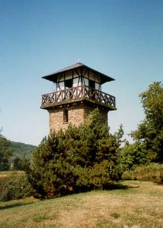
Pike Hill Signal Tower
Pike Hill Signal Tower is a fort in the United Kingdom.
 📷 3
📷 3Historic houses · North West England
Slack House Organic Farm
Slack House Organic Farm — a other in scotland-lowlands, United Kingdom.
 📷 3
📷 3Natural landmarks · North West England
Banks East Turret - Hadrians Wall
Banks East Turret - Hadrians Wall — a other in scotland-lowlands, United Kingdom.
Nearby
📷 3Archaeological sites · North East England
Magnis Roman fort
Magnis Roman fort — a archaeological in scotland-lowlands, United Kingdom.
📷 3Museums · North East England
Magna Roman Fort
Magna Roman Fort in England North East, United Kingdom.
📷 3Museums · North East England
Roman Army Museum
Roman Army Museum — a museum in scotland-lowlands, United Kingdom.
📷 3Natural landmarks · North East England
Walltown Quarry
Walltown Quarry — a other in scotland-lowlands, United Kingdom.
📷 4Archaeological sites · North East England
Milecastle 46
Milecastle 46 in England North East, United Kingdom.
📷 3Archaeological sites · North East England
Milecastle 36 (Carvoran)
Milecastle 36 (Carvoran) — a archaeological in scotland-lowlands, United Kingdom.
Where to eat & stay near Greenhead
Places to stay
📷 5Hostels · North East England
Greenhead Hostel
Greenhead Hostel — a hostel in scotland lowlands.
📷 5Caravan parks · North East England
Blenkinsopp Castle Home Park
Blenkinsopp Castle Home Park — a caravan park in scotland lowlands.
 📷 5
📷 5Campsites · North East England
Chapel house farm walkers campsite
Chapel house farm walkers campsite — a campsite in scotland lowlands.
 📷 5
📷 5Campsites · North East England
Haltwhistle - Camping and Caravanning Club Site
Haltwhistle - Camping and Caravanning Club Site — a campsite in scotland lowlands.
 📷 5📷 5
Hotels · North East England
Manor House Inn
Manor House Inn — a hotel in scotland lowlands.
Places to eat & drink
 📷 4
📷 4 📷 4
📷 4Historic pubs · North West England
Hallbankgate
Hallbankgate in England North East, United Kingdom.
 📷 5
📷 5 📷 5
📷 5Historic pubs · North West England
Graham Arms (West Of Gelt Bridge)
Graham Arms (West Of Gelt Bridge) in Scotland Lowlands, United Kingdom.
 📷 7
📷 7Historic pubs · North East England
Anchor Hotel
Anchor Hotel in Scotland Lowlands, United Kingdom.
More towns in this region
 Flagship📷 3
Towns & cities · North East England
Newby
Newby — village and civil parish in Hambleton, North Yorkshire, England, UK.
 📷 5
📷 5Towns & cities · North East England
Archdeacon Newton
Archdeacon Newton — village and civil parish in County Durham, England, UK.
 📷 3
📷 3Towns & cities · North East England
Boosbeck
Boosbeck — village in North Yorkshire, England, UK.
 📷 3
📷 3Frequently asked questions
- Where is Greenhead?
- Greenhead is in the Scottish Lowlands, United Kingdom (postcode CA8 7HF), in the parish of Greenhead.
- What is Greenhead?
- Greenhead — village in Northumberland, England, United Kingdom.
- How do I get to Greenhead?
- The nearest railway station is Haltwhistle, about 4.2 km away. Drivers can use postcode CA8 7HF.
- Is Greenhead a protected site?
- Yes — Greenhead is part of the River Eden and Tributaries SSSI Site of Special Scientific Interest.
- Is Greenhead free to visit?
- Yes, Greenhead is free to enter.
- How do I get to Greenhead?
- The nearest railway station is Haltwhistle, about 4.2 km away. Drivers can navigate to postcode CA8 7HF.