
UNESCO World Heritage · North West England
borders of the Roman Empire
In or near Greenhead.
borders of the Roman Empire — world heritage site (limes in Germany and UK).

Wikimedia Commons contributors — see linked file page for photographer and licence licence

Plan your visit
- Typical visit
- 2 h–4 h
- Nearest railway station
- Haltwhistle · 9.2 km
Getting there & planning your visit
To visit the borders of the Roman Empire, the nearest railway station is Haltwhistle, located 9.2 km away. The postcode for the site is CA8 7DD. Entry details are not provided, so please check in advance for any fees, and accessibility information is not specified.
About
borders of the Roman Empire is inscribed on the UNESCO World Heritage List. Wikidata describes it as: "world heritage site (limes in Germany and UK)". Coordinates: 54.9926°, -2.6010°.
Photo gallery
Summary from the official site
Birdoswald Roman Fort is part of Hadrian's Wall and offers visitors a chance to explore the history of Roman Britain. The site features interactive displays, the longest visible stretch of Hadrian's Wall, and activities for families, including puzzles and model-making.
Read more on the official property page.
Protected designations
- Site of Special Scientific Interest: River Eden and Tributaries SSSI
Designations sourced from Natural England open data under OGL v3.
From the Wikipedia article
The borders of the Roman Empire, which fluctuated throughout the empire's history, were realised as a combination of military roads and linked forts, natural frontiers (most notably the Rhine and Danube rivers) and man-made fortifications which separated the lands of the empire from the countries beyond.
Excerpt from Wikipedia under CC BY-SA 4.0. See the source article linked in Sources below.
Background
Description
and the Antonine Wall in Scotland and Northern England.]]In continental Europe, the borders were generally well defined, usually following the courses of major rivers such as the Rhine and the Danube. Nevertheless, those were not always the final border lines; the province of Dacia, modern Romania, was completely on the far side of the Danube, and the province of Germania Magna, which must not be confused with Germania Inferior and Germania Superior, was the land between the Rhine, the Danube and the Elbe (Although this province was lost three years after its creation as a result of the Battle of Teutoburg Forest). In Great Britain both Hadrian and Antoninus Pius built defences to protect…
Sourced from Wikipedia under CC BY-SA 4.0.
- Coordinates
- 54.9926, -2.6010
- District
- Cumberland
- Parish
- Waterhead
- Postcode
- CA8 7DD
- Parliamentary constituency
- Carlisle
- Nearest railway station
- Haltwhistle — 9.2 km
- Opening
- Daily 10am–5pm; last entry at 4.30pm
- Official site
- www.english-heritage.org.uk
Sources
- wikidata: Q4147903 (CC0)
- wikipedia: Borders of the Roman Empire (CC BY-SA 4.0)
- commons: Limes03.jpg (CC BY-SA 4.0)
Other places nearby

Hadrian's Wall Path
Natural landmarks · 0.2 km

Birdoswald Roman Fort and Study Centre
Museums · 0.3 km
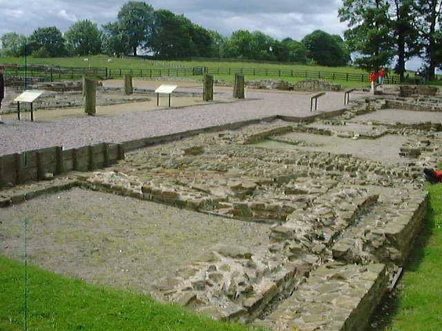
Banna
Hill forts · 0.3 km

Birdoswald
Archaeological sites · 0.4 km

Birdoswald Roman Fort
Forts · 0.4 km

Roman Altar
Archaeological sites · 0.4 km

Milecastle
Historic houses · 0.4 km
Milecastle 49
Roman villas · 0.4 km

Birdoswald Roman fort and the section of Hadrian's Wall and vallum between the River Irthing and the field boundaries east of milecastle 50
Archaeological sites · 0.5 km

Waterhead
Archaeological sites · 0.6 km

Slack House Organic Farm
Historic houses · 0.6 km
Turret 49B
Archaeological sites · 0.6 km
Nearby
★ Iconic📷 5Natural landmarks · North West England
Hadrian's Wall Path
84-mile National Trail along the UNESCO Roman frontier — 7-day walk across Northumberland.
📷 3Museums · North West England
Birdoswald Roman Fort and Study Centre
Birdoswald Roman Fort and Study Centre — a museum in scotland-lowlands, United Kingdom.
📷 5Hill forts · North West England
Banna
Banna — Roman fort in Cumbria, England.
📷 4Archaeological sites · North West England
Birdoswald
Birdoswald in England North East, United Kingdom.
📷 5Forts · North West England
Birdoswald Roman Fort
Birdoswald Roman Fort is a fort in the United Kingdom.
📷 3Archaeological sites · North East England
Roman Altar
Roman Altar — a archaeological in scotland-lowlands, United Kingdom.
Where to eat & stay near borders of the Roman Empire
Places to stay
 📷 5
📷 5Campsites · North East England
Chapel house farm walkers campsite
Chapel house farm walkers campsite — a campsite in scotland lowlands.
 📷 5
📷 5Hostels · North East England
Greenhead Hostel
Greenhead Hostel — a hostel in scotland lowlands.
 📷 5
📷 5Campsites · North West England
Camping at Banks
Camping at Banks — a campsite in scotland lowlands.
 📷 5
📷 5Caravan parks · North West England
Cleugh Head Caravan Club
Cleugh Head Caravan Club — a caravan park in scotland lowlands.
 📷 5
📷 5Caravan parks · North East England
Blenkinsopp Castle Home Park
Blenkinsopp Castle Home Park — a caravan park in scotland lowlands.
 📷 5
📷 5Places to eat & drink
 📷 4
📷 4 📷 4
📷 4Historic pubs · North West England
Hallbankgate
Hallbankgate in England North East, United Kingdom.
 📷 5
📷 5Historic pubs · North West England
Graham Arms (West Of Gelt Bridge)
Graham Arms (West Of Gelt Bridge) in Scotland Lowlands, United Kingdom.
 📷 5
📷 5 📷 7
📷 7Historic pubs · North East England
Anchor Hotel
Anchor Hotel in Scotland Lowlands, United Kingdom.
 📷 5
📷 5Historic pubs · North West England
St Nicholas Arms Public House
St Nicholas Arms Public House in Scotland Lowlands, United Kingdom.
More UNESCO sites in this region
 Flagship📷 5
UNESCO World Heritage · North West England
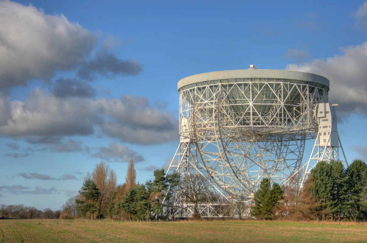
Jodrell Bank Observatory
Jodrell Bank Observatory — astronomical observatory in Cheshire, England, UK.
Frequently asked questions
- Where is borders of the Roman Empire?
- borders of the Roman Empire is in the Scottish Lowlands, United Kingdom (postcode CA8 7DD), in the parish of Waterhead.
- What is borders of the Roman Empire?
- borders of the Roman Empire — world heritage site (limes in Germany and UK).
- How do I get to borders of the Roman Empire?
- The nearest railway station is Haltwhistle, about 9.2 km away. Drivers can use postcode CA8 7DD.
- Is borders of the Roman Empire a protected site?
- Yes — borders of the Roman Empire is part of the River Eden and Tributaries SSSI Site of Special Scientific Interest.
- How do I get to borders of the Roman Empire?
- Drivers can navigate to postcode CA8 7DD. It sits within the Carlisle parliamentary constituency.