Forts · North West England
Upper Denton
In or near Greenhead.
Upper Denton in England North East, United Kingdom.

Stephen Craven — CC BY-SA 2.0 via Wikimedia Commons licence
Plan your visit
- Typical visit
- 45 min–1.5 h
- Nearest railway station
- Brampton · 8.5 km
Getting there & planning your visit
To visit Upper Denton, the nearest railway station is Brampton, located 8.5 km away. The postcode for navigation is CA8 7AG. Entry details are not specified, so please check ahead for any potential fees or accessibility options.
About
Upper Denton is a place of interest in England North East, United Kingdom — drawn from open-data sources for visitor reference. See the linked Wikipedia article for the full description.
Photo gallery
Protected designations
- Site of Special Scientific Interest: River Eden and Tributaries SSSI
Designations sourced from Natural England open data under OGL v3.
From the Wikipedia article
Upper Denton is a small village and civil parish in the north of Cumbria, England, about 1 km north of the A69 road linking Haltwhistle and Brampton. The population of the civil parish when taken at the Census of 2011 was less than 100. Details are included in the parish of Nether Denton. The village is situated on the line of the Roman Stanegate road which ran from Corbridge (Coria) to Carlisle (Luguvalium). Just 1 km to the north across the river Irthing is Birdoswald fort on Hadrian's Wall. Nearby villages include Gilsland, Greenhead and Lanercost. The church was built using Roman stones including a re-used Roman arch, believed to have been removed from Birdoswald fort across the river to the north. The old roofless Bastle house just to the east of the church was at one time a Vicarage. An accident at the level crossing on 24 December 1970 led to a Department of the Environment report. The level crossing is staffed and not automated even though there are very few residences on the north side of the line, and the road north of the line is a dead end.
Excerpt from Wikipedia under CC BY-SA 4.0. See the source article linked in Sources below.
- Coordinates
- 54.9817, -2.6015
- District
- Cumberland
- Parish
- Upper Denton
- Postcode
- CA8 7AG
- Parliamentary constituency
- Carlisle
- Nearest railway station
- Brampton — 8.5 km
Sources
- wikidata: Q2300975 (CC0)
- wikipedia: Upper Denton (CC BY-SA 4.0)
Other places nearby

Bastle at Upper Denton
Historic houses · 0.1 km

Mains Rigg Roman signal tower
Archaeological sites · 0.4 km

Birdoswald Roman fort and the section of Hadrian's Wall and vallum between the River Irthing and the field boundaries east of milecastle 50
Archaeological sites · 0.8 km

Birdoswald Roman Fort
Forts · 0.9 km

Waterhead
Archaeological sites · 0.9 km

Roman Altar
Archaeological sites · 0.9 km

Birdoswald
Archaeological sites · 0.9 km
Banna
Hill forts · 0.9 km
Turret 49B
Archaeological sites · 0.9 km

Birdoswald Roman Fort and Study Centre
Museums · 0.9 km

Milecastle 50TW
Archaeological sites · 1.0 km

Hadrian's Wall Path
Natural landmarks · 1.0 km
Nearby
📷 3Historic houses · North West England
Bastle at Upper Denton
Bastle at Upper Denton — a Grade II*-listed historic house in scotland-lowlands, United Kingdom.
📷 3Archaeological sites · North West England
Mains Rigg Roman signal tower
Mains Rigg Roman signal tower — a archaeological in scotland-lowlands, United Kingdom.
📷 3Archaeological sites · North West England
Birdoswald Roman fort and the section of Hadrian's Wall and vallum between the River Irthing and the field boundaries east of milecastle 50
Birdoswald Roman fort and the section of Hadrian's Wall and vallum between the River Irthing and the field boundaries east of milecastle 50 — archaeological site in Waterhead, Carlisle, England, UK.
📷 5Forts · North West England
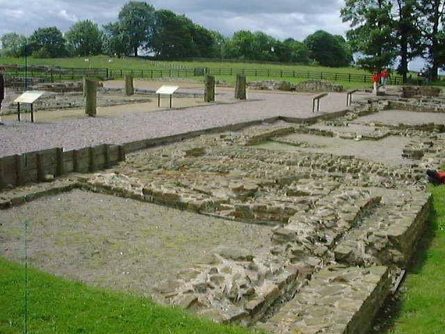
Birdoswald Roman Fort
Birdoswald Roman Fort is a fort in the United Kingdom.
📷 4Archaeological sites · North West England
Waterhead
Waterhead in England North East, United Kingdom.
📷 3Archaeological sites · North East England
Roman Altar
Roman Altar — a archaeological in scotland-lowlands, United Kingdom.
Where to eat & stay near Upper Denton
Places to stay
 📷 5
📷 5Campsites · North East England
Chapel house farm walkers campsite
Chapel house farm walkers campsite — a campsite in scotland lowlands.
 📷 5
📷 5Caravan parks · North West England
Cleugh Head Caravan Club
Cleugh Head Caravan Club — a caravan park in scotland lowlands.
 📷 5
📷 5Hostels · North East England
Greenhead Hostel
Greenhead Hostel — a hostel in scotland lowlands.
 📷 5
📷 5Campsites · North West England
Camping at Banks
Camping at Banks — a campsite in scotland lowlands.
 📷 5
📷 5Caravan parks · North East England
Blenkinsopp Castle Home Park
Blenkinsopp Castle Home Park — a caravan park in scotland lowlands.
 📷 5
📷 5Places to eat & drink
 📷 4
📷 4 📷 4
📷 4Historic pubs · North West England
Hallbankgate
Hallbankgate in England North East, United Kingdom.
 📷 5
📷 5Historic pubs · North West England
Graham Arms (West Of Gelt Bridge)
Graham Arms (West Of Gelt Bridge) in Scotland Lowlands, United Kingdom.
 📷 5
📷 5 📷 7
📷 7Historic pubs · North East England
Anchor Hotel
Anchor Hotel in Scotland Lowlands, United Kingdom.
 📷 5
📷 5Historic pubs · North West England
St Nicholas Arms Public House
St Nicholas Arms Public House in Scotland Lowlands, United Kingdom.
More forts in this region
 📷 3
📷 3 📷 5
📷 5Forts · North West England
Obelisk in Whiteoaks Wood
Obelisk in Whiteoaks Wood — a martello broad in england-west-midlands, United Kingdom.
 📷 5
📷 5Forts · North West England
Obelisk At Rode Hall
Obelisk At Rode Hall — a martello broad in england-west-midlands, United Kingdom.
 📷 5
📷 5Forts · North West England
The Stanley Obelisk
The Stanley Obelisk — a martello broad in england-west-midlands, United Kingdom.
Frequently asked questions
- Where is Upper Denton?
- Upper Denton is in North-East England, United Kingdom (postcode CA8 7AG), in the parish of Upper Denton.
- What is Upper Denton?
- Upper Denton in England North East, United Kingdom.
- How do I get to Upper Denton?
- The nearest railway station is Brampton, about 8.5 km away. Drivers can use postcode CA8 7AG.
- Is Upper Denton a protected site?
- Yes — Upper Denton is part of the River Eden and Tributaries SSSI Site of Special Scientific Interest.
- How do I get to Upper Denton?
- Drivers can navigate to postcode CA8 7AG. It sits within the Carlisle parliamentary constituency.