
Archaeological sites · North West England
Milecastle 50TW
In or near Greenhead.
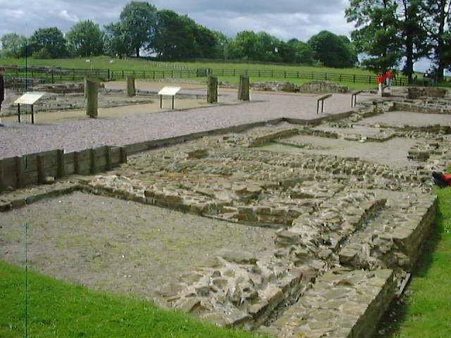
Milecastle 50TW in England North East, United Kingdom.

Mick Garratt — CC BY-SA 2.0 via Wikimedia Commons licence

Plan your visit
- Typical visit
- 45 min–1.5 h
- Nearest railway station
- Brampton · 8.2 km
- Free entry
- Dog-friendly
Getting there & planning your visit
To visit Milecastle 50TW, the nearest railway station is Brampton, located 8.2 km away. The postcode for navigation is CA8 2NA, and entry to the site is free.
About
Milecastle 50TW is a place of interest in England North East, United Kingdom — drawn from open-data sources for visitor reference. See the linked Wikipedia article for the full description.
Photo gallery
See it from the streetimagery from 2022
Imagery © Mapillary contributors, CC BY-SA 4.0
Protected designations
- Site of Special Scientific Interest: River Eden and Tributaries SSSI
Designations sourced from Natural England open data under OGL v3.
From the Wikipedia article
Milecastle 50TW (High House) was a milecastle on the Turf Wall section of Hadrian's Wall (grid reference NY60716583). The milecastle is located close to the Birdoswald Roman Fort and is unique in that it was not replaced by a stone milecastle when the turf wall was upgraded to stone, the replacement wall instead running some 200m to the north. The milecastle was partially demolished by the Romans after it was abandoned. The milecastle was excavated in 1934 and several Roman rubbish pits discovered. The remains of the two turrets associated with this milecastle (which were demolished when the turf wall was abandoned) have also been located. As the turf wall lies some distance from the stone wall, the sites are not accessible from the Hadrian's Wall Path.
Excerpt from Wikipedia under CC BY-SA 4.0. See the source article linked in Sources below.
Background
Architecture
Milecastle 50TW measured 20.12 m x 16.76 m (long-axis type). The ramparts measured 6.1 m at the base. The north gateway(similarly sized to a Turret) was found to contain five square posts at each side (each measuring 23 cm on a side), whereas the south gateway was of a smaller area, and only contained three posts on each side. It has been speculated that the additional posts were used to support the extra weight imposed by a tower above the north gateway, not required over the south gateway. Evidence of an internal timber structure (dimensions 9.14 m x 3.66 m was identified in the eastern side of the milecastle (southern end). The structure was divided into two unequal rooms, each…
Description
Milecastle 50TW was constructed as part of the turf wall section of Hadrian's Wall, and is situated to the west of Birdoswald fort. It is unique in being the only original turf wall milecastle where the stone wall milecastle built to replace it was not constructed on the same site; this is due to the divergent nature of the original turf wall, and replacement stone wall at this reach. The replacement stone wall milecastle, milecastle 50 was built some 200 m to the north. All milecastles on the turf wall section of Hadrian's Wall were thought to have been constructed with turf ramparts, with a wooden tower over the north gate. There are no visible remains of Milecastle 50TW, however a…
Visiting
Although there are no visible remains at any of the three sites, they are all visible (but not accessible) from the Hadrian's Wall path. The nearest accessible parking is at Birdoswald.
Sourced from Wikipedia under CC BY-SA 4.0.
- Coordinates
- 54.9856, -2.6154
- District
- Cumberland
- Parish
- Upper Denton
- Postcode
- CA8 2NA
- Parliamentary constituency
- Carlisle
- Nearest railway station
- Brampton — 8.2 km
Sources
- wikidata: Q16156676 (CC0)
- wikipedia: Milecastle 50TW (CC BY-SA 4.0)
Other places nearby

Milecastle 50
Historic houses · 0.2 km

Turret 50A
Archaeological sites · 0.5 km

Turret 49B
Archaeological sites · 0.6 km
Waterhead
Archaeological sites · 0.7 km

Birdoswald Roman fort and the section of Hadrian's Wall and vallum between the River Irthing and the field boundaries east of milecastle 50
Archaeological sites · 0.7 km

Hadrian's Wall and vallum between the field boundaries east of milecastle 50 and the boundary west of Coombe Crag in wall miles 50 and 51
Archaeological sites · 0.7 km

Mains Rigg Roman signal tower
Archaeological sites · 0.9 km

Birdoswald
Archaeological sites · 0.9 km
Banna
Hill forts · 0.9 km

Bastle at Upper Denton
Historic houses · 0.9 km

Birdoswald Roman Fort
Forts · 0.9 km

Birdoswald Roman Fort and Study Centre
Museums · 0.9 km
Nearby
📷 3Historic houses · North West England
Milecastle 50
Milecastle 50 in England North East, United Kingdom.
📷 3Archaeological sites · North West England
Turret 50A
Turret 50A — a archaeological in scotland-lowlands, United Kingdom.
📷 3Archaeological sites · North West England
Turret 49B
Turret 49B — a archaeological in scotland-lowlands, United Kingdom.
📷 4Archaeological sites · North West England
Waterhead
Waterhead in England North East, United Kingdom.
📷 3Archaeological sites · North West England
Birdoswald Roman fort and the section of Hadrian's Wall and vallum between the River Irthing and the field boundaries east of milecastle 50
Birdoswald Roman fort and the section of Hadrian's Wall and vallum between the River Irthing and the field boundaries east of milecastle 50 — archaeological site in Waterhead, Carlisle, England, UK.
📷 3Archaeological sites · North West England
Hadrian's Wall and vallum between the field boundaries east of milecastle 50 and the boundary west of Coombe Crag in wall miles 50 and 51
Hadrian's Wall and vallum between the field boundaries east of milecastle 50 and the boundary west of Coombe Crag in wall miles 50 and 51 — archaeological site in Waterhead, Cumbria, England, UK.
Where to eat & stay near Milecastle 50TW
Places to stay
 📷 5
📷 5Campsites · North West England
Camping at Banks
Camping at Banks — a campsite in scotland lowlands.
 📷 5
📷 5Campsites · North East England
Chapel house farm walkers campsite
Chapel house farm walkers campsite — a campsite in scotland lowlands.
 📷 5
📷 5Caravan parks · North West England
Cleugh Head Caravan Club
Cleugh Head Caravan Club — a caravan park in scotland lowlands.
 📷 5
📷 5Hostels · North East England
Greenhead Hostel
Greenhead Hostel — a hostel in scotland lowlands.
 📷 5
📷 5Caravan parks · North East England
Blenkinsopp Castle Home Park
Blenkinsopp Castle Home Park — a caravan park in scotland lowlands.
 📷 5
📷 5Places to eat & drink
 📷 4
📷 4 📷 4
📷 4Historic pubs · North West England
Hallbankgate
Hallbankgate in England North East, United Kingdom.
 📷 5
📷 5Historic pubs · North West England
Graham Arms (West Of Gelt Bridge)
Graham Arms (West Of Gelt Bridge) in Scotland Lowlands, United Kingdom.
 📷 5
📷 5 📷 5
📷 5Historic pubs · North West England
St Nicholas Arms Public House
St Nicholas Arms Public House in Scotland Lowlands, United Kingdom.
 📷 7
📷 7Historic pubs · North West England
The Andalusian
The Andalusian in Scotland Lowlands, United Kingdom.
More archaeological sites in this region
 📷 3
📷 3Archaeological sites · North West England
Early medieval sculptural fragments in St Mary's churchyard
Early medieval sculptural fragments in St Mary's churchyard — archaeological site in Sandbach, Cheshire East, England, UK.
 📷 3
📷 3Archaeological sites · North West England
Gaddum's Wood
Gaddum's Wood is a archaeological site in the United Kingdom.
 📷 3
📷 3Archaeological sites · North West England
Marton moated monastic grange, three fishponds, connecting channels and base of stone cross
Marton moated monastic grange, three fishponds, connecting channels and base of stone cross — archaeological site in Whitegate and Marton, Cheshire West and Chester, England, UK.
 📷 3
📷 3Archaeological sites · North West England
St Oswalds Well
St Oswalds Well — a archaeological in england-west-midlands, United Kingdom.
Frequently asked questions
- Where is Milecastle 50TW?
- Milecastle 50TW is in North-West England, United Kingdom (postcode CA8 2NA), in the parish of Upper Denton.
- What is Milecastle 50TW?
- Milecastle 50TW in England North East, United Kingdom.
- How do I get to Milecastle 50TW?
- The nearest railway station is Brampton, about 8.2 km away. The nearest town is Greenhead. Drivers can use postcode CA8 2NA.
- Is Milecastle 50TW a protected site?
- Yes — Milecastle 50TW is part of the River Eden and Tributaries SSSI Site of Special Scientific Interest.
- Is Milecastle 50TW free to visit?
- Yes, Milecastle 50TW is free to enter.
- How do I get to Milecastle 50TW?
- Drivers can navigate to postcode CA8 2NA. It sits within the Carlisle parliamentary constituency.