
Watermills · North East England
Battersby
In or near Great Broughton.
Battersby in England North East, United Kingdom.

Gordon Hatton — CC BY-SA 2.0 via Wikimedia Commons licence

Plan your visit
- Typical visit
- 30 min–1 h
- Nearest railway station
- Battersby · 0.9 km
- Free entry
- Family-friendly
- Dog-friendly
Getting there & planning your visit
To visit Battersby watermill, the nearest railway station is Battersby, located 0.9 km away. The postcode for navigation is TS9 6LP, and entry is free.
About
Battersby is a place of interest in England North East, United Kingdom — drawn from open-data sources for visitor reference. See the linked Wikipedia article for the full description.
Photo gallery
Protected designations
- Site of Special Scientific Interest: North York Moors SSSI
Designations sourced from Natural England open data under OGL v3.
From the Wikipedia article
Battersby is a hamlet in North Yorkshire, England. It lies on the edge of the North York Moors National Park and within the historic boundaries of the North Riding of Yorkshire, 5 miles (8 km) east of Stokesley, and 1.5 miles (2.4 km) south-west of Kildale. The settlement is mentioned in the Domesday Book as being part of the hundred of Langbaurgh, and having one ploughland. The name is recorded in 1086 as Badresbi, and in the 14th century as Batheresby. The first part is an Old Norse name (Bothvar or Boðvarr), and the by means farmstead. In the Late Middle Ages a watermill was employed on the local beck (Otter Hills Beck, and affluent of the River Leven) to grind corn. Until 1974, the hamlet was in the North Riding of Yorkshire, part of the Stokesley Rural District, being transferred to the Hambleton District of the newer county of North Yorkshire. In 2023 the districts were abolished to be replaced by the unitary North Yorkshire Council. It is now part of the civil parish of Ingleby Greenhow, and is represented at the Houses of Parliament as part of the Richmond and Northallerton constituency.
Excerpt from Wikipedia under CC BY-SA 4.0. See the source article linked in Sources below.
- Coordinates
- 54.4500, -1.0900
- District
- North Yorkshire
- Parish
- Ingleby Greenhow
- Postcode
- TS9 6LP
- Parliamentary constituency
- Richmond and Northallerton
- Nearest railway station
- Battersby — 0.9 km
Sources
Other places nearby

Battersby railway station
Heritage railway stations · 0.8 km
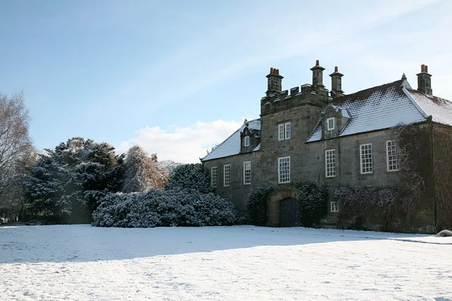
Ingleby Manor
Stately homes · 0.8 km

Ingleby Greenhow
Other places · 0.9 km
The Dudley Arms Public House
Historic pubs · 1.0 km

Ingleby railway station
Heritage railway stations · 1.3 km

Easby Castle Hill
Castles · 2.0 km

Easby Castle Motte
Literary houses · 2.0 km

Kildale Camping & Barn
Campsites · 2.3 km

Drummer Hill Farm
Historic houses · 2.4 km

Easby Hall
Historic houses · 2.6 km
Easby
Chapels · 2.6 km

Meynell Hall
Historic houses · 2.8 km
Nearby
📷 4Heritage railway stations · North East England
Battersby railway station
Battersby railway station in England North East, United Kingdom.
📷 3Stately homes · Yorkshire & the Humber
Ingleby Manor
Ingleby Manor — house in Ingleby Greenhow, North Yorkshire, England, UK.
📷 4Other places · North East England
Ingleby Greenhow
Ingleby Greenhow in England North East, United Kingdom.
📷 4Historic pubs · North East England
The Dudley Arms Public House
The Dudley Arms Public House in England North East, United Kingdom.
📷 4Heritage railway stations · North East England
Ingleby railway station
Ingleby railway station in England North East, United Kingdom.
📷 5Where to eat & stay near Battersby
Places to stay
📷 5Campsites · Yorkshire & the Humber
Kildale Camping & Barn
Kildale Camping & Barn — a campsite in england yorkshire.
 📷 5
📷 5Caravan parks · Yorkshire & the Humber
Angrove Country Park
Angrove Country Park — a caravan park in england yorkshire.
 📷 5
📷 5Campsites · Yorkshire & the Humber
Southview Farm Campsite
Southview Farm Campsite — a campsite in england yorkshire.
 📷 5
📷 5Campsites · Yorkshire & the Humber
Lordstones Country Park
Lordstones Country Park — a campsite in england yorkshire.
 📷 5
📷 5Campsites · Yorkshire & the Humber
Raven Gill Campsite
Raven Gill Campsite — a campsite in england yorkshire.
 📷 5
📷 5Campsites · Yorkshire & the Humber
Holiday Lodge Park
Holiday Lodge Park — a campsite in england yorkshire.
Places to eat & drink
📷 4Historic pubs · North East England
The Dudley Arms Public House
The Dudley Arms Public House in England North East, United Kingdom.
 📷 5
📷 5Historic pubs · North East England
The Royal Oak Hotel
The Royal Oak Hotel in England North East, United Kingdom.
 📷 7
📷 7Historic pubs · North East England
The Queen's Head Public House
The Queen's Head Public House in England North East, United Kingdom.
 📷 5
📷 5 📷 4
📷 4Historic pubs · North East England
The Bay Horse Inn
The Bay Horse Inn in England North East, United Kingdom.
 📷 7
📷 7More watermills in this region
 📷 3
📷 3 📷 4
📷 4Watermills · North East England
Poltross Burn
Poltross Burn in England North East, United Kingdom.
 📷 4
📷 4Watermills · North East England
Rutter Force
Rutter Force in England North East, United Kingdom.
 📷 4
📷 4Frequently asked questions
- Where is Battersby?
- Battersby is in North-East England, United Kingdom (postcode TS9 6LP), in the parish of Ingleby Greenhow.
- What is Battersby?
- Battersby in England North East, United Kingdom.
- How do I get to Battersby?
- The nearest railway station is Battersby, about 0.9 km away. Drivers can use postcode TS9 6LP.
- Is Battersby a protected site?
- Yes — Battersby is part of the North York Moors SSSI Site of Special Scientific Interest.
- Is Battersby free to visit?
- Yes, Battersby is free to enter.
- How do I get to Battersby?
- The nearest railway station is Battersby, about 0.9 km away. Drivers can navigate to postcode TS9 6LP.