
Historic pubs · North East England
The Queen's Head Public House
In or near Seamer.
The Queen's Head Public House in England North East, United Kingdom.

Paul Buckingham — CC BY-SA 2.0 via Wikimedia Commons licence

Plan your visit
- Typical visit
- 1 h–2 h
- Nearest railway station
- Great Ayton · 5.5 km
- Free entry
- Dog-friendly
Getting there & planning your visit
The Queen's Head Public House is located in North Yorkshire, postcode TS9 5BF. The nearest railway station is Great Ayton, which is 5.5 km away. Entry is free.
About
The Queen's Head Public House is a place of interest in England North East, United Kingdom — drawn from open-data sources for visitor reference. See the linked Wikipedia article for the full description.
Photo gallery
See it from the streetimagery from 2018
Imagery © Mapillary contributors, CC BY-SA 4.0
Protected designations
- Site of Special Scientific Interest: North York Moors SSSI
Designations sourced from Natural England open data under OGL v3.
From the Wikipedia article
The Queen's Head is a historic pub in Stokesley, a town in North Yorkshire, in England. The building was constructed in the early or mid 18th century. A coach house was later added. The building was grade II listed in 1966. It was refurbished in 2023, the work including internal and external redecoration, alterations to the bar, and replacement of some flooring. The public house is built of painted brick, and has a parapet, and a tile roof with a stone coping. There are three storeys and five bays. On the front is a doorway, and on the right two bays is an oriel shop window. The other windows are sashes in architraves. The windows and doorway have flat gauged brick arches and keystones. There is a small modern dormer, and on the left return is a small coach house extension.
Excerpt from Wikipedia under CC BY-SA 4.0. See the source article linked in Sources below.
- Coordinates
- 54.4695, -1.1927
- District
- North Yorkshire
- Parish
- Stokesley
- Postcode
- TS9 5BF
- Parliamentary constituency
- Richmond and Northallerton
- Nearest railway station
- Great Ayton — 5.5 km
Sources
- wikidata: Q26601814 (CC0)
- wikipedia: The Queen's Head, Stokesley (CC BY-SA 4.0)
Other places nearby

Levenside packhorse bridge
Historic bridges · 0.0 km

42 High Street
Historic houses · 0.1 km

Castle Hill
Literary houses · 0.2 km
Stokesley Castle Hill
Castles · 0.2 km
Manor House and Wall Adjoining
Stately homes · 0.2 km

Stokesley Rural District
Other places · 0.2 km

Stokesley
Memorials & monuments · 0.2 km

Handyside Cottage Handyside House
Historic houses · 0.3 km

Stokesley School
Other places · 0.7 km

St Joseph
Historic churches · 0.7 km

Stokesley Sports Club F.C.
Stadiums · 0.9 km
Aerial Ashes
Natural landmarks · 1.2 km
Nearby
📷 4Historic bridges · North East England
Levenside packhorse bridge
Levenside packhorse bridge in England North East, United Kingdom.
📷 3Historic houses · Yorkshire & the Humber
42 High Street
42 High Street — Grade II* listed building in Stokesley, North Yorkshire, England, UK.
📷 5Literary houses · Yorkshire & the Humber
Castle Hill
Castle Hill — a literary house museum in england yorkshire.
📷 5Castles · Yorkshire & the Humber
Stokesley Castle Hill
Stokesley Castle Hill — a castle in england yorkshire.
📷 5Stately homes · Yorkshire & the Humber
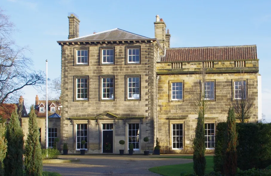
Manor House and Wall Adjoining
Manor House and Wall Adjoining — house in Stokesley, North Yorkshire, England, UK.
📷 3Other places · North East England
Stokesley Rural District
Stokesley Rural District in England North East, United Kingdom.
Where to eat & stay near The Queen's Head Public House
Places to stay
 📷 5
📷 5Caravan parks · Yorkshire & the Humber
Angrove Country Park
Angrove Country Park — a caravan park in england yorkshire.
 📷 5
📷 5Campsites · Yorkshire & the Humber
Southview Farm Campsite
Southview Farm Campsite — a campsite in england yorkshire.
 📷 5
📷 5Campsites · Yorkshire & the Humber
Holiday Lodge Park
Holiday Lodge Park — a campsite in england yorkshire.
 📷 5
📷 5Campsites · Yorkshire & the Humber
Lordstones Country Park
Lordstones Country Park — a campsite in england yorkshire.
 📷 2
📷 2Caravan parks · Yorkshire & the Humber
Goulton Beck Lodges
Goulton Beck Lodges — a caravan park in england yorkshire.
 📷 5
📷 5Campsites · Yorkshire & the Humber
Kildale Camping & Barn
Kildale Camping & Barn — a campsite in england yorkshire.
Places to eat & drink
 📷 5
📷 5Historic pubs · North East England
The Royal Oak Hotel
The Royal Oak Hotel in England North East, United Kingdom.
 📷 4
📷 4Historic pubs · North East England
The Bay Horse Inn
The Bay Horse Inn in England North East, United Kingdom.
 📷 4
📷 4Historic pubs · North East England
The Dudley Arms Public House
The Dudley Arms Public House in England North East, United Kingdom.
 📷 5
📷 5 📷 5
📷 5Historic pubs · North East England
The Stainton Public House
The Stainton Public House in England North East, United Kingdom.
 📷 5
📷 5Historic pubs · North East England
The Crathorne Arms Public House And Outbuilding Adjoining To South
The Crathorne Arms Public House And Outbuilding Adjoining To South in England North East, United Kingdom.
More historic pubs in this region
 📷 3
📷 3Historic pubs · North East England
The Crown Posada
Newcastle's Quayside Victorian pub, with William Morris stained glass.
 📷 5
📷 5 📷 5
📷 5 📷 4
📷 4Frequently asked questions
- Where is The Queen's Head Public House?
- The Queen's Head Public House is in North-East England, United Kingdom (postcode TS9 5BF), in the parish of Stokesley.
- What is The Queen's Head Public House?
- The Queen's Head Public House in England North East, United Kingdom.
- How do I get to The Queen's Head Public House?
- The nearest railway station is Great Ayton, about 5.5 km away. Drivers can use postcode TS9 5BF.
- Is The Queen's Head Public House a protected site?
- Yes — The Queen's Head Public House is part of the North York Moors SSSI Site of Special Scientific Interest.
- Is The Queen's Head Public House free to visit?
- Yes, The Queen's Head Public House is free to enter.
- How do I get to The Queen's Head Public House?
- The nearest railway station is Great Ayton, about 5.5 km away. Drivers can navigate to postcode TS9 5BF.