
Historic pubs · North East England
The Dudley Arms Public House
In or near Great Broughton.
The Dudley Arms Public House in England North East, United Kingdom.

Gordon Hatton — CC BY-SA 2.0 via Wikimedia Commons licence

Plan your visit
- Typical visit
- 1 h–2 h
- Nearest railway station
- Battersby · 1.2 km
- Free entry
- Dog-friendly
Getting there & planning your visit
The Dudley Arms Public House is located in North Yorkshire, postcode TS9 6LX. The nearest railway station is Battersby, which is 1.2 km away. Entry is free.
About
The Dudley Arms Public House is a place of interest in England North East, United Kingdom — drawn from open-data sources for visitor reference. See the linked Wikipedia article for the full description.
Photo gallery
Protected designations
- Site of Special Scientific Interest: North York Moors SSSI
Designations sourced from Natural England open data under OGL v3.
From the Wikipedia article
The Dudley Arms is a historic pub in Ingleby Greenhow, a village in North Yorkshire, England. The pub was built in the second half of the 18th century, and was extended in the early or mid 19th century. Additions were made to the rear in the 20th century. In the 1960s, its dining room was decorated in a style inspired by the Mediaeval period, with vaulted ceilings and tapestries. The pub is known for its "Flowering Onion" dish, an onion sliced and opened out to resemble a flower, then battered and deep fried. The building was grade II listed in 1966. It is built of stone, with an eaves band, and a tile roof with a stone ridge and coping. It has two storeys, three bays and a two-bay extension on the right. On the front are two doorways, the right with a fanlight. The windows are a mix of sashes, most horizontally-sliding, and 20th-century small-paned windows. The openings in the left three bays have long lintels and tall raised keystones. On the right return are external steps.
Excerpt from Wikipedia under CC BY-SA 4.0. See the source article linked in Sources below.
- Coordinates
- 54.4496, -1.1054
- District
- North Yorkshire
- Parish
- Ingleby Greenhow
- Postcode
- TS9 6LX
- Parliamentary constituency
- Richmond and Northallerton
- Nearest railway station
- Battersby — 1.2 km
Sources
- wikidata: Q26601309 (CC0)
- wikipedia: The Dudley Arms (CC BY-SA 4.0)
Other places nearby
Ingleby Greenhow
Other places · 0.1 km

Ingleby railway station
Heritage railway stations · 0.6 km
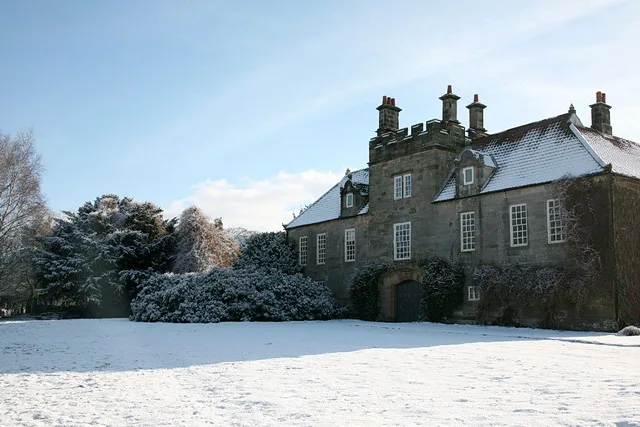
Ingleby Manor
Stately homes · 0.8 km

Battersby
Watermills · 1.0 km

Battersby railway station
Heritage railway stations · 1.1 km

Drummer Hill Farm
Historic houses · 1.6 km

Meynell Hall
Historic houses · 1.8 km

Easby Castle Hill
Castles · 2.2 km

Easby Castle Motte
Literary houses · 2.3 km

Lawns Hill
Mountains & hills · 2.3 km

Easby
Chapels · 2.3 km
Easby Hall
Historic houses · 2.4 km
Nearby
📷 4Other places · North East England
Ingleby Greenhow
Ingleby Greenhow in England North East, United Kingdom.
📷 4Heritage railway stations · North East England
Ingleby railway station
Ingleby railway station in England North East, United Kingdom.
📷 3Stately homes · Yorkshire & the Humber
Ingleby Manor
Ingleby Manor — house in Ingleby Greenhow, North Yorkshire, England, UK.
📷 4📷 4Heritage railway stations · North East England
Battersby railway station
Battersby railway station in England North East, United Kingdom.
📷 3Historic houses · North East England
Drummer Hill Farm
Drummer Hill Farm in England North East, United Kingdom.
Where to eat & stay near The Dudley Arms Public House
Places to stay
 📷 5
📷 5Campsites · Yorkshire & the Humber
Kildale Camping & Barn
Kildale Camping & Barn — a campsite in england yorkshire.
 📷 5
📷 5Caravan parks · Yorkshire & the Humber
Angrove Country Park
Angrove Country Park — a caravan park in england yorkshire.
 📷 5
📷 5Campsites · Yorkshire & the Humber
Southview Farm Campsite
Southview Farm Campsite — a campsite in england yorkshire.
 📷 5
📷 5Campsites · Yorkshire & the Humber
Lordstones Country Park
Lordstones Country Park — a campsite in england yorkshire.
 📷 5
📷 5Campsites · Yorkshire & the Humber
Holiday Lodge Park
Holiday Lodge Park — a campsite in england yorkshire.
 📷 5
📷 5Campsites · Yorkshire & the Humber
Raven Gill Campsite
Raven Gill Campsite — a campsite in england yorkshire.
Places to eat & drink
 📷 5
📷 5Historic pubs · North East England
The Royal Oak Hotel
The Royal Oak Hotel in England North East, United Kingdom.
 📷 7
📷 7Historic pubs · North East England
The Queen's Head Public House
The Queen's Head Public House in England North East, United Kingdom.
 📷 5
📷 5 📷 4
📷 4Historic pubs · North East England
The Bay Horse Inn
The Bay Horse Inn in England North East, United Kingdom.
 📷 5
📷 5Historic pubs · North East England
The Stainton Public House
The Stainton Public House in England North East, United Kingdom.
 📷 7
📷 7More historic pubs in this region
 📷 3
📷 3Historic pubs · North East England
The Crown Posada
Newcastle's Quayside Victorian pub, with William Morris stained glass.
 📷 5
📷 5 📷 5
📷 5 📷 4
📷 4Frequently asked questions
- Where is The Dudley Arms Public House?
- The Dudley Arms Public House is in North-East England, United Kingdom (postcode TS9 6LX), in the parish of Ingleby Greenhow.
- What is The Dudley Arms Public House?
- The Dudley Arms Public House in England North East, United Kingdom.
- How do I get to The Dudley Arms Public House?
- The nearest railway station is Battersby, about 1.2 km away. Drivers can use postcode TS9 6LX.
- Is The Dudley Arms Public House a protected site?
- Yes — The Dudley Arms Public House is part of the North York Moors SSSI Site of Special Scientific Interest.
- Is The Dudley Arms Public House free to visit?
- Yes, The Dudley Arms Public House is free to enter.
- How do I get to The Dudley Arms Public House?
- The nearest railway station is Battersby, about 1.2 km away. Drivers can navigate to postcode TS9 6LX.