
Archaeological sites · North East England
Two round cairns on Newton Moor, 850m north east of Summer Hill Farm
In or near Great Ayton.
Two round cairns on Newton Moor, 850m north east of Summer Hill Farm — archaeological site in Guisborough, Redcar and Cleveland, England, UK.

Wikimedia Commons contributors — see linked file page for photographer and licence licence

Plan your visit
- Typical visit
- 45 min–1.5 h
- Nearest railway station
- Great Ayton · 2.8 km
- Free entry
- Dog-friendly
About
Two round cairns on Newton Moor, 850m north east of Summer Hill Farm is an archaeological site in the United Kingdom. Heritage designation: scheduled monument. Wikidata describes it as: "archaeological site in Guisborough, Redcar and Cleveland, England, UK". Coordinates: 54.5044°, -1.0807°.
Photo gallery
Protected designations
- Site of Special Scientific Interest: North York Moors SSSI
Designations sourced from Natural England open data under OGL v3.
Place summary
Two round cairns on Newton Moor, located 850m north-east of Summer Hill Farm in North-East England, are designated as a scheduled monument. These archaeological features are part of the North York Moors SSSI, highlighting their significance in the region's historical landscape.
AI-generated from the structured facts on this page (operator, designation, listing, era). Not a substitute for visiting.
- Coordinates
- 54.5044, -1.0807
- District
- North Yorkshire
- Parish
- Great Ayton
- Postcode
- TS9 6HW
- Parliamentary constituency
- Richmond and Northallerton
- Nearest railway station
- Great Ayton — 2.8 km
Sources
- wikidata: Q17678049 (CC0)
- commons: Two boundary stones and a Bronze Age round cairn - geograph.org.uk - 6272188.jpg (CC BY-SA 4.0)
Other places nearby

Great Ayton Moor
Mountains & hills · 0.2 km

Tumulus;Chambered Cairn
Burial mounds & barrows · 1.0 km

Great Ayton Iron Age Enclosure
Archaeological sites · 1.2 km

Percy Cross
Memorials & monuments · 1.2 km

Percy Rigg Cross
Historic houses · 1.2 km

Forest Enterprise Cycle Trail
Mountain bike trails · 1.3 km

Roseberry Mine
Mines & mining heritage · 1.3 km

Hutton Village
Natural landmarks · 1.4 km

Gribdale Gate
Natural landmarks · 1.6 km

Site of Leper's Hospital
Archaeological sites · 1.6 km
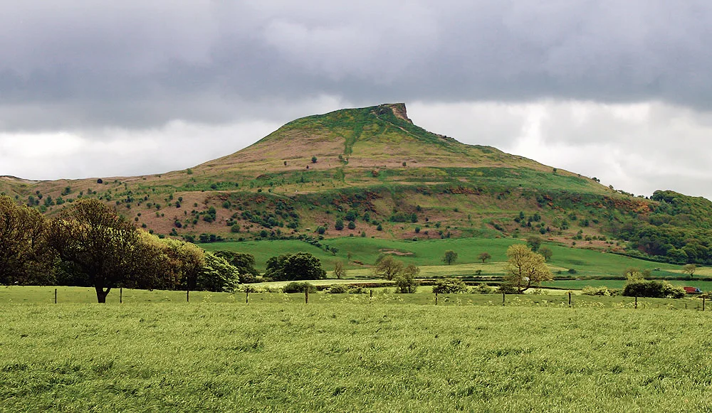
Roseberry Topping
Mountains & hills · 1.7 km
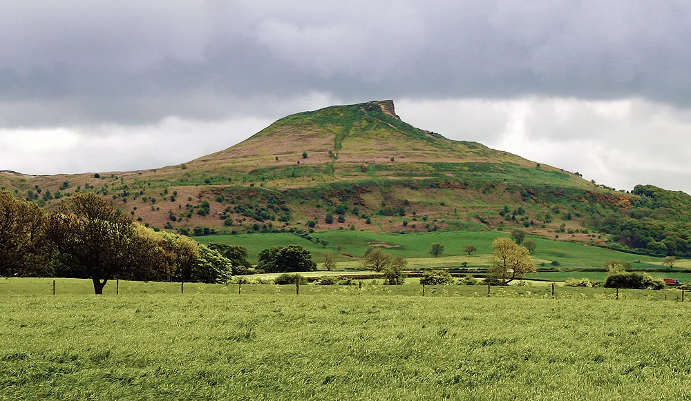
Roseberry Topping
Mountains & hills · 1.7 km
Nearby
📷 5Mountains & hills · North East England
Great Ayton Moor
Great Ayton Moor — a hill or mountain in england north east.
📷 3Burial mounds & barrows · Yorkshire & the Humber
Tumulus;Chambered Cairn
Tumulus;Chambered Cairn — a burial mound in england-yorkshire, United Kingdom.
📷 3Archaeological sites · Yorkshire & the Humber
Great Ayton Iron Age Enclosure
Great Ayton Iron Age Enclosure — a archaeological in england-yorkshire, United Kingdom.
📷 4Memorials & monuments · Yorkshire & the Humber
Percy Cross
Percy Cross is a memorial in the United Kingdom.
📷 3Historic houses · Yorkshire & the Humber
Percy Rigg Cross
Percy Rigg Cross — a Grade II-listed historic house in england-yorkshire, United Kingdom.
📷 5Mountain bike trails · North East England
Forest Enterprise Cycle Trail
Forest Enterprise Cycle Trail — a mtb trail in england north east.
Where to eat & stay near Two round cairns on Newton Moor, 850m north east of Summer Hill Farm
Places to stay
 📷 5
📷 5Campsites · Yorkshire & the Humber
Kildale Camping & Barn
Kildale Camping & Barn — a campsite in england yorkshire.
 📷 5
📷 5 📷 5
📷 5Caravan parks · Yorkshire & the Humber
Angrove Country Park
Angrove Country Park — a caravan park in england yorkshire.
 📷 5
📷 5 📷 5
📷 5 📷 5
📷 5Campsites · Yorkshire & the Humber
Raven Gill Campsite
Raven Gill Campsite — a campsite in england yorkshire.
Places to eat & drink
 📷 5
📷 5Historic pubs · North East England
The Royal Oak Hotel
The Royal Oak Hotel in England North East, United Kingdom.
 📷 4
📷 4Historic pubs · North East England
The Dudley Arms Public House
The Dudley Arms Public House in England North East, United Kingdom.
 📷 4
📷 4 📷 7
📷 7Historic pubs · North East England
The Queen's Head Public House
The Queen's Head Public House in England North East, United Kingdom.
 📷 5
📷 5Historic pubs · North East England
The Stainton Public House
The Stainton Public House in England North East, United Kingdom.
 📷 6
📷 6Historic pubs · North East England
The Zetland
The Zetland in England North East, United Kingdom.
More archaeological sites in this region
 📷 5
📷 5Archaeological sites · North East England
Medieval Manorial Site of Low Dinsdale
Medieval Manorial Site of Low Dinsdale — archaeological in england yorkshire.
 📷 3
📷 3Archaeological sites · North East England
Old Smelting Mill
Old Smelting Mill — a archaeological in england-north-west, United Kingdom.
 📷 5
📷 5Archaeological sites · North East England
Roper Castle or Round Table (Roman Signal Station)
Roper Castle or Round Table (Roman Signal Station) — archaeological in england north west.
 📷 5
📷 5Archaeological sites · North East England
Nine Standards Rigg
Nine Standards Rigg — archaeological in england north west. Elevation: 662 m.
Frequently asked questions
- Where is Two round cairns on Newton Moor, 850m north east of Summer Hill Farm?
- Two round cairns on Newton Moor, 850m north east of Summer Hill Farm is in North-East England, United Kingdom (postcode TS9 6HW), in the parish of Great Ayton.
- What is Two round cairns on Newton Moor, 850m north east of Summer Hill Farm?
- Two round cairns on Newton Moor, 850m north east of Summer Hill Farm — archaeological site in Guisborough, Redcar and Cleveland, England, UK.
- How do I get to Two round cairns on Newton Moor, 850m north east of Summer Hill Farm?
- The nearest railway station is Great Ayton, about 2.8 km away. The nearest town is Great Ayton. Drivers can use postcode TS9 6HW.
- Is Two round cairns on Newton Moor, 850m north east of Summer Hill Farm a listed building?
- Two round cairns on Newton Moor, 850m north east of Summer Hill Farm is officially recognised as scheduled monument listed.
- Is Two round cairns on Newton Moor, 850m north east of Summer Hill Farm a protected site?
- Yes — Two round cairns on Newton Moor, 850m north east of Summer Hill Farm is part of the North York Moors SSSI Site of Special Scientific Interest.
- Is Two round cairns on Newton Moor, 850m north east of Summer Hill Farm free to visit?
- Yes, Two round cairns on Newton Moor, 850m north east of Summer Hill Farm is free to enter.
- How do I get to Two round cairns on Newton Moor, 850m north east of Summer Hill Farm?
- The nearest railway station is Great Ayton, about 2.8 km away. Drivers can navigate to postcode TS9 6HW.