
Historic houses · North West England
Queen's Aid House
In or near Aston juxta Mondrum.
Queen's Aid House — Grade II listed house in Nantwich, Cheshire, England, UK.

Wikimedia Commons contributors — see linked file page for photographer and licence licence

Plan your visit
- Typical visit
- 1 h–2 h
- Nearest railway station
- Nantwich · 0.4 km
- Family-friendly
- Wheelchair accessible
Getting there & planning your visit
To visit Queen's Aid House in Cheshire East, the nearest railway station is Nantwich, located 0.4 km away. Entry is free, and the site is wheelchair accessible. The postcode for sat-nav is CW5 5DB.
About
Queen's Aid House is a historic house in the United Kingdom — typically a country seat, manor, or town house with notable architecture or history. Records date its origin to 1584. Heritage designation: Grade II listed building. Wikidata describes it as: "Grade II listed house in Nantwich, Cheshire, England, UK". Coordinates: 53.0668°, -2.5219°.
Photo gallery
From the Wikipedia article
The Queen's Aid House, or 41 High Street, is a timber-framed, black-and-white Elizabethan merchant's house in Nantwich, Cheshire, England. It is on the High Street immediately off the town square and opposite the junction with Castle Street (at SJ6512752298). It is listed at grade II. Built shortly after the fire of 1583 by Thomas Cleese, a local craftsman, it has three storeys with attics, and features ornamental panelling, overhangs or jetties at each storey, and a 19th-century oriel window. The building is best known for its contemporary inscription commemorating Elizabeth I's aid in rebuilding the town, which gives the building its name. It has been used as a café, as well as various types of shop. The High Street was the home of the wealthiest townspeople in the 1580s, and the houses dating from the rebuilding form the finest examples of post-fire architecture in the town. The modern High Street still contains many other good examples of Elizabethan timber-framed buildings, all of which date from after the fire; these include the grade-II*-listed number 46, which stands opposite the Queen's Aid House, and the grade-I-listed Crown Inn.
Excerpt from Wikipedia under CC BY-SA 4.0. See the source article linked in Sources below.
Background
History
In December 1583, a fire destroyed most of Nantwich to the east of the River Weaver. According to the contemporary account of Richard Wilbraham, 150 houses burned down, and the devastation was such that a national relief fund was organised to help pay for the town's rebuilding. The appeal was successful: "every person damaged in the loss of their houses have been holpen and relieved in some portion". Elizabeth I personally contributed – the only time that she is known to have done so – giving £1000 (around £200,000 today). The Queen's Aid House was built as a merchant's house shortly after the fire by local craftsman Thomas Cleese. Cleese (also known as Clease or Clowes) appears to have…
Description
The Queen's Aid House is a tall black-and-white building of three storeys plus attics under a tiled roof, with a timber frame infilled with plaster. In common with most merchant's houses of this date in Nantwich, its single gable faces the street, with all the accommodation fitting into a single bay's width. The gable is topped with a finial. There is ornamental panelling to all storeys except the ground floor, which has a modern shop front. Motifs include ogee lozenges, similar to the decoration of Churche's Mansion, as well as quatrefoils and herringbone patterns. The first storey is flanked by a pair of fluted pilasters, which are in early Renaissance style. None of the windows is…
Sourced from Wikipedia under CC BY-SA 4.0.
- Coordinates
- 53.0668, -2.5219
- District
- Cheshire East
- Parish
- Nantwich
- Postcode
- CW5 5DB
- Parliamentary constituency
- Crewe and Nantwich
- Established
- 1584
- Nearest railway station
- Nantwich — 0.4 km
Sources
- wikidata: Q7269917 (CC0)
- wikipedia: Queen's Aid House (CC BY-SA 4.0)
- commons: 41 High St, Nantwich.jpg (CC BY-SA 4.0)
Other places nearby

Nantwich
Castles · 0.0 km

Nantwich War Memorial
Memorials & monuments · 0.0 km

1–5 Pillory Street, Nantwich
Gardens · 0.0 km

Lamb Hotel
Historic pubs · 0.1 km

Cosy Super Cinema
Theatres · 0.1 km
1–3 Churchyard Side, Nantwich
Historic churches · 0.1 km

46 High Street, Nantwich
Historic houses · 0.1 km
11 Churchyard Side, Nantwich
Historic churches · 0.1 km

Nantwich Castle
Castles · 0.1 km

Crown Hotel, Bar & Grill
Hotels · 0.1 km
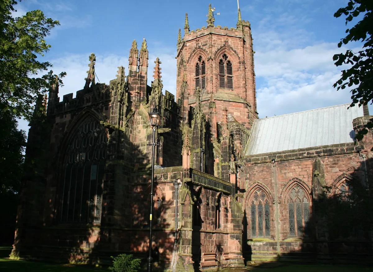
St Mary's Church, Nantwich
Historic churches · 0.1 km

20 High Street, Nantwich
Historic houses · 0.1 km
Nearby
📷 5Castles · North West England
Nantwich
Nantwich — a castle in england-west-midlands, United Kingdom.
📷 3Memorials & monuments · North West England
Nantwich War Memorial
Nantwich War Memorial — Grade II listed building-listed memorial in england-west-midlands, United Kingdom.
📷 4Gardens · North West England
1–5 Pillory Street, Nantwich
1–5 Pillory Street, Nantwich — a garden in england-west-midlands, United Kingdom.
📷 5📷 5Theatres · North West England
Cosy Super Cinema
Cosy Super Cinema — a cinema heritage in england-west-midlands, United Kingdom.
📷 4Historic churches · North West England
1–3 Churchyard Side, Nantwich
1–3 Churchyard Side, Nantwich — a Grade II-listed church in england-west-midlands, United Kingdom.
Where to eat & stay near Queen's Aid House
Places to stay
📷 5Hotels · North West England
Crown Hotel, Bar & Grill
Crown Hotel, Bar & Grill — a hotel in england west midlands.
 📷 5
📷 5 📷 5
📷 5Hotels · North West England
The Waverley Hotel
The Waverley Hotel — a hotel in england west midlands.
 📷 5
📷 5 📷 5
📷 5 📷 5
📷 5Campsites · North West England
Marbury Camp and Lodge
Marbury Camp and Lodge — a campsite in wales north.
Places to eat & drink
📷 5 📷 5
📷 5Restaurants · North West England
The Cheshire Cat
The Cheshire Cat — a restaurant in england west midlands.
 📷 5
📷 5 📷 5
📷 5Historic pubs · North West England
The Commercial Hotel
The Commercial Hotel in England North West, United Kingdom.
 📷 5
📷 5Historic pubs · North West England
Old Hall Hotel, Sandbach
Old Hall Hotel, Sandbach in England North West, United Kingdom.
 📷 7
📷 7Historic pubs · North West England
The Black Bear Public House
The Black Bear Public House in Wales North, United Kingdom.
Other historic houses from this era
.jpg?width=1200) 📷 5
📷 5Historic houses · London
Aubrey House
Aubrey House — large 18th-century house in Holland Park in west London.
.jpg?width=1200) 📷 5
📷 5Historic houses · London
Cloth Hill
Cloth Hill — 17th-century house in Hampstead, London NW3.
 📷 5
📷 5Historic houses · London
Cromwell House
Cromwell House — Grade I listed building in the London Borough of Haringey, England,UK.
 📷 5
📷 5More historic houses in this region
 📷 3
📷 3Historic houses · North West England
116 Hospital Street, Nantwich
116 Hospital Street, Nantwich — substantial townhouse in Nantwich, Cheshire, England, UK.
 📷 3
📷 3Historic houses · North West England
140–142 Hospital Street, Nantwich
140–142 Hospital Street, Nantwich — grade II listed building in Nantwich, Cheshire East, Cheshire, England, UK.
📷 3Historic houses · North West England
46 High Street, Nantwich
46 High Street, Nantwich — house in Nantwich, Cheshire, England, UK.
 📷 3
📷 3Historic houses · North West England
64, St Ann's Road
64, St Ann's Road — Grade II* listed house in Middlewich, Cheshire East, England, UK.
Frequently asked questions
- Where is Queen's Aid House?
- Queen's Aid House is in North-West England, United Kingdom (postcode CW5 5DB), in the parish of Nantwich.
- What is Queen's Aid House?
- Queen's Aid House — Grade II listed house in Nantwich, Cheshire, England, UK.
- How do I get to Queen's Aid House?
- The nearest railway station is Nantwich, about 0.4 km away. The nearest town is Aston juxta Mondrum. Drivers can use postcode CW5 5DB.
- When was Queen's Aid House built?
- Built or established in 1584.
- Is Queen's Aid House a listed building?
- Queen's Aid House is officially recognised as Grade II listed building listed.
- How do I get to Queen's Aid House?
- The nearest railway station is Nantwich, about 0.4 km away. Drivers can navigate to postcode CW5 5DB.