
National parks · Yorkshire & the Humber
North York Moors
In or near Goathland.
North York Moors is a Upland area in North Yorkshire, England.

Photo by oeuvre personnelle/own work (Wikimedia Commons, CC BY-SA 2.5) licence
Plan your visit
- Typical visit
- 4 h–8 h
- Best time of year
- Spring – autumn (Apr–Oct)
- Nearest railway station
- Goathland · 3.1 km
- Free entry
- Family-friendly
- Dog-friendly
Getting there & planning your visit
To visit North York Moors, the nearest railway station is Goathland, located 3.1 km away. The postcode for navigation is YO22 5AP, and entry to the park is free.
About
North York Moors is a national park in the United Kingdom. It covers approximately 1435 km². According to Wikipedia: "The North York Moors is an upland area and national park in North Yorkshire, England.". It is one of fifteen designated national parks across England, Scotland, and Wales, protected for its landscape and recreation value.
Photo gallery
Summary from the official site
The North York Moors National Park is a stunning area known for its natural beauty and tranquility. Visitors can enjoy a variety of outdoor activities such as walking, cycling, and exploring the diverse landscapes, including coastal areas and woodlands.
Read more on the official property page.
Protected designations
- Site of Special Scientific Interest: North York Moors SSSI
Designations sourced from Natural England open data under OGL v3.
From the Wikipedia article
The North York Moors is an upland area and national park in North Yorkshire, England. It contains one of the largest expanses of heather moorland in the United Kingdom. The area was designated a national park in 1952, through the National Parks and Access to the Countryside Act 1949. The park covers an area of 554 sq mi (1,430 km2), and had a population of 22,935 at the 2021 census. It is administered by the North York Moors National Park Authority, which is based in Helmsley.
Excerpt from Wikipedia under CC BY-SA 4.0. See the source article linked in Sources below.
Background
History
There are records of 12,000 archaeological sites and features in the North York Moors National Park of which 700 are scheduled monuments. Radio carbon dating of pollen grains preserved in the moorland peat provides a record of the actual species of plants that existed at various periods in the past. About 10,000 years ago, the cold climate of the ice age ameliorated and temperatures rose above growing point of . Plant life was gradually re-established and animals and humans also returned.
Visiting
]] Many visitors to the North York Moors are engaged in outdoor pursuits, particularly walking; the National Park has a network of public rights of way almost 2,300 km in length, and most of the areas of open moorland are open access under the Countryside and Rights of Way Act 2000. Popular named walks include the Cleveland Way, which circles the North York Moors, including a coastal section; and the Lyke Wake Walk, which leads directly across the heart of the National Park. The route of the White Rose Way, a long distance walk from Leeds to Scarborough also passes through. The area also offers opportunities for cycling, mountain biking, and horse-riding, including a circular long distance…
Sourced from Wikipedia under CC BY-SA 4.0.
- Coordinates
- 54.3833, -0.7500
- District
- North Yorkshire
- Parish
- Goathland
- Postcode
- YO22 5AP
- Parliamentary constituency
- Scarborough and Whitby
- Established
- 1952
- Nearest railway station
- Goathland — 3.1 km
- Official site
- www.northyorkmoors.org.uk
Sources
- wikidata: Q1544595 (CC0)
- wikipedia: North York Moors (CC BY-SA 4.0)
- commons: Moors near Hawnby (N Yorks Moors).JPG (CC BY-SA 2.5)
.JPG)
Featured in this guide
Other places nearby

Nelly Ayre Foss
Waterfalls · 0.3 km
Wade's Causeway
Hill forts · 1.5 km

Wheeldale Roman Road
Archaeological sites · 1.7 km

Mallyan Spout
Natural landmarks · 2.0 km

Mallyan Spout
Waterfalls · 2.0 km

Brow House Farm Caravan & Camping Site
Caravan parks · 2.1 km

Simon's Howe
Mountains & hills · 2.1 km

Goathland War Memorial
Memorials & monuments · 2.7 km

Goathland
Towns & cities · 2.7 km

Brereton Cottage Brereton House
Historic houses · 2.7 km

Abbots House Farm Campsite
Campsites · 2.8 km

Crag Stone Rigg
Mountains & hills · 2.9 km
Nearby
📷 5📷 5Hill forts · Yorkshire & the Humber
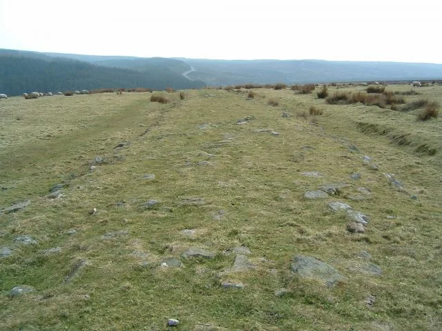
Wade's Causeway
Wade's Causeway — Sinuous, linear monument in the North York Moors national park in North Yorkshire, England.
📷 3Archaeological sites · Yorkshire & the Humber
Wheeldale Roman Road
Wheeldale Roman Road — a archaeological in england-yorkshire, United Kingdom.
📷 3Natural landmarks · Yorkshire & the Humber
Mallyan Spout
Mallyan Spout — a other in england-yorkshire, United Kingdom.
📷 5📷 5Caravan parks · Yorkshire & the Humber
Brow House Farm Caravan & Camping Site
Brow House Farm Caravan & Camping Site — a caravan park in england yorkshire.
Where to eat & stay near North York Moors
Places to stay
📷 5Caravan parks · Yorkshire & the Humber
Brow House Farm Caravan & Camping Site
Brow House Farm Caravan & Camping Site — a caravan park in england yorkshire.
📷 5Campsites · Yorkshire & the Humber
Abbots House Farm Campsite
Abbots House Farm Campsite — a campsite in england yorkshire.
 📷 5
📷 5Hotels · Yorkshire & the Humber
The Horseshoe Hotel
The Horseshoe Hotel — a hotel in england yorkshire.
 📷 5
📷 5Campsites · Yorkshire & the Humber
Priory Farm Campsite
Priory Farm Campsite — a campsite in england yorkshire.
 📷 5
📷 5Campsites · Yorkshire & the Humber
Marfit Head Farm
Marfit Head Farm — a campsite in england yorkshire.
 📷 5
📷 5Campsites · Yorkshire & the Humber
Bank Top Camping
Bank Top Camping — a campsite in england yorkshire.
Places to eat & drink
 📷 5
📷 5Historic pubs · Yorkshire & the Humber
Birch Hall Inn
Birch Hall Inn in England Yorkshire, United Kingdom.
 📷 5
📷 5Historic pubs · Yorkshire & the Humber
Station Tavern
Station Tavern in England Yorkshire, United Kingdom.
 📷 5
📷 5Historic pubs · Yorkshire & the Humber
The Wilson Arms
The Wilson Arms in England Yorkshire, United Kingdom.
 📷 6
📷 6Restaurants · North East England
Estbek House
Estbek House — a restaurant in england north east.
 📷 5
📷 5Historic pubs · Yorkshire & the Humber
The Blacksmith's Arms Restaurant
The Blacksmith's Arms Restaurant in England Yorkshire, United Kingdom.
 📷 7
📷 7Historic pubs · Yorkshire & the Humber
The Ship Inn Flats
The Ship Inn Flats in England Yorkshire, United Kingdom.
More national parks in this region
 📷 3
📷 3National parks · Yorkshire & the Humber
Danby Lodge National Park Centre
Danby Lodge National Park Centre — a other in england-yorkshire, United Kingdom.
 📷 5
📷 5National parks · Yorkshire & the Humber
Forbidden Corner
The Forbidden Corner is a folly garden located in the Tupgill Park Estate, at Coverham in Coverdale, in the Yorkshire Dales National Park, England. It is open to the public. The folly garden is design
 Flagship📷 5
National parks · Yorkshire & the Humber
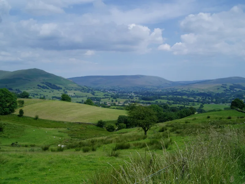
Yorkshire Dales
Yorkshire Dales is a Upland area of the Pennines in Northern England.
 📷 5
📷 5National parks · Yorkshire & the Humber
Malham Cove
Malham Cove is a large curved limestone formation 0.6 miles (1 km) north of the village of Malham, North Yorkshire, England. It was formed by a waterfall carrying meltwater from glaciers at the end of
Frequently asked questions
- Where is North York Moors?
- North York Moors is in Yorkshire, United Kingdom (postcode YO22 5AP), in the parish of Goathland.
- What is North York Moors?
- North York Moors is a Upland area in North Yorkshire, England.
- How do I get to North York Moors?
- The nearest railway station is Goathland, about 3.1 km away. Drivers can use postcode YO22 5AP.
- When was North York Moors built?
- Built or established in 1952.
- Is North York Moors a protected site?
- Yes — North York Moors is part of the North York Moors SSSI Site of Special Scientific Interest.
- Is North York Moors free to visit?
- Yes, North York Moors is free to enter.
- How do I get to North York Moors?
- The nearest railway station is Goathland, about 3.1 km away. Drivers can navigate to postcode YO22 5AP.