
Museums · Yorkshire & the Humber
North Yorkshire
Also known as: Gogledd Swydd Efrog, Yorkshire Thuaidh, Yorkshire Hwoaie
In or near Marton-le-Moor.
North Yorkshire is a ceremonial county in Northern England. It is bordered by County Durham to the north, the North Sea to the east, the East Riding of Yorkshire to the south-east, South Yorkshire to

DS Pugh — CC BY-SA 2.0 via Wikimedia Commons licence

Plan your visit
- Typical visit
- 1.5 h–3 h
- Best time of year
- Year-round
- Family-friendly
- Limited wheelchair access
About
North Yorkshire is a ceremonial county in Northern England. It is bordered by County Durham to the north, the North Sea to the east, the East Riding of Yorkshire to the south-east, South Yorkshire to the south, West Yorkshire to the south-west, and Cumbria and Lancashire to the west. The county is the largest in England by land area, at 8,654 km2 (3,341 sq mi), and had an estimated population of 1,201,415 in 2024. Middlesbrough and Redcar are located in the north-east of the county and form part of the Teesside conurbation, which extends into County Durham. The city of York is located in the south. The remainder of the county is rural, and its settlements include Harrogate in the south-west, the city of Ripon near the centre, and Scarborough on the coast in the east. For local government purposes the county comprises the unitary authority areas of North Yorkshire, Middlesbrough, Redcar and Cleveland, York, and part of Stockton-on-Tees. The local authorities of York and North Yorkshire form a combined authority of the same name, and the local authorities of the other three areas are part of the Tees Valley Combined Authority. The county was historically part of Yorkshire. The centre of the county contains a wide plain, called the Vale of Mowbray in the north and Vale of York in the south. The North York Moors uplands lie to the east, and south of them the Vale of Pickering is separated from the main plain by the Howardian Hills. Further east, the county has a coastline on the
Photo gallery
Official information
Johanna Ropner has been appointed as the Lord-Lieutenant of North Yorkshire, representing the Queen in the county. Her role involves promoting civic and social activities and upholding the dignity of the Crown.
From the Wikipedia article
North Yorkshire is a ceremonial county in Northern England. It is bordered by County Durham to the north, the North Sea to the east, the East Riding of Yorkshire to the south-east, South Yorkshire to the south, West Yorkshire to the south-west, and Cumbria and Lancashire to the west. The county is the largest in England by land area, at 8,654 km2 (3,341 sq mi), and had an estimated population of 1,201,415 in 2024. Middlesbrough and Redcar are located in the north-east of the county and form part of the Teesside conurbation, which extends into County Durham. The city of York is located in the south. The remainder of the county is rural, and its settlements include Harrogate in the south-west, the city of Ripon near the centre, and Scarborough on the coast in the east. For local government purposes the county comprises the unitary authority areas of North Yorkshire, Middlesbrough, Redcar and Cleveland, York, and part of Stockton-on-Tees. The local authorities of York and North Yorkshire form a combined authority of the same name, and the local authorities of the other three areas are part of the Tees Valley Combined Authority. The county was historically part of Yorkshire. The centre of the county contains a wide plain, called the Vale of Mowbray in the north and Vale of York in the south. The North York Moors uplands lie to the east, and south of them the Vale of Pickering is separated from the main plain by the Howardian Hills. Further east, the county has a coastline on the North Sea. The west of the county contains the Yorkshire Dales, an extensive upland area which contains the source of the River Ouse/Ure and many of its tributaries, which together drain most of the county before reaching the Humber estuary in the south. The Dales also contain the county's highest point, Whernside, at 2,415 feet (736 m).
Excerpt from Wikipedia under CC BY-SA 4.0. See the source article linked in Sources below.
Background
History
The Local Government Act 1888 reformed English local government by creating administrative counties, county boroughs, and elected county councils and county borough councils to govern them. County boroughs largely consisted of those settlements with a population over 50,000, and administrative counties covered smaller towns and rural areas. The three ridings of Yorkshire were reconstituted as the administrative counties of County of York, East Riding, County of York, North Riding, and County of York, West Riding. Within what would later become North Yorkshire, Middlesbrough and York were made county boroughs. In 1967, the county borough of Middlesbrough was abolished and replaced with the…
Sourced from Wikipedia under CC BY-SA 4.0.
- Coordinates
- 54.1000, -1.3500
- District
- North Yorkshire
- Parish
- Ellenthorpe
- Postcode
- YO51 9HJ
- Parliamentary constituency
- Wetherby and Easingwold
- Official site
- www.gazetteherald.co.uk
Sources
- wikipedia: North Yorkshire (CC BY-SA 4.0)
Other places nearby

Battle of Myton
Forts · 0.7 km

Myton Hall
Historic houses · 1.5 km

Aldborough Hall
Historic houses · 2.0 km

Aldborough, North Yorkshire
Museums · 2.2 km

Battle Cross
Memorials & monuments · 2.2 km

Isurium Brigantum
Archaeological sites · 2.3 km
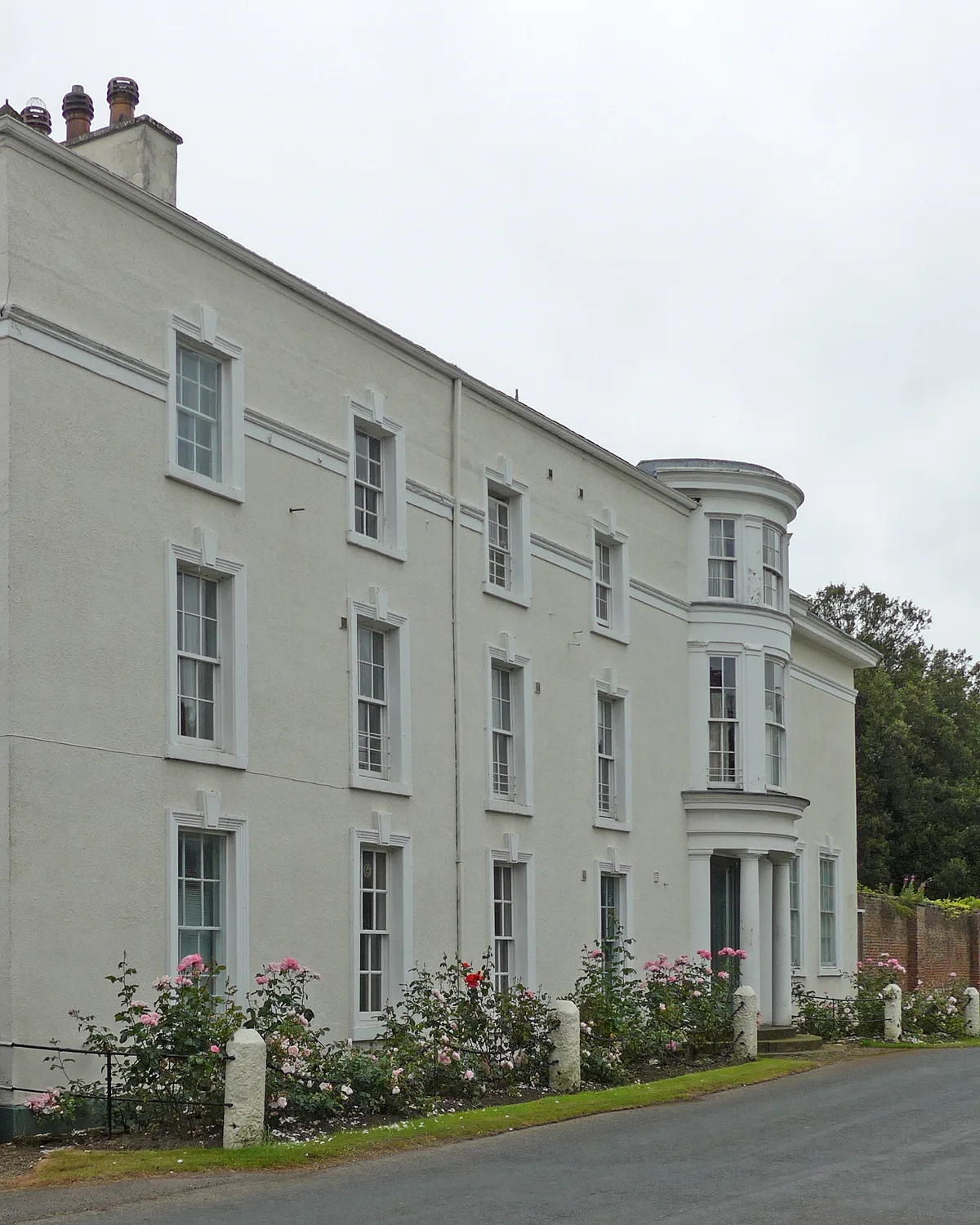
Aldborough Manor
Stately homes · 2.3 km

Studforth Hill
Archaeological sites · 2.3 km

Aldborough Castle
Literary houses · 2.4 km
Aldborough Roman Site Museum
Museums · 2.4 km
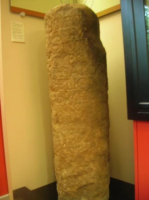
Aldborough Roman Town
Museums · 2.4 km
Aldborough
Castles · 2.4 km
Nearby
📷 3📷 5Historic houses · Yorkshire & the Humber
Myton Hall
Myton Hall — house in Myton-on-Swale, North Yorkshire, England, UK.
📷 3Historic houses · Yorkshire & the Humber
Aldborough Hall
Aldborough Hall — house in Boroughbridge, Harrogate, England, UK.
📷 5Museums · Yorkshire & the Humber
Aldborough, North Yorkshire
Aldborough is a village in the civil parish of Boroughbridge, 7 miles (11 km) to the north-east of Knaresborough, in North Yorkshire, England. Historically a part of the West Riding of Yorkshire, Aldb
📷 3Memorials & monuments · Yorkshire & the Humber
Battle Cross
Battle Cross is a memorial in the United Kingdom.
📷 5Archaeological sites · Yorkshire & the Humber
Isurium Brigantum
Isurium or Isurium of the Brigantes (Latin: Isurium Brigantum) was a Roman fort and town in the province of Britannia at the site of present-day Aldborough in North Yorkshire, England, in the United K
Where to eat & stay near North Yorkshire
Places to stay
 📷 5
📷 5 📷 5
📷 5Caravan parks · Yorkshire & the Humber
Oak Tree Caravan Park
Oak Tree Caravan Park — a caravan park in england yorkshire.
 📷 5
📷 5Caravan parks · Yorkshire & the Humber
Ponderosa Paddocks
Ponderosa Paddocks — a caravan park in england yorkshire.
 📷 5
📷 5Caravan parks · Yorkshire & the Humber
Old Hall Holiday Park
Old Hall Holiday Park — a caravan park in england yorkshire.
 📷 5
📷 5Caravan parks · Yorkshire & the Humber
Bluebell Caravan Park
Bluebell Caravan Park — a caravan park in england yorkshire.
 📷 5
📷 5Caravan parks · Yorkshire & the Humber
Ashdown Park
Ashdown Park — a caravan park in england yorkshire.
Places to eat & drink
 📷 5
📷 5Historic pubs · Yorkshire & the Humber
Golden Lion Public House Old Fountain Stores
Golden Lion Public House Old Fountain Stores in England Yorkshire, United Kingdom.
 📷 5
📷 5Historic pubs · Yorkshire & the Humber
Yorkshire Rose Public House
Yorkshire Rose Public House in England Yorkshire, United Kingdom.
 📷 5
📷 5Historic pubs · Yorkshire & the Humber
Riverside Court
Riverside Court in England Yorkshire, United Kingdom.
 📷 5
📷 5Historic pubs · Yorkshire & the Humber
The Oak Tree Public House
The Oak Tree Public House in England Yorkshire, United Kingdom.
 📷 5
📷 5Historic pubs · Yorkshire & the Humber
The Commercial Public House
The Commercial Public House in England Yorkshire, United Kingdom.
 📷 5
📷 5Historic pubs · Yorkshire & the Humber
The Dawnay Arms
The Dawnay Arms in England Yorkshire, United Kingdom.
More museums in this region
 📷 3
📷 3Museums · Yorkshire & the Humber
Avro Heritage Museum
Avro Heritage Museum — aviation museum in England.
 📷 5
📷 5Museums · Yorkshire & the Humber
Hat Works
Hat Works — museum and former cotton mill Greater Manchester, England.
 📷 3
📷 3Museums · Yorkshire & the Humber
Anson Engine Museum
Anson Engine Museum — a museum in england-west-midlands, United Kingdom.
 📷 3
📷 3Museums · Yorkshire & the Humber
Portland Basin Museum
Portland Basin Museum — a museum in england-west-midlands, United Kingdom.
Frequently asked questions
- Where is North Yorkshire?
- North Yorkshire is in Yorkshire, United Kingdom (postcode YO51 9HJ), in the parish of Ellenthorpe.
- What is North Yorkshire?
- North Yorkshire is a ceremonial county in Northern England. It is bordered by County Durham to the north, the North Sea to the east, the East Riding of Yorkshire to the south-east, South Yorkshire to
- How do I get to North Yorkshire?
- Drivers can use postcode YO51 9HJ.
- How do I get to North Yorkshire?
- Drivers can navigate to postcode YO51 9HJ. It sits within the Wetherby and Easingwold parliamentary constituency.