
Mountains & hills · East Midlands
Minninglow Hill
In or near Hopton.
Minninglow Hill — Named summit at 372 m.

Wikimedia Commons contributors — see linked file page for photographer and licence licence

Plan your visit
- Typical visit
- 3 h–8 h
- Best time of year
- Late spring – early autumn (May–Oct)
- Nearest railway station
- Recreation Ground Halt · 7.6 km
- Free entry
- Dog-friendly
Getting there & planning your visit
To visit Minninglow Hill, the nearest railway station is Recreation Ground Halt, located 7.6 km away. The postcode for your sat-nav is DE4 4HX, and entry is free.
About
Minninglow Hill is a named summit in the United Kingdom. Wikidata describes it as: "Named summit at 372 m.". Coordinates: 53.1124°, -1.6888°.
Photo gallery
From the Wikipedia article
Minninglow (or Minning Low) is a hill in the Peak District National Park in Derbyshire, located within the White Peak area at grid reference SK209573. Within the clump of trees crowning the hill are a Neolithic chambered tomb and two Bronze Age bowl barrows. The chambered tomb (Derbyshire's largest) and barrows are a Scheduled Monument. The chambered tomb comprises an oval cairn of 45 by 38 metres (148 by 125 ft) surviving to a height of 2.4 metres (7 ft 10 in) and containing two complete chambers made of limestone slabs, and at least three other incomplete chambers. The tomb was excavated by Thomas Bateman in 1843 and 1851 and was described by Nikolaus Pevsner as "one of the most impressive of Derbyshire's surviving prehistoric burials". The barrow is considered to be a multi-period site, the oldest chamber dating from the Early Neolithic period but with other finds indicating use in the Late Neolithic or early Bronze Age, and also the Roman period. The two bowl barrows, also excavated by Bateman, date from the Bronze Age and also show signs of Roman disturbance. Although it is within 200 metres (660 ft) of the High Peak Trail between Parwich and Longcliffe, there is no public right of way to the site. Since 31 January 2007, however, concessionary access has been granted by the landowner, allowing the public to walk to and explore the site. The concessionary path from the High Peak Trail is signposted with a wooden sign similar to a public footpath sign and there are wooden markers on the route to the barrow. About one kilometre northwest of Minninglow hill is the massive Minninglow Embankment on the former Cromford and High Peak Railway, the trackbed of which now forms the High Peak Trail. This Grade-II-listed structure, constructed from local limestone and earth in the 1820s, is a pre-Victorian example of civil engineering on the grand scale. There is access from the car park and picnic site about 200 metres (660 ft) further along the High Peak Trail at grid…
Excerpt from Wikipedia under CC BY-SA 4.0. See the source article linked in Sources below.
- Coordinates
- 53.1124, -1.6888
- County
- Derbyshire
- District
- Derbyshire Dales
- Parish
- Brassington
- Postcode
- DE4 4HX
- Parliamentary constituency
- Derbyshire Dales
- Nearest railway station
- Recreation Ground Halt — 7.6 km
Sources
- osm: n676641390 (ODbL)
- wikipedia: Minninglow (CC BY-SA 4.0)
- commons: Minninglow Hill Summit - geograph.org.uk - 1194536.jpg (CC BY-SA 4.0)
Other places nearby
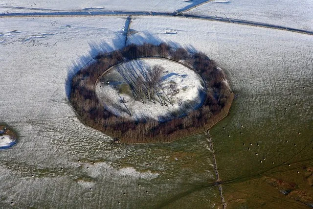
Minninglow
Hill forts · 0.0 km

Ruins of Pipers Inn Coaching Inn on the Roman Road
Historic houses · 0.3 km

Smiths Rodley Crane
Memorials & monuments · 0.5 km

Minninglow View
Campsites · 0.7 km

Fig's Dig
Caves · 1.4 km

Middlehills Farm
Campsites · 2.7 km

Medieval settlement and associated field system immediately south of Ballidon village
Vineyards · 2.9 km
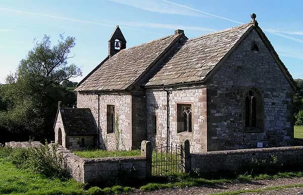
All Saints Church, Ballidon
Historic churches · 2.9 km

Parwich Hill
Mountains & hills · 3.1 km

Holly Bush Inn
Historic pubs · 3.4 km

High Peak Trail
Mountain bike trails · 3.6 km

Parwich
Villages · 3.7 km
Nearby
📷 3Hill forts · East Midlands
Minninglow
Minninglow — archaeological site in Derbyshire, England, UK.
📷 3Historic houses · East Midlands
Ruins of Pipers Inn Coaching Inn on the Roman Road
Ruins of Pipers Inn Coaching Inn on the Roman Road — a historic house in East Midlands, United Kingdom.
📷 3Memorials & monuments · East Midlands
Smiths Rodley Crane
Smiths Rodley Crane — a memorial in East Midlands, United Kingdom.
📷 5📷 4Caves · East Midlands
Fig's Dig
Fig's Dig — a cave broad in england-east-midlands, United Kingdom.
📷 5Where to eat & stay near Minninglow Hill
Places to stay
📷 5📷 5 📷 5
📷 5B&Bs · East Midlands
Gratton Grange Farm
Gratton Grange Farm — a bed-and-breakfast in england east midlands.
 📷 5
📷 5Caravan parks · East Midlands
Rivendale Caravan and Leisure Park
Rivendale Caravan and Leisure Park — a caravan park in england east midlands.
 📷 5
📷 5Campsites · East Midlands
Newhaven Holiday Park
Newhaven Holiday Park — a campsite in england east midlands.
 📷 5
📷 5Places to eat & drink
📷 5 📷 5
📷 5Historic pubs · East Midlands
Duke of York Inn
Duke of York Inn in England East Midlands, United Kingdom.
 📷 5
📷 5Historic pubs · East Midlands
Miner's Arms Inn
Miner's Arms Inn in England East Midlands, United Kingdom.
 📷 5
📷 5Historic pubs · East Midlands
The Square House
The Square House in England West Midlands, United Kingdom.
 📷 5
📷 5Historic pubs · East Midlands
Three Stags Heads Public House
Three Stags Heads Public House in England East Midlands, United Kingdom.
 📷 5
📷 5More mountains in this region
 📷 5
📷 5Mountains & hills · East Midlands
Errwood Hall
The ruin of Errwood Hall is a popular tourist destination in the scenic Upper Goyt Valley within the Peak District of England.
 📷 3
📷 3 📷 5
📷 5 📷 3
📷 3Mountains & hills · East Midlands
Black Edge - Summit
Black Edge - Summit — Named summit at 506.7 m.
Frequently asked questions
- Where is Minninglow Hill?
- Minninglow Hill is in Derbyshire, the East Midlands, United Kingdom (postcode DE4 4HX), in the parish of Brassington.
- What is Minninglow Hill?
- Minninglow Hill — Named summit at 372 m.
- How do I get to Minninglow Hill?
- The nearest railway station is Recreation Ground Halt, about 7.6 km away. The nearest town is Hopton. Drivers can use postcode DE4 4HX.
- Is Minninglow Hill free to visit?
- Yes, Minninglow Hill is free to enter.
- How do I get to Minninglow Hill?
- The nearest railway station is Recreation Ground Halt, about 7.6 km away. Drivers can navigate to postcode DE4 4HX.