
Vineyards · East Midlands
Medieval settlement and associated field system immediately south of Ballidon village
In or near Hopton.
Medieval settlement and associated field system immediately south of Ballidon village — a UK vineyard in england east midlands, producing English or Welsh wine from cool-climate grape varieties.

Paul Glover — CC BY-SA 2.0 via Wikimedia Commons licence

Plan your visit
- Typical visit
- 1 h–2 h
- Best time of year
- Late summer & autumn (Aug–Oct)
- Nearest railway station
- Recreation Ground Halt · 8.0 km
About
Medieval settlement and associated field system immediately south of Ballidon village is one of Britain's growing number of vineyards, located in england east midlands. UK viticulture has expanded significantly since the 1980s, with English sparkling wines now winning international awards. Most British vineyards offer tours and tastings of their estate-grown wines. human settlement in Ballidon, Derbyshire Dales, Derbyshire, England, UK
Photo gallery
Place summary
The Medieval settlement and associated field system immediately south of Ballidon village is located in the East Midlands. This site features remnants of historical agricultural practices indicative of the medieval period. The surrounding area includes a vineyard, where visitors can expect a tranquil setting for wine production, often complemented by scenic views of the countryside. The vineyard may offer opportunities for tours and tastings, providing insight into local viticulture.
AI-generated from the structured facts on this page (operator, designation, listing, era). Not a substitute for visiting.
- Coordinates
- 53.0871, -1.6969
- County
- Derbyshire
- District
- Derbyshire Dales
- Parish
- Ballidon
- Postcode
- DE6 1QX
- Parliamentary constituency
- Derbyshire Dales
- Nearest railway station
- Recreation Ground Halt — 8 km
Sources
- wikidata: Q17678366 (CC0)
Other places nearby
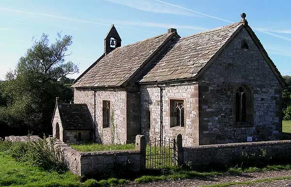
All Saints Church, Ballidon
Historic churches · 0.0 km

Parwich
Castles · 1.5 km

Parwich
Villages · 1.6 km

Parwich Hill
Mountains & hills · 1.7 km

Bradbourne Mill
Watermills · 2.3 km

Medieval settlement, including fishpond and open field system, immediately north and 240m south of Lea Cottage Farm
Vineyards · 2.6 km

Haven Hill
Mountains & hills · 2.7 km
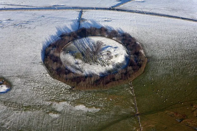
Minninglow Hill
Mountains & hills · 2.9 km
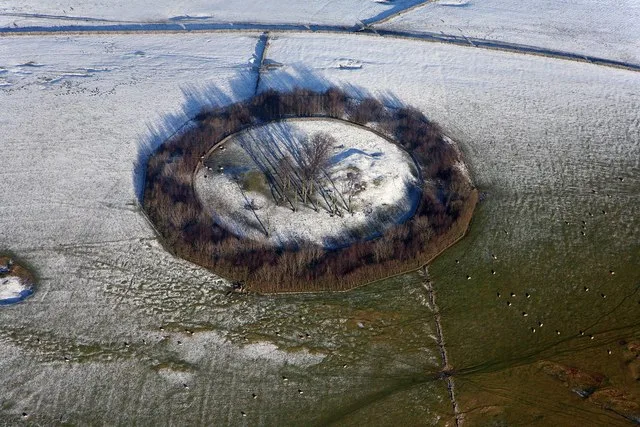
Minninglow
Hill forts · 2.9 km

Wibben Hill
Mountains & hills · 3.0 km

Wigber low
Archaeological sites · 3.0 km

Minninglow View
Campsites · 3.0 km
Nearby
📷 3Historic churches · East Midlands
All Saints Church, Ballidon
All Saints Church, Ballidon — grade II listed church in Ballidon, Derbyshire Dales, Derbyshire, England, UK.
📷 5📷 5📷 5Mountains & hills · East Midlands
Parwich Hill
Parwich Hill — mountain in england east midlands. Elevation: 294 m.
📷 3Watermills · East Midlands
Bradbourne Mill
Bradbourne Mill — Grade II listed building-listed watermill in england-east-midlands, United Kingdom.
📷 5Vineyards · East Midlands
Medieval settlement, including fishpond and open field system, immediately north and 240m south of Lea Cottage Farm
human settlement in Tissington and Lea Hall, Derbyshire Dales, Derbyshire, England, UK
Where to eat & stay near Medieval settlement and associated field system immediately south of Ballidon village
Places to stay
📷 5 📷 5
📷 5Caravan parks · East Midlands
Tissington Caravan and Motorhome site
Tissington Caravan and Motorhome site — a caravan park in england east midlands.
 📷 5
📷 5Campsites · East Midlands
New House Farm Campsite
New House Farm Campsite — a campsite in england east midlands.
 📷 5
📷 5 📷 5
📷 5Campsites · East Midlands
The Closes Caravan Park
The Closes Caravan Park — a campsite in england east midlands.
 📷 5
📷 5Campsites · East Midlands
Knockerdown Caravan & Camping
Knockerdown Caravan & Camping — a campsite in england east midlands.
Places to eat & drink
 📷 5
📷 5Historic pubs · East Midlands
Miner's Arms Inn
Miner's Arms Inn in England East Midlands, United Kingdom.
 📷 5
📷 5 📷 5
📷 5Historic pubs · East Midlands
Duke of York Inn
Duke of York Inn in England East Midlands, United Kingdom.
 📷 5
📷 5Historic pubs · East Midlands
Okeover Arms Public House
Okeover Arms Public House in England West Midlands, United Kingdom.
 📷 7
📷 7Historic pubs · East Midlands
George And Dragon Public House
George And Dragon Public House in England West Midlands, United Kingdom.
 📷 5
📷 5Historic pubs · East Midlands
Smiths Wine Tavern
Smiths Wine Tavern in England West Midlands, United Kingdom.
More places in this region
 📷 5
📷 5Vineyards · East Midlands
Settlement site E of Uffington and Barnack Station
Settlement site E of Uffington and Barnack Station — a UK vineyard in england london, producing English or Welsh wine from cool-climate grape varieties.
 📷 5
📷 5Vineyards · East Midlands
Settlement site E of Greatford village
Settlement site E of Greatford village — a UK vineyard in england london, producing English or Welsh wine from cool-climate grape varieties.
 📷 4
📷 4Vineyards · East Midlands
Fleet settlement site near Lambert Drain
Fleet settlement site near Lambert Drain — a UK vineyard in england london, producing English or Welsh wine from cool-climate grape varieties.
 📷 5
📷 5Vineyards · East Midlands
Settlement site at Greatford
Settlement site at Greatford — a UK vineyard in england london, producing English or Welsh wine from cool-climate grape varieties.
Frequently asked questions
- Where is Medieval settlement and associated field system immediately south of Ballidon village?
- Medieval settlement and associated field system immediately south of Ballidon village is in Derbyshire, the East Midlands, United Kingdom (postcode DE6 1QX), in the parish of Ballidon.
- What is Medieval settlement and associated field system immediately south of Ballidon village?
- Medieval settlement and associated field system immediately south of Ballidon village — a UK vineyard in england east midlands, producing English or Welsh wine from cool-climate grape varieties.
- How do I get to Medieval settlement and associated field system immediately south of Ballidon village?
- The nearest railway station is Recreation Ground Halt, about 8.0 km away. The nearest town is Hopton. Drivers can use postcode DE6 1QX.
- How do I get to Medieval settlement and associated field system immediately south of Ballidon village?
- Drivers can navigate to postcode DE6 1QX. It sits within the Derbyshire Dales parliamentary constituency.