
Archaeological sites · Northern Ireland
Donaghaguy Rath
In or near Burren.
Donaghaguy Rath — a archaeological in northern-ireland, United Kingdom.

David Crozier — CC BY-SA 2.0 via Wikimedia Commons licence

Plan your visit
- Typical visit
- 45 min–1.5 h
- Free entry
- Dog-friendly
About
Donaghaguy Rath is a archaeological located in northern-ireland, United Kingdom. Sourced from OpenStreetMap (ODbL licence); see local listings for visitor information, opening hours and admission details.
Photo gallery
Place summary
Donaghaguy Rath is an archaeological site located in Northern Ireland. It is notable for its ancient earthworks, which are characteristic of early medieval settlement patterns in the region. The site provides insight into the historical landscape and the people who once inhabited the area.
AI-generated from the structured facts on this page (operator, designation, listing, era). Not a substitute for visiting.
- Coordinates
- 54.1161, -6.2577
- District
- Newry, Mourne and Down
- Postcode
- BT34 3FU
- Parliamentary constituency
- South Down
Sources
- osm: way/860482829 (ODbL)
Other places nearby

St Mark's High School, Warrenpoint
Historic churches · 0.4 km

Milltown
Natural landmarks · 0.4 km
Warrenpoint Town F.C.
Natural landmarks · 0.4 km

Clann MacGuinness Coronation Stone
Archaeological sites · 0.7 km

The Irish Elk
Public art & sculpture · 1.3 km

Narrow Water Picnic Area
Natural landmarks · 1.4 km

Narrow Water Forest
Archaeological sites · 1.5 km

Warrenpoint ambush
Natural landmarks · 1.5 km

Narrow Water Keep
Natural landmarks · 1.5 km

Joanne Reilly
Memorials & monuments · 1.6 km

Warrenpoint
Villages · 1.6 km
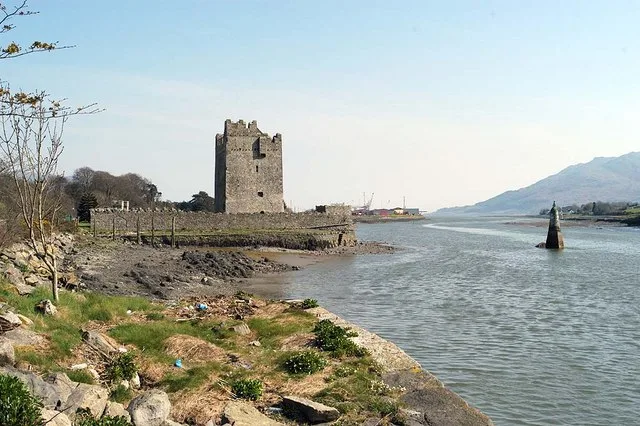
Narrow Water Castle
Castles · 1.6 km
Nearby
Historic churches · Northern Ireland
St Mark's High School, Warrenpoint
St Mark's High School, Warrenpoint in Northern Ireland, United Kingdom.
📷 3📷 3Natural landmarks · Northern Ireland
Warrenpoint Town F.C.
Warrenpoint Town F.C. in Northern Ireland, United Kingdom.
📷 5Archaeological sites · Northern Ireland
Clann MacGuinness Coronation Stone
Clann MacGuinness Coronation Stone — a archaeological in northern-ireland, United Kingdom.
📷 3Public art & sculpture · Northern Ireland
The Irish Elk
The Irish Elk — a public art in northern-ireland, United Kingdom.
📷 3Natural landmarks · Northern Ireland
Narrow Water Picnic Area
Narrow Water Picnic Area — a other in northern-ireland, United Kingdom.
Where to eat & stay near Donaghaguy Rath
Places to stay
 📷 5
📷 5Hostels · Northern Ireland
Kilbroney Youth Centre C.O.I
Kilbroney Youth Centre C.O.I — a hostel in northern ireland.
 📷 5
📷 5Caravan parks · Northern Ireland
Kilbroney Caravan Park
Kilbroney Caravan Park — a caravan park in northern ireland.
 📷 5
📷 5Caravan parks · Northern Ireland
Touring in the Trees - Kilbroney
Touring in the Trees - Kilbroney — a caravan park in northern ireland.
 📷 5
📷 5Caravan parks · Northern Ireland
Slieve Gullion Getaways
Slieve Gullion Getaways — a caravan park in northern ireland.
 📷 5
📷 5 📷 5
📷 5Caravan parks · Northern Ireland
Loughside Holiday Park
Loughside Holiday Park — a caravan park in northern ireland.
More archaeological sites in this region
 Flagship📷 5
Archaeological sites · Northern Ireland
Tollymore Forest Park
Tollymore Forest Park — park in the United Kingdom.
 📷 3
📷 3Archaeological sites · Northern Ireland
Annalong Forest
Annalong Forest — Forest in County Down, Northern Ireland.
 📷 3
📷 3Archaeological sites · Northern Ireland
Ballysallagh Forest
Ballysallagh Forest — forest in Northern Ireland.
 📷 3
📷 3Archaeological sites · Northern Ireland
Castleward Forest
Castleward Forest — castleward Forest: Northern Ireland.
Frequently asked questions
- Where is Donaghaguy Rath?
- Donaghaguy Rath is in Northern Ireland, United Kingdom (postcode BT34 3FU).
- What is Donaghaguy Rath?
- Donaghaguy Rath — a archaeological in northern-ireland, United Kingdom.
- How do I get to Donaghaguy Rath?
- Drivers can use postcode BT34 3FU.
- Is Donaghaguy Rath free to visit?
- Yes, Donaghaguy Rath is free to enter.
- How do I get to Donaghaguy Rath?
- Drivers can navigate to postcode BT34 3FU. It sits within the South Down parliamentary constituency.