
Archaeological sites · Northern Ireland
Annalong Forest
In or near Kilcoo.
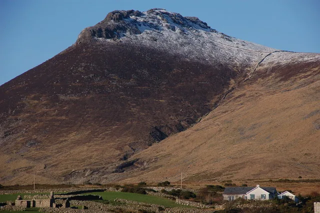
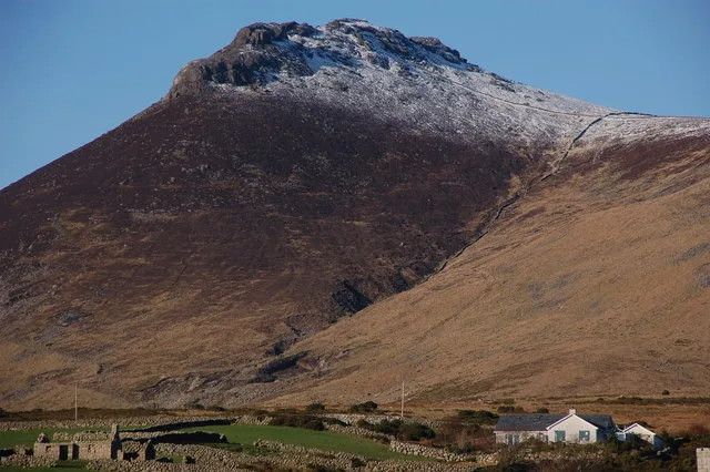
Annalong Forest — Forest in County Down, Northern Ireland.

Wikimedia Commons contributors — see linked file page for photographer and licence licence

Plan your visit
- Typical visit
- 45 min–1.5 h
- Free entry
- Dog-friendly
About
Annalong Forest is an archaeological site in the United Kingdom. Wikidata describes it as: "Forest in County Down, Northern Ireland". Coordinates: 54.1440°, -5.9400°.
Photo gallery
From the Wikipedia article
Annalong Forest is located near the village of Annalong in County Down, Northern Ireland. It is made up of two sections: Annalong Wood and Silent Valley. The forest consists of various species of conifer. It is part of the Mourne Area of Outstanding Natural Beauty. It has been the site of two major fires, in 2010 and 2011.
Excerpt from Wikipedia under CC BY-SA 4.0. See the source article linked in Sources below.
Background
Visiting
Annalong Forest is located near the village of Annalong in County Down, Northern Ireland. It is made up of two sections: Annalong Wood and Silent Valley, which runs along the Silent Valley reservoir. The forest consists of various species of conifer, and is managed by the Northern Irish Forest Service.
Sourced from Wikipedia under CC BY-SA 4.0.
- Coordinates
- 54.1440, -5.9400
- District
- Newry, Mourne and Down
- Postcode
- BT34 4RQ
- Parliamentary constituency
- South Down
Sources
- wikidata: Q19460221 (CC0)
- wikipedia: Annalong Forest (CC BY-SA 4.0)
- commons: Annalong Wood and the Mourne Mountains - geograph.org.uk - 1138157.jpg (CC BY-SA 4.0)
Other places nearby

Carrick Little Glamping
Campsites · 1.3 km

Round Seefin
Viewpoints · 1.4 km

Rocky Mountain
Mountains & hills · 1.6 km
Rocky Mountain
Mountains & hills · 1.7 km

Slieve Binnian East Top
Mountains & hills · 2.0 km

Percey Bysshe
Caves · 2.1 km

Spences Mountain
Mountains & hills · 2.3 km
Slieve Binnian
Mountains & hills · 2.6 km
Slieve Binnian
Natural landmarks · 2.7 km

Chimney Rock Mountain
Mountains & hills · 2.7 km
Chimney Rock Mtn
Mountains & hills · 2.7 km

Slieve Binnian North Tor
Mountains & hills · 2.9 km
Nearby
📷 5Campsites · Northern Ireland
Carrick Little Glamping
Carrick Little Glamping — a campsite in northern ireland.
📷 3📷 5Mountains & hills · Northern Ireland
Rocky Mountain
Rocky Mountain — a hill or mountain in northern ireland.
📷 5Mountains & hills · Northern Ireland
Rocky Mountain
Rocky Mountain — mountain in northern ireland. Elevation: 524 m.
📷 5Mountains & hills · Northern Ireland
Slieve Binnian East Top
Slieve Binnian East Top — mountain in northern ireland. Elevation: 630 m.
📷 3Where to eat & stay near Annalong Forest
Places to stay
📷 5Campsites · Northern Ireland
Carrick Little Glamping
Carrick Little Glamping — a campsite in northern ireland.
 📷 5
📷 5Caravan parks · Northern Ireland
Annalong Caravan Park
Annalong Caravan Park — a caravan park in northern ireland.
 📷 5
📷 5 📷 5
📷 5 📷 5
📷 5Campsites · Northern Ireland
Millstone Motorhome, Caravan and Camping Park
Millstone Motorhome, Caravan and Camping Park — a campsite in northern ireland.
 📷 5
📷 5Places to eat & drink
 📷 3
📷 3Historic pubs · Northern Ireland
Soma Festival
The Soma Festival (Sanskrit: सोम, or sóma, meaning drink of the Gods, see Soma (drink); Irish: Féile Soma) is an annual music, arts, and cultural festival. The festival includes concerts, musical perf
More archaeological sites in this region
 Flagship📷 5
Archaeological sites · Northern Ireland
Tollymore Forest Park
Tollymore Forest Park — park in the United Kingdom.
 📷 3
📷 3Archaeological sites · Northern Ireland
Ballysallagh Forest
Ballysallagh Forest — forest in Northern Ireland.
 📷 3
📷 3Archaeological sites · Northern Ireland
Castleward Forest
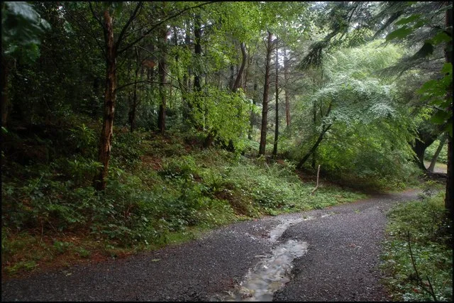
Castleward Forest — castleward Forest: Northern Ireland.
 📷 4
📷 4Archaeological sites · Northern Ireland
Donard Forest
Donard Forest is a archaeological site in the United Kingdom.
Frequently asked questions
- Where is Annalong Forest?
- Annalong Forest is in Northern Ireland, United Kingdom (postcode BT34 4RQ).
- What is Annalong Forest?
- Annalong Forest — Forest in County Down, Northern Ireland.
- How do I get to Annalong Forest?
- Drivers can use postcode BT34 4RQ.
- Who owns Annalong Forest?
- Annalong Forest is owned by Northern Ireland Water.
- Is Annalong Forest free to visit?
- Yes, Annalong Forest is free to enter.
- How do I get to Annalong Forest?
- Drivers can navigate to postcode BT34 4RQ. It sits within the South Down parliamentary constituency.