
Islands · East of England
Bridgemarsh Island
In or near Althorne.
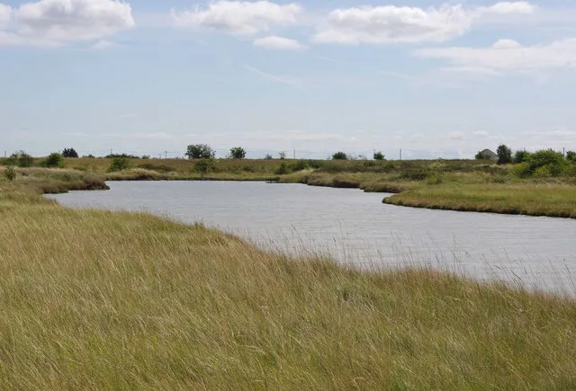
Bridgemarsh Island — island in the River Crouch, Essex.

Wikimedia Commons contributors — see linked file page for photographer and licence licence

Plan your visit
- Typical visit
- 4 h–12 h
- Nearest railway station
- Althorne · 1.6 km
- Free entry
- Dog-friendly
Getting there & planning your visit
To visit Bridgemarsh Island, the nearest railway station is Althorne, located 1.6 km away. The postcode for sat-nav is SS4 3SE, and entry to the island is free.
About
Bridgemarsh Island is a island in the United Kingdom. Wikidata describes it as: "island in the River Crouch, Essex". Coordinates: 51.6383°, 0.7350°.
Photo gallery
Protected designations
- Site of Special Scientific Interest: Crouch and Roach Estuaries SSSI
- Ramsar wetland: Crouch & Roach Estuaries (Mid-Essex Coast Phase 3)
Designations sourced from Natural England open data under OGL v3.
From the Wikipedia article
Bridgemarsh Island is in the tidal part of the River Crouch in the English county of Essex, three miles upstream from Burnham-on-Crouch. The main river channel runs to the south between the island and Canewdon, and it is separated from the mainland to the north by Bridgemarsh and Althorne Creeks, channels of the estuary. Following a flood in 1736 Bridgemarsh Island was enclosed by a sea wall and a causeway was built giving access at low tide. Farming was supplemented by industry with the island used as a source of clay. This led to the construction of a brickworks of which the chimney (at grid reference TQ890967) survives. A tramway linked these works to a quay that was used by Thames barges. Shortsightedly, no serious effort was made to maintain the sea wall. The flood of 1953 caused the end of regular occupation of the island, which is now a haven for wildlife and salt marsh flowers. It is owned by the Bridgemarsh Island Trust.
Excerpt from Wikipedia under CC BY-SA 4.0. See the source article linked in Sources below.
- Coordinates
- 51.6383, 0.7350
- County
- Essex
- District
- Rochford
- Parish
- Canewdon
- Postcode
- SS4 3SE
- Parliamentary constituency
- Southend East and Rochford
- Nearest railway station
- Althorne — 1.6 km
Sources
- wikidata: Q4966523 (CC0)
- wikipedia: Bridgemarsh Island (CC BY-SA 4.0)
- commons: Bridgemarsh Island and marshes looking north across the River Crouch, Essex - geograph.org.uk - 240217.jpg (CC BY-SA 4.0)
Other places nearby

Althorne War Memorial
Memorials & monuments · 2.3 km

Canewdon Village Sign
Public art & sculpture · 2.6 km

Althorne
Towns & cities · 2.7 km

Lambourne Hall
Historic houses · 3.2 km

The Black Lion Public House
Historic pubs · 3.4 km

Latchingdon Village Sign
Public art & sculpture · 3.5 km
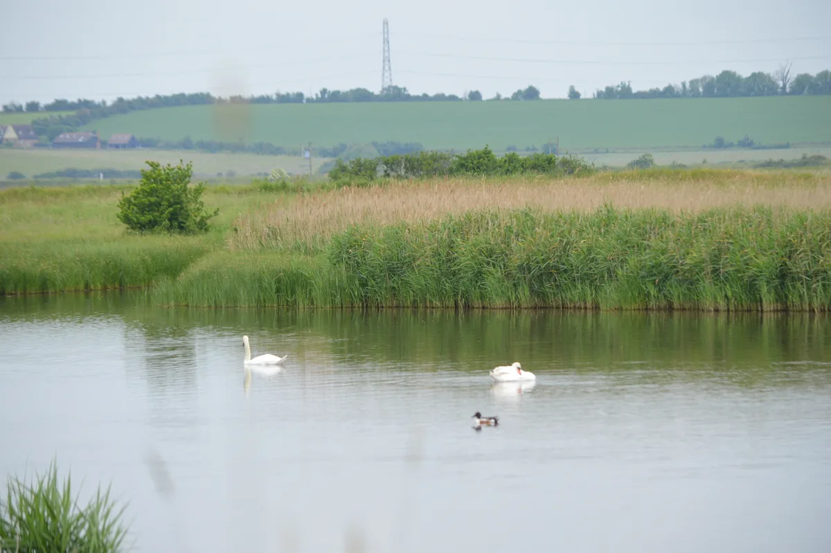
Lion Creek and Lower Raypits
Wildlife reserves · 3.6 km
Blue House Farm
Wildlife reserves · 3.8 km

Latchingdon and Snoreham
Villages · 3.8 km

Huntsman & Hounds Camping
Campsites · 3.9 km

Creeksea Place
Manor houses · 4.1 km

North Fambridge
Villages · 4.2 km
Nearby
📷 3Memorials & monuments · East of England
Althorne War Memorial
Althorne War Memorial — Grade II listed building-listed memorial in england-east, United Kingdom.
📷 3Public art & sculpture · East of England
Canewdon Village Sign
Canewdon Village Sign — a public art in East of England, United Kingdom.
📷 3📷 3Historic houses · East of England
Lambourne Hall
Lambourne Hall — house in Canewdon, Rochford, England, UK.
📷 5Historic pubs · East of England
The Black Lion Public House
The Black Lion Public House in England East, United Kingdom.
📷 3Public art & sculpture · East of England
Latchingdon Village Sign
Latchingdon Village Sign — a public art in East of England, United Kingdom.
Where to eat & stay near Bridgemarsh Island
Places to stay
📷 5Campsites · East of England
Huntsman & Hounds Camping
Huntsman & Hounds Camping — a campsite in england east.
 📷 5
📷 5Hotels · East of England
Ye Olde White Harte Hotel
Ye Olde White Harte Hotel — a hotel in england east.
 📷 5
📷 5Caravan parks · East of England
Silver Road Caravan Park
Silver Road Caravan Park — a caravan park in england east.
 📷 5
📷 5 📷 5
📷 5Caravan parks · East of England
Sea End Caravan Park
Sea End Caravan Park — a caravan park in england east.
 📷 5
📷 5Campsites · East of England
Belchamps Scout Activity Centre
Belchamps Scout Activity Centre — a campsite in england south east.
Places to eat & drink
📷 5Historic pubs · East of England
The Black Lion Public House
The Black Lion Public House in England East, United Kingdom.
 📷 5
📷 5Historic pubs · East of England
The Mayland Mill Public House
The Mayland Mill Public House in England East, United Kingdom.
 📷 5
📷 5Historic pubs · East of England
The Cherry Tree Public House
The Cherry Tree Public House in England South East, United Kingdom.
 📷 5
📷 5Historic pubs · East of England
Cottages And The Golden Lion Public House
Cottages And The Golden Lion Public House in England South East, United Kingdom.
 📷 5
📷 5 📷 5
📷 5Historic pubs · East of England
Bell House Public House
Bell House Public House in England South East, United Kingdom.
More places in this region
 📷 5
📷 5 📷 4
📷 4 📷 3
📷 3Islands · East of England
New England Island
New England Island — island in Essex, United Kingdom.
 📷 5
📷 5Frequently asked questions
- Where is Bridgemarsh Island?
- Bridgemarsh Island is in Essex, East of England, United Kingdom (postcode SS4 3SE), in the parish of Canewdon.
- What is Bridgemarsh Island?
- Bridgemarsh Island — island in the River Crouch, Essex.
- How do I get to Bridgemarsh Island?
- The nearest railway station is Althorne, about 1.6 km away. The nearest town is Althorne. Drivers can use postcode SS4 3SE.
- Is Bridgemarsh Island a protected site?
- Yes — Bridgemarsh Island is part of the Crouch and Roach Estuaries SSSI Site of Special Scientific Interest and the Crouch & Roach Estuaries (Mid-Essex Coast Phase 3) Ramsar wetland.
- Is Bridgemarsh Island free to visit?
- Yes, Bridgemarsh Island is free to enter.
- How do I get to Bridgemarsh Island?
- The nearest railway station is Althorne, about 1.6 km away. Drivers can navigate to postcode SS4 3SE.