
Wildlife reserves · East of England
Lion Creek and Lower Raypits
In or near Althorne.
Lion Creek and Lower Raypits — Essex Wildlife Trust Nature reserve.

Wikimedia Commons contributors — see linked file page for photographer and licence licence

Plan your visit
- Typical visit
- 2 h–4 h
- Best time of year
- Autumn & winter (migration & wildfowl)
- Nearest railway station
- Burnham-on-Crouch · 3.1 km
- Free entry
- Family-friendly
- Dog-friendly
- Limited wheelchair access
Getting there & planning your visit
To visit Lion Creek and Lower Raypits, the nearest railway station is Burnham-on-Crouch, located 3.1 km away. Admission is free, but wheelchair accessibility is limited. The postcode for sat-nav is SS4 2EY.
About
Lion Creek and Lower Raypits is a wildlife reserve in the United Kingdom. It covers approximately 65 km². Managed by Essex Wildlife Trust. Wikidata describes it as: "Essex Wildlife Trust Nature reserve". Coordinates: 51.6190°, 0.7760°.
Photo gallery
Summary from the official site
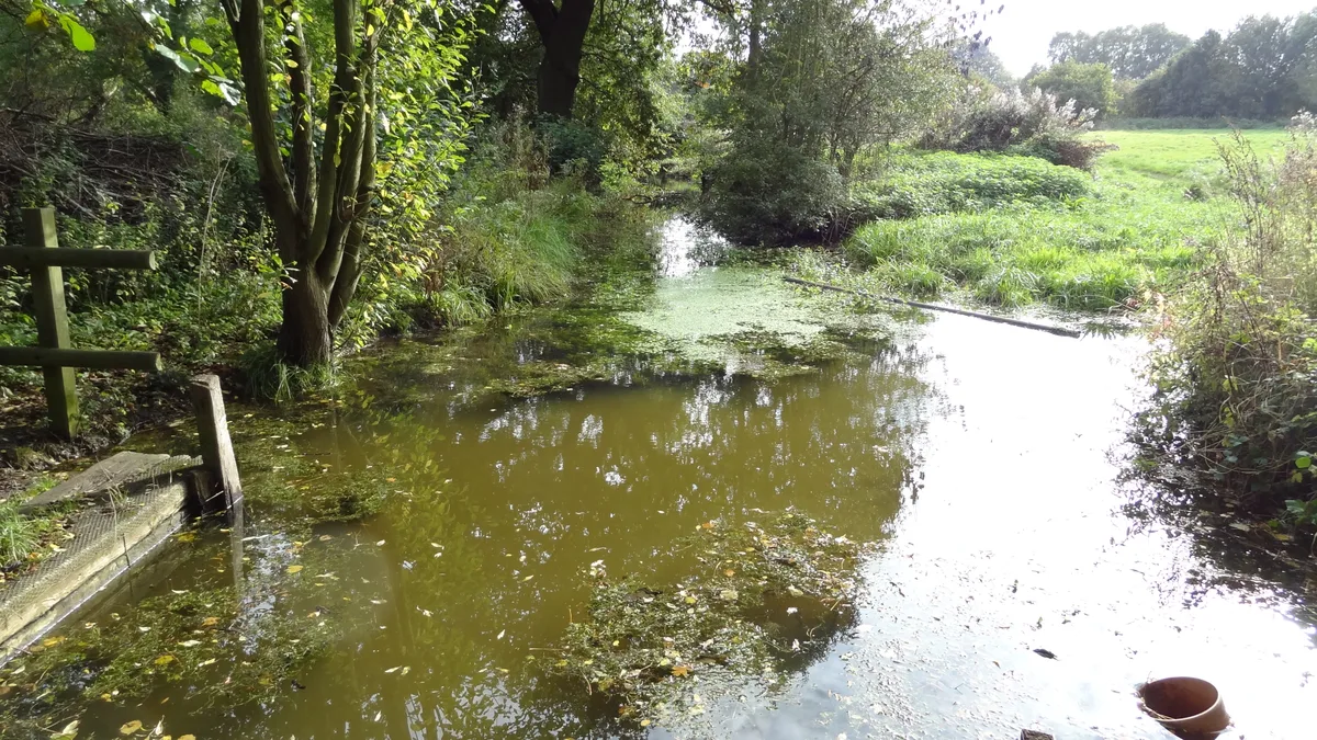
Lion Creek and Lower Raypits Nature Reserve is a remote area featuring seawall paths where visitors can observe a variety of bird species, including waders and wildfowl. The reserve is home to unique salt marsh plants and offers bird hides for wildlife watching throughout the year.
Read more on the official property page.
Protected designations
- Site of Special Scientific Interest: Crouch and Roach Estuaries SSSI
- Ramsar wetland: Crouch & Roach Estuaries (Mid-Essex Coast Phase 3)
Designations sourced from Natural England open data under OGL v3.
From the Wikipedia article
Lion Creek and Lower Raypits is a 65.2-hectare (161-acre) nature reserve east of Canewdon in Essex. It is part of the Crouch and Roach Estuaries Site of Special Scientific Interest, and is owned and managed by the Essex Wildlife Trust. The former creek has been cut off from the Crouch Estuary by a seawall, and it has salt marsh plants such as golden samphire and sea-spurrey. There is a bird hide from which many species of sea birds can be seen. Lower Raypits can be accessed from Lion Creek by the seawall path. It has a variety of pasture, salt marsh and intertidal habitats, with nationally scarce plants such as beaked tasselweed, sea barley, grass vetchling and curved hard-grass. Invertebrates include Roesel's bush-cricket. There is access from the road between Canewdon and Wallasea Island.
Excerpt from Wikipedia under CC BY-SA 4.0. See the source article linked in Sources below.
- Coordinates
- 51.6190, 0.7760
- County
- Essex
- District
- Rochford
- Parish
- Canewdon
- Postcode
- SS4 2EY
- Parliamentary constituency
- Southend East and Rochford
- Nearest railway station
- Burnham-on-Crouch — 3.1 km
- Opening
- Accessible at all times
- Official site
- www.essexwt.org.uk
Sources
- wikidata: Q28404727 (CC0)
- wikipedia: Lion Creek and Lower Raypits (CC BY-SA 4.0)
- commons: View From Garon Hide - geograph.org.uk - 1445511.jpg (CC BY-SA 4.0)
Other places nearby

Lambourne Hall
Historic houses · 1.1 km

Creeksea Place
Manor houses · 1.8 km

Burnham-on-Crouch and District Museum
Museums · 2.7 km

Canewdon Village Sign
Public art & sculpture · 2.7 km

Burnham-on-Crouch & District Museum
Museums · 2.7 km
Rio Cinema
Theatres · 2.9 km
Burnham-on-Crouch
Museums · 2.9 km

War Memorial
Memorials & monuments · 2.9 km
Burnham-on-Crouch War Memorial
Memorials & monuments · 2.9 km

Ye Olde White Harte Hotel
Hotels · 3.0 km

Silver Road Caravan Park
Caravan parks · 3.4 km

St Mary's Church, Burnham on Crouch
Historic churches · 3.4 km
Nearby
📷 3Historic houses · East of England
Lambourne Hall
Lambourne Hall — house in Canewdon, Rochford, England, UK.
📷 3Manor houses · East of England
Creeksea Place
Creeksea Place — a manor in East of England, United Kingdom.
📷 3Museums · East of England
Burnham-on-Crouch and District Museum
Burnham-on-Crouch and District Museum — a museum in East of England, United Kingdom.
📷 3Public art & sculpture · East of England
Canewdon Village Sign
Canewdon Village Sign — a public art in East of England, United Kingdom.
📷 5Museums · East of England
Burnham-on-Crouch & District Museum
The Burnham-on-Crouch and District Museum, located in Burnham-on-Crouch, Essex, is a registered charity run by members of the Burnham History Society, aiming to reflect the history and development of
📷 4Where to eat & stay near Lion Creek and Lower Raypits
Places to stay
📷 5Hotels · East of England
Ye Olde White Harte Hotel
Ye Olde White Harte Hotel — a hotel in england east.
📷 5Caravan parks · East of England
Silver Road Caravan Park
Silver Road Caravan Park — a caravan park in england east.
 📷 5
📷 5Caravan parks · East of England
Sea End Caravan Park
Sea End Caravan Park — a caravan park in england east.
 📷 5
📷 5Campsites · East of England
Huntsman & Hounds Camping
Huntsman & Hounds Camping — a campsite in england east.
 📷 5
📷 5Campsites · East of England
Ark Lane Scout Campsite
Ark Lane Scout Campsite — a campsite in england south east.
 📷 5
📷 5Campsites · East of England
Belchamps Scout Activity Centre
Belchamps Scout Activity Centre — a campsite in england south east.
Places to eat & drink
 📷 5
📷 5Historic pubs · East of England
The Cherry Tree Public House
The Cherry Tree Public House in England South East, United Kingdom.
 📷 5
📷 5Historic pubs · East of England
The Black Lion Public House
The Black Lion Public House in England East, United Kingdom.
 📷 5
📷 5Historic pubs · East of England
Cottages And The Golden Lion Public House
Cottages And The Golden Lion Public House in England South East, United Kingdom.
 📷 5
📷 5Historic pubs · East of England
The Mayland Mill Public House
The Mayland Mill Public House in England East, United Kingdom.
 📷 5
📷 5Historic pubs · East of England
The George And Dragon Public House
The George And Dragon Public House in England East, United Kingdom.
 📷 5
📷 5Historic pubs · East of England
Bell House Public House
Bell House Public House in England South East, United Kingdom.
More places run by Essex Wildlife Trust
 Flagship📷 10
Wildlife reserves · London
Bedfords Park
Bedfords Park — Havering London Borough green landscape, also an Essex Wildlife Trust Nature reserve.
 Flagship📷 10
Wildlife reserves · London
Chafford Gorges Nature Park
Chafford Gorges Nature Park — Essex Wildlife Trust Nature reserve.
 Flagship📷 10
Wildlife reserves · London
Cranham Marsh
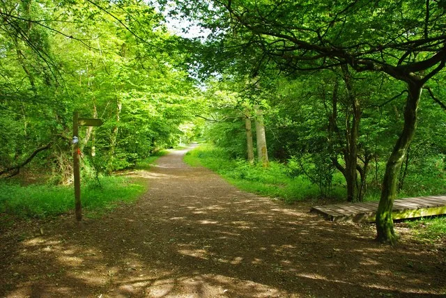
Cranham Marsh — Essex Wildlife Trust Nature reserve in the London Borough of Havering, England, UK.
 Flagship📷 10
Wildlife reserves · London
Gernon Bushes
Gernon Bushes — Essex Wildlife Trust Nature reserve.
More places in this region
 Flagship📷 10
Wildlife reserves · East of England
Amwell Quarry
Amwell Quarry — nature reserve in United Kingdom.
 Flagship📷 10
Wildlife reserves · East of England
Aubrey Buxton Nature Reserve
Aubrey Buxton Nature Reserve — Essex Wildlife Trust Nature reserve.
 Flagship📷 10
Wildlife reserves · East of England
Canvey Wick
Canvey Wick — nature reserve in Essex, United Kingdom.
 Flagship📷 10
Wildlife reserves · East of England
Crowsheath Wood
Crowsheath Wood — Essex Wildlife Trust Nature reserve.
Frequently asked questions
- Where is Lion Creek and Lower Raypits?
- Lion Creek and Lower Raypits is in Essex, East of England, United Kingdom (postcode SS4 2EY), in the parish of Canewdon.
- What is Lion Creek and Lower Raypits?
- Lion Creek and Lower Raypits — Essex Wildlife Trust Nature reserve.
- How do I get to Lion Creek and Lower Raypits?
- The nearest railway station is Burnham-on-Crouch, about 3.1 km away. The nearest town is Althorne. Drivers can use postcode SS4 2EY.
- Who runs Lion Creek and Lower Raypits?
- Lion Creek and Lower Raypits is operated by Essex Wildlife Trust.
- Is Lion Creek and Lower Raypits a protected site?
- Yes — Lion Creek and Lower Raypits is part of the Crouch and Roach Estuaries SSSI Site of Special Scientific Interest and the Crouch & Roach Estuaries (Mid-Essex Coast Phase 3) Ramsar wetland.
- Is Lion Creek and Lower Raypits free to visit?
- Yes, Lion Creek and Lower Raypits is free to enter.
- How do I get to Lion Creek and Lower Raypits?
- The nearest railway station is Burnham-on-Crouch, about 3.1 km away. Drivers can navigate to postcode SS4 2EY.
- Are dogs allowed at Lion Creek and Lower Raypits?
- Most wildlife reserves allow dogs on lead only, with restrictions during ground-nesting bird season (March-July). Check signage at the reserve.