
Islands · East of England
Havengore Island
In or near Sutton.
Havengore Island — island in Essex, England.

Wikimedia Commons licence
Plan your visit
- Typical visit
- 4 h–12 h
- Nearest railway station
- Shoeburyness · 5.5 km
- Free entry
- Dog-friendly
Getting there & planning your visit
Havengore Island is located in Rochford, Essex, with the postcode SS3 9XD. The nearest railway station is Shoeburyness, which is 5.5 km away. Entry to the island is free.
About
Havengore Island is a island in the United Kingdom. Wikidata describes it as: "island in Essex, England". Coordinates: 51.5667°, 0.8500°.
Photo gallery
Protected designations
- Site of Special Scientific Interest: Foulness SSSI
- Ramsar wetland: Foulness (Mid-Essex Coast Phase 5)
Designations sourced from Natural England open data under OGL v3.
From the Wikipedia article
Havengore Island is a low-lying, marshy island in the civil parish of Foulness, in the Rochford district of the county of Essex, England. It is bounded by New England Creek to the north, Havengore Creek to the south west, the Middleway to the north west, with the North Sea to the south and east. Access to the island is restricted by the Ministry of Defence. An Ordnance Survey map of 1880 shows a private ferry across Havengore Creek, linking the island to the mainland near to where Havengore Bridge now stands. Two farms are also shown. The War Office acquired the island in 1902 and later authorised the construction of a Scherzer rolling lift bridge across the Creek, which was completed in 1919. Two petitions urging the Ministry of Defence (MOD) to replace the bridge owing to its poor condition were presented in the House of Commons by Rochford MP Dr Michael Clark on 21 February 1986. The MOD obliged and the current Havengore Bridge was opened in 1988. The bridge roadway can be lifted to allow the passage of marine traffic using the Creek to reach the River Roach from the North Sea and vice versa. The bridge is operated by defence contractor, QinetiQ as part of MOD Shoeburyness. Another bridge spans New England Creek to New England Island, from which the road continues to Foulness. The island's south east coast and south west shore is protected by dykes. The island has never been heavily populated and now has a few buildings along its single road. Its southern end is Ministry of Defence land. HMS Beagle is said to have been used to block one of the channels around the island in its last days.
Excerpt from Wikipedia under CC BY-SA 4.0. See the source article linked in Sources below.
- Coordinates
- 51.5667, 0.8500
- County
- Essex
- District
- Rochford
- Parish
- Foulness
- Postcode
- SS3 9XD
- Parliamentary constituency
- Southend East and Rochford
- Nearest railway station
- Shoeburyness — 5.5 km
Sources
- wikidata: Q5683720 (CC0)
- wikipedia: Havengore Island (CC BY-SA 4.0)
Other places nearby

New England Island
Islands · 0.8 km

Rushley Island
Islands · 1.3 km

Havengore Maypole
Natural landmarks · 1.8 km

Brimstone Hill
Castles · 3.2 km

Half Moon Viewpoint
Viewpoints · 3.3 km

Great Wakering
Villages · 3.6 km

Wallasea Island
Islands · 3.9 km

HMS Beagle (remains of)
Archaeological sites · 4.1 km

Beagle Viewpoint
Viewpoints · 4.1 km
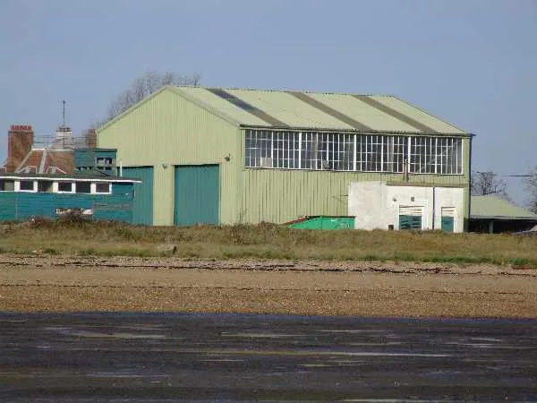
Pig's Bay
Mountains & hills · 4.3 km

Little Wakering
Villages · 4.3 km

Barling Magna War Memorial
Memorials & monuments · 4.5 km
Nearby
📷 3Islands · East of England
New England Island
New England Island — island in Essex, United Kingdom.
📷 5📷 5Natural landmarks · East of England
Havengore Maypole
Havengore Maypole — a place in East of England, United Kingdom.
📷 5📷 5Viewpoints · East of England
Half Moon Viewpoint
Half Moon Viewpoint is a viewpoint in the United Kingdom.
📷 5Where to eat & stay near Havengore Island
Places to stay
 📷 5
📷 5Caravan parks · East of England
Sea End Caravan Park
Sea End Caravan Park — a caravan park in england east.
 📷 5
📷 5Caravan parks · East of England
Silver Road Caravan Park
Silver Road Caravan Park — a caravan park in england east.
 📷 5
📷 5Hotels · East of England
Ye Olde White Harte Hotel
Ye Olde White Harte Hotel — a hotel in england east.
 📷 5
📷 5Hotels · East of England
The Last Post
The Last Post — a hotel in england south east.
 📷 5
📷 5Campsites · East of England
Ark Lane Scout Campsite
Ark Lane Scout Campsite — a campsite in england south east.
 📷 5
📷 5Campsites · East of England
Huntsman & Hounds Camping
Huntsman & Hounds Camping — a campsite in england east.
Places to eat & drink
 📷 5
📷 5Historic pubs · East of England
The George And Dragon Public House
The George And Dragon Public House in England East, United Kingdom.
 📷 5
📷 5Historic pubs · East of England
The Cherry Tree Public House
The Cherry Tree Public House in England South East, United Kingdom.
 📷 5
📷 5Restaurants · East of England
Billy Hundreds Fish n Tapas
Billy Hundreds Fish n Tapas — a restaurant in england south east. Cuisine: seafood. 4.6-star.
 📷 5
📷 5Historic pubs · East of England
Cottages And The Golden Lion Public House
Cottages And The Golden Lion Public House in England South East, United Kingdom.
 📷 5
📷 5Historic pubs · East of England
The Black Lion Public House
The Black Lion Public House in England East, United Kingdom.
 📷 5
📷 5Historic pubs · East of England
Bell House Public House
Bell House Public House in England South East, United Kingdom.
More places in this region
 📷 5📷 3
Islands · East of England
New England Island
New England Island — island in Essex, United Kingdom.
📷 5 Flagship📷 5
Frequently asked questions
- Where is Havengore Island?
- Havengore Island is in Essex, East of England, United Kingdom (postcode SS3 9XD), in the parish of Foulness.
- What is Havengore Island?
- Havengore Island — island in Essex, England.
- How do I get to Havengore Island?
- The nearest railway station is Shoeburyness, about 5.5 km away. The nearest town is Sutton. Drivers can use postcode SS3 9XD.
- Is Havengore Island a protected site?
- Yes — Havengore Island is part of the Foulness SSSI Site of Special Scientific Interest and the Foulness (Mid-Essex Coast Phase 5) Ramsar wetland.
- Is Havengore Island free to visit?
- Yes, Havengore Island is free to enter.
- How do I get to Havengore Island?
- The nearest railway station is Shoeburyness, about 5.5 km away. Drivers can navigate to postcode SS3 9XD.