
Museums · East of England
River Crouch
In or near St Lawrence.
River Crouch — a museum in england-east, United Kingdom.

Wikimedia Commons licence
Plan your visit
- Typical visit
- 1.5 h–3 h
- Best time of year
- Year-round
- Nearest railway station
- Southminster · 8.1 km
- Family-friendly
- Limited wheelchair access
About
River Crouch is a museum in england-east, United Kingdom, listed in the Wikipedia register of British heritage and tourism sites. See the linked Wikipedia article for full details.
Photo gallery
Protected designations
- Site of Special Scientific Interest: Foulness SSSI
- Site of Special Scientific Interest: Dengie SSSI
- National Nature Reserve: DENGIE
- Ramsar wetland: Dengie (Mid-Essex Coast Phase 1)
Designations sourced from Natural England open data under OGL v3.
Place summary
The River Crouch is a museum located in the East of England. It focuses on the history and ecology of the River Crouch and its surrounding areas. The museum provides insights into the local maritime heritage and the significance of the river to the community.
AI-generated from the structured facts on this page (operator, designation, listing, era). Not a substitute for visiting.
Background
History
There was a proposal in 1825 to extend navigation onwards from Battlesbridge to Purfleet with a branch to Billericay. The route to Billericay would have been around 7.5 mi long, and 29 locks were proposed, in order to negotiate the difference in height of 181 ft. Because the river is still tidal at Battlesbridge, a sea lock would have provided access from the river, with five locks soon afterwards. A further seven locks would have been constructed along the route, with a flight of 16 locks to raise the canal by 100 ft in the final 1.25 mi. The engineer Alexander Clark prepared the proposal, with help from surveyors J & H Clayton. The statutory documents were submitted to Essex County…
Description
The river is navigable from below the bridge for 17.5 mi to the sea. The upper reaches are quite narrow and wind between sandbanks. There are high sea walls on both sides of the channel. The river flows through Long Reach, after which it reaches Hullbridge on the south bank. A little further back from the river on the north bank is South Woodham Ferrers. Its western boundary is defined by Fenn Creek, which begins as a stream called Rettendon Brook rising near Hanningfield Reservoir and is tidal below the point where it is crossed by the A132 road. There are footpaths along both river banks at this location, with Marsh Farm Country Park situated between South Woodham Ferrers and the river.…
Sourced from Wikipedia under CC BY-SA 4.0.
- Coordinates
- 51.6267, 0.9392
- Nearest railway station
- Southminster — 8.1 km
- Official site
- rsis.ramsar.org
Sources
- wikipedia: River Crouch (CC BY-SA 4.0)
Other places nearby

Foulness
Villages · 3.9 km

The George And Dragon Public House
Historic pubs · 4.2 km
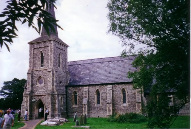
Saint Mary the Virgin, Foulness Island
Historic churches · 4.2 km

Foulness Island War Memorial
Memorials & monuments · 4.3 km

Foulness Island
Islands · 4.4 km

River Roach
Museums · 4.8 km

Crouch harbour
Marinas · 4.9 km

School House Viewpoint
Viewpoints · 5.6 km

Wallasea Wetlands
Wildlife reserves · 6.0 km
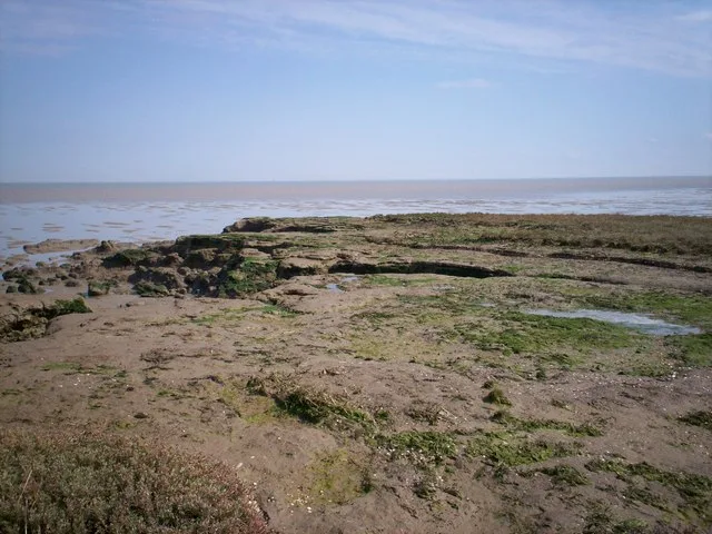
Dengie SPA
Wildlife reserves · 6.3 km

Half Moon Viewpoint
Viewpoints · 7.0 km

Dengie Manor
Manor houses · 7.2 km
Nearby
📷 5📷 5Historic pubs · East of England
The George And Dragon Public House
The George And Dragon Public House in England East, United Kingdom.
📷 3Historic churches · East of England
Saint Mary the Virgin, Foulness Island
Saint Mary the Virgin, Foulness Island — grade II listed church in Foulness, Rochford, Essex, England, UK.
📷 3Memorials & monuments · East of England
Foulness Island War Memorial
Foulness Island War Memorial — Grade II listed building-listed memorial in england-east, United Kingdom.
📷 5📷 3Museums · East of England
River Roach
River Roach — a museum in england-east, United Kingdom.
Where to eat & stay near River Crouch
Places to stay
 📷 5
📷 5Caravan parks · East of England
Sea End Caravan Park
Sea End Caravan Park — a caravan park in england east.
 📷 5
📷 5Caravan parks · East of England
Silver Road Caravan Park
Silver Road Caravan Park — a caravan park in england east.
 📷 5
📷 5Hotels · East of England
Ye Olde White Harte Hotel
Ye Olde White Harte Hotel — a hotel in england east.
 📷 5
📷 5Caravan parks · East of England
Waterside Holiday Park
Waterside Holiday Park — a caravan park in england east.
 📷 5
📷 5Caravan parks · East of England
St Lawrence Holiday Park
St Lawrence Holiday Park — a caravan park in england east.
 📷 5
📷 5Campsites · East of England
Huntsman & Hounds Camping
Huntsman & Hounds Camping — a campsite in england east.
Places to eat & drink
📷 5Historic pubs · East of England
The George And Dragon Public House
The George And Dragon Public House in England East, United Kingdom.
 📷 5
📷 5Historic pubs · East of England
The Fox And Hounds
The Fox And Hounds in England East, United Kingdom.
 📷 5
📷 5Historic pubs · East of England
The Mayland Mill Public House
The Mayland Mill Public House in England East, United Kingdom.
 📷 5
📷 5Historic pubs · East of England
The Black Lion Public House
The Black Lion Public House in England East, United Kingdom.
 📷 5
📷 5Historic pubs · East of England
The Cherry Tree Public House
The Cherry Tree Public House in England South East, United Kingdom.
 📷 5
📷 5Historic pubs · East of England
The King's Head Public House
The King's Head Public House in England East, United Kingdom.
More museums in this region
 📷 5
📷 5Museums · East of England
American Air Museum
American Air Museum — museum at Imperial War Museum Duxford, Cambridgeshire, England, UK.
 📷 5
📷 5Museums · East of England
Ashwell Village Museum
Ashwell Village Museum — historic building museum in Ashwell, Hertfordshire, England, United Kingdom.
 📷 5
📷 5Museums · East of England
Barleylands Farm Museum
Barleylands Farm Museum — Farm museum in Billericay, England.
 📷 5
📷 5Museums · East of England
Cromwell Museum
Cromwell Museum — museum in Huntingdon, England, United Kingdom.
Frequently asked questions
- Where is River Crouch?
- River Crouch is in East of England, United Kingdom.
- What is River Crouch?
- River Crouch — a museum in england-east, United Kingdom.
- How do I get to River Crouch?
- The nearest railway station is Southminster, about 8.1 km away. Its coordinates are 51.6267°, 0.9392°.
- Is River Crouch a protected site?
- Yes — River Crouch is part of the Foulness SSSI Site of Special Scientific Interest and the Dengie SSSI Site of Special Scientific Interest.