Reservoirs & lochs · Scottish Highlands
Aberchalder
Also known as: Obar Chaladair
In or near Fort Augustus.
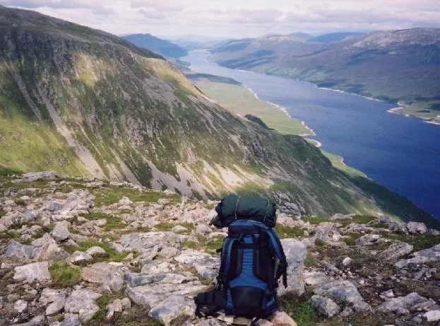
Aberchalder in Scotland Islands, United Kingdom.

Jonathan Billinger — CC BY-SA 2.0 via Wikimedia Commons licence
Plan your visit
- Typical visit
- 1 h–2.5 h
- Free entry
- Dog-friendly
About
Aberchalder is a place of interest in Scotland Islands, United Kingdom — drawn from open-data sources for visitor reference. See the linked Wikipedia article for the full description.
Photo gallery
From the Wikipedia article
Aberchalder (Gaelic: Obar Chaladair) is a small settlement and estate at the northern end of Loch Oich in the Scottish Highlands and is in the Highland council area of Scotland. It lies on the A82 road and is situated in two parishes, Boleskine and Kilmonivaig. Fort Augustus is within 5 mi (8.0 km).
Excerpt from Wikipedia under CC BY-SA 4.0. See the source article linked in Sources below.
Background
History
Aberchalder was owned at one time by Randolph, Earl of Moray, then passing to Dunbar, Earl of Moray, and later to the Clan Fraser of Lovat, and still later to Glengarry. On 27 August 1745 the MacDonald of Glencoe's and Glengarry's Regiment joined the Jacobite Army at Aberchalder. In 1812, residents of Aberchalder produced a petition which led to the building of a road connecting the eastern part of the Loch Oich to Loch Hourn. A swing bridge is located in the area, the Caledonian Canal and locks (Cullochy Lock), built upon rocks. The locks were afforded to allow a depth of over 20 feet over its upper-gate sills. The canal flooded during the great floods of November 1834, rising some 27 feet…
Sourced from Wikipedia under CC BY-SA 4.0.
- Coordinates
- 57.0901, -4.7403
- District
- Highland
- Postcode
- PH35 4HN
- Parliamentary constituency
- Inverness, Skye and West Ross-shire
Sources
- wikidata: Q3431722 (CC0)
- wikipedia: Aberchalder (CC BY-SA 4.0)
Other places nearby
Aberchalder Lodge
Natural landmarks · 0.2 km

Bridge of Oich
Historic bridges · 0.5 km

Oich Bridge
Historic bridges · 0.5 km

Cullochy Lock
Canal locks · 0.9 km

Aberchalder railway station
Heritage railway stations · 1.0 km

Great Glen Fault
Natural landmarks · 1.6 km

Meall Mor
Mountains & hills · 1.7 km

Eilean Drynachan, Crannog
Archaeological sites · 1.9 km

Leitirfearn Trailblazer Rest
Campsites · 2.3 km

Caledonian Canal
Canals · 2.5 km

Meall a' Cholumain
Mountains & hills · 2.6 km

River Garry
Reservoirs & lochs · 2.7 km
Nearby
📷 3Natural landmarks · Scottish Highlands
Aberchalder Lodge
Aberchalder Lodge in Scotland Islands, United Kingdom.
📷 4Historic bridges · Scottish Highlands
Bridge of Oich
Bridge of Oich is a historic bridge in the United Kingdom.
📷 5Historic bridges · Scottish Highlands
Oich Bridge
Oich Bridge — category B listed building-listed bridge in scotland-highlands, United Kingdom.
📷 3Canal locks · Scottish Highlands
Cullochy Lock
Cullochy Lock — lock on the Caledonian Canal in Highland, Scotland, UK.
📷 3Heritage railway stations · Scottish Highlands
Aberchalder railway station
Aberchalder railway station in Scotland Islands, United Kingdom.
📷 4Natural landmarks · Scottish Highlands
Great Glen Fault
Great Glen Fault in Scotland Islands, United Kingdom.
Where to eat & stay near Aberchalder
Places to stay
📷 5Campsites · Scottish Highlands
Leitirfearn Trailblazer Rest
Leitirfearn Trailblazer Rest — a campsite in scotland highlands.
 📷 5
📷 5Hotels · Scottish Highlands
Glengarry Castle Hotel
Glengarry Castle Hotel — a hotel in scotland highlands.
 📷 5
📷 5 📷 7
📷 7Hotels · Scottish Highlands
Invergarry Hotel
Invergarry Hotel — a hotel in scotland highlands.
 📷 5
📷 5Hostels · Scottish Highlands
Saddle Mountain Hostel
Saddle Mountain Hostel — a hostel in scotland highlands.
 📷 5
📷 5Campsites · Scottish Highlands
Faichemard Farm Caravan & Camping
Faichemard Farm Caravan & Camping — a campsite in scotland highlands.
Places to eat & drink
 📷 5
📷 5Historic pubs · Scottish Highlands
The Lovat Hotel
The Lovat Hotel in Scotland Highlands, United Kingdom.
More places in this region
 Flagship📷 3
Reservoirs & lochs · Scottish Highlands
Loch Ericht
Loch Ericht — lake in Perth and Kinross, and Highland, Scotland, UK, outflows to River Ericht.
 Flagship📷 3
Reservoirs & lochs · Scottish Highlands
Loch Shin
Loch Shin — reservoir in Highland, Scotland, UK, outflows to the River Shin.
 📷 4
📷 4Reservoirs & lochs · Scottish Highlands
Backwater Reservoir
Backwater Reservoir — lake in Angus, Scotland, UK.
 📷 3
📷 3Reservoirs & lochs · Scottish Highlands
Blackwater Reservoir
Blackwater Reservoir — reservoir in Highland, Scotland, UK, outflows to the River Leven.
Frequently asked questions
- Where is Aberchalder?
- Aberchalder is in the Scottish Highlands, United Kingdom (postcode PH35 4HN).
- What is Aberchalder?
- Aberchalder in Scotland Islands, United Kingdom.
- How do I get to Aberchalder?
- Drivers can use postcode PH35 4HN.
- Is Aberchalder free to visit?
- Yes, Aberchalder is free to enter.
- How do I get to Aberchalder?
- Drivers can navigate to postcode PH35 4HN. It sits within the Inverness, Skye and West Ross-shire parliamentary constituency.