
Villages · North East England
Wall Houses
In or near Matfen.
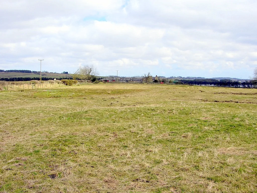
Wall Houses — a village in scotland lowlands.

Peter Wood — CC BY-SA 2.0 via Wikimedia Commons licence

Plan your visit
- Typical visit
- 1 h–2 h
- Nearest railway station
- Prudhoe · 6.9 km
About
A British village — settlements of this size traditionally cluster a green, parish church, pub and post office around historic land routes.
Photo gallery
Protected designations
- Site of Special Scientific Interest: Northumberland Shore SSSI
Designations sourced from Natural England open data under OGL v3.
Place summary
Wall Houses is a village located in the Scottish Lowlands. It is characterised by its rural setting and traditional architecture. The area offers a glimpse into local life, with a mix of historical and modern influences. Visitors can expect a tranquil environment typical of the Lowlands, suitable for exploring the surrounding countryside.
AI-generated from the structured facts on this page (operator, designation, listing, era). Not a substitute for visiting.
- Coordinates
- 55.0108, -1.9402
- District
- Northumberland
- Parish
- Matfen
- Postcode
- NE45 5PU
- Parliamentary constituency
- Hexham
- Nearest railway station
- Prudhoe — 6.9 km
Sources
- manual: geonames-2634870 (CC BY 4.0)
Other places nearby

Milecastle 19
Archaeological sites · 0.6 km
Roman temple in Matfen
Follies · 0.6 km

Milecastle 18
Archaeological sites · 0.9 km

Hadrian's Wall and vallum between the B6309 and the B6321 in wall miles 16, 17 and 18
Archaeological sites · 1.2 km

Shildon Hill
Vineyards · 1.6 km

Wellhouse Farm Caravan Park
Caravan parks · 1.9 km
Wellhouse Farm Camping site
Campsites · 1.9 km

Milecastle 20
Roman villas · 2.0 km

Standing stone with cup markings, 50m south of Standing Stone Farm
Windmills · 2.1 km

Milecastle 17
Reservoirs & lochs · 2.4 km
Whittle Dene reservoirs
Reservoirs & lochs · 2.6 km
Welton medieval settlement, open field system and fishponds
Archaeological sites · 2.6 km
Nearby
📷 4Archaeological sites · North East England
Milecastle 19
Milecastle 19 in England North East, United Kingdom.
📷 5Follies · North East England
Roman temple in Matfen
Roman temple in Matfen — a temple folly in scotland-lowlands, United Kingdom.
📷 4Archaeological sites · North East England
Milecastle 18
Milecastle 18 in England North East, United Kingdom.
📷 3Archaeological sites · North East England
Hadrian's Wall and vallum between the B6309 and the B6321 in wall miles 16, 17 and 18
Hadrian's Wall and vallum between the B6309 and the B6321 in wall miles 16, 17 and 18 — archaeological site in Horsley, Northumberland, England, UK.
📷 5Vineyards · North East England
Shildon Hill
Shildon Hill — a UK vineyard in scotland lowlands, producing English or Welsh wine from cool-climate grape varieties.
📷 5Caravan parks · North East England
Wellhouse Farm Caravan Park
Wellhouse Farm Caravan Park — a caravan park in scotland lowlands.
Where to eat & stay near Wall Houses
Places to stay
📷 5Caravan parks · North East England
Wellhouse Farm Caravan Park
Wellhouse Farm Caravan Park — a caravan park in scotland lowlands.
📷 5Campsites · North East England
Wellhouse Farm Camping site
Wellhouse Farm Camping site — a campsite in scotland lowlands.
 📷 5
📷 5B&Bs · North East England
Duke Of Wellington Inn
Duke Of Wellington Inn — a bed-and-breakfast in scotland lowlands.
 📷 5
📷 5Caravan parks · North East England
High Hermitage Caravan Park
High Hermitage Caravan Park — a caravan park in scotland lowlands.
📷 5Campsites · North East England
High Hermitage Caravan Park
High Hermitage Caravan Park — a campsite in scotland lowlands.
 📷 5
📷 5Campsites · North East England
Dilston Scout Camp
Dilston Scout Camp — a campsite in scotland lowlands.
Places to eat & drink
 📷 5
📷 5 📷 5
📷 5Historic pubs · North East England
The Crown And Anchor
The Crown And Anchor in Scotland Lowlands, United Kingdom.
 📷 7
📷 7Historic pubs · North East England
The Vicars Pele
The Vicars Pele in Scotland Lowlands, United Kingdom.
 📷 5
📷 5Historic pubs · North East England
Wellington Inn
Wellington Inn in Scotland Lowlands, United Kingdom.
 📷 4
📷 4 📷 6
📷 6More places in this region
 📷 5
📷 5 📷 5
📷 5 📷 5
📷 5 📷 5
📷 5Frequently asked questions
- Where is Wall Houses?
- Wall Houses is in the Scottish Lowlands, United Kingdom (postcode NE45 5PU), in the parish of Matfen.
- What is Wall Houses?
- Wall Houses — a village in scotland lowlands.
- How do I get to Wall Houses?
- The nearest railway station is Prudhoe, about 6.9 km away. Drivers can use postcode NE45 5PU.
- Is Wall Houses a protected site?
- Yes — Wall Houses is part of the Northumberland Shore SSSI Site of Special Scientific Interest.
- How do I get to Wall Houses?
- The nearest railway station is Prudhoe, about 6.9 km away. Drivers can navigate to postcode NE45 5PU.