
Towns & cities · North East England
Matfen
Matfen — village in Northumberland, England, UK.
.jpg?width=1200)
Wikimedia Commons contributors — see linked file page for photographer and licence licence
.jpg)
Plan your visit
- Typical visit
- 3 h–6 h
- Nearest railway station
- Corbridge · 9.3 km
- Free entry
- Family-friendly
- Dog-friendly
About
Matfen is a town, city, village or settlement in the United Kingdom. Recent population estimates put it at around 495 people. Wikidata describes it as: "village in Northumberland, England, UK". Coordinates: 55.0410°, -1.9540°.
Photo gallery
Protected designations
- Site of Special Scientific Interest: Northumberland Shore SSSI
Designations sourced from Natural England open data under OGL v3.
From the Wikipedia article
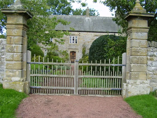
Matfen is a village and a civil parish in Northumberland, England, near the town of Hexham and the city of Newcastle upon Tyne. It is an example of a 19th-century planned estate village. It was the birthplace of the 7th Premier of British Columbia, William Smithe. In 2001 it had a population of 495.
Excerpt from Wikipedia under CC BY-SA 4.0. See the source article linked in Sources below.
Background
History
Matfen is a few miles north of Hadrian's Wall. About halfway between the two there is a prehistoric standing stone called Stob Stone, adjacent to Standing Stone Farmhouse. The stone is about seven feet high and decorated with cup marks. The place-name Matfen is first attested in the Pipe Rolls for 1159, where it appears as Matefen. The name means Matta's fen. The civil parish was formed in 1955 from East Matfen, Fenwick, Ingoe, Kearsley, Ryal and West Matfen.
Sourced from Wikipedia under CC BY-SA 4.0.
- Coordinates
- 55.0410, -1.9540
- District
- Northumberland
- Parish
- Matfen
- Postcode
- NE20 0RL
- Parliamentary constituency
- Hexham
- Population
- 495
- Nearest railway station
- Corbridge — 9.3 km
Sources
- wikidata: Q1925697 (CC0)
- wikipedia: Matfen (CC BY-SA 4.0)
- commons: Matfen village green (geograph 2374157).jpg (CC BY-SA 4.0)
Other places nearby

Matfen War Memorial
Memorials & monuments · 0.0 km

Bridge At West End Of Village Green
Historic bridges · 0.1 km

Matfen Hall
Historic houses · 0.2 km

Bridge Over River Pont Approx 300 Yards South-West Of Matfen Hall
Historic bridges · 0.5 km

Standing stone with cup markings, 50m south of Standing Stone Farm
Windmills · 1.4 km

Windmill C 100 Yards West Of Whittington Mill
Windmills · 2.3 km
Whittington Mill
Windmills · 2.3 km

Great Whittington
Towns & cities · 2.7 km

Bridge Approx 200 Yards North-East Of Fenwick Shield Farmhouse
Historic bridges · 2.8 km

Fenwick Tower
Historic houses · 2.9 km

Ryal
Historic churches · 3.0 km

South Hall
Historic houses · 3.0 km
Matfen is a village located in the Scottish Lowlands with a population of 495. Our guide lists N attractions within reach.
At a glance
- Population
- 495
- Constituency
- Hexham
- Top categories near here
Things to see in Matfen
29 attractions within 12 km — showing the 24 most editorially-significant. Full guide: things to do in Matfen →
 📷 3
📷 3Natural landmarks · North East England
Great Bavington
Great Bavington in England North East, United Kingdom.
 📷 3
📷 3Natural landmarks · North East England
Little Bavington
Little Bavington in England North East, United Kingdom.
 📷 3
📷 3Wildlife reserves · North East England
Bavington Crags
Bavington Crags in England North East, United Kingdom.
 📷 4
📷 4Archaeological sites · North East England
Milecastle 18
Milecastle 18 in England North East, United Kingdom.
 📷 4
📷 4Archaeological sites · North East England
Milecastle 19
Milecastle 19 in England North East, United Kingdom.

Other places · North East England
Bavington
Bavington in England North East, United Kingdom.
📷 3Historic houses · North East England
Fenwick Tower
Fenwick Tower in England North East, United Kingdom.
📷 4Historic houses · North East England
Matfen Hall
Matfen Hall in England North East, United Kingdom.
📷 5 📷 4
📷 4Historic churches · North East England
Stamfordham
Stamfordham in England North East, United Kingdom.
 📷 3
📷 3Historic houses · North East England
Bavington Hall
Bavington Hall — seventeenth-century country house at Little Bavington, Northumberland, England, UK.
 📷 3
📷 3Historic churches · North East England
Church of St Mary
Church of St Mary — historic church in Stamfordham, Northumberland, England, UK.
 📷 3
📷 3Archaeological sites · North East England
Hadrian's Wall and vallum between the B6309 and the B6321 in wall miles 16, 17 and 18
Hadrian's Wall and vallum between the B6309 and the B6321 in wall miles 16, 17 and 18 — archaeological site in Horsley, Northumberland, England, UK.
.jpg?width=1200) 📷 3
📷 3Historic houses · North East England
Hawkwell House
Hawkwell House — house in Stamfordham, Northumberland, England, UK.
 Flagship📷 3
Stately homes · North East England
Kirkheaton Manor
Kirkheaton Manor — house in Kirkheaton, Northumberland, England, UK.
📷 3Historic houses · North East England
South Hall
South Hall — house in Matfen, Northumberland, England, UK.
📷 3Historic bridges · North East England
Bridge At West End Of Village Green
Bridge At West End Of Village Green — Grade II listed building-listed bridge in scotland-lowlands, United Kingdom.
📷 3Historic bridges · North East England
Bridge Over River Pont Approx 300 Yards South-West Of Matfen Hall
Bridge Over River Pont Approx 300 Yards South-West Of Matfen Hall — Grade II listed building-listed bridge in scotland-lowlands, United Kingdom.
📷 2Historic bridges · North East England
Bridge Approx 200 Yards North-East Of Fenwick Shield Farmhouse
Bridge Approx 200 Yards North-East Of Fenwick Shield Farmhouse — Grade II listed building-listed bridge in scotland-lowlands, United Kingdom.
📷 3Memorials & monuments · North East England
Matfen War Memorial
Matfen War Memorial — Grade II listed building-listed memorial in scotland-lowlands, United Kingdom.
📷 5Follies · North East England
Roman temple in Matfen
Roman temple in Matfen — a temple folly in scotland-lowlands, United Kingdom.
📷 5Windmills · North East England
Standing stone with cup markings, 50m south of Standing Stone Farm
Standing stone with cup markings, 50m south of Standing Stone Farm — a post mill in scotland-lowlands, United Kingdom.
 📷 5
📷 5Windmills · North East England
Standing stone with cup markings, 230m south of Sandyway Heads
Standing stone with cup markings, 230m south of Sandyway Heads — a post mill in scotland-lowlands, United Kingdom.
 📷 5
📷 5Literary houses · North East England
Blackheddon Farmhouse
Blackheddon Farmhouse — a literary house museum in scotland lowlands.
Nearby
📷 3Memorials & monuments · North East England
Matfen War Memorial
Matfen War Memorial — Grade II listed building-listed memorial in scotland-lowlands, United Kingdom.
📷 3Historic bridges · North East England
Bridge At West End Of Village Green
Bridge At West End Of Village Green — Grade II listed building-listed bridge in scotland-lowlands, United Kingdom.
📷 4Historic houses · North East England
Matfen Hall
Matfen Hall in England North East, United Kingdom.
📷 3Historic bridges · North East England
Bridge Over River Pont Approx 300 Yards South-West Of Matfen Hall
Bridge Over River Pont Approx 300 Yards South-West Of Matfen Hall — Grade II listed building-listed bridge in scotland-lowlands, United Kingdom.
📷 5Windmills · North East England
Standing stone with cup markings, 50m south of Standing Stone Farm
Standing stone with cup markings, 50m south of Standing Stone Farm — a post mill in scotland-lowlands, United Kingdom.
📷 3Windmills · North East England
Windmill C 100 Yards West Of Whittington Mill
Windmill C 100 Yards West Of Whittington Mill — Grade II listed building-listed windmill in scotland-lowlands, United Kingdom.
Where to eat & stay near Matfen
Places to stay
 📷 5
📷 5Caravan parks · North East England
Wellhouse Farm Caravan Park
Wellhouse Farm Caravan Park — a caravan park in scotland lowlands.
📷 5Campsites · North East England
Wellhouse Farm Camping site
Wellhouse Farm Camping site — a campsite in scotland lowlands.
 📷 5
📷 5B&Bs · North East England
Duke Of Wellington Inn
Duke Of Wellington Inn — a bed-and-breakfast in scotland lowlands.
 📷 5
📷 5Caravan parks · North East England
Well House CAMC CL
Well House CAMC CL — a caravan park in scotland lowlands.
 📷 5
📷 5Caravan parks · North East England
High Hermitage Caravan Park
High Hermitage Caravan Park — a caravan park in scotland lowlands.
📷 5Campsites · North East England
High Hermitage Caravan Park
High Hermitage Caravan Park — a campsite in scotland lowlands.
Places to eat & drink
 📷 5
📷 5 📷 7
📷 7Historic pubs · North East England
The Vicars Pele
The Vicars Pele in Scotland Lowlands, United Kingdom.
 📷 5
📷 5Historic pubs · North East England
The Crown And Anchor
The Crown And Anchor in Scotland Lowlands, United Kingdom.
 📷 5
📷 5Historic pubs · North East England
Wellington Inn
Wellington Inn in Scotland Lowlands, United Kingdom.
 📷 6
📷 6 📷 5
📷 5More towns in this region
 Flagship📷 3
Towns & cities · North East England
Newby
Newby — village and civil parish in Hambleton, North Yorkshire, England, UK.
 📷 5
📷 5Towns & cities · North East England
Archdeacon Newton
Archdeacon Newton — village and civil parish in County Durham, England, UK.
 📷 3
📷 3Towns & cities · North East England
Boosbeck
Boosbeck — village in North Yorkshire, England, UK.
 📷 3
📷 3Frequently asked questions
- Where is Matfen?
- Matfen is in the Scottish Lowlands, United Kingdom (postcode NE20 0RL), in the parish of Matfen.
- What is Matfen?
- Matfen — village in Northumberland, England, UK.
- How do I get to Matfen?
- The nearest railway station is Corbridge, about 9.3 km away. Drivers can use postcode NE20 0RL.
- Is Matfen a protected site?
- Yes — Matfen is part of the Northumberland Shore SSSI Site of Special Scientific Interest.
- Is Matfen free to visit?
- Yes, Matfen is free to enter.
- How do I get to Matfen?
- Drivers can navigate to postcode NE20 0RL. It sits within the Hexham parliamentary constituency.