
Towns & cities · West Midlands
Tixall
Tixall — village in Staffordshire, England, UK.

Wikimedia Commons licence
Plan your visit
- Typical visit
- 3 h–6 h
- Nearest railway station
- Amerton Station · 5.3 km
- Free entry
- Family-friendly
- Dog-friendly
Getting there & planning your visit
To visit Tixall, you can reach it via Amerton Station, which is 5.3 km away. The postcode for Tixall is ST18 0XT. Entry to Tixall is free.
About
Tixall is a town, city, village or settlement in the United Kingdom. Recent population estimates put it at around 192 people. Wikidata describes it as: "village in Staffordshire, England, UK". Coordinates: 52.8028°, -2.0341°.
Photo gallery
Protected designations
- Area of Outstanding Natural Beauty: Cannock Chase
Designations sourced from Natural England open data under OGL v3.
From the Wikipedia article
Tixall is a small village and civil parish in the Stafford district, in the English county of Staffordshire lying on the western side of the Trent valley between Rugeley and Stone, Staffordshire and roughly 4 miles east of Stafford. The population of the civil parish taken at the 2011 census was 239. The place-name 'Tixall' is first attested in the Domesday Book of 1086, where it appears as Ticheshale. Deriving from Old English, the name means 'the hollow of the goats'. It is a fairly elongated village lying to the west of Great Haywood and just north of the sprawling Shugborough estate, the River Sow forming the natural boundary between the two, which joins the Trent on the Shugborough estate a mile or so east of Tixall. The village has benefited substantially from its close proximity to such affluent estates as Shugborough to the south and Sandon Hall and Ingestre Hall to the north, homes of the Earl of Lichfield, the Earl of Harrowby and the Earl of Shrewsbury respectively. Also passing nearby to the east and through the Trent valley is the Staffordshire and Worcestershire Canal, which expands into a body of water called Tixall Wide near to Tixall Gatehouse. Tixall Hall was the home of the Aston family, who held the title Lord Aston of Forfar. They were staunch Roman Catholics and Tixall was the centre of the local Catholic community. During the Popish Plot Tixall briefly became notorious as the centre of the alleged conspiracy to kill King Charles II, and many victims of the plot such as William Howard, 1st Viscount Stafford were questioned intensively as to their actions while at Tixall. Tixall is served hourly by Chaserider bus service 828, Monday to Saturday. This was formerly Arriva service 825.
Excerpt from Wikipedia under CC BY-SA 4.0. See the source article linked in Sources below.
- Coordinates
- 52.8028, -2.0341
- County
- Staffordshire
- District
- Stafford
- Parish
- Tixall
- Postcode
- ST18 0XT
- Parliamentary constituency
- Stone, Great Wyrley and Penkridge
- Population
- 192
- Nearest railway station
- Amerton Station — 5.3 km
Sources
Other places nearby

Tixall Gatehouse
Historic houses · 0.2 km

Tixall Wide
Natural landmarks · 0.6 km

Way for the Millennium
Military museums · 0.7 km

Dark Lantern
Memorials & monuments · 1.1 km

Shugborough
Villages · 1.2 km

Holdiford Bridge (Over River Sow)
Historic bridges · 1.3 km

Shugborough Servants' Quarters
Museums · 1.4 km

Staffordshire County Museum
Museums · 1.4 km

The Lichfield Apartments
Natural landmarks · 1.4 km

Shugborough Hall
Historic houses · 1.5 km

Shepherd's Monument
Public art & sculpture · 1.5 km
Shugborough inscription
Abbeys & priories · 1.5 km
Tixall is a charming town located in Staffordshire, within the West Midlands region. Visitors can explore the historic Tixall Gatehouse and the natural beauty of Tixall Wide. The area also offers cultural interest at Milford museum and the Church of St Mary in Ingestre.
At a glance
- Population
- 192
- Administrative county
- Staffordshire
- Constituency
- Stone, Great Wyrley and Penkridge
Things to see in Tixall
13 attractions within 12 km. Full guide: things to do in Tixall →
 📷 3
📷 3Archaeological sites · West Midlands
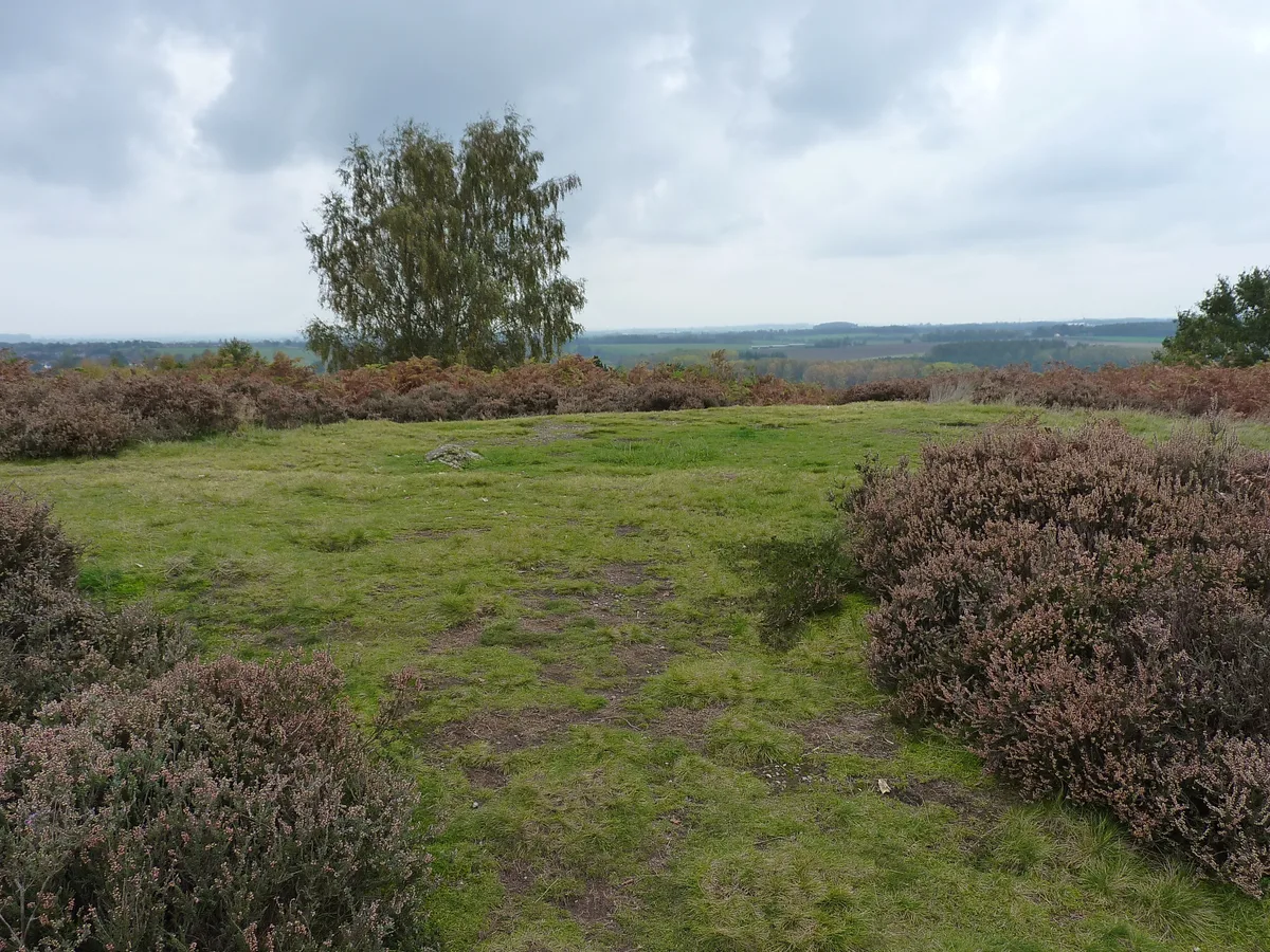
Saucer barrow on Spring Hill
Saucer barrow on Spring Hill — archaeological site in Berkswich, Stafford, England, UK.
📷 3 📷 3
📷 3Burial mounds & barrows · West Midlands
Saucer barrow
Saucer barrow — a burial mound in england-west-midlands, United Kingdom.
📷 4Historic houses · West Midlands
Tixall Gatehouse
Tixall Gatehouse — a Grade I-listed historic house in england-west-midlands, United Kingdom.
 📷 3
📷 3Historic churches · West Midlands
Church of St Mary, Ingestre
Church of St Mary, Ingestre — Grade I listed building-listed church in england-west-midlands, United Kingdom.
📷 3Historic bridges · West Midlands
Holdiford Bridge (Over River Sow)
Holdiford Bridge (Over River Sow) — Grade II listed building-listed bridge in england-west-midlands, United Kingdom.
📷 3Memorials & monuments · West Midlands
Dark Lantern
Dark Lantern — a memorial in england-west-midlands, United Kingdom.
📷 3Memorials & monuments · West Midlands
Hadrian's Arch
Hadrian's Arch — a memorial in england-west-midlands, United Kingdom.
 📷 5
📷 5Museums · West Midlands
Milford, Staffordshire
Milford is a village in the county of Staffordshire, England. It lies at the edge of Cannock Chase, on the A513 road between Stafford and Rugeley. Just to the north of the village is the River Sow.
📷 5Military museums · West Midlands
Way for the Millennium
Way for the Millennium — a military museum in england west midlands.
 📷 5
📷 5 📷 5
📷 5Mountains & hills · West Midlands
Oat Hill
Oat Hill — mountain in england west midlands. Elevation: 161 m.
 📷 5
📷 5Mountains & hills · West Midlands
Satnall Hill
Satnall Hill — mountain in england west midlands. Elevation: 151 m.
Nearby
📷 4Historic houses · West Midlands
Tixall Gatehouse
Tixall Gatehouse — a Grade I-listed historic house in england-west-midlands, United Kingdom.
📷 3📷 5Military museums · West Midlands
Way for the Millennium
Way for the Millennium — a military museum in england west midlands.
📷 3Memorials & monuments · West Midlands
Dark Lantern
Dark Lantern — a memorial in england-west-midlands, United Kingdom.
📷 5📷 3Historic bridges · West Midlands
Holdiford Bridge (Over River Sow)
Holdiford Bridge (Over River Sow) — Grade II listed building-listed bridge in england-west-midlands, United Kingdom.
Where to eat & stay near Tixall
Places to stay
 📷 5
📷 5Caravan parks · West Midlands
Green Man Caravan Site
Green Man Caravan Site — a caravan park in england east midlands.
 📷 5
📷 5Campsites · West Midlands
Spring Slade Lodge
Spring Slade Lodge — a campsite in england west midlands.
 📷 5
📷 5Caravan parks · West Midlands
Silvertrees Caravan Park
Silvertrees Caravan Park — a caravan park in england east midlands.
 📷 5
📷 5Caravan parks · West Midlands
Tackeroo Caravan Site
Tackeroo Caravan Site — a caravan park in england west midlands.
 📷 5
📷 5Caravan parks · West Midlands
Cannock Chase Camping and Caravanning Club
Cannock Chase Camping and Caravanning Club — a caravan park in england east midlands.
 📷 5
📷 5Caravan parks · West Midlands
Red Lion Farm Caravan Park
Red Lion Farm Caravan Park — a caravan park in england west midlands.
Places to eat & drink
 📷 5
📷 5Historic pubs · West Midlands
Shrewsbury Arms
Shrewsbury Arms in England West Midlands, United Kingdom.
 📷 5
📷 5 📷 5
📷 5Historic pubs · West Midlands
The Chains Public House
The Chains Public House in England West Midlands, United Kingdom.
 📷 5
📷 5Historic pubs · West Midlands
Eagle Inn Public House
Eagle Inn Public House in England West Midlands, United Kingdom.
 📷 7
📷 7 📷 7
📷 7More towns in this region
 📷 5
📷 5Towns & cities · West Midlands
Colton
Colton — village and civil parish in Lichfield District, Staffordshire, England.
 📷 3
📷 3Towns & cities · West Midlands
Hoar Cross
Hoar Cross — village in Staffordshire, England, UK.
 Flagship📷 3
 Flagship📷 3
Frequently asked questions
- Where is Tixall?
- Tixall is in Staffordshire, the West Midlands, United Kingdom (postcode ST18 0XT), in the parish of Tixall.
- What is Tixall?
- Tixall — village in Staffordshire, England, UK.
- How do I get to Tixall?
- The nearest railway station is Amerton Station, about 5.3 km away. Drivers can use postcode ST18 0XT.
- Is Tixall a protected site?
- Yes — Tixall is part of the Cannock Chase National Landscape (AONB).
- Is Tixall free to visit?
- Yes, Tixall is free to enter.
- How do I get to Tixall?
- The nearest railway station is Amerton Station, about 5.3 km away. Drivers can navigate to postcode ST18 0XT.