
Natural landmarks · West Midlands
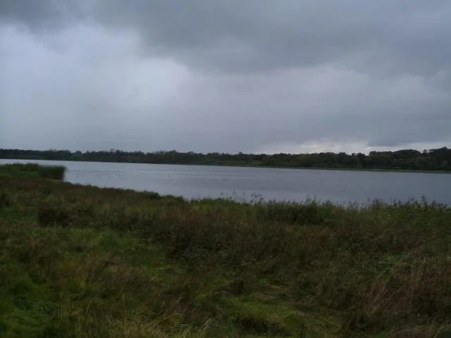
Tixall Wide
In or near Tixall.
Tixall Wide — lake in the United Kingdom.

Wikimedia Commons licence
Plan your visit
- Typical visit
- 1 h–2 h
- Nearest railway station
- Amerton Station · 5.2 km
- Free entry
- Dog-friendly
Getting there & planning your visit
Tixall Wide is located in Stafford, Staffordshire, with the postcode ST18 0XJ. The nearest railway station is Amerton Station, which is 5.2 km away. Entry to Tixall Wide is free.
About
Tixall Wide is a named natural landmark in the United Kingdom. Wikidata describes it as: "lake in the United Kingdom". Coordinates: 52.8020°, -2.0250°.
Photo gallery
Protected designations
- Site of Special Scientific Interest: Rawbones Meadow SSSI
- Area of Outstanding Natural Beauty: Cannock Chase
Designations sourced from Natural England open data under OGL v3.
From the Wikipedia article
Tixall Wide, also known as Tixall Broad or The Broad Water, is a body of water that forms part of the Staffordshire and Worcestershire Canal near Tixall in Staffordshire, England, to the south of the former Tixall Hall. The lake was probably created during the construction of the canal in 1771. At that time, the hall was owned by Thomas Clifford, the fourth son of Hugh Clifford, 3rd Baron Clifford of Chudleigh, and the grounds had been designed on the advice of the landscape architect Lancelot "Capability" Brown. It is said Clifford "gave permission for the canal to pass through his land on the condition that it was made ... wide enough to look like a lake from the house". and thus in order not to spoil the view. The towpath is a very popular overnight mooring spot. Boaters moored here, or just passing through, have an excellent view of the magnificent Elizabethan gatehouse that is the only remaining part of Tixall Hall. It has also been suggested that the canal was routed to utilise a lake that already existed, in which the angler and writer Izaak Walton had learned to fish.
Excerpt from Wikipedia under CC BY-SA 4.0. See the source article linked in Sources below.
- Coordinates
- 52.8020, -2.0250
- County
- Staffordshire
- District
- Stafford
- Parish
- Tixall
- Postcode
- ST18 0XJ
- Parliamentary constituency
- Stone, Great Wyrley and Penkridge
- Nearest railway station
- Amerton Station — 5.2 km
Sources
- wikidata: Q7363609 (CC0)
- wikipedia: Tixall Wide (CC BY-SA 4.0)
Other places nearby

Way for the Millennium
Military museums · 0.1 km

Tixall Gatehouse
Historic houses · 0.5 km

Shugborough
Villages · 0.6 km

Tixall
Towns & cities · 0.6 km

Dark Lantern
Memorials & monuments · 0.8 km

Shugborough Servants' Quarters
Museums · 0.8 km

Staffordshire County Museum
Museums · 0.8 km

The Lichfield Apartments
Natural landmarks · 0.8 km

Shugborough Hall
Historic houses · 0.8 km

Shepherd's Monument
Public art & sculpture · 0.8 km
Shugborough inscription
Abbeys & priories · 0.8 km

Shepherd's Monument at Shugborough Hall
Memorials & monuments · 0.8 km
Nearby
📷 5Military museums · West Midlands
Way for the Millennium
Way for the Millennium — a military museum in england west midlands.
📷 4Historic houses · West Midlands
Tixall Gatehouse
Tixall Gatehouse — a Grade I-listed historic house in england-west-midlands, United Kingdom.
📷 5📷 5📷 3Memorials & monuments · West Midlands
Dark Lantern
Dark Lantern — a memorial in england-west-midlands, United Kingdom.
📷 3Museums · West Midlands
Shugborough Servants' Quarters
Shugborough Servants' Quarters — a museum in england-west-midlands, United Kingdom.
Where to eat & stay near Tixall Wide
Places to stay
 📷 5
📷 5Caravan parks · West Midlands
Green Man Caravan Site
Green Man Caravan Site — a caravan park in england east midlands.
 📷 5
📷 5Campsites · West Midlands
Spring Slade Lodge
Spring Slade Lodge — a campsite in england west midlands.
 📷 5
📷 5Caravan parks · West Midlands
Silvertrees Caravan Park
Silvertrees Caravan Park — a caravan park in england east midlands.
 📷 5
📷 5Caravan parks · West Midlands
Tackeroo Caravan Site
Tackeroo Caravan Site — a caravan park in england west midlands.
 📷 5
📷 5Caravan parks · West Midlands
Cannock Chase Camping and Caravanning Club
Cannock Chase Camping and Caravanning Club — a caravan park in england east midlands.
 📷 5
📷 5Caravan parks · West Midlands
Red Lion Farm Caravan Park
Red Lion Farm Caravan Park — a caravan park in england west midlands.
Places to eat & drink
 📷 5
📷 5Historic pubs · West Midlands
Shrewsbury Arms
Shrewsbury Arms in England West Midlands, United Kingdom.
 📷 5
📷 5 📷 5
📷 5Historic pubs · West Midlands
The Chains Public House
The Chains Public House in England West Midlands, United Kingdom.
 📷 5
📷 5Historic pubs · West Midlands
Eagle Inn Public House
Eagle Inn Public House in England West Midlands, United Kingdom.
 📷 7
📷 7 📷 7
📷 7More natural landmarks in this region
 📷 5
📷 5Natural landmarks · West Midlands
Abbots Bromley School
Abbots Bromley School — a school heritage in england-east-midlands, United Kingdom.
 📷 5
📷 5Natural landmarks · West Midlands
Fair Oak Academy
Fair Oak Academy — a school heritage in england-east-midlands, United Kingdom.
 📷 5
📷 5Natural landmarks · West Midlands
The Hart School
The Hart School — a school heritage in england-east-midlands, United Kingdom.
 📷 3
📷 3Natural landmarks · West Midlands
Aqualate Mere
Aqualate Mere is a natural landmark in the United Kingdom.
Frequently asked questions
- Where is Tixall Wide?
- Tixall Wide is in Staffordshire, the West Midlands, United Kingdom (postcode ST18 0XJ), in the parish of Tixall.
- What is Tixall Wide?
- Tixall Wide — lake in the United Kingdom.
- How do I get to Tixall Wide?
- The nearest railway station is Amerton Station, about 5.2 km away. The nearest town is Tixall. Drivers can use postcode ST18 0XJ.
- Is Tixall Wide a protected site?
- Yes — Tixall Wide is part of the Rawbones Meadow SSSI Site of Special Scientific Interest and the Cannock Chase National Landscape (AONB).
- Is Tixall Wide free to visit?
- Yes, Tixall Wide is free to enter.
- How do I get to Tixall Wide?
- The nearest railway station is Amerton Station, about 5.2 km away. Drivers can navigate to postcode ST18 0XJ.