
Museums · West Midlands
Milford, Staffordshire
In or near Tixall.
Milford is a village in the county of Staffordshire, England. It lies at the edge of Cannock Chase, on the A513 road between Stafford and Rugeley. Just to the north of the village is the River Sow.

JThomas — CC BY-SA 2.0 via Wikimedia Commons licence

Plan your visit
- Typical visit
- 1.5 h–3 h
- Best time of year
- Year-round
- Nearest railway station
- Stafford · 5.7 km
- Family-friendly
- Limited wheelchair access
About
Milford is a village in the county of Staffordshire, England. It lies at the edge of Cannock Chase, on the A513 road between Stafford and Rugeley. Just to the north of the village is the River Sow.
Photo gallery
Protected designations
- Site of Special Scientific Interest: Cannock Chase SSSI
- Area of Outstanding Natural Beauty: Cannock Chase
Designations sourced from Natural England open data under OGL v3.
From the Wikipedia article
Milford is a village in the county of Staffordshire, England. It lies at the edge of Cannock Chase, on the A513 road between Stafford and Rugeley. Just to the north of the village is the River Sow.
Excerpt from Wikipedia under CC BY-SA 4.0. See the source article linked in Sources below.
Background
History
, Milford]] Milford was described as a "pleasant hamlet" by the 1851 History, Gazetteer and Directory of Staffordshire, it then being part of Baswich parish. There is no church, the church at Walton-on-the-Hill, Staffordshire being less than a mile away.
Visiting
The nearest railway station is in the town of Stafford, about four miles from Milford. Stafford station currently serves most inter-city services running on the West Coast Main Line Birmingham-Manchester route, as well as offering local services. Road access is by way of the A513 road. Milford is accessible by canal narrowboat, along the Staffordshire and Worcestershire Canal. There is a cycle path along the Staffordshire and Worcestershire Canal towpath, leading to the National Cycle Network National Route 5 that currently ends at Walton-on-the-Hill, but will be extended southwards to Birmingham.
Sourced from Wikipedia under CC BY-SA 4.0.
- Coordinates
- 52.7875, -2.0415
- County
- Staffordshire
- District
- Stafford
- Parish
- Berkswich
- Postcode
- ST17 0UR
- Parliamentary constituency
- Stone, Great Wyrley and Penkridge
- Nearest railway station
- Stafford — 5.7 km
Sources
- wikipedia: Milford, Staffordshire (CC BY-SA 4.0)
Other places nearby
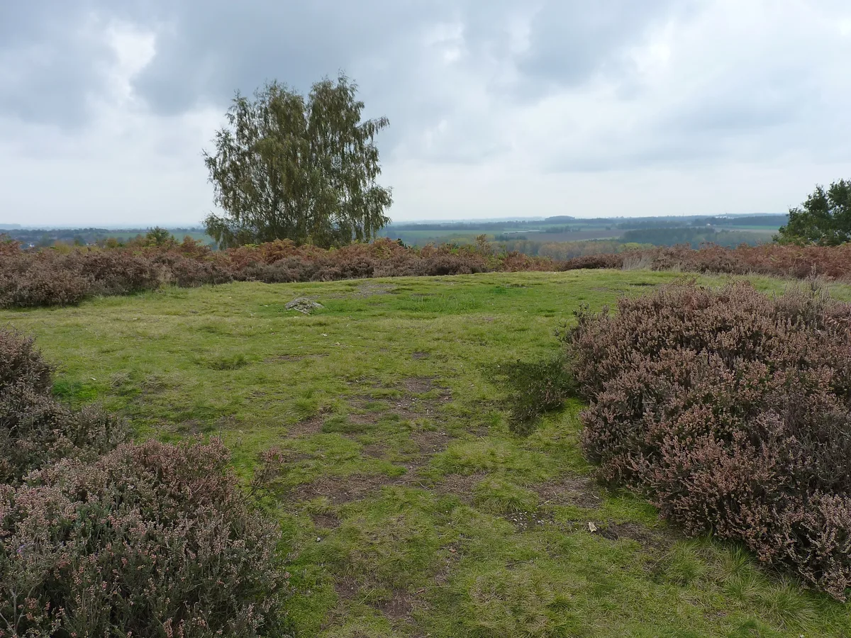
Saucer barrow on Spring Hill
Archaeological sites · 0.5 km

Saucer barrow
Burial mounds & barrows · 0.5 km

Holdiford Bridge (Over River Sow)
Historic bridges · 0.5 km

Milford Bridge, No.105, North Of Home Farm, Milford
Historic bridges · 0.6 km

Satnall Hill
Mountains & hills · 0.7 km

Milford
Villages · 0.7 km
Milford Hall
Manor houses · 0.8 km

Oat Hill
Mountains & hills · 0.9 km

Walton Bridge No 104
Historic bridges · 1.2 km

Hadrian's Arch
Memorials & monuments · 1.4 km
Dark Lantern
Memorials & monuments · 1.5 km

Berry Hill
Mountains & hills · 1.5 km
Nearby
📷 3Archaeological sites · West Midlands
Saucer barrow on Spring Hill
Saucer barrow on Spring Hill — archaeological site in Berkswich, Stafford, England, UK.
📷 3Burial mounds & barrows · West Midlands
Saucer barrow
Saucer barrow — a burial mound in england-west-midlands, United Kingdom.
📷 3Historic bridges · West Midlands
Holdiford Bridge (Over River Sow)
Holdiford Bridge (Over River Sow) — Grade II listed building-listed bridge in england-west-midlands, United Kingdom.
📷 3Historic bridges · West Midlands
Milford Bridge, No.105, North Of Home Farm, Milford
Milford Bridge, No.105, North Of Home Farm, Milford — Grade II listed building-listed bridge in england-west-midlands, United Kingdom.
📷 5Mountains & hills · West Midlands
Satnall Hill
Satnall Hill — mountain in england west midlands. Elevation: 151 m.
📷 5Where to eat & stay near Milford, Staffordshire
Places to stay
 📷 5
📷 5Campsites · West Midlands
Spring Slade Lodge
Spring Slade Lodge — a campsite in england west midlands.
 📷 5
📷 5Caravan parks · West Midlands
Tackeroo Caravan Site
Tackeroo Caravan Site — a caravan park in england west midlands.
 📷 5
📷 5Caravan parks · West Midlands
Silvertrees Caravan Park
Silvertrees Caravan Park — a caravan park in england east midlands.
 📷 5
📷 5Caravan parks · West Midlands
Green Man Caravan Site
Green Man Caravan Site — a caravan park in england east midlands.
 📷 5
📷 5Caravan parks · West Midlands
Cannock Chase Camping and Caravanning Club
Cannock Chase Camping and Caravanning Club — a caravan park in england east midlands.
 📷 5
📷 5Caravan parks · West Midlands
Red Lion Farm Caravan Park
Red Lion Farm Caravan Park — a caravan park in england west midlands.
Places to eat & drink
 📷 5
📷 5Historic pubs · West Midlands
Shrewsbury Arms
Shrewsbury Arms in England West Midlands, United Kingdom.
 📷 5
📷 5 📷 5
📷 5Historic pubs · West Midlands
The Chains Public House
The Chains Public House in England West Midlands, United Kingdom.
 📷 5
📷 5Historic pubs · West Midlands
Eagle Inn Public House
Eagle Inn Public House in England West Midlands, United Kingdom.
 📷 7
📷 7Historic pubs · West Midlands
The Littleton Arms
The Littleton Arms in England West Midlands, United Kingdom.
 📷 7
📷 7More museums in this region
 📷 3
📷 3Museums · West Midlands
Redfern Cottage
Redfern Cottage — a museum in england-east-midlands, United Kingdom.
 📷 3
📷 3Museums · West Midlands
Museum of Cannock Chase
Museum of Cannock Chase — a museum in england-east-midlands, United Kingdom.
 📷 5
📷 5Museums · West Midlands
Cannock Chase District
Cannock Chase is a designated Area of Outstanding Natural Beauty and National Landscape in Staffordshire, England. It gives its name to Cannock Chase District, a non-metropolitan local government dist
 📷 5
📷 5Museums · West Midlands
Uttoxeter
Uttoxeter — a museum in england-east-midlands, United Kingdom.
Frequently asked questions
- Where is Milford, Staffordshire?
- Milford, Staffordshire is in Staffordshire, the West Midlands, United Kingdom (postcode ST17 0UR), in the parish of Berkswich.
- What is Milford, Staffordshire?
- Milford is a village in the county of Staffordshire, England. It lies at the edge of Cannock Chase, on the A513 road between Stafford and Rugeley. Just to the north of the village is the River Sow.
- How do I get to Milford, Staffordshire?
- The nearest railway station is Stafford, about 5.7 km away. The nearest town is Tixall. Drivers can use postcode ST17 0UR.
- Is Milford, Staffordshire a protected site?
- Yes — Milford, Staffordshire is part of the Cannock Chase SSSI Site of Special Scientific Interest and the Cannock Chase National Landscape (AONB).
- How do I get to Milford, Staffordshire?
- The nearest railway station is Stafford, about 5.7 km away. Drivers can navigate to postcode ST17 0UR.