
Hill forts · South East England
The Sanctuary
In or near Avebury.
The Sanctuary — English prehistoric site.

Wikimedia Commons contributors — see linked file page for photographer and licence licence

Plan your visit
- Typical visit
- 1 h–2 h
- Nearest railway station
- Pewsey · 8.7 km
- Free entry
- Family-friendly
- Dog-friendly
- Limited wheelchair access
Getting there & planning your visit
To visit The Sanctuary, the nearest railway station is Pewsey, located 8.7 km away. Entry is free, but please note that wheelchair accessibility is limited. The postcode for sat-nav is SN8 4EY.
About
The Sanctuary is a hill fort in the United Kingdom. Heritage designation: scheduled monument. Owned by English Heritage. Managed by English Heritage. Part of Stonehenge, Avebury and Associated Sites. Wikidata describes it as: "English prehistoric site". Coordinates: 51.4112°, -1.8313°.
Photo gallery
See it from the streetimagery from 2026
Imagery © Mapillary contributors, CC BY-SA 4.0
From English Heritage
Begun in about 3000 BC as a complex circle of timber posts, later replaced by stones. Its function is still mystifies: human bone finds with food remains point to elaborate death rites and ceremonies.
Read more on the official property page.
Protected designations
- Area of Outstanding Natural Beauty: Cotswolds
- Area of Outstanding Natural Beauty: North Wessex Downs
Designations sourced from Natural England open data under OGL v3.
From the Wikipedia article
The Sanctuary was a stone and timber circle near the village of Avebury in the south-western English county of Wiltshire. Excavation has revealed the location of the 58 stone sockets and 62 post-holes. The ring was part of a tradition of stone circle construction that spread throughout much of Britain, Ireland, and Brittany during the Late Neolithic and Early Bronze Age, over a period between 3300 and 900 BCE. The purpose of such monuments is unknown, although archaeologists speculate that the stones represented supernatural entities for the circle's builders. The Sanctuary was erected on Overton Hill, overlooking older Early Neolithic sites like West Kennet Long Barrow and East Kennet Long Barrow. It was connected to the Late Neolithic henge and stone circle at Avebury via the West Kennet Avenue of stones. It also lies close to the route of the prehistoric Ridgeway and near several Bronze Age barrows. In the early 18th century, the site was recorded by the antiquarian William Stukeley although the stones were destroyed by local farmers in the 1720s. The Sanctuary underwent archaeological excavation by Maud and Ben Cunnington in 1930, after which the location of the prehistoric posts was marked out by concrete posts. Now a scheduled monument under the guardianship of English Heritage, it is classified as part of the "Stonehenge, Avebury and Associated Sites" UNESCO World Heritage Site and is open without charge to visitors all year round.
Excerpt from Wikipedia under CC BY-SA 4.0. See the source article linked in Sources below.
Background
Architecture
The location on which the Sanctuary was built saw prior human activity. This is reflected by a scatter of Peterborough Ware discovered by archaeologists that possibly extends for several hundred metres to the north of the monument. From its location on Overton Hill, the Sanctuary offers views of various Early Neolithic monuments in the landscape, including the West Kennet Long Barrow, East Kennet Long Barrow, and Windmill Hill. Excavation revealed that the Sanctuary consisted of two concentric rings with an overall diameter of circa 40 metres. The inner stone circle was encompassed by six concentric rings of post holes, marking where timber posts had once stood. The first stage of activity…
Sourced from Wikipedia under CC BY-SA 4.0.
- Coordinates
- 51.4112, -1.8313
- District
- Wiltshire
- Parish
- East Kennett
- Postcode
- SN8 4EY
- Parliamentary constituency
- East Wiltshire
- Phone
- 01672 539250
- Nearest railway station
- Pewsey — 8.7 km
- Opening
- Open any reasonable time during daylight hours
- Official site
- www.english-heritage.org.uk
Sources
- wikidata: Q1570657 (CC0)
- wikipedia: The Sanctuary (CC BY-SA 4.0)
- commons: Thesanctuary.jpg (CC BY-SA 4.0)
Other places nearby

Bowl Barrow
Archaeological sites · 0.1 km
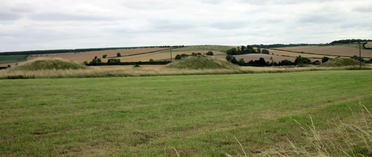
Overton Hill
Mountains & hills · 0.1 km

Bowl Barrow
Archaeological sites · 0.1 km

Lavington Monument In Churchyard, Against South West Corner Of Christ Church
Memorials & monuments · 0.6 km

East Kennett Long Barrow
Burial mounds & barrows · 1.2 km

East Kennett Long Barrow
Archaeological sites · 1.2 km

Silbaby
Archaeological sites · 1.2 km
East Kennet
Villages · 1.2 km
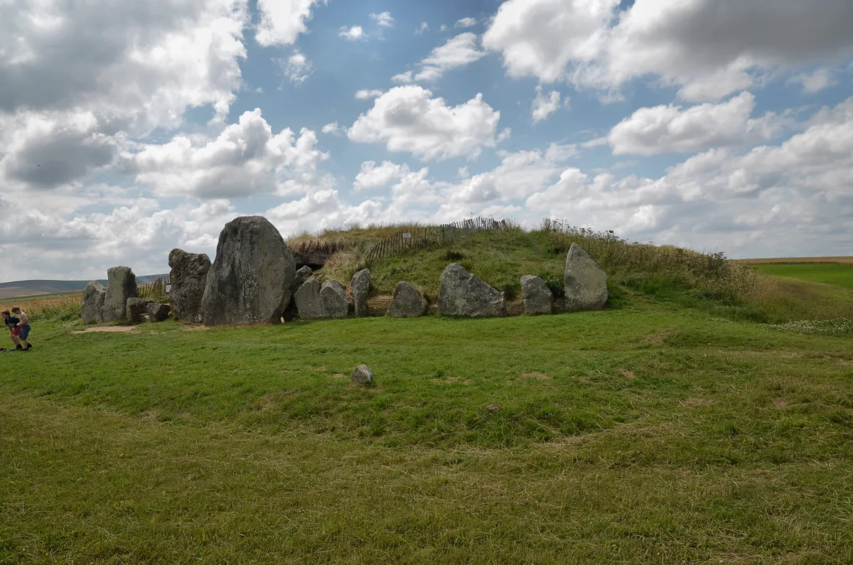
West Kennet Long Barrow
Hill forts · 1.4 km

Medieval settlement remains immediately west of The Vicarage
Vineyards · 1.5 km

Wymans Hill
Mountains & hills · 1.5 km

West Overton War Memorial
Memorials & monuments · 1.6 km
Nearby
📷 5Archaeological sites · South East England
Bowl Barrow
Bowl Barrow — archaeological in england south east.
📷 5📷 5Archaeological sites · South East England
Bowl Barrow
Bowl Barrow — archaeological in england south east.
📷 5Memorials & monuments · South East England
Lavington Monument In Churchyard, Against South West Corner Of Christ Church
Lavington Monument In Churchyard, Against South West Corner Of Christ Church — Grade II listed building-listed memorial in england-south-east, United Kingdom.
📷 5Burial mounds & barrows · South East England
East Kennett Long Barrow
East Kennett Long Barrow — a burial mound in england-south-east, United Kingdom.
📷 5Archaeological sites · South East England
East Kennett Long Barrow
East Kennett Long Barrow — archaeological in england south east.
Where to eat & stay near The Sanctuary
Places to stay
 📷 5
📷 5 📷 7
📷 7Hotels · South East England
Castle & Ball Hotel
Castle & Ball Hotel — a hotel in england south east.
 📷 7
📷 7 📷 5
📷 5 📷 5
📷 5 📷 5
📷 5Campsites · South East England
Totteridge Farm
Totteridge Farm — a campsite in england south east.
Places to eat & drink
 📷 7
📷 7Cafés · South East England
St Peter's and St Paul's
St Peter's and St Paul's — a café in england south east.
 📷 7
📷 7 📷 7
📷 7Historic pubs · South West England
The Queens Head Inn
The Queens Head Inn in England South West, United Kingdom.
 📷 7
📷 7Historic pubs · South West England
The Talbot Public House
The Talbot Public House in England South West, United Kingdom.
 📷 5
📷 5Historic pubs · South West England
Bricklayers Arms Public House
Bricklayers Arms Public House in England South West, United Kingdom.
_(geograph_6422891).jpg?width=1200) 📷 5
📷 5Historic pubs · South East England
The White Hart
The White Hart — Historic pub — listed building or notable heritage status.
More places run by English Heritage
 Flagship📷 10
Museums · London
Kenwood House
Kenwood House — art museum and historic house in Hampstead, London.
 📷 5
📷 5Galleries · London
Apsley House
Apsley House — London townhouse of the Dukes of Wellington.
 📷 5
📷 5Castles · London
Eynsford Castle
Eynsford Castle — castle, now ruinous, in Eynsford, Kent, England, UK.
 📷 5
📷 5Museums · London
Jewel Tower
Jewel Tower — medieval tower in Westminster, London, England, UK.
More places in this region
 📷 5
📷 5Hill forts · South East England
Ankerwycke Priory
Ankerwycke Priory — Benedictine nunnery with associated moat and fishponds.
 📷 5
📷 5Hill forts · South East England
Shornemead Fort
Shornemead Fort — fort in Shorne, Kent, England, UK.
 📷 5
📷 5Hill forts · South East England
Smythe's Megalith
Smythe's Megalith — neolithic monument in Kent, England.
 📷 5
📷 5Hill forts · South East England
White Horse Stone
White Horse Stone — Two megaliths near Aylesford, Kent, England.
Frequently asked questions
- Where is The Sanctuary?
- The Sanctuary is in South-East England, United Kingdom (postcode SN8 4EY), in the parish of East Kennett.
- What is The Sanctuary?
- The Sanctuary — English prehistoric site.
- How do I get to The Sanctuary?
- The nearest railway station is Pewsey, about 8.7 km away. Drivers can use postcode SN8 4EY.
- Who runs The Sanctuary?
- The Sanctuary is operated by English Heritage.
- Is The Sanctuary a listed building?
- The Sanctuary is officially recognised as scheduled monument listed.
- Is The Sanctuary a protected site?
- Yes — The Sanctuary is part of the Cotswolds National Landscape (AONB) and the North Wessex Downs National Landscape (AONB).
- Is The Sanctuary free to visit?
- Yes, The Sanctuary is free to enter.
- How do I get to The Sanctuary?
- Drivers can navigate to postcode SN8 4EY. It sits within the East Wiltshire parliamentary constituency.