
Towns & cities · East Midlands
Terrington St Clement
Terrington St Clement — village and civil parish in Norfolk, UK.

Wikimedia Commons contributors — see linked file page for photographer and licence licence

Plan your visit
- Typical visit
- 3 h–6 h
- Nearest railway station
- King's Lynn · 7.4 km
- Free entry
- Family-friendly
- Dog-friendly
Getting there & planning your visit
To visit Terrington St Clement, the nearest railway station is King's Lynn, located 7.4 km away. The postcode for the area is PE34 4FD, which you can use for sat-nav coordinates. Entry to the town is free.
About
Terrington St Clement is a town, city, village or settlement in the United Kingdom. It covers approximately 45 km². Recent population estimates put it at around 3,902 people. Wikidata describes it as: "village and civil parish in Norfolk, UK". Coordinates: 52.7546°, 0.2948°.
Photo gallery
From the Wikipedia article
Terrington St Clement is a village and civil parish in King's Lynn and West Norfolk borough and district in Norfolk, England. It is in the drained marshlands to the south of the Wash, 7 miles (11 km) west of King's Lynn, Norfolk, and 5 miles (8.0 km) east of Sutton Bridge, Lincolnshire, on the old route of the A17 trunk road. The parish covers an area of 17.50 square miles (50 km2). Much of the farmland is of alluvial silt and clay which has been reclaimed from the sea. About half the parish has been reclaimed from the east bank of the River Nene, in Anglo-Saxon times. It is bordered by the so called Roman Bank, which is of a later than Roman date. The other half has been reclaimed from The Wash since the end of the 18th century. Terrington St Clement in area is the largest village in Norfolk, and the second largest in the country.
Excerpt from Wikipedia under CC BY-SA 4.0. See the source article linked in Sources below.
Background
History
The name Terrington derives from the Old English for 'Farm/settlement of Tir(a)'s people' as -ingtūn means a settlement called after, or connected with... .
Sourced from Wikipedia under CC BY-SA 4.0.
- Coordinates
- 52.7546, 0.2948
- County
- Norfolk
- District
- King's Lynn and West Norfolk
- Parish
- Terrington St. Clement
- Postcode
- PE34 4FD
- Parliamentary constituency
- North West Norfolk
- Population
- 3,902
- Nearest railway station
- King's Lynn — 7.4 km
- Official site
- www.neighbourhood.statistics.gov.uk
Sources
- wikidata: Q1923867 (CC0)
- wikipedia: Terrington St Clement (CC BY-SA 4.0)
- commons: TerringtonStClementChurch.JPG (CC BY-SA 4.0)
Other places nearby

Terrington St Clement Village Sign
Public art & sculpture · 0.1 km

Tower to Church of Saint Clement
Memorials & monuments · 0.6 km

Medieval settlement remains north of Kenwick Farm house
Vineyards · 2.2 km
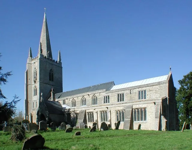
Tilney All Saints
Towns & cities · 2.5 km

TilneyAll Saints Village Sign
Public art & sculpture · 2.7 km

Tilney All Saints War Memorial Cross
Memorials & monuments · 2.7 km

Walpole Cross Keys Village Sign
Public art & sculpture · 2.9 km

Tilney All Saints Village Sign
Public art & sculpture · 2.9 km
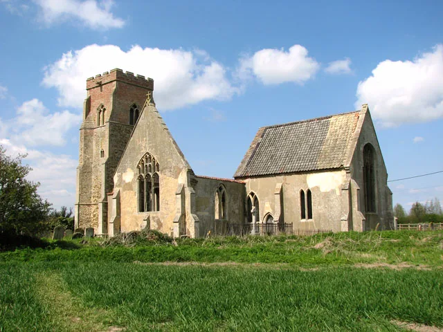
St Mary's Church
Historic churches · 3.7 km

Clenchwarton Village Sign
Public art & sculpture · 3.8 km

Clenchwarton
Museums · 4.0 km

Terrington St John War Memorial Cross
Memorials & monuments · 4.2 km
Terrington St Clement is a village in Norfolk, located in the East Midlands region, with a population of 3,902. Our guide lists nearby attractions within reach.
At a glance
- Population
- 3,902
- Administrative county
- Norfolk
- Constituency
- North West Norfolk
- Top categories near here
Things to see in Terrington St Clement
9 attractions within 12 km. Full guide: things to do in Terrington St Clement →
 📷 5
📷 5Museums · East of England
River Great Ouse
River Great Ouse — a museum in england-east-midlands, United Kingdom.
 📷 3
📷 3Lighthouses · East Midlands
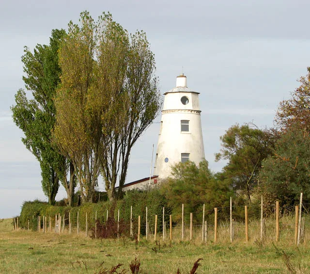
East Bank Lighthouse
East Bank Lighthouse — lighthouse in South Holland, England.
 📷 3
📷 3Historic houses · East Midlands
Hydraulic Engine House
Hydraulic Engine House — house in Sutton Bridge, South Holland, England, UK.
 📷 3
📷 3Natural landmarks · East Midlands
East Bank picnic site
East Bank picnic site — a other in england-east-midlands, United Kingdom.
 📷 5
📷 5Historic bridges · East Midlands
Crosskeys Bridge
Crosskeys Bridge — Grade II* listed building-listed bridge in england-east-midlands, United Kingdom.
📷 3Memorials & monuments · East Midlands
Tower to Church of Saint Clement
Tower to Church of Saint Clement — Grade I listed building-listed memorial in england-east-midlands, United Kingdom.
📷 3Public art & sculpture · East Midlands
Terrington St Clement Village Sign
Terrington St Clement Village Sign — a public art in england-east-midlands, United Kingdom.
📷 3Public art & sculpture · East Midlands
Walpole Cross Keys Village Sign
Walpole Cross Keys Village Sign — a public art in england-east-midlands, United Kingdom.
 📷 5
📷 5Nearby
📷 3Public art & sculpture · East Midlands
Terrington St Clement Village Sign
Terrington St Clement Village Sign — a public art in england-east-midlands, United Kingdom.
📷 3Memorials & monuments · East Midlands
Tower to Church of Saint Clement
Tower to Church of Saint Clement — Grade I listed building-listed memorial in england-east-midlands, United Kingdom.
📷 5Vineyards · East Midlands
Medieval settlement remains north of Kenwick Farm house
human settlement in Tilney All Saints, King's Lynn and West Norfolk, Norfolk, England, UK
Flagship📷 3Towns & cities · East Midlands
Tilney All Saints
Tilney All Saints — village and civil parish in Norfolk, United Kingdom.
📷 3Public art & sculpture · East Midlands
TilneyAll Saints Village Sign
TilneyAll Saints Village Sign — a public art in england-east-midlands, United Kingdom.
📷 3Memorials & monuments · East Midlands
Tilney All Saints War Memorial Cross
Tilney All Saints War Memorial Cross — Grade II listed building-listed memorial in england-east-midlands, United Kingdom.
Where to eat & stay near Terrington St Clement
Places to stay
 📷 5
📷 5Caravan parks · East of England
Hardwick Bridge Park
Hardwick Bridge Park — a caravan park in england east midlands.
 📷 5
📷 5 📷 5
📷 5Campsites · East of England
Four Oaks Camping
Four Oaks Camping — a campsite in england east midlands.
 📷 5
📷 5Campsites · East of England
King's Lynn Caravan and Camping Park
King's Lynn Caravan and Camping Park — a campsite in england east midlands.
 📷 5📷 5
Caravan parks · East of England
King's Lynn Caravan and Camping Park
King's Lynn Caravan and Camping Park — a caravan park in england east midlands.
Places to eat & drink
 📷 5
📷 5Historic pubs · East of England
Crown And Mitre Public House
Crown And Mitre Public House in England East, United Kingdom.
 📷 5
📷 5Historic pubs · East of England
Globe Hotel
Globe Hotel in England East, United Kingdom.
 📷 5
📷 5 📷 5
📷 5 📷 5
📷 5Historic pubs · East Midlands
Number 18, Formerly The Cock And Magpie Public House
Number 18, Formerly The Cock And Magpie Public House in England East, United Kingdom.
 📷 5
📷 5More towns in this region
 📷 5
📷 5 📷 5
📷 5Towns & cities · East Midlands
Marholm
Marholm — village and civil parish in Cambridgeshire, UK.
 📷 5
📷 5Towns & cities · East Midlands
Thornhaugh
Thornhaugh — village and civil parish in Cambridgeshire, UK.
 Flagship📷 4
Towns & cities · East Midlands
Austerfield
Austerfield — village and civil parish in South Yorkshire, England, UK.
Frequently asked questions
- Where is Terrington St Clement?
- Terrington St Clement is in Norfolk, the East Midlands, United Kingdom (postcode PE34 4FD), in the parish of Terrington St. Clement.
- What is Terrington St Clement?
- Terrington St Clement — village and civil parish in Norfolk, UK.
- How do I get to Terrington St Clement?
- The nearest railway station is King's Lynn, about 7.4 km away. Drivers can use postcode PE34 4FD.
- Is Terrington St Clement free to visit?
- Yes, Terrington St Clement is free to enter.
- How do I get to Terrington St Clement?
- The nearest railway station is King's Lynn, about 7.4 km away. Drivers can navigate to postcode PE34 4FD.