
Vineyards · East Midlands
Medieval settlement remains north of Kenwick Farm house
In or near Tilney All Saints.
human settlement in Tilney All Saints, King's Lynn and West Norfolk, Norfolk, England, UK

Mat Fascione — CC BY-SA 2.0 via Wikimedia Commons licence

Plan your visit
- Typical visit
- 1 h–2 h
- Best time of year
- Late summer & autumn (Aug–Oct)
- Nearest railway station
- King's Lynn · 5.4 km
About
Medieval settlement remains north of Kenwick Farm house is one of Britain's growing number of vineyards, located in england east midlands. UK viticulture has expanded significantly since the 1980s, with English sparkling wines now winning international awards. Most British vineyards offer tours and tastings of their estate-grown wines. human settlement in Tilney All Saints, King's Lynn and West Norfolk, Norfolk, England, UK
Photo gallery
Place summary
The Medieval settlement remains north of Kenwick Farm house, located in the East Midlands, provide insight into historical agricultural practices. This area is now home to a vineyard, which produces wine in a setting that contrasts with its ancient roots. Visitors can expect a rural landscape, with opportunities to learn about both viticulture and the archaeological significance of the site. The vineyard's operation reflects the region's evolving agricultural heritage.
AI-generated from the structured facts on this page (operator, designation, listing, era). Not a substitute for visiting.
- Coordinates
- 52.7462, 0.3240
- County
- Norfolk
- District
- King's Lynn and West Norfolk
- Parish
- Tilney All Saints
- Postcode
- PE34 4SP
- Parliamentary constituency
- North West Norfolk
- Nearest railway station
- King's Lynn — 5.4 km
Sources
- wikidata: Q17648201 (CC0)
Other places nearby
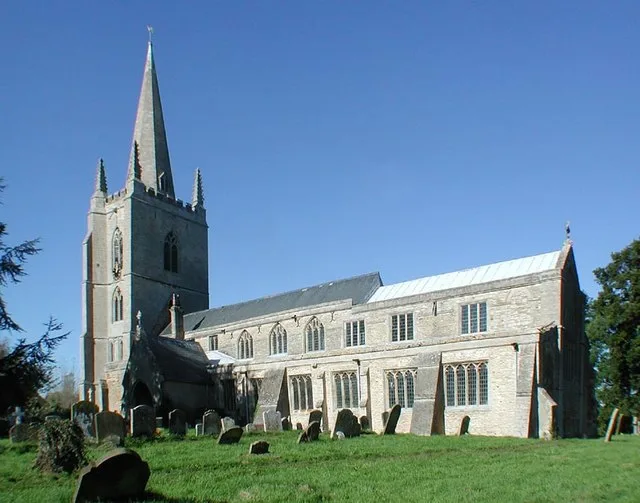
Tilney All Saints
Towns & cities · 0.9 km

TilneyAll Saints Village Sign
Public art & sculpture · 1.1 km

Tilney All Saints War Memorial Cross
Memorials & monuments · 1.1 km

Tilney All Saints Village Sign
Public art & sculpture · 1.8 km

Terrington St Clement Village Sign
Public art & sculpture · 2.2 km
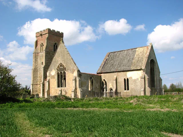
St Mary's Church
Historic churches · 2.2 km
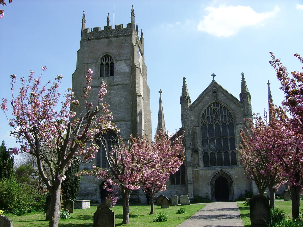
Terrington St Clement
Towns & cities · 2.2 km

Clenchwarton Village Sign
Public art & sculpture · 2.2 km

Clenchwarton
Museums · 2.3 km

Tower to Church of Saint Clement
Memorials & monuments · 2.3 km

Jubilee Bank Anchor
Public art & sculpture · 3.4 km

West Lynn Village Sign
Public art & sculpture · 4.0 km
Nearby
Flagship📷 3Towns & cities · East Midlands
Tilney All Saints
Tilney All Saints — village and civil parish in Norfolk, United Kingdom.
📷 3Public art & sculpture · East Midlands
TilneyAll Saints Village Sign
TilneyAll Saints Village Sign — a public art in england-east-midlands, United Kingdom.
📷 3Memorials & monuments · East Midlands
Tilney All Saints War Memorial Cross
Tilney All Saints War Memorial Cross — Grade II listed building-listed memorial in england-east-midlands, United Kingdom.
📷 3Public art & sculpture · East Midlands
Tilney All Saints Village Sign
Tilney All Saints Village Sign — a public art in england-east-midlands, United Kingdom.
📷 3Public art & sculpture · East Midlands
Terrington St Clement Village Sign
Terrington St Clement Village Sign — a public art in england-east-midlands, United Kingdom.
📷 3Historic churches · East Midlands
St Mary's Church
St Mary's Church — church in Tilney St Lawrence, King's Lynn and West Norfolk, Norfolk, England, UK.
Where to eat & stay near Medieval settlement remains north of Kenwick Farm house
Places to stay
 📷 5
📷 5Caravan parks · East of England
Hardwick Bridge Park
Hardwick Bridge Park — a caravan park in england east midlands.
 📷 5
📷 5Campsites · East of England
King's Lynn Caravan and Camping Park
King's Lynn Caravan and Camping Park — a campsite in england east midlands.
📷 5Caravan parks · East of England
King's Lynn Caravan and Camping Park
King's Lynn Caravan and Camping Park — a caravan park in england east midlands.
 📷 5
📷 5Campsites · East of England
Four Oaks Camping
Four Oaks Camping — a campsite in england east midlands.
 📷 5
📷 5 📷 5
📷 5Caravan parks · East of England
Innisfree Park Homes
Innisfree Park Homes — a caravan park in england east midlands.
Places to eat & drink
 📷 5
📷 5Historic pubs · East of England
Crown And Mitre Public House
Crown And Mitre Public House in England East, United Kingdom.
 📷 5
📷 5Historic pubs · East of England
Globe Hotel
Globe Hotel in England East, United Kingdom.
 📷 5
📷 5 📷 5
📷 5 📷 5
📷 5 📷 5
📷 5More places in this region
 📷 5
📷 5Vineyards · East Midlands
Settlement site E of Uffington and Barnack Station
Settlement site E of Uffington and Barnack Station — a UK vineyard in england london, producing English or Welsh wine from cool-climate grape varieties.
 📷 5
📷 5Vineyards · East Midlands
Settlement site E of Greatford village
Settlement site E of Greatford village — a UK vineyard in england london, producing English or Welsh wine from cool-climate grape varieties.
 📷 4
📷 4Vineyards · East Midlands
Fleet settlement site near Lambert Drain
Fleet settlement site near Lambert Drain — a UK vineyard in england london, producing English or Welsh wine from cool-climate grape varieties.
 📷 5
📷 5Vineyards · East Midlands
Settlement site at Greatford
Settlement site at Greatford — a UK vineyard in england london, producing English or Welsh wine from cool-climate grape varieties.
Frequently asked questions
- Where is Medieval settlement remains north of Kenwick Farm house?
- Medieval settlement remains north of Kenwick Farm house is in Norfolk, the East Midlands, United Kingdom (postcode PE34 4SP), in the parish of Tilney All Saints.
- What is Medieval settlement remains north of Kenwick Farm house?
- human settlement in Tilney All Saints, King's Lynn and West Norfolk, Norfolk, England, UK
- How do I get to Medieval settlement remains north of Kenwick Farm house?
- The nearest railway station is King's Lynn, about 5.4 km away. Drivers can use postcode PE34 4SP.
- How do I get to Medieval settlement remains north of Kenwick Farm house?
- The nearest railway station is King's Lynn, about 5.4 km away. Drivers can navigate to postcode PE34 4SP.